Acadia National Park - Beachcroft and Champlain South Ridge Route

The hike from Sieur de Monts to Sand Beach via Beachcroft and Champlain Mountain trails features panoramic coastal mountain views of Mount Desert Island, Frenchman Bay, and the outer islands. The Beachcroft Trail is an historic memorial pathway, constructed in 1915.
Trail Activity
Hiking
Length
3.70 miles, One Way
Difficulty
Advanced
Town
Bar Harbor
Surface
Dirt/Forest Floor, Rock/Ledge
Pets
Permitted
Fees
Yes

Description

HIGH USE TRAIL:

This is a busy trail system, especially on weekends between 9AM-4PM. Consider visiting outside of peak periods. Use Maine Trail Finder to identify other nearby trails. If the parking lot is full when you arrive, please choose another trail. 

The Wild Gardens Path leads to the Tarn, a shallow body of water in the process of turning back into a meadow. Once reaching the Tarn, turn left and continue to ME Route 3. The Beachcroft Trailhead is across ME Route 3 slightly to the right. Use care crossing the road.

Cut granite stairs and flat stone pathways wind up the side of Huguenot Head, crossing a large boulder field. Views of Dorr Mountain and the Tarn are quickly revealed. After circling around Huguenot Head, the trail dips slightly before ascending Champlain Mountain. This section of trail has granite stairs, rocky scrambles up granite ledges, and finally, just before attaining the 1,058 foot peak of the mountain, smooth expanses of granite. This trail is not recommended in wet weather.

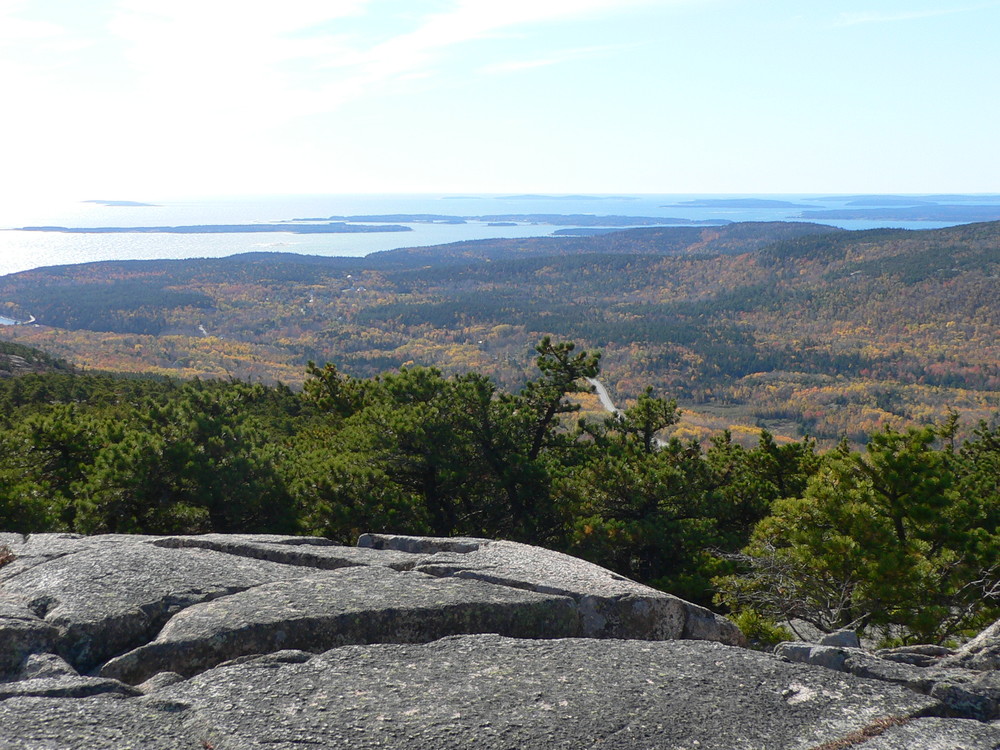
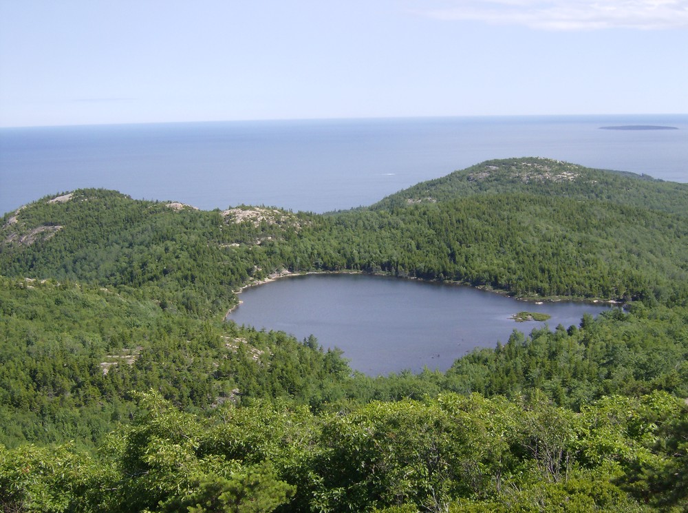
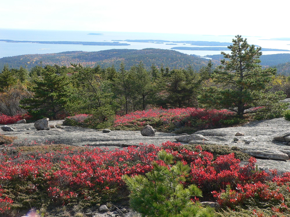
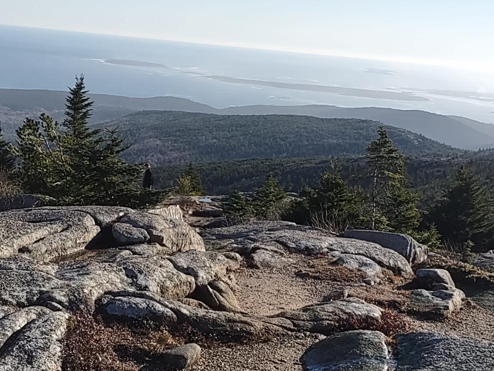
The South Ridge of Champlain Mountain crosses beautiful open granite expanses with views of the Cranberry Isles and other islands to the south. It passes through stunted gnarly pitch pines. Expect to be delayed in your hike during August as you stop to browse on blueberries. Pause also to enjoy the Bowl, a peaceful pond nestled behind the Beehive.

The South Ridge Trail connects with the Bowl Trail which leads to the Park Loop Road and Sand Beach (0.8 miles). For a longer, more scenic route consider the Gorham Mountain Trail (1.4 miles).

If you choose to hike to the 525 ft summit of Gorham Mountain, you will be rewarded with additional expansive views of Frenchman Bay and the outer islands. The trail continues down the south side of Gorham Mountain to the Gorham Mountain parking area and the Park Loop Road. Choosing this option adds 1 mile, for a total of 5 miles. 

Other Information

The steep east face of Champlain Mountain which faces Frenchman Bay, is the nesting area of Peregrine Falcons from March until August, so for a special treat, watch for these swift predators flying above or in front of you. The Precipice Trail on this cliff face is closed during breeding and nesting season, and is a poor choice for a descent down the mountain at any time of year.

Geocaching is prohibited within Acadia National Park; however, the park does sponsor an EarthCache Program for those seeking a virtual treasure hunt!

Trail Manager

Visit Acadia National Park online for more information or contact:

National Park Service, Acadia National Park

National Park Service, Acadia National Park
PO Box 177
Bar Harbor, ME 04609
Phone: (207) 288-3338
acadia_information@nps.gov

Nearby Events

VIEW EVENTS CALENDAR

Trail Tips

Dispose of Waste Properly
Pack it in, pack it out. This goes for trash, leftover food, toilet paper, and hygiene products. If you brought it into nature, please bring it out.
Legend
Hide All

Trailhead Information

Starting from ME Route 3, turn off at the Hulls Cove Entrance to Acadia National Park and park at the Hulls Cove Visitor Center parking lot. Take the Island Explorer Bus to Sieur de Monts. When the bus is not running, shuttle one car to the Sand Beach Parking lot and park the second car at Sieur de Monts. To reach The Wild Gardens Path trailhead, walk towards the Nature Center, before reaching the building turn left  and cross the lawn. Look for the trailhead marker on the other side of the service road leading to the Abbe Museum.

The Island Explorer bus usually runs from mid-June through mid-October. Check at the Hulls Cove Visitor Center for current schedules. For alternative ways to access or hike these trails, check your map or discuss it with a ranger at the Hulls Cove Visitor Center. The Park Loop Road is closed December 1 to April 15.

(The Island Explorer bus can be caught along the Park Loop Road to return to the Hulls Cove Visitor Center at the end of your hike.)

Click on a parking icon to get custom directions
Please Log In or Create Account to add comments.
bigeloafah
May 22, 2016
Beachcroft and Champlain North Ridge Loop route: If you don't want to spot a second car, consider this fine loop route as an alternative. We did it on a beautiful spring Saturday when the Precipice Trail for closed for the falcons to enjoy. This loop is about 3.2 miles total and took us about 1 hour 40 minutes with plenty of time to enjoy the Champlain summit and ridge. Park in the lot near the Tarn on Route 3, cross the road and ascend the Beachcroft Trail. The ascent is steady, up truly impressive stone work, then open ledges, and across a brief stretch of scrub pine. Lots of blueberry bushes in season. Stunning, expansive views from the summit of Champlain and the ridge running south. Okay, so the descent via the Champlain North Ridge trail is not super-scenic (Jackson Labs looms below you), but it's gradual with better footing than the Beachcroft trail, especially if it's a wet day. You emerge onto the Park Loop Road and walk maybe 1.3 miles or so. You're on the shoulder facing mostly-courteous oncoming traffic, so it's safe - plus you get to see Beaver Dam Pond. Clamber up by the overpass back onto Route 3 to the Tarn and your car. Easy! The payoff is all the good views without the "excitement" of the Precipice Trail or a steep descent on the Beachcroft Trail.
These awesome businesses support our goal of connecting people to outdoor adventures in Maine!
Hang Tight!
Nearby services are loading
No Results
No Services Found
SHARE THIS TRAIL

Add Trail Log

Please wait…
Join In on the Fun!
Log in or create an account below to unlock all the great features of Maine trail finder: keep track of trails you want to do, preserve memories of trails you’ve done, earn badges, and more!
Your log in attempt was not successful. Please try again.
    Lost your password? Reset your password
    Don't yet have an account?
    There was an issue with your submission. Please try again.
      * Indicates required field
      Already have an account? Login here
      Enter your username, and we will send you a new, randomly generated password to your email account.
      There was an issue with your submission. Please try again.

        Success! A new password has been emailed to you.

        Log in now

        Please wait…