Berry Woods Preserve

This extensive trail system on Georgetown Island stretches from the Kennebec River to Robinhood Cove and provides diverse year round recreation highlighting several features of the preserve including an old quarry, a freshwater pond, salt marshes and natural blowdowns.
Trail Activity
Snowshoeing Cross-country-skiing Hiking
Length
3.90 miles, Network
Difficulty
Moderate
Town
Georgetown
Surface
Dirt/Forest Floor
Pets
Not Permitted
Fees
No

Description

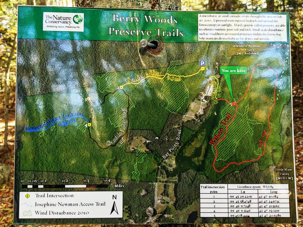
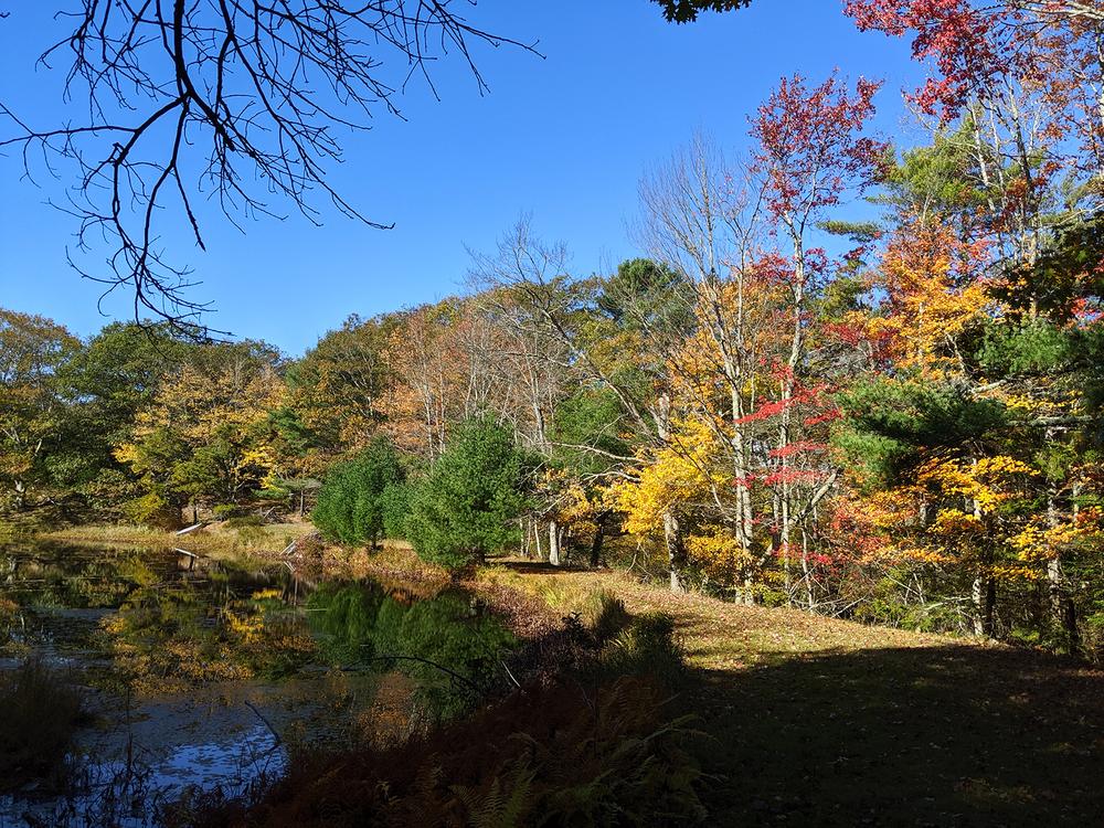
This 377-acre preserve connects with another 2,000 acres of conserved lands—including Reid State Park and Maine Audubon’s Josephine Newman Sanctuary, an area stretching all the way across Georgetown Island. The preserve is accessible through an extensive and interesting trail system over relatively level and easy terrain. Aside from hiking, visitors to Berry Woods also enjoy hunting, fishing, snowshoeing, cross-country skiing, bird-watching, and more.

Thanks to trail work completed after 2009, trails now lead through oak-pine forest from the shores of the Kennebec to Robinhood Cove. Visitors can see an old mica mine, Wilson Pond, an old cellar hole, and natural blowdowns.

Other Information

Please adhere to the following policies while using the preserve:

  • Day use only
  • Foot traffic only
  • Please stay on the trail and boardwalk to protect this fragile ecosystem
  • No collecting of plants or animals
  • No pets
  • Carry out all litter
  • No fires, smoking, or camping

LMF Logo

This trail passes through a property that was acquired in part with funds from the Land for Maine’s Future program. For more information about the LMF program and the places it has helped to protect, please visit the LMF webpage.

Trail Manager

Visit The Nature Conservancy online for more information or contact:

The Nature Conservancy, Maine Field Office

The Nature Conservancy, Maine Field Office
14 Maine Street, Suite 401
Brunswick, ME 04011
Phone: (207) 729-5181
naturemaine@tnc.org
View website

Nearby Events

VIEW EVENTS CALENDAR

Trail Tips

Dispose of Waste Properly
Dispose of solid human waste in a cathole 6-8 inches deep and at least 200 feet from water, camp, or trails. Don't forget to cover it up when you're done!
Legend
Hide All

Trailhead Information

From US Route 1 in Woolwich, take ME Route 127 South approximately 10 miles, and bear right on to Bay Point Road. The parking area for the preserve is approximately 1 mile down on the right. From the parking lot, hikers can take a short trail to cross Bay Point Road to access the eastern half of the preserve. The trail crosses private property and hikers must stay on the trail.

Click on a parking icon to get custom directions
Please Log In or Create Account to add comments.
These awesome businesses support our goal of connecting people to outdoor adventures in Maine!
Hang Tight!
Nearby services are loading
No Results
No Services Found
SHARE THIS TRAIL

Add Trail Log

Please wait…
Join In on the Fun!
Log in or create an account below to unlock all the great features of Maine trail finder: keep track of trails you want to do, preserve memories of trails you’ve done, earn badges, and more!
Your log in attempt was not successful. Please try again.
    Lost your password? Reset your password
    Don't yet have an account?
    There was an issue with your submission. Please try again.
      * Indicates required field
      Already have an account? Login here
      Enter your username, and we will send you a new, randomly generated password to your email account.
      There was an issue with your submission. Please try again.

        Success! A new password has been emailed to you.

        Log in now

        Please wait…