Black and White Trail

The Black and White Trail connects Rumford Whitecap Mountain to Black Mountain ski area. The trails intersect a short distance below the summit of Rumford Whitecap, which is a worthwhile side trip for 360 degree views of the area.
Trail Activity
Snowshoeing Hiking
Length
7.50 miles, Network
Difficulty
Moderate
Towns
Andover, Rumford
Surface
Dirt/Forest Floor, Rock/Ledge, Grass
Pets
Permitted
Fees
No

Description

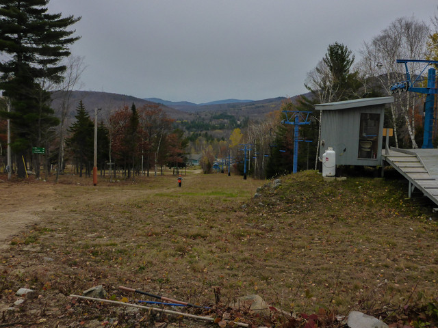
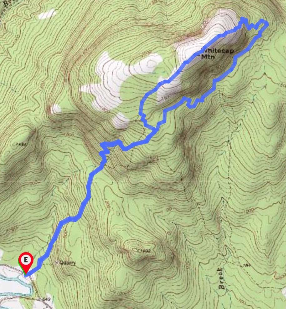
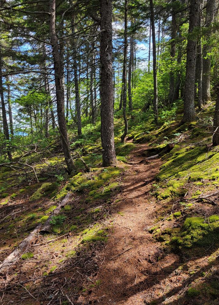
The Black and White trail connects Black Mountain ski area with Rumford Whitecap Mountain. From the ski area trailhead, head up the mountain on a winding trail through the woods to the tower just below the summit. The trail to Whitecap is behind the fenced-in tower and marked with a sign and white blazes. The trail winds around the mountain for a short distance before descending into the col between the two mountains. The trail crosses a dirt road / snowmobile trail before crossing a small stream and heading towards Whitecap, which is visible from this road.

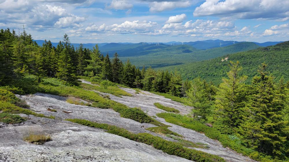
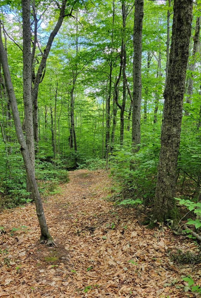
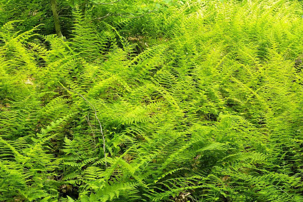
From here, the trail to Whitecap is fairly easy and well marked. The trail winds through a hardwood forest with limited views, except for a grassy area with mountain views and the cliffs on the side of Whitecap. Enjoy the pleasant walk through the woods with the birdsong and occasional sighting of wildlife. When you reach the intersection with the Red Trail on Rumford Whitecap (at 44.564156, -70.666314), there is an option to continue right, up Whitecap to the summit (about 20 minutes) or descend straight to the Rumford Whitecap parking lot by following the red/orange blazes down the trail.

Other Information

LMF Logo

This trail passes through a property that was acquired in part with funds from the Land for Maine’s Future program. For more information about the LMF program and the places it has helped to protect, please visit the LMF webpage.

Trail Manager

Visit the Mahoosuc Land Trust online for more information or contact:

Mahoosuc Land Trust

Mahoosuc Land Trust
PO Box 981
162 North Road
Bethel, ME 04217
Phone: (207) 824-3806
info@mahoosuc.org
View website

Nearby Events

VIEW EVENTS CALENDAR

Trail Tips

Dispose of Waste Properly
Keep Maine green and clean! Pick up trash, even if it's not yours. Leave soon-to-be trash like excess packaging, stickers, and twist ties at home.
Legend
Hide All

Trailhead Information

You can start at either trailhead, although the trail from Black Mountain to Rumford Whitecap will have less elevation gain.

To Black Mountain, 39 Glover Road, Rumford: From US-2 at the base of the falls in Rumford, take a left onto Spruce Street and continue on Swain Road to the end, approximately 2 miles. Take a right on Isthmus Road and drive 1.8 miles. Take a left on Grover Road and park in the ski area parking lot.

To Rumford Whitecap: From US-2 in Rumford Point, take ME Route 5/Ellis River Road north for 3.1 miles. Turn right on Andover Road and cross the bridge over the Ellis River. After 0.4 miles, turn left on East Andover Road, and go another 0.2 miles to the parking lot on the left and the trailhead at a gated gravel road on the right.

Click on a parking icon to get custom directions
Please Log In or Create Account to add comments.
mehiker
July 04, 2022
I hiked the Black and White Trail towards Black Mountain and was stunned at how well maintained it was! It was as clean, as if someone had vacuumed it. There was only one small tree branch on the trail that I tossed aside. What a delight to hike. There are now new trail markers and the trail was VERY easy to follow. The grade was easy.

I hiked along the Black and White Trail to the east end of Whitecap, then took the connector trail that follows the old red blazes that you see on trees and the granite ledge. I always thought these were survey marks and have hiked up that route for many years. Now there are blue trail markesr up this connector and it comes up to open ledge at the very eastern end of Whitecap.

This route made a perfect loop from the parking area: Iles Trail > Black and White Trail > connector up Whitecap blazed in blue > summit of Whitecap > then back down the Iles Trail to parking.
kirk@mahoosuc.org
July 31, 2019
Work was done on the B & W trail last August, after the post by John Betts. However, trail work has not done since. There is an event in late September that will be using the trail and some work will be done between now and then to make it easier to follow. This will likely not bring the trail to where we would like it. We have potential volunteers available this summer, but no date has been set. The trail gets used much less than the other Whitecap trails, and Mahoosuc Land Trust's work on the trail is therefore less. But . . . we very much would like to improve the user experience and will do so as soon as we can. Thank you for bearing with us and we appreciate the frank feedback. And any potential volunteers should contact us at any time--our Whitecap Stewards group is very active, but always welcomes new helpers that could extend or annual capacity. Kirk Siegel, Executive Director, Mahoosuc Land Trust, kirk@mahoosuc.org
walkwoman
July 29, 2019
Has there been any trail maintenance/blazing improvements on this trail since the above two postings?
kirk@mahoosuc.org
July 23, 2018
Thank you for the feedback. The trail is maintained by volunteers, as we do not have a hired stewardship staff. We anticipate work parties in the near future, in anticipation of the organized trail run event taking place on September 23, 2018. As to the blazing, it was my understanding that standardized trail blazing was used, but I will have to look into that. For feedback, questions, and latest maintenance updates, trail users can contact Mahoosuc Land Trust directly.
mehiker
July 21, 2018
This trail needs serious maintenance. The trail is overgrown, trees are down, and the trail is poorly marked. The trail builder used white blazes to mark the trail. These white blazes look exactly like lichen on the tree trunks and difficult to follow. Somebody added orange ribbon markers, but many of those were found on the ground. I do not recommend hiking this trail.
These awesome businesses support our goal of connecting people to outdoor adventures in Maine!
Hang Tight!
Nearby services are loading
No Results
No Services Found
SHARE THIS TRAIL

Add Trail Log

Please wait…
Join In on the Fun!
Log in or create an account below to unlock all the great features of Maine trail finder: keep track of trails you want to do, preserve memories of trails you’ve done, earn badges, and more!
Your log in attempt was not successful. Please try again.
    Lost your password? Reset your password
    Don't yet have an account?
    There was an issue with your submission. Please try again.
      * Indicates required field
      Already have an account? Login here
      Enter your username, and we will send you a new, randomly generated password to your email account.
      There was an issue with your submission. Please try again.

        Success! A new password has been emailed to you.

        Log in now

        Please wait…