Blueberry Mountain Trail

A steep climb to the summit of Blueberry Mountain where hikers are rewarded with 360 degree views of the Maine High Peaks Region
Trail Activity
Hiking
Length
1.20 miles, One Way
Difficulty
Moderate, Advanced
Town
Township 6 North of Weld
Surface
Dirt/Forest Floor
Pets
Permitted
Fees
No

Description

HIGH USE TRAIL:

This is a busy trail system, especially on weekends between 9AM-4PM. Consider visiting outside of peak periods. Use Maine Trail Finder to identify other nearby trails. If the parking lot is full when you arrive, please choose another trail. 

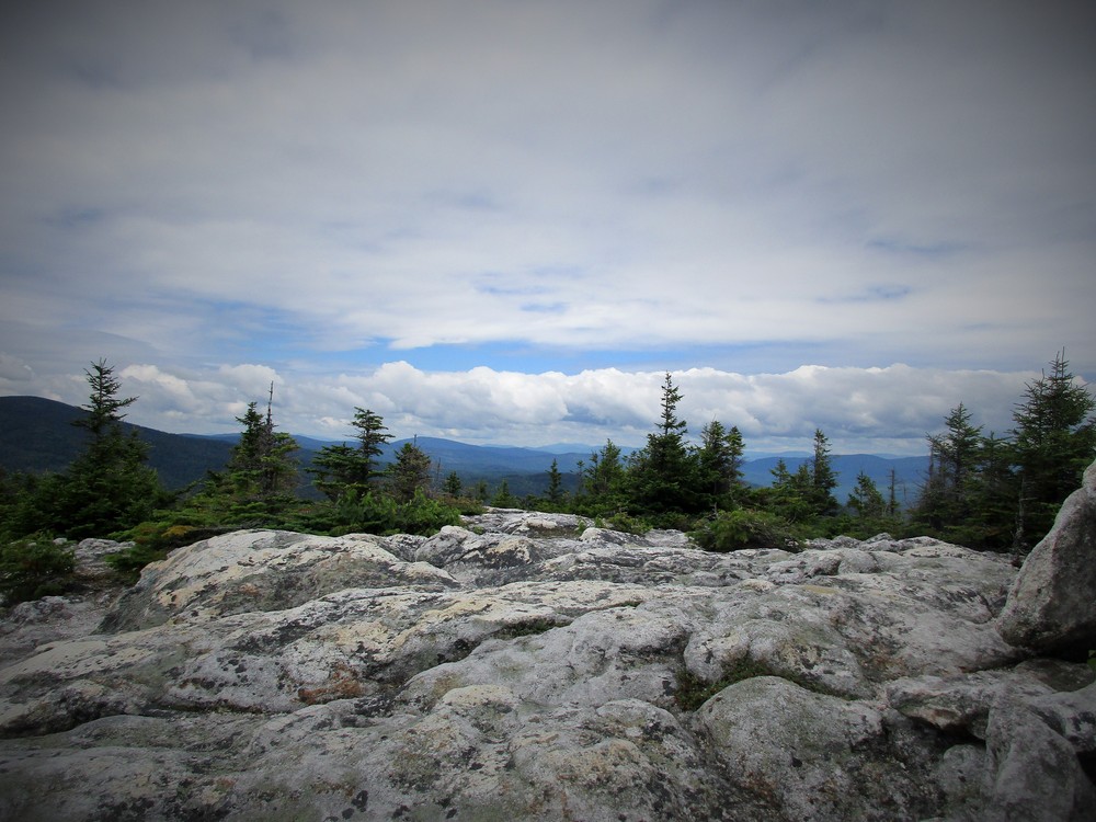
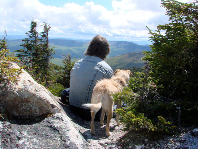
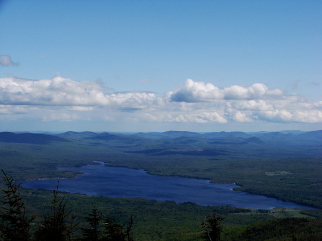
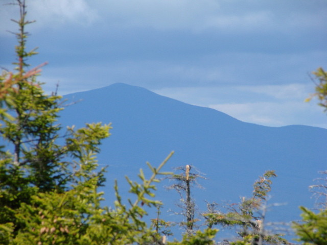
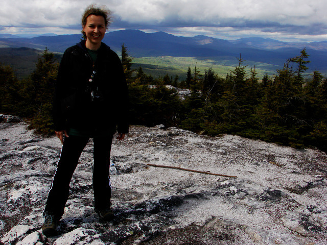
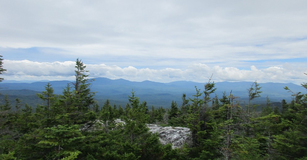
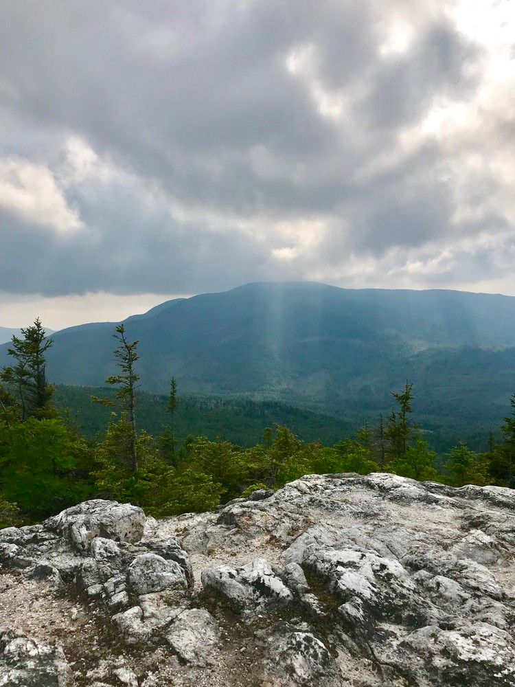
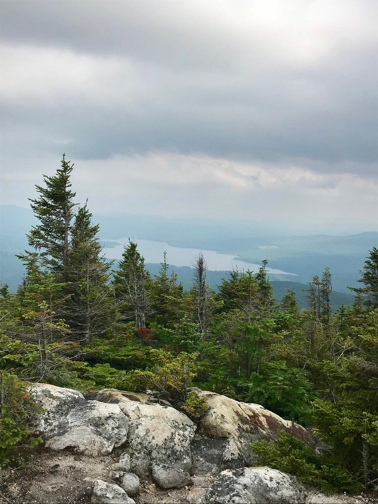
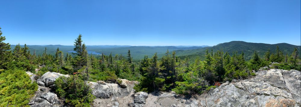
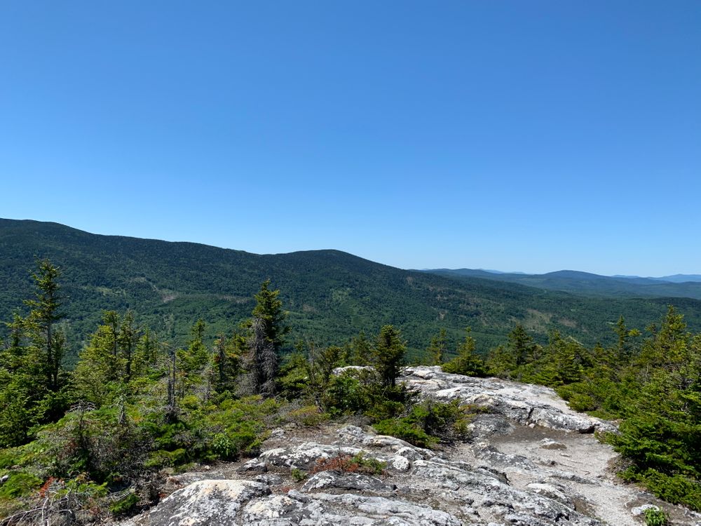
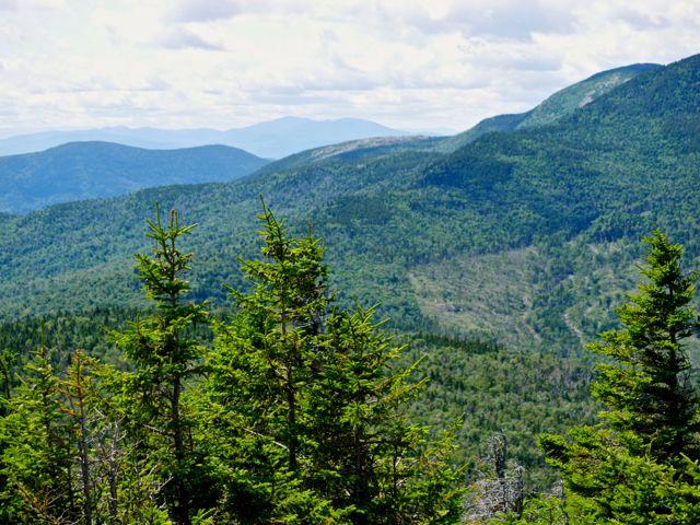
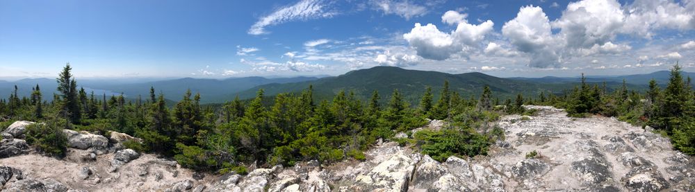
At 2890 feet in elevation, Blueberry Mountain is one of the lesser known and hiked trails in the Weld region. However, the summit offers some of the best views of the Maine High Peaks Region.  On a clear day hikers can see the nearby peaks of Jackson, Tumbledown, Bald, and Mt. Blue, as well as more distant peaks including, Saddleback, Spaulding, Mt. Abram, North and South Crocker, Sugarloaf, and on very clear days the Bigelow Mountains Range and Mt. Washington in New Hampshire. 

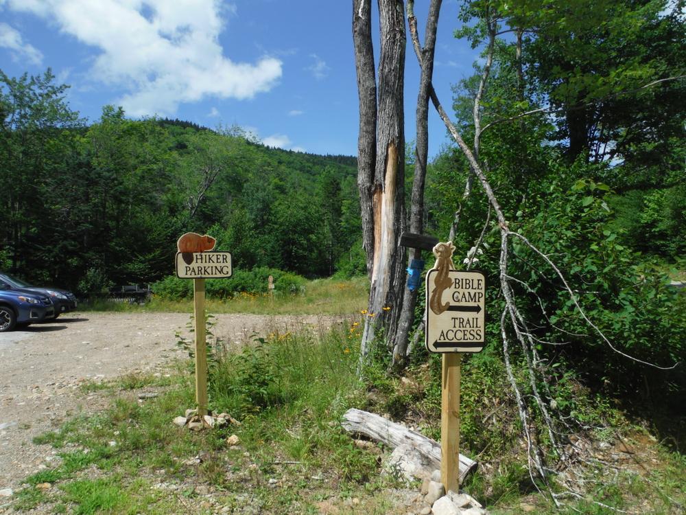
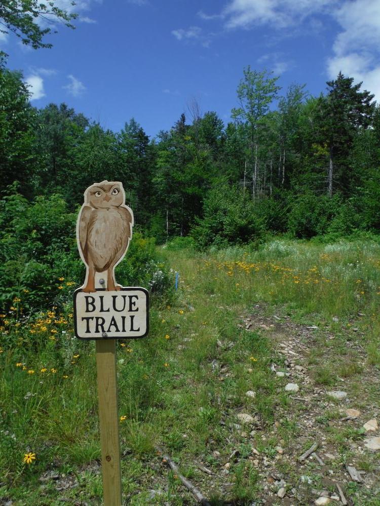
The Blueberry Mountain Trail leaves from the Blueberry Mountain Bible Camp parking lot.  There is no sign but with the main lodge behind you, look for a path to the right of the parking lot that leads to an athletic field.  Follow this into and directly across the field into a hardwood forest, where the path continues following an old woods road.  After about 100 yards the trail bears right leaving the woods road, and begins to climb steadily.  Dark blue paint blazes on rocks and trees mark the way, and even though these are spaced at long intervals, the trail is clearly trodden from years of use, and it is not hard to locate. 

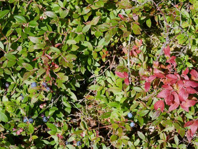
The trails passes through Maple, Yellow-birch, and Gray birch forest stands, and hikers have a good chance of seeing signs of wildlife on the way.  At higher elevations, spruce, fir, and white birch dominate the forest stands before the trees give way to low scrub and blueberry bushes. 

Once above tree line, follow the cairns (rock piles) to the summit which is recognized by its large cairn, geological survey marker, and spectacular views.

Other Information

LMF Logo

This trail passes through a property that was acquired in part with funds from the Land for Maine’s Future program. For more information about the LMF program and the places it has helped to protect, please visit the LMF webpage.

Trail Manager

Visit Maine Bureau of Parks and Lands online for more information or contact:

Maine Bureau of Parks and Lands, Western Public Lands Office

Maine Bureau of Parks and Lands, Western Public Lands Office
PO Box 327
Farmington, Maine 04938
Phone: (207) 778-8231
Tim.Post@maine.gov
View website

Nearby Events

VIEW EVENTS CALENDAR

Trail Tips

Leave What You Find
Avoid the introduction or transport of non-native species. Use local firewood from within 50 miles and clean, drain, and dry water equipment when moving between water bodies.
Legend
Hide All

Trailhead Information

From South: At the intersection of ME Route 142 and 156 in Weld, head north on ME Route 142 toward Philips about 3.8 miles until you see a sign on the left indicating the entrance to the Blueberry Mountain Bible Camp (a dirt road). Turn on to this road and drive uphill for almost 1.5 miles.  The road ends at the Bible camp buildings (look for Diradoudian Lodge); the trailhead and parking is just south of the camp.

From North: From Philips, the Blueberry Mountain Bible Camp is 8.7 miles from the intersection of ME Route 4 and 142.  There should be a sign indicating the entrance to the Blueberry Mountain Bible Camp (a dirt road). Turn on to this road and drive uphill for almost 1.5 miles.  The road ends at the Bible camp buildings (look for Diradoudian Lodge); the trailhead and parking is just south of the camp.

Click on a parking icon to get custom directions
Please Log In or Create Account to add comments.
kcormier
June 21, 2023
According to a sign at entrance of Bible camp, the hiking trail is closed.
heidi & nikes
May 08, 2021
aaaargh, i parked in left hand side lot just below bible camp that said trail parking and had a sign saying BLUE TRAIL. my parking buddy parked up further and we both sat in cars for an hour and never hiked :( i guess im posting this for the next time/person
bigeloafah
August 12, 2019
As always, SO HELPFUL to have others' comments here to know what to expect. This one's definitely short but stiff, which is just the workout we were hoping for, and fine views as a reward on top. Summit was very windy on a warm August Sunday. Glad to have packed windbreakers.

Berries were ripe and a fun diversion for the last quarter-mile or so. Blowdowns noted by others include several go-unders as well as go-overs - a challenge for us creaky seniors. The pup--the most athletic member of the family--loved them all.

Saw only a few other hikers, a nice change from the busyness of nearby Tumbledown and Mount Blue. FWIW, we got ~2.4 miles TOTAL roundtrip per my GPS watch.
thebreester
July 08, 2019
Wow what a view! Poles definitely would have been a help. There is a fair amount of blowdown on the trail but as long as you don’t mind crawling over a few trees you’ll be fine.
ajmorgan82014
May 28, 2019
I meant 1 hour 20 minutes each way LOL.
ajmorgan82014
May 28, 2019
This is a great hike. Took me about an hour 20 to summit and back.
The trail currently has several down trees in the steepest part, which made it a little more difficult.
Also the moose poop was plentiful and unavoidable LOL.
dalyj
August 10, 2018
Always a great hike! As mentioned in an earlier comment, the new parking area is on the left before you reach the lodge, and is clearly marked. The trailhead from this lot is also clearly marked and parallels the road through long grass and sedges before joining the existing trail. This new route entirely avoids the camp buildings.
swrandall70
September 27, 2017
Not 2.4 miles. My gps equipped Fitbit calculated from parking lot to the exact summit at 1.49 miles and took me 50 minutes. It is not a technical hike at all. Its just straight up. Felt like climbing a huge flight of stairs. Works cardio and thighs!
like to hike
November 17, 2016
Fantastic hike and views in all directions. My friend and our two dogs agree. Longer hike than my books indicated, but more than worth the effort. The Bible Camp has relocated the start of the trail.
carleyd
March 27, 2016
Great Hike! Hiked 03/27/16- 4 Wheel Drive needed to get up to the parking area! Trail well marked. Shoe spikes recommended, steep ice areas! Glad they increased the difficulty to moderate/advanced, steep steady incline. Took two dogs along with us who did great! The view from the top was AMAZING!
sapphire50
September 27, 2015
Using GPS we found the hike to be 2.4 miles or so up as the total for the trip was over 4 miles round trip. Possibly a typo? Great hike though, i would upgrade to a little more than moderate. Awesome views!
Moose the Cat
August 17, 2014
Elizabeth Jacobson: Though I loved Blueberry Mountain and didn't find the hike too difficult, Rumford White Cap is an easier hike and has more blueberries. LOTS more blueberries. Enjoy!
http://www.mainetrailfinder.com/trails/trail/rumford-whitecap-mountain-preserve
ejacobson
July 07, 2014
My friend and I want to hike this with our kiddos. They are 3 and 4 and we will most likely carry them in backpacks. Is this doable? My daughter is obsessed with Blueberries for Sal and wants to hike "Blueberry Mountain".
mainetrailfinder
June 23, 2014
We just bumped up the difficulty on this hike to Moderate and Advanced.
Aligthis1
June 22, 2014
Nice hike. Beautiful views. Very steep right of the get go. View at the top is definitely worth it. I would say its more strenuous than moderate however.
Threetimewinner
June 08, 2014
Great hike. Beautiful trail, and well marked and maintained. As far as being a moderate trail, I would highly disagree, I'd hate to see an advanced trail ;)
These awesome businesses support our goal of connecting people to outdoor adventures in Maine!
Hang Tight!
Nearby services are loading
No Results
No Services Found
SHARE THIS TRAIL

Add Trail Log

Please wait…
Join In on the Fun!
Log in or create an account below to unlock all the great features of Maine trail finder: keep track of trails you want to do, preserve memories of trails you’ve done, earn badges, and more!
Your log in attempt was not successful. Please try again.
    Lost your password? Reset your password
    Don't yet have an account?
    There was an issue with your submission. Please try again.
      * Indicates required field
      Already have an account? Login here
      Enter your username, and we will send you a new, randomly generated password to your email account.
      There was an issue with your submission. Please try again.

        Success! A new password has been emailed to you.

        Log in now

        Please wait…