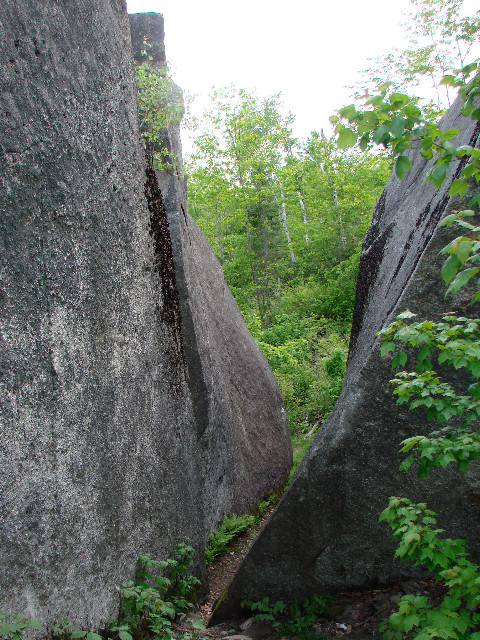
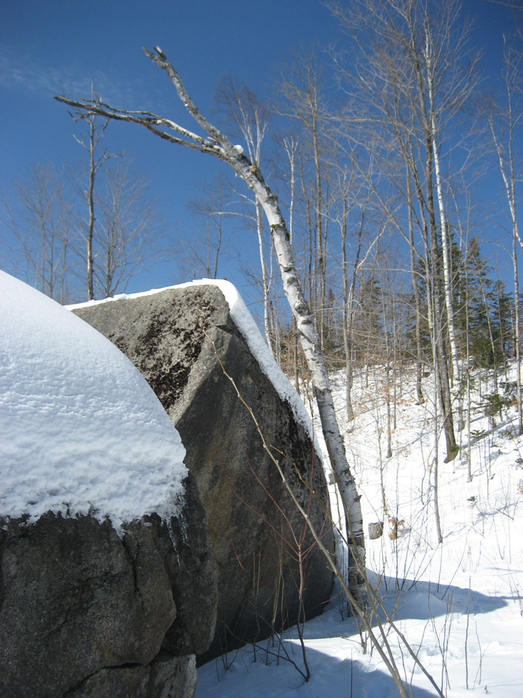
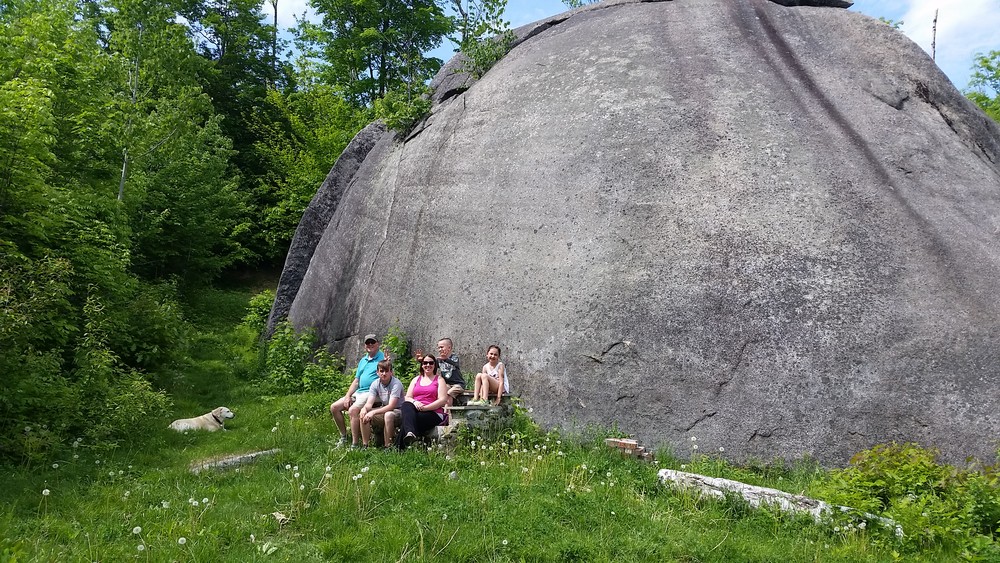
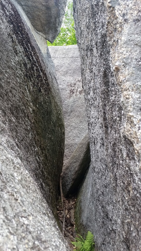
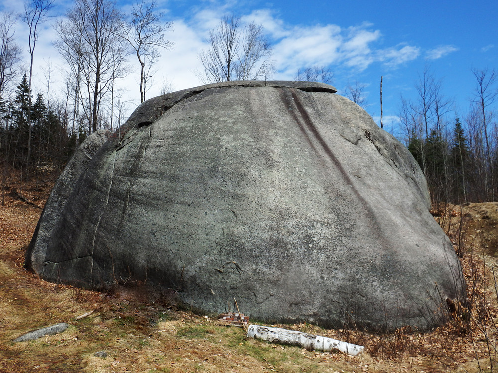
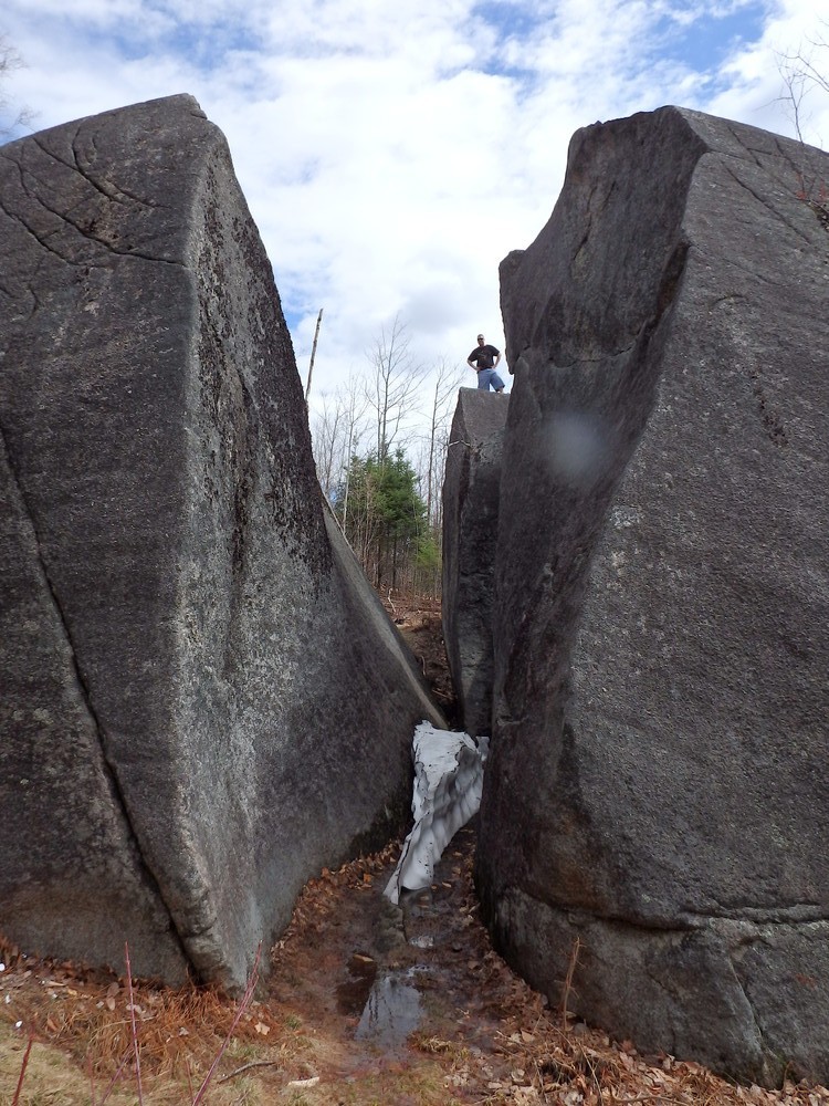
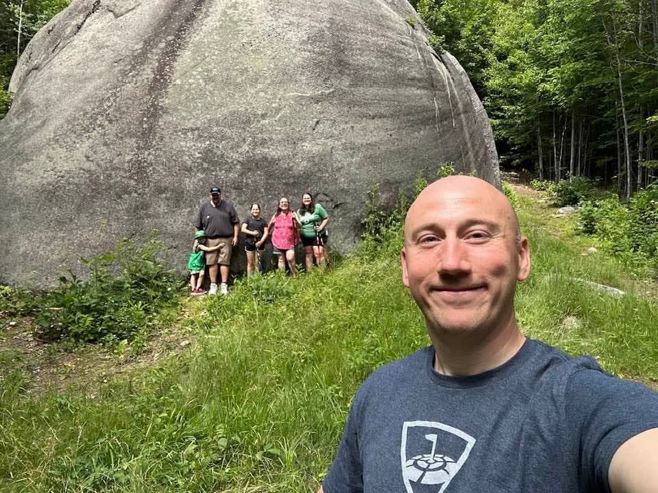
At an estimated weight of 8,000 tons and measuring 80 feet long, 30 feet wide, and 25 feet high, with only a portion of the rock exposed above ground, Daggett Rock is the largest glacial erratic in Maine and one of the largest in the world. An erratic is a rock deposited by glaciers some distance from its original bedrock. Geologists believe this boulder was plucked from Saddleback Mountain in Rangeley and deposited here—about 12 miles southwest of the mountain—during the last ice age. It has been a popular destination since the 1800s as evidenced by the postcards and souvenirs from that era. Because the rock is split, trails also weave between the parts of the rock, but may be slippery when conditions are wet.
One legend has it that Daggett, a local woodsman, came upon the rock while inebriated during a violent storm. Climbing atop the rock, he cursed his ill luck by taking the Lord's name in vain, whereupon a fantastic bolt of lightning struck the rock and split it into three parts. Geologic evidence, however, suggests that Daggett Rock split during its deposition here thousands of years ago.
Check the Maine Geological Survey for more information about Daggett Rock.
The trail is owned and maintained by the Phillips Historical Society located at the corner of Main, Sawyer, and Pleasant Streets in downtown Phillips.
Visit the Phillips Historical Society online for more information or contact:
Phillips Historical SocietyDon’t Disturb Rock Cairns: Those stacked rock formations? They mark the trail—don’t move or build new ones.
From South: Follow ME Route 142 North from the junction of ME Routes 4 and 142 in Phillips. Turn left onto Main Street at the stop sign. Continue on ME Route 142 (Main Street becomes Park Street and then Salem Road). Cross the Woolen Mill Bridge, take the second right onto Wheeler Hill Road and stay on this road until you reach the parking area on the right (about 2.3 miles from the junction). The trailhead is on the left side of the road. Please respect private property near the trailhead and stay on the trail.
Success! A new password has been emailed to you.