Foundry Trail

This easy walk along the Androscoggin River follows Foundry Road around the Livermore Falls recreation fields. With multiple access points this walk can be adjusted to any length.
Trail Activity
Mountain-biking Walking
Length
0.70 miles, One Way
Difficulty
Easy
Town
Livermore Falls
Surface
Pavement
Pets
Permitted
Fees
No

Description

In the middle of Livermore Falls and along the Androscoggin River, this walking and biking trail winds around the Livermore Falls Recreation Area and offering a nice casual walk on a paved sidewalk. Though no longer visible, the Livermore Falls Recreation Area is the site where the first pulp paper mill in Maine was built by Alvin Record. 

The nearby Riverside Park and gazebo at the northern end of the trail near downtown Livermore Falls provides glimpses of this town's industrial history. Now part of a massive dam structure, Livermore Falls on the Androscoggin River still possesses an impressive drop and is visible from many sections of Riverside Park. The pulp paper legacy of the region continued at Chisholm Mill that once operated just upstream from the park and continues today at the Verso Paper Mill further upstream in Jay.

Trail Manager

Visit the Town of Livermore Falls online for more information or contact:

Town of Livermore Falls

Town of Livermore Falls
2 Main Street
Livermore Falls, ME 04254
Phone: (207) 897-3321
Fax: (207) 897-9397
manager@lfme.org
View website

Nearby Events

VIEW EVENTS CALENDAR

Trail Tips

Leave What You Find
Leave the trail work to the pros: they will add or remove blazes, cairns (stone trail markers), structures, and trail improvements as deemed necessary.
Legend
Hide All

Trailhead Information

Livermore Falls Municipal Parking Area:

From intersection of ME Routes 4 and 17 in Livermore Falls, follow ME Route 17 (Main Street) south. ME Route 17 makes a sharp left approximately 500 feet after the starting point and becomes Depot Street; instead, continue straight along Main Street, driving past the municipal buildings to the parking lots. The Foundry Trail is towards the recreational fields on the left. Additional parking is also available near the tennis courts. 

Tennis Court Parking Area:

Halfway down Foundry Road is another parking area next to the tennis courts. Follow the directions above, go through the municipal parking lot and turn left onto Foundry Road. The tennis courts and parking is 0.3 miles down the road on the right.

Boat Carry and South Entrance:

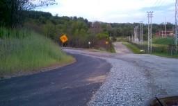
At the junction of ME Routes 17 and 133 about a mile south of downtown Livermore Falls, turn west onto Foundry Road and continue 0.2 miles. Parking is a dirt area on the left. 

Click on a parking icon to get custom directions
Please Log In or Create Account to add comments.
These awesome businesses support our goal of connecting people to outdoor adventures in Maine!
Hang Tight!
Nearby services are loading
No Results
No Services Found
SHARE THIS TRAIL

Add Trail Log

Please wait…
Join In on the Fun!
Log in or create an account below to unlock all the great features of Maine trail finder: keep track of trails you want to do, preserve memories of trails you’ve done, earn badges, and more!
Your log in attempt was not successful. Please try again.
    Lost your password? Reset your password
    Don't yet have an account?
    There was an issue with your submission. Please try again.
      * Indicates required field
      Already have an account? Login here
      Enter your username, and we will send you a new, randomly generated password to your email account.
      There was an issue with your submission. Please try again.

        Success! A new password has been emailed to you.

        Log in now

        Please wait…