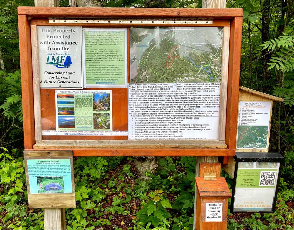
The Pigeon Hill Preserve consists of the 175-acre Hill Section to the West of Pigeon Hill Road, and the 10-acre Shore Section between Pigeon Hill Road and Pigeon Hill Bay to the East.
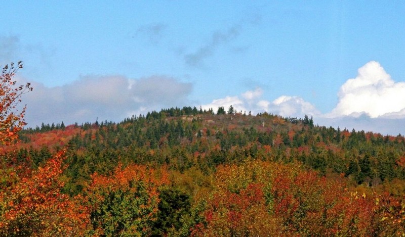
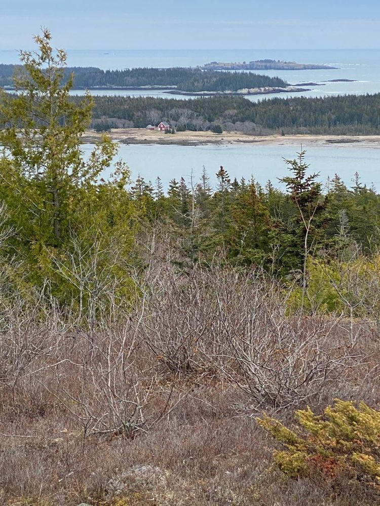
The 317-foot summit of Pigeon Hill is the highest in coastal Washington County. For more than a century, people have climbed the Historic Trail from Pigeon Hill Road through an open forest to the bald granite summit to enjoy the spectacular panoramic views. From various points, hikers can look north westerly to Schoodic and the Black Mountains; westerly to Schoodic Point and Cadillac Mountain on Mount Desert Island; southerly across the 2,400-acre wildlife refuge on Petit Manan Point to the second tallest lighthouse in Maine; and easterly across Bois Bubert Island, Jordan’s Delight, Nash Island and myriad bold islands on the Greater Pleasant Bay archipelago.
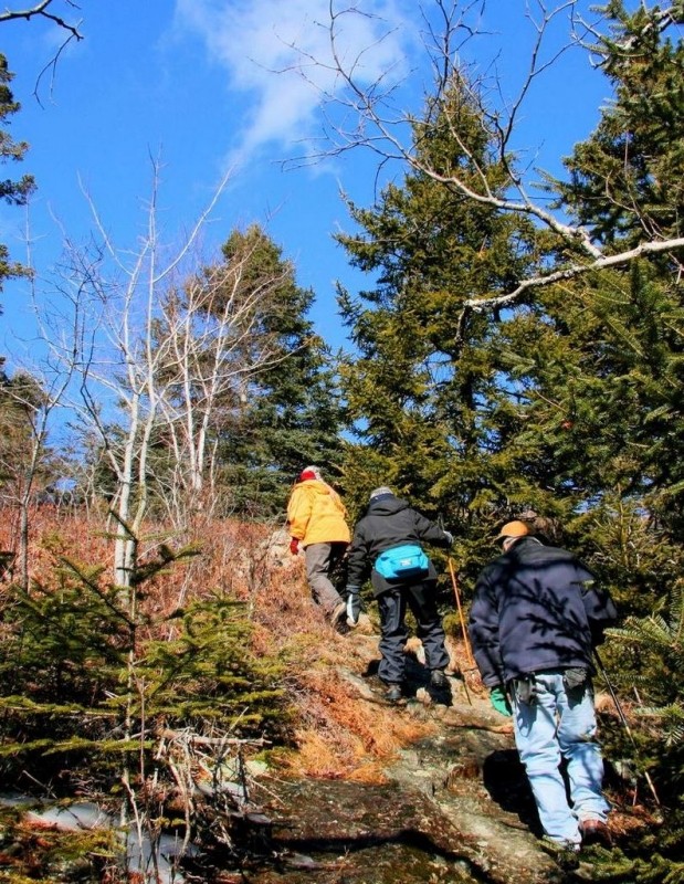
The Hill Section’s 1.8-mile trail system features three loops with a figure-eight loop that allows hikers to reach the summit and return without retracing their steps. Hike up the Historic Trail to the Summit and return via the Summit Loop and Silver Mine Trails for the easiest hiking, the most viewscapes and the opportunity to view evidence of some of Pigeon Hill’s human history. The Summit Loop and Silver Mine Trails provide the least steep route to the Summit. Explore the Ledge Woods Trail for a more challenging and longer hike. It offers views to the south and open woods with large maple trees along the edge of the western woods. Take the short Glacial Erratic Spur Trail off the Ledge Woods Trail to visit the fun loving Big Lonely Boulder.
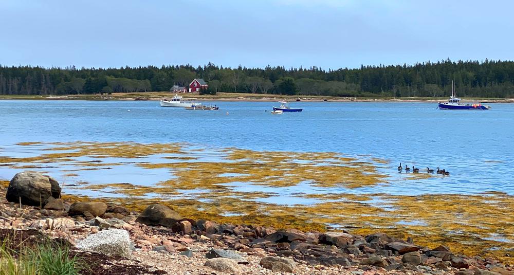
The Shore Section’s 0.5-mile trail winds through a beautiful and interesting mixed woods before reaching the shore of Pigeon Hill Bay for a view of Bois Bubert Island and the distant Petit Manan Lighthouse. Note that you can take Blue trails from the Sea to the Summit or from the Summit to the Sea.
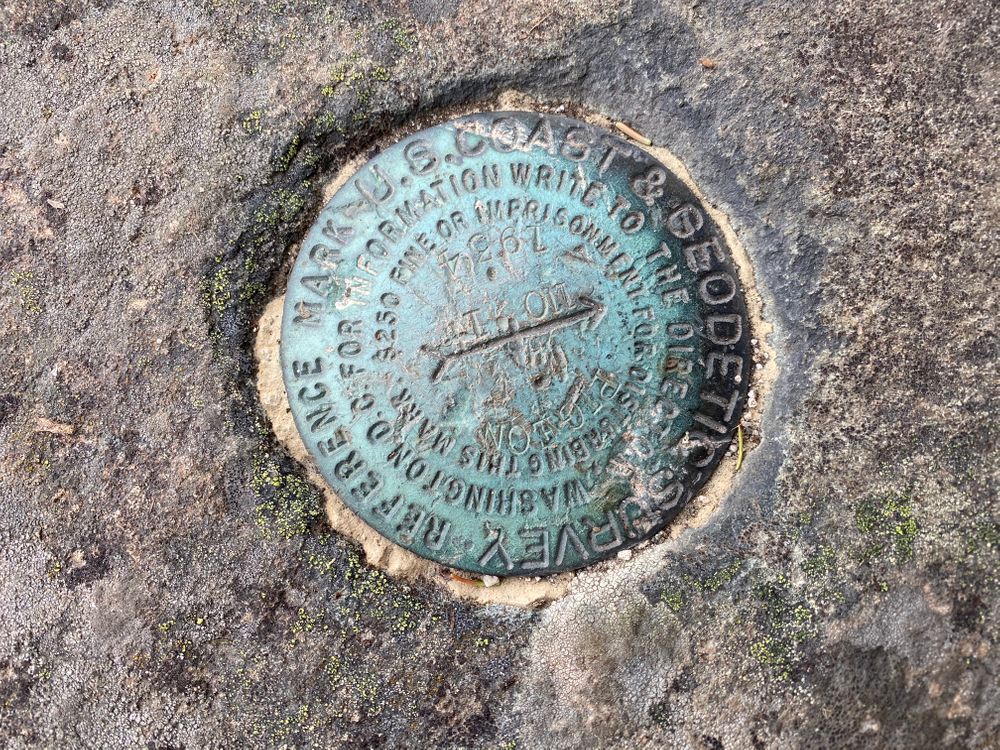
Pigeon Hill played an important role in the “Eastern Oblique Arc” survey triangulation of the eastern US from New Orleans, LA to Calais, ME that began in 1833 and completed in 1898. The US Coast and Geodetic Survey first monumented station “Pigeon” in 1855. The summit of Pigeon Hill then provided an unobstructed northerly view toward the Epping Baseline. The east and west granite monuments for that baseline are still in good condition – a unique situation since none of the other baselines of the Eastern Oblique Arc still exist.
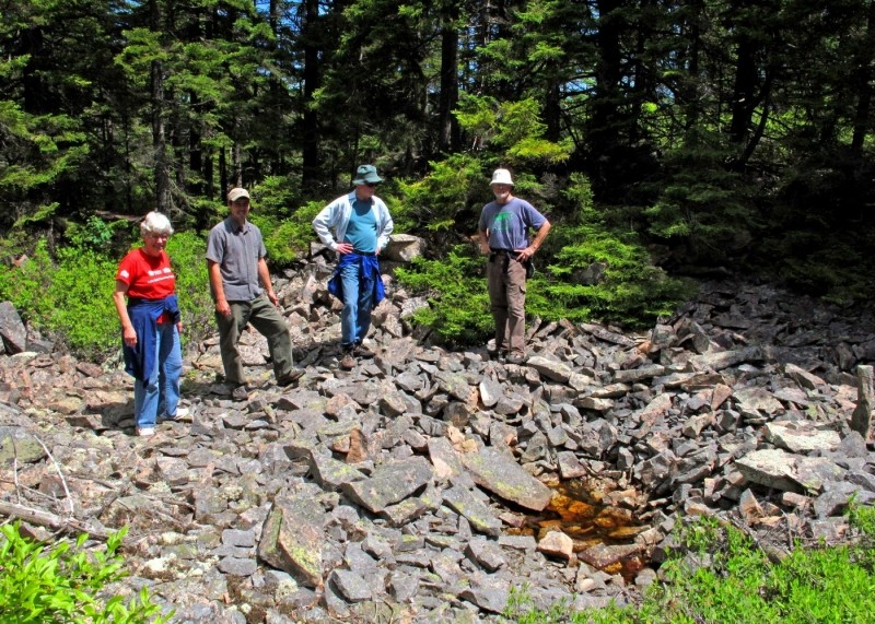
Large areas of broken rocks along the Silver Mine Trail in the eastern woods section of the preserve are almost certainly the remains of old silver mining activities. The writings of a descendant of an early immigrant farmer indicate that silver mining started on the hill sometime after the Civil War and that “The first diggings can still be traced on the hill with a boiling spring where the sheep and cattle drank, replacing the precious metal.” Barbed wire fencing, a rocky access ramp, and the watering hole are still visible from the trail.
Public Access is from the Pigeon Hill Road parking area only. Please respect neighboring private property and roads and visit only during daylight at your own risk. Trails are rocky and steep in sections and may be slippery when wet or icy. Please practice “carry-in/carry-out” and “leave no trace” ethics. Fires, camping, ATVs, snowmobiles, and collection of lichens or other plants is not permitted. Dogs should be kept under leash or voice control. The hill section of the preserve is open for hunting in season when visitors are advised to wear safety orange vests, jackets or hats. Hunting is not allowed on the Shore Section.

This trail passes through a property that was acquired in part with funds from the Land for Maine’s Future program. For more information about the LMF program and the places it has helped to protect, please visit the LMF webpage.
Visit the Downeast Coastal Conservancy online for more information or contact:

Coming west on US-1 from Milbridge or east on US-1 from the Hancock-Washington County line, turn south onto Pigeon Hill Road in Steuben. Drive about 4.5 miles on the road to the trailhead parking area on the right and opposite an old cemetery on the left. There is an informational sign and parking for approximately six vehicles. Overflow parking is available along the road. The trailhead for the Shore Section is directly across from the parking area and to the right of the old cemetery.
Success! A new password has been emailed to you.

by DCC | Oct 22, 2020 | BLOG
The map on here is correct but not labeled. What good is that? Seriously .. LABEL THIS !! WITH the correct blazer colors. Here I will copy and paste the blaze colors.....
Difficulty & Length: Moderate to Difficult
Blue: Historic Trail, 0.4 miles, 250 ft climb
Yellow: Silver Mine Trail, 0.4 miles, 170 ft climb
Yellow: Summit Loop, 0.3 miles, 110 ft climb
Red: Ledge Woods Trail, 0.6 miles, 170 ft climb
White: Glacial Erratic Spur, 1000 ft round trip
Blue: Shore Section Trail, 0.5 miles total It wont let me post the copied map from that article. Sorry.
I would NOT take dogs or young kids on the Historic trail. Just TOO steep, slippery and rocky. Bring treking poles and a day pack and wear good hiking shoes. I wear Merrels with Vibram soles. Its VERY slippery ! and coming down can jam your toes into the toebox of your shoe. Its that steep on the historic trail. That very short trail seemed like hours of torture on the way down ! We are avid hikers but elderly. We love these trails though, worth the effort for sure. Just wish the map on here would get labled and colored.