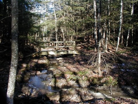
Whiskeag Trail explores pockets of lovely woodland while connecting desirable destinations such as the YMCA, McMann Athletic Complex, Bath Middle School, Oak Grove Cemetery, and the conserved land at Sewall Woods and Thorne Head Preserves.
The trail takes its name from an Abenaki word meaning "a creek that runs nearly dry at low tides." Whiskeag Creek runs north from Lily Pond between High Street and State Road into the Kennebec River at Thorne Head. Here its fresh water mixes with the brackish water of the Kennebec Estuary. An estuary is a body of water where fresh and salt water mix. The water in the lower Kennebec is salty because the tide carries salt water from the ocean upstream, against the current of the river. Wetlands and the land around waterways perform critical environmental functions such as absorbing floodwater, reducing erosion, filtering pollutants, and recharging drinking water.
Wetlands also provide habitat for many species of Maine's wildlife. Whiskeag Creek contains highly valuable tidal habitat for wading birds and waterfowl such as Blue-winged Teal, Great Blue Heron, Bald Eagle, and Egret. Terrestrial wildlife such as beaver, wild turkey, and coyote live along the trail. Development that is too close to sensitive bird nesting and feeding areas, or that happens at times that are critical to bird breeding activities, put these species at risk. Respect for the wildlife and their habitat is essential to the success of Whiskeag Trail.
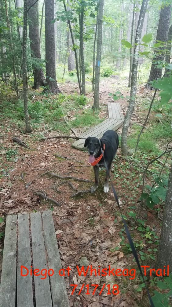
The trail is open to the public free of charge from dawn to dusk. Please help us protect it by staying on the trail, respecting adjoining private property, and understanding that natural areas are delicate: no camping, fires, unleashed dogs, or motorized vehicles are allowed.

This trail passes through a property that was acquired in part with funds from the Land for Maine’s Future program. For more information about the LMF program and the places it has helped to protect, please visit the LMF webpage.
Visit Bath Trails online for more information or contact:

There are four official access points to the Whiskeag Trail:
Bath Area Family YMCA: Take US Route 1 into Bath, take the Congress Avenue exit. Coming from the south, bear right onto State Street and then right again onto Congress Avenue. Coming from the north simply turn right onto Congress Avenue. Continue to the blinking light at intersection of Congress Avenue and Centre Street, and take a right onto Centre Street. The YMCA is located on the left, a quarter mile from the light.
Edward J. McMann Outdoor Athletic Complex: Take US Route 1 into Bath, take the Congress Avenue exit. Coming from the south, bear right onto State Street and then right again onto Congress Avenue. Coming from the north simply turn right onto Congress Avenue. Continue on Congress Avenue through a blinking light at its intersection with Centre Street, and the parking and trailhead for the athletic fields will be another quarter of a mile on the left just after a bend in the road.
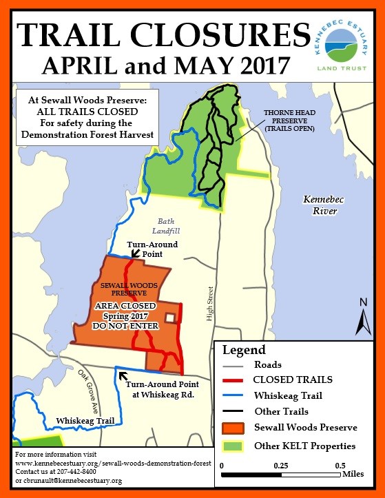
Sewall Woods Preserve: From the intersection of High Street and Center Street in Bath, take High Street north 1.5 miles and turn left onto Whiskeag Road. Take the next right into the parking area and trailhead for Sewall Woods Preserve.
Thorne Head Preserve: From the intersection of High Street and Centre Street in Bath, go north on High Street 2.1 miles until the road ends and there is the parking lot and trailhead for the Thorne Head Preserve.
Success! A new password has been emailed to you.