Debsconeag Loop Paddling Trip

Multiple-day backcountry paddling trip through the beautiful and remote Debsconeag Lakes Wilderness Area.
Trail Activity
Paddling
Length
28.00 miles, Loop
Difficulty
Strenuous
Towns
T1 R11 WELS, T1 R9 WELS, T10 R10 WELS, T2 R10 WELS, T2 R9 WELS
Surface
Water - Lake/Pond, Water - River/Stream
Pets
Not Permitted
Fees
No

Description

The Debsconeag Loop Paddling Trail is meant to be traveled in a clockwise direction, west from Spencer Cove across Ambajejus and Pemadumcook Lakes and then north across the watershed divide to the Debsconeag Lakes to return southeast on the West Branch of the Penobscot River. From Third Debsconeag Lake there is an optional side-trip to Fourth Debsconeag. Hand-carry boat launches at Omaha Beach, Little Omaha Beach, and Grant Brook Road Bridge provide alternate access points to this paddling trail. This route contains several portages lengthier than 0.25 miles and two major falls along the West Branch of the Penobscot. Prior backcountry and whitewater experience are recommended. Please camp only at designated sites.

From the public boat launch on Spencer Cove it is just over 9 miles west across Ambajejus Lake and up the north shore of Pemadumcook Lake to the White House Landing Wilderness Camp. Food and lodging are available at White House and there are two public campsites; one on Moose Island approximately 4 miles east along the north shore of Pemadumcook and another just under 1 mile west up the Nahmakanta Stream from White House. Both Ambajejus and Pemadumcook Lakes are wide and exposed; expect large waves in wind.

The portage between Pemadumcook and Third Debsconeag departs from White House Landing and travels due north along logging roads and dedicated trail for approximately 2 miles. The terrain is hilly, but the path accommodates portage wheels.

From the put-in at the south end of Third Debsconeag there is a single beautifully situated campsite 0.25 miles up the east shore of the lake.

  • Optional Out-and-Back to Fourth Debsconeag: Fourth Debsconeag Lake offers pristine and remote wilderness. The only structures on this lake are Chewonki’s Wilderness Camps along the north shore. The portage trail to Fourth Debsconeag can be found at an old dock on the north shore of the farthest west cove of Third Debsconeag, 2.5 miles from the southern put-in. The portage trail extends for 0.6 miles with mild uphills and rocky footing. It is not wheelable. The put-in for Fourth Debsconeag is at the lake’s outlet. Portage back along this same trail to rejoin the main Debsconeag Loop Paddling Trail.

The portage trail from Third to Second Debsconeag Lake is located 2.5 miles from the southern put-in at the far north end of Third Debsconeag. The trail is not obviously marked, but is located approximately 200 feet east (right) of the lake’s outlet. This portage is the shortest of the Debsconeag Loop trip, measuring only 0.3 miles in length, and passes through rolling terrain; not wheel-able. A side-trail leads west to several pools along the outlet stream between Third and Second Debsconeag.

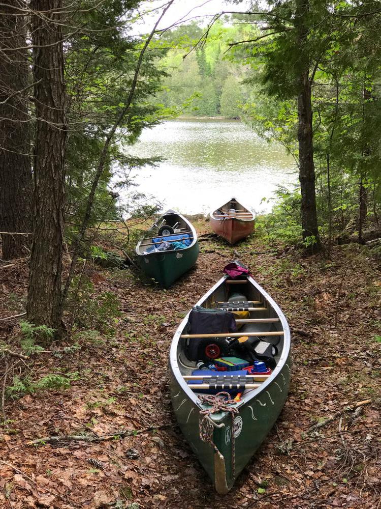
Two undeveloped campsites, one just to the east of the put-in on Second Debsconeag and another on the opposite (north) shore, provide a good place to spend the night before continuing toward First Debsconeag.

The portage from Second to First Debsconeag Lake is the longest of the trip at 0.8 miles. The take-out is prominently marked with a snowmobile sign and is located on the south shore roughly 0.25 miles past where the outlet of Second Debsconeag begins to narrow. The path is wide and flat with foot bridges over wet areas; however, carrying is best as portage wheels are only useable in some sections. As the trail approaches First Debsconeag it forks. The left fork continues to the nearest put-in in the shallows near the outlet.

A short ways from the put-in and on the opposite shore of First Debsconeag there is a spacious campsite with a gravel beach and a pit toilet. Halfway down the north shore of First Debsconeag is a trailhead for the Ice Caves Trail. This trail accesses several year round ice caves less than 1 mile from the lake. On the east end of the lake, two more campsites, each with their own pit toilet, are great places to spend the night before continuing on to the West Branch of the Penobscot.

For paddlers not wishing to continue down the West Branch of the Penobscot, Omaha and Little Omaha Beach offer two take-out sites with road access and public camping. From the eastern outlet of First Debsconeag it is just under 1 mile upriver through calm water on the West Branch of the Penobscot to the Little Omaha Beach campsite and boat launch. From this same point, it is just over 1 mile downstream and across the Debsconeag Deadwater to the Omaha Beach boat launch and group tent site.

Continuing towards Spencer Cove, the Debsconeag Lakes Paddling Loop turns southeast out of First Debsconeag and follows the West Branch of the Penobscot 4.5 miles back to Ambajejus Lake. Just beyond the outlet of First Debsconeag, the West Branch widens and slows to become the Debsconeag Deadwater, 1 mile of flat water.

Below the deadwater, the West Branch passes over two major sets of falls. The first and smaller one is runnable on either side of the large island, though the first channel on river-right contains a smooth straight run.

Approximately 0.5 miles further downriver is Passamagamet Falls. CAUTION: This falls contains Class III-IV white water; significant whitewater experience recommended; portage or scout from the big island. The channel river-right of the island is an easier line and may be the safest option for running the falls. Otherwise, there is a portage trail from the upriver end of the island to the pools below the falls.

From the pools below Passamagamet Falls it is a short way to the outlet of Passamagamet Lake. Two campsites are situated nearby along the eastern shore of this lake. From here it is another 1.5 miles downriver to where Grant Brook Road Bridge crosses the river. There is a hand-carry boat launch at the bridge that may be used as an alternate starting or ending point for the Debsconeag Lakes Paddling Loop.

Below Grant Brook Road Bridge, the West Branch of the Penobscot River descends over the gentle drop of Ambajejus Falls and opens into Ambajejus Lake. Located on a small island just past the inlet to Ambajejus is the historic Ambajejus Boom House. Built in 1907, the boom house is the only surviving structure associated with river log driving in the state.

From the inlet to Ambajejus it is 3.2 miles east across the lake and north up Spencer Cove to the public boat launch on the Golden Road. Expect high waves on this lake crossing if there is any wind. The total distance from the outlet of First Debsconeag Lake to Spencer Cove is just under 9 miles.

Other Information

This is a suggested paddle, numerous side trips and alternate configurations are possible. Consult the best available maps when planning your trip. [And bring them with you!]

The Debsconeag Lakes Wilderness Area Preserve Guidelines:

  • Hunting and fishing are allowed according to state laws and regulations.
  • Vehicles are restricted to designated roads. ATVs are not permitted anywhere in the reserve.
  • Horses, pets, and other domestic animals are not permitted.
  • Fires are allowed by permit only in existing fire rings at designated locations. Use only dead and down wood.
  • Do not collect or remove plants or animals.
  • Camp only in designated campsites. First come first served. No reservations or fees required.
  • Camping at any one site is limited to a two week maximum stay.
  • Please use the latrines installed at campsites.
  • Carry water for washing at least 200 feet away from streams or lakes and use small amounts of biodegradable soap.
  • Pack it in, pack it out! Remove all trash and leave your campsite looking better than when you arrived.

Trail Manager

For more information or a printable map please contact The Nature Conservancy.

The Nature Conservancy, Maine Field Office

The Nature Conservancy, Maine Field Office
14 Maine Street, Suite 401
Brunswick, ME 04011
Phone: (207) 729-5181
naturemaine@tnc.org
View website

Nearby Events

VIEW EVENTS CALENDAR

Trail Tips

Plan Ahead and Prepare
Be prepared to find your way home. Familiarize yourself with the area before you set out and bring your map and compass along.
Legend
Hide All

Trailhead Information

  • To Spencer Cove boat launch on Ambajejus Lake: From Millinocket: travel northwest on the Baxter Park Road for just under 9 miles. Go past the turn for New England Outdoor Center on the right, travel another 0.1 miles down the Park Road and then turn left to cross the Park Road and the Golden Road where they run adjacent. The boat launch is immediately across the Golden Road.
  • To Fourth Debsconeag hand-carry boat launch: From Millinocket: travel 15 miles south on ME-11 and turn left at the Jo Mary Lake Campground sign onto a gravel road. Within 100 yards stop at the Jo Mary Road Checkpoint to pay a small road-use fee. After 20 miles (through the Henderson Checkpoint), turn right onto the Nahmakanta Road. One mile later, turn right onto the Nahmakanta Stream Road. The boat launch is approximately 4.5 miles ahead. From Milo: travel 23 miles north on ME-11 and turn left at the Jo Mary Lake Campground sign onto a gravel road.

To access the following boat launches, from Millinocket travel about 10 miles northwest on the Baxter Park Road and turn left at the junction marked "Allagash." This short connecting road quickly comes to the Golden Road; turn right here.

  • To Debsconeag Deadwater boat launch, HIGH CENTER VEHICLES ONLY: Travel about 3.7 miles on the Golden Road and turn left onto the road marked "Debsconeag Area 4.5 Miles." This very rough road, not suitable for most vehicles, goes about 3.5 miles directly to the boat launch.
  • To Omaha Beach hand-carry boat launch, HIGH CENTER VEHICLES ONLY: Travel about 3.7 miles on the Golden Road and turn left onto the road marked "Debsconeag Area 4.5 Miles." Travel this very rough road, not suitable for most vehicles, about 2.6 miles; at a triangular campsite sign for "Omaha Beach," turn left and travel to the end of the road.
  • To Grant Brook Road Bridge hand-carry boat launch: Travel 1.3 miles on the Golden Road and turn left onto the unsigned "Grant Brook Road." Continue on this road 2.7 miles to the bridge.
Click on a parking icon to get custom directions
Please Log In or Create Account to add comments.
aust1227
September 20, 2020
Amazing paddle. Took us three days and two nights to complete. That left us plenty of camp and fishing time. The Debs are so serene and isolated. The two portages are tough, but that makes the lakes worth it.
These awesome businesses support our goal of connecting people to outdoor adventures in Maine!
Hang Tight!
Nearby services are loading
No Results
No Services Found

Trail Alerts

Safety
Be a Safe and Respectful Paddler
Paddling conditions will vary according to the weather and season, so always exercise caution and always wear a lifejacket. With good judgment and proper equipment, the risk associated with paddling can be minimized. Respect the natural world and the rights of landowners, and be considerate of other outdoor enthusiasts. Paddlers should seek to avoid causing erosion, trampling vegetation, disturbing wildlife, and harming water quality.
Facilities
Camping Guidelines
Each camping location may have specific user requirements and guidelines. More information can be found in the resources -- website, map, or guidebook -- provided by the trail manager.
Roads
Logging Road Access
Access to the trailhead/put-in is on gravel logging roads managed and maintained to transport timber. Be aware that logging trucks have the right of way and be prepared to pull to the side of the road when encountering logging trucks. Do not park in the travel portion of the road or block side roads. Yield to any equipment working on roads. Logging roads may be closed during active logging operations.
Roads
Remote Access
This part of Maine has poor signage and GPS driving directions can be misleading. Mobile phone use may also be limited. First time visitors should carry a map and printed directions.
SHARE THIS TRAIL

Add Trail Log

Please wait…
Join In on the Fun!
Log in or create an account below to unlock all the great features of Maine trail finder: keep track of trails you want to do, preserve memories of trails you’ve done, earn badges, and more!
Your log in attempt was not successful. Please try again.
    Lost your password? Reset your password
    Don't yet have an account?
    There was an issue with your submission. Please try again.
      * Indicates required field
      Already have an account? Login here
      Enter your username, and we will send you a new, randomly generated password to your email account.
      There was an issue with your submission. Please try again.

        Success! A new password has been emailed to you.

        Log in now

        Please wait…