From the Town Office: The first leg of this hike is along the Bangor and Aroostook Multi-use Trail. Head north along this flat, wide, and gravel-surfaced trail for approximately 1.25 miles. This section of trail, as its name implies, is open to multiple uses, including bikes, horses, ATVs, and snowmobiles in addition to pedestrian uses.
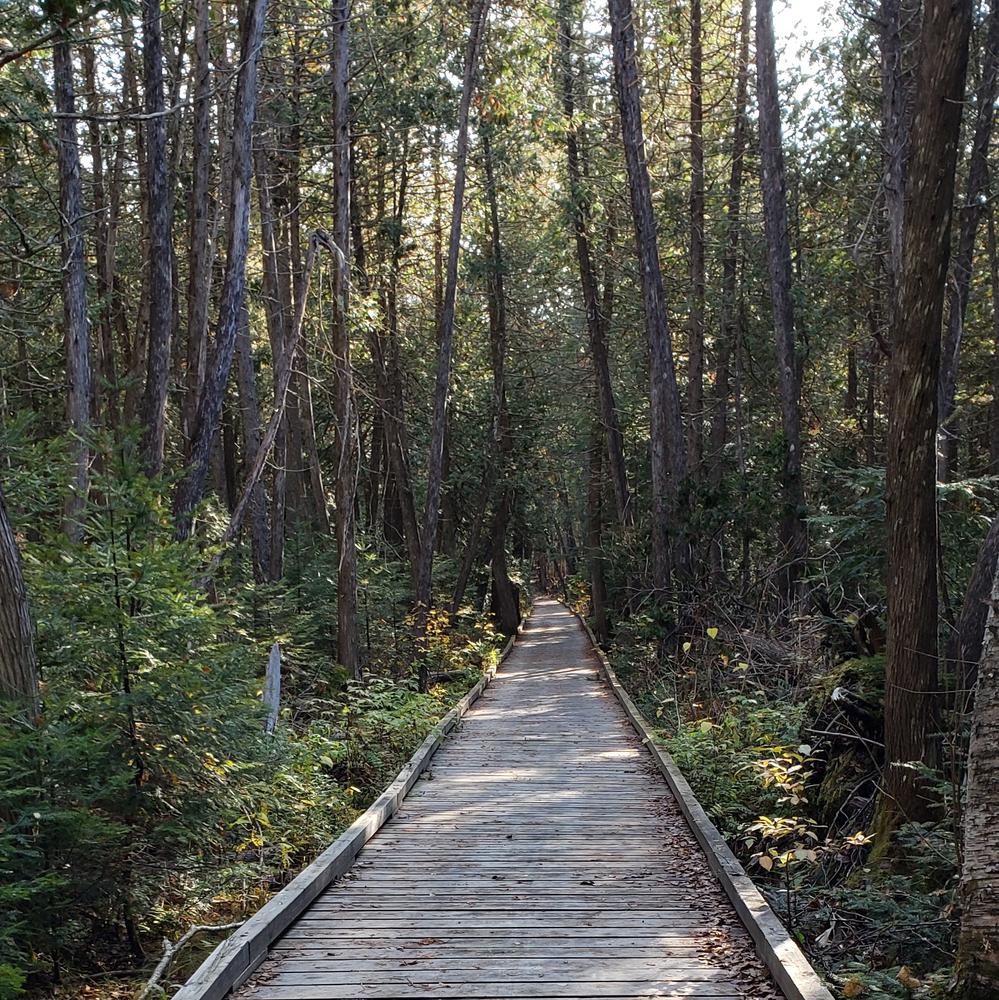
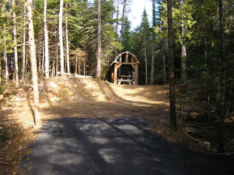
At roughly 1.25 miles, there is a spur trail to the right (east). This trail leads nearly 0.2 miles to a day-use area complete with a picnic shelter. The trail to the picnic shelter is also open to multiple uses. Unlike the main multi-use trail, it is somewhat narrower, has several boardwalk sections, and uses an attractive crushed shale to harden and surface the trail. The boardwalk sections are specifically designed for multiple uses. The first section passes through a stand of northern white cedar and the second occurs right before reaching the day-use site.
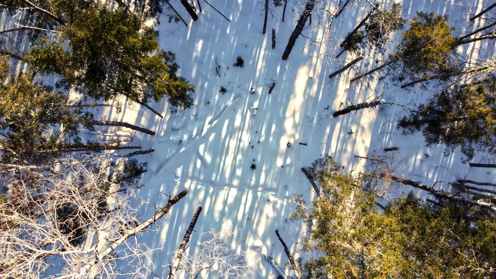
The day-use area marks the end of multiple-use trail until the hiking trail rejoins the Bangor and Aroostook Trail in a little over one mile. The day-use area also serves to provide hand-carry boat access to Salmon Brook Lake, a shallow, 51-acre lake with a maximum depth of five feet (although most of the lake averages between one to two feet).
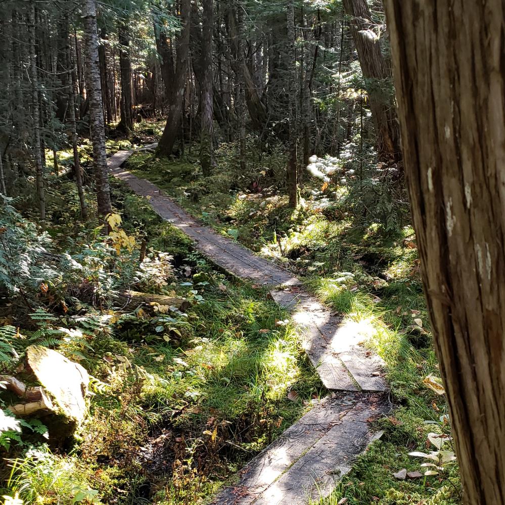
From the day-use area to the trail junction further north along the Bangor and Aroostook Trail is one mile. Along the way, hikers pass through a number of forest types including another northern white cedar stand. The trail is typical of a primitive hiking trail in that it includes bog bridging and has an uneven surface with exposed roots and rocks. However, there is negligible elevation change.
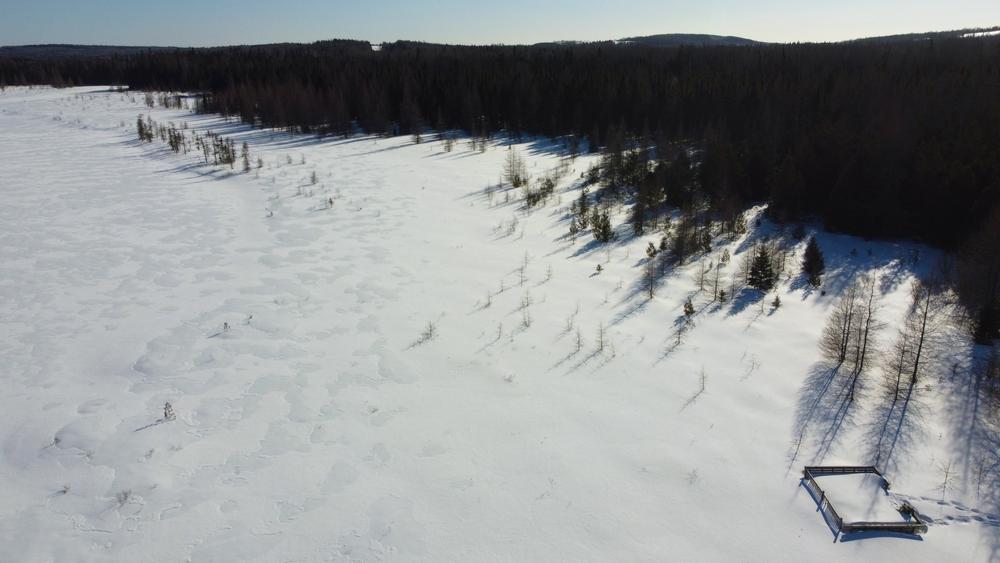
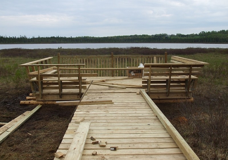
Along the hiking trail, look for a third boardwalk along a spur off the hiking trail. This 215-foot section of boardwalk takes you out to a 12’x16’ viewing platform overlooking the grassland surrounding the lake. This recently constructed platform is an ideal place to take in the unique landscape and look for a variety of birds and other wildlife.
Upon reaching the junction with the Bangor and Aroostook Trail, turn left (south) and head back towards where the previously described spur headed towards the lake. It is a little under one mile to reach that first spur and another 1.25 miles from there to reach the town office/ trailhead. Just before reaching the Bangor and Aroostook Trail, there will be an intersection where one can continue north 0.8 miles to the Tangle Ridge Road trailhead.
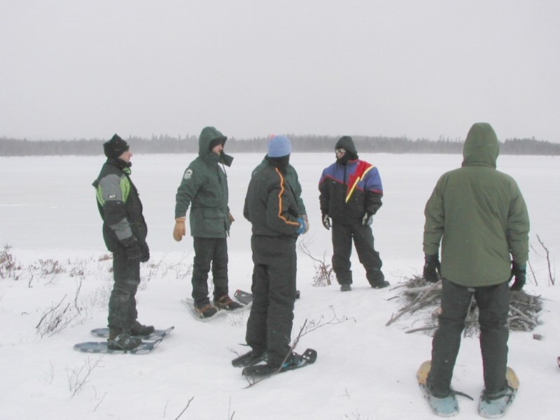
In the winter months, the same general pattern occurs along the trail. Snowmobiles share the groomed trail with snowshoers and cross-country skiers up until the hiking trail section, which is restricted to human-powered activities including snowshoeing and skiing. Anyone snowshoeing or skiing along the trail in winter should recognize that snowmobiles may be traveling along the trail at relatively high rates of speed and all users should be aware of other users' presence.
Upon reaching the junction with the Bangor and Aroostook Trail, turn left (south) and head back towards where the previously described spur headed towards the lake. It is a little under one mile to reach that first spur and another 1.25 miles from there to reach the town office/ trailhead.
In the winter months, the same general pattern occurs along the trail. Snowmobiles share the groomed trail with snowshoers and cross-country skiers up until the hiking trail section, which is restricted to human-powered activities including snowshoeing and skiing. Anyone snowshoeing or skiing along the trail in winter should recognize that snowmobiles may be travelling along the trail at relatively high rates of speed and all users should be aware of other users' presence.
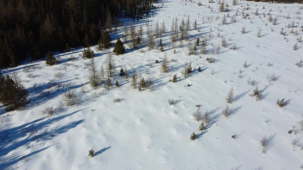
From the Tangle Ridge Road Trailhead: The trail running south from the trailhead toward the multi-use railbed is a classic primitive hiking trail through forest stands in which any timber management is focused on benefitting wildlife habitat. Approximately 0.8 miles from the start of the trail on Tangle Ridge Road, the trail enters the ecological reserve area and joins the trail segment coming in from the south. Here, there is the option to turn west to reach the multi-use trail via a short spur. It is roughly 0.6 miles south to the viewing platform at the bog. It is approximately 0.7 miles further south to reach a more southern intersection with the multi-use trail. From here, it is just under a mile north to reach the hiking trail again (thereby making a loop). Return to the trailhead by heading just over 0.8 miles to the trailhead. Following the full hiking trail and returning via the rail bed and a portion of retracing the hiking trail to the trailhead is just under a 4-mile trail experience.
The Maine Bureau of Parks and Lands' Off-Road Vehicle Division, the Bureau's Northern Region Lands Office, and the Town of Perham all partner to manage the trails described here.
The 1,857-acre Salmon Brook Lake Bog property was acquired from The Nature Conservancy in1993 through the Land for Maine’s Future Program. The property is known for its extensive wetlands and is host to six rare plant populations and six exemplary natural communities. The Nature Conservancy continues to be involved in management discussions here.
A 1,055-acre Ecological Reserve surrounds the lake and wetlands on the property. According to the Maine Natural Areas Program, "the Salmon Brook Lake reserve captures many ecological features characteristic of Maine's northeastern limestone belt, including circumneutral fens, northern white cedar swamps, and numerous rare plants".

This trail passes through a property that was acquired in part with funds from the Land for Maine’s Future program. For more information about the LMF program and the places it has helped to protect, please visit the LMF webpage.
Visit Maine Bureau of Parks and Lands online for more information or contact:
![]()
There are two trailhead options for enjoying the hiking trail system at Salmon Brook Lake Bog Public Land.
Users looking to access the property via the Bangor and Aroostook Multi-useTrail can park at the Perham Town Office. From the south, come through Presque Isle, taking ME-164 to Wasburn and ME-228/Perham Road north to a sharp intersection with the High Meadow Road in Perham. At this point, ME-228 becomes the Woodland Center Road and heads east to Woodland. Travel west on the High Meadow Road roughly one mile to the Perham Town Office, where you can access the Bangor and Aroostook Multi-use Trail. Walk the Bangor and Aroostook Trail north to begin the hike.
Access from the east is available via ME-228/Woodland Road out of Caribou. See above for directions from the junction of ME-228 and the High Meadow Road in Perham.
Hikers looking to enter the trail system from the north can use a trailhead located on Tangle Ridge Road. This trailhead with off-road parking is reached via turning north off of the High Meadows Road onto Tangle Ridge Road or by picking up the Tangle Ridge Road in Woodland.
Success! A new password has been emailed to you.