From Limerick:
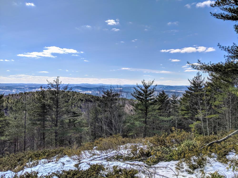
The Smith Trail starts from the back corner of the Limerick parking lot located near the end of the Sawyer Mountain Road. The trail is marked with small wooden plaques, each of which bears a carved yellow turtle. The trail ascends steeply for 0.2 miles then bears to the right across a small depression. The trail continues along an old logging path. Bear left to the base of some cliffs and then follow the trail further to your left keeping the cliffs to your right. At the end of the series of cliffs, first bear right and then left following the marked trail through a small pass. At approximately 0.4 of a mile in, the trail turns left sharply (marked by arrow signs), crosses a break in the stone wall, and levels off. At this point adventurous hikers can take a side trip off of the trail and climb to the height of land above the trail for a rewarding view. Or continue along the trail until it reaches the old Sawyer Mountain Road at the 0.6 mile point marked by a trail sign. On the far side of the Sawyer Mountain Road, look for remains of the house and barns of the Sawyer Family homestead. There is also a Terracache near this point. Follow the old Sawyer Mountain Road to the right for 0.3 miles until you reach the next sign for the summit. Turn right and follow the trail along the mountain ridge for another 0.3 miles to the summit. The summit is located in Limington just over the Limerick/Limington town line.
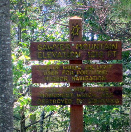
Look for the sign that marks the site of the whale oil light that was used for Portland Harbor navigation in the eighteenth century. Sawyer Mountain is visible from the ocean and sailors could line up the light with other points to guide their ships into the harbor. The lighthouse was later replaced with a stone monument which was then destroyed by a lightning strike in 1913.
For variation on the way down, hikers can follow the old Sawyer Mountain Road back to the parking area rather than following the Smith Trail through the woods.
From Limington:
From the back of the Limington parking area located off of ME Route 117, follow the rightmost trail which is the trail closest to the map box. The trail is marked with small wooden plaques, each of which bears a carved yellow turtle. The trail remains straight and level for the first 0.2 miles. At the point where the trail begins to ascend, bear left to the marked foot trail that parallels the old Sawyer Mountain Road. Please note that at this point the road is the Trust boundary and that the land to the right is private property. Please respect our neighbors. One tenth of a mile later, the trail rejoins the old Sawyer Mountain Road and ascends steeply. The old road was the main access to homes and farms on Sawyer Mountain until the road was officially discontinued over 100 years ago. At the top of the rise, note the red historic hunting camp on the right. This camp was built in the 1940’s by the father of Sherwood Libby who was one of the Trust’s founders. A short distance past the camp, the Trust’s property lies on both sides of the old Sawyer Mountain Road. At 0.7 miles in, look for the beaver dam on the right. At 0.8 miles, the trail reaches “The New Road” which was built at the turn of the century to provide access to Sawyer Mountain from the Norton Road. A Trust trail sign marks this junction.
At 0.9 miles, you will pass the Estes Cemetery on the right.
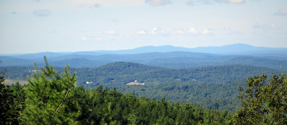
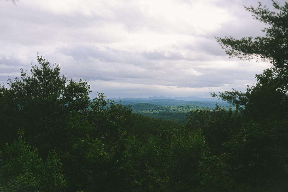
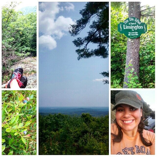
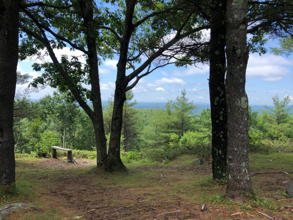
At 1.0 miles, a trust trail sign marks the junction of the trail and the “New Skidway” logging road. The trail to the sign’s left leads to the Town of Limington’s scenic overlook. However, to reach the summit, continue straight. Please note that immediately after the sign, the land to the right of the road is private property. Stay left on the old Sawyer Mountain Road which after a tenth of a mile leaves Trust property. Please stay on the old Sawyer Mountain Road which is a legal Right-Of-Way across private property. On the Right-Of-Way, note the nine-foot deep gullies though which the trail passes. For hundreds of years until the 1980’s, this road was level with the surrounding ground. Then modern vehicles caused the severe erosion that you see today. Continue up the road on the Right-Of-Way until you again reach Trust property. You might notice red blazes which mark the boundary; this is also the boundary between the Towns of Limington and Limerick. Continue up the trail until you reach the Trust sign for the summit at the 1.5 mile mark. Turn left and continue to the summit along the ridge of the mountain.
The trail crosses back into Limington where the summit is located 0.3 miles later. Look for the sign that marks the site of the whale oil light that was used for Portland Harbor navigation in the eighteenth century. Sawyer Mountain is visible from the ocean and sailors could line up the light with other points to guide their ships into the harbor. The lighthouse was later replaced with a stone monument which was then destroyed by a lightning strike in 1913.
Hikers are welcome to leave the trail and explore FSHT property. However if you are leaving the trail, it is easy to get turned around in the many ridges and valleys in this wild area. If you are going to leave the trail, you should bring a map and compass and optionally a GPS device. This remote area is one of the few places where a hiker can still get lost yet be so close to civilization.
FSHT land is surrounded by private property so please be considerate of our neighbors. Hunting is allowed on FSHT lands so dress appropriately during hunting season. Please keep you pet under control as there are many wild animals in the area.
 Natural Heritage Hikes is a project of the Maine Natural Areas Program in partnership with Maine Trail Finder. View the "Sawyer Mountain - Smith Trail" guide online here.

This trail passes through a property that was acquired in part with funds from the Land for Maine’s Future program. For more information about the LMF program and the places it has helped to protect, please visit the LMF webpage.
Visit the Francis Small Heritage Trust online for more information or contact:

Limerick Trailhead: From ME Route 11 in Limerick, turn on to the Emery Corner Road from near the mill. Follow the Emery Corner Road for 2 miles until it ends at the Sawyer Mountain Road. Turn left on the Sawyer Mountain Road and follow it for 1.1 miles down and up hills to the parking lot which is on the right hand side of the road. Past the parking area, the Sawyer Mountain Road rapidly becomes impassible to vehicles.
Limington Trailhead: The trailhead and parking area are located on the west side of ME Route 117 at a sharp turn in the highway. The trailhead is located 2.5 miles south of the junction of ME Routes 25 and 117. The trailhead is located 2.4 miles north of the junction of ME Routes 11 and 117.
Success! A new password has been emailed to you.

I saw two deer at two different points during the hike. A beautiful hike that I'll repeat soon, maybe next time from the Limerick side.
Bonus: Jumping in the river at the Limington Rapids rest stop afterward is the ultimate way to end this hike!