Singepole Trail

Climb to the top of Singepole Mountain for views of Streaked Mountain and the White Mountains. An old granite quarry near the top provides a unique opportunity for rock hunting and photography.
Trail Activity
Snowshoeing Mountain-biking Cross-country-skiing Hiking
Length
3.00 miles, Network
Difficulty
Moderate, Advanced
Town
Paris
Surface
Dirt/Forest Floor, Gravel/Crushed Stone, Rock/Ledge
Pets
Permitted
Fees
No

Description

Two trails ascend Singepole Mountain from opposite sides and meet just below the summit at an old granite quarry. The trail from Brett Hill follows a multi-use jeep road to the top, offering moderate grades and a wide sandy surface. The trail from Hall's Pond is a narrow foot trail which travels around the pond and then switchbacks up the steep south face of Singepole, offering a more interesting and challenging climb.

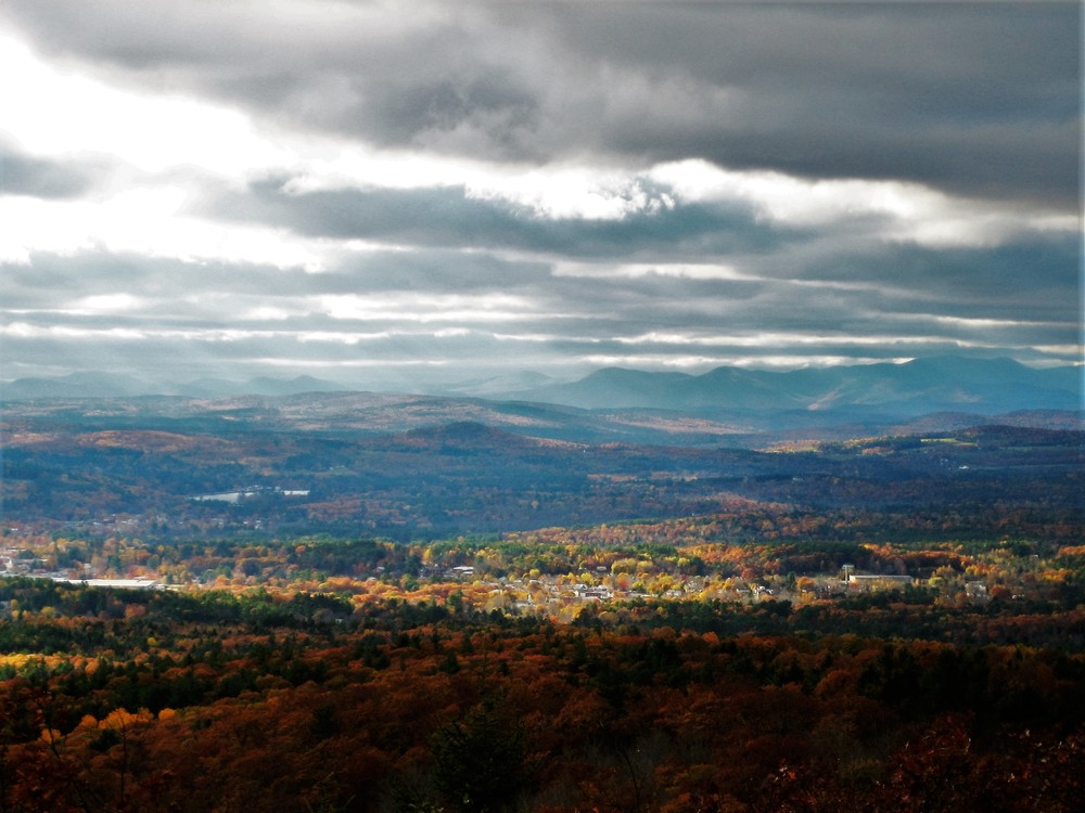
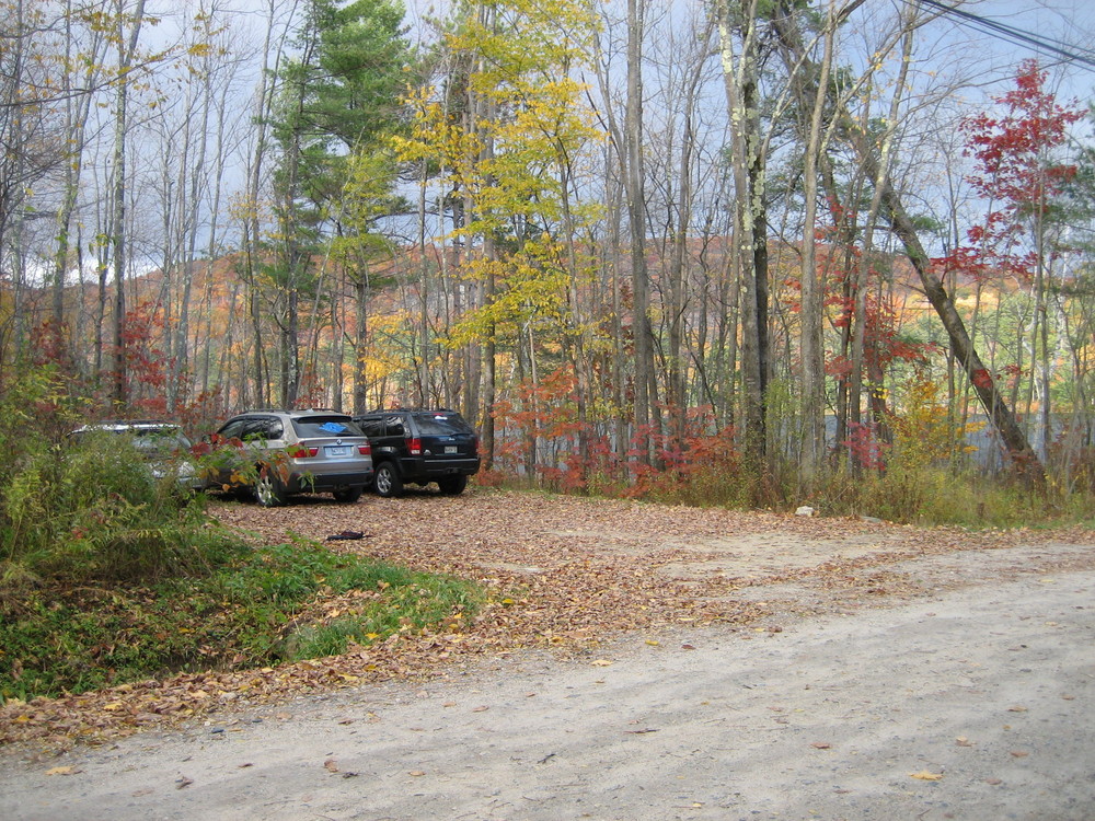
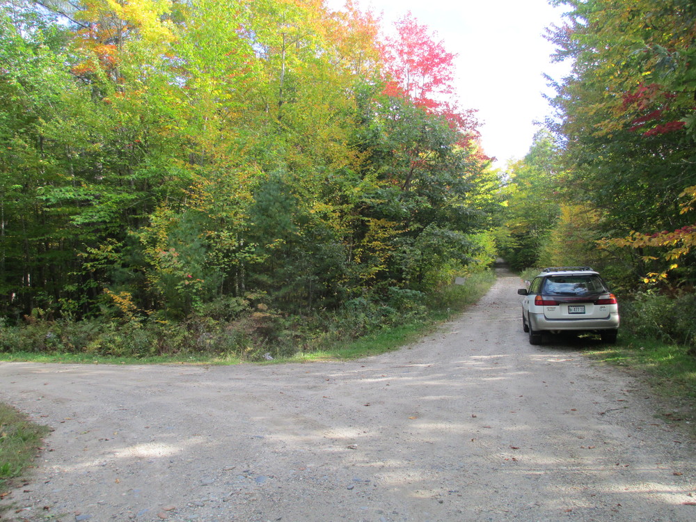
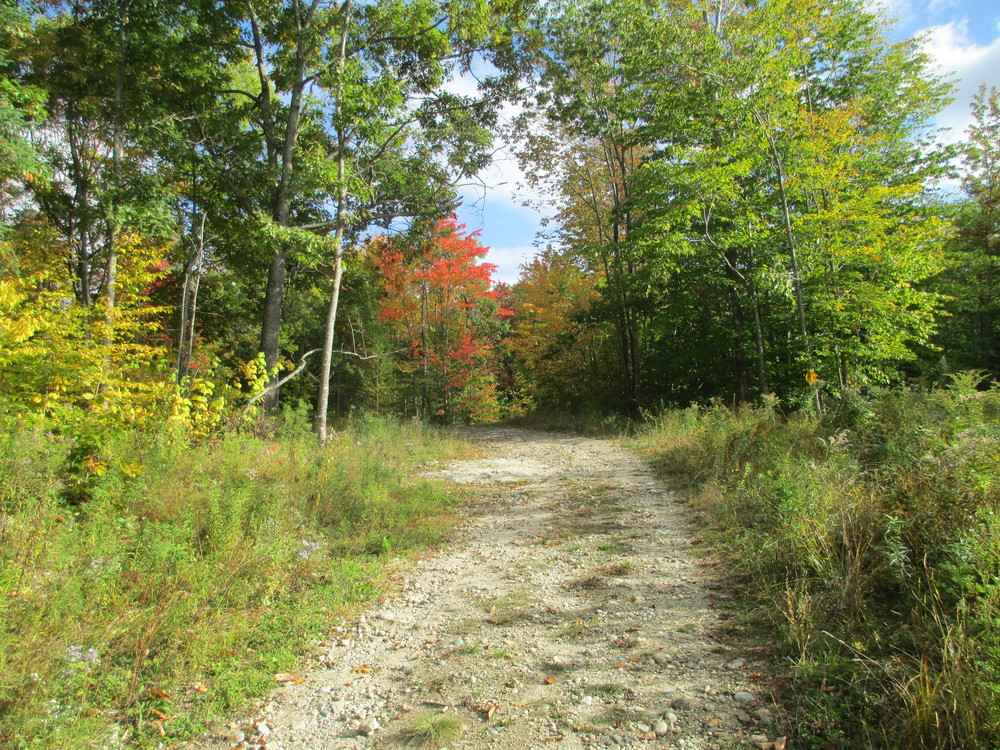
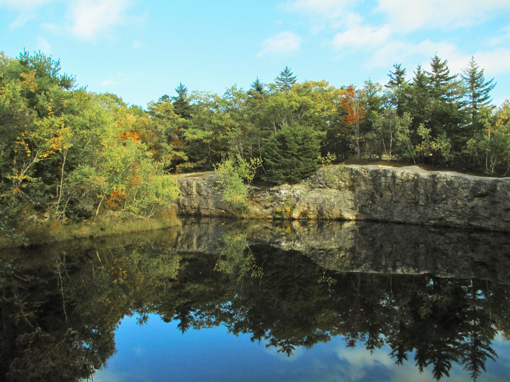
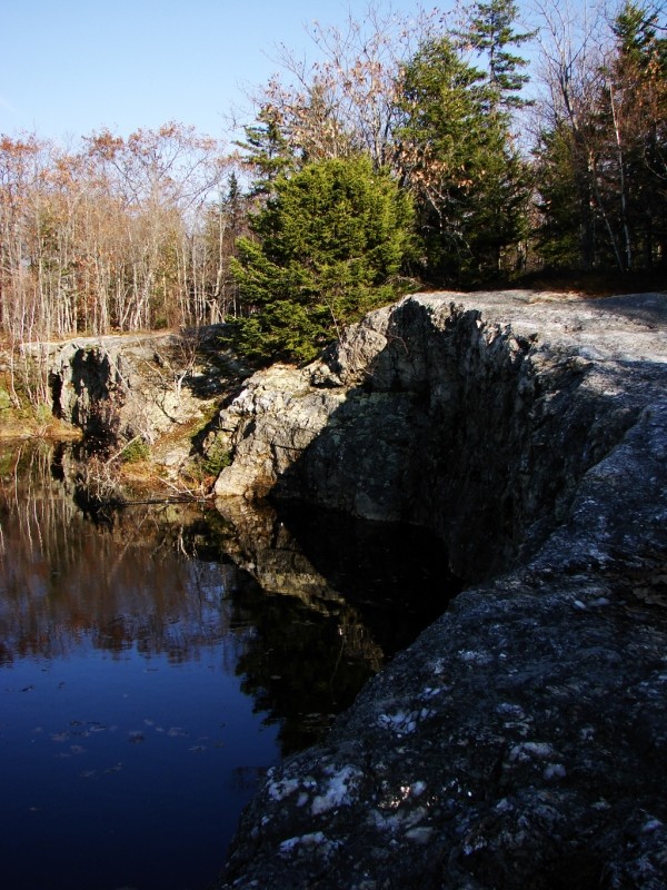
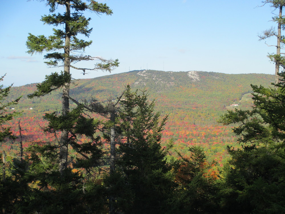
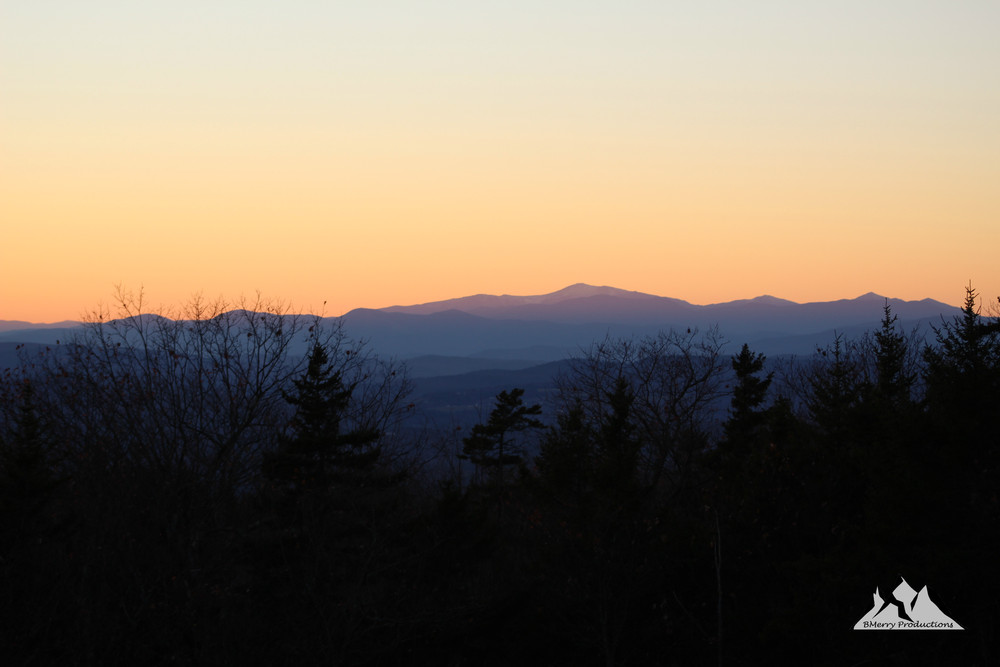
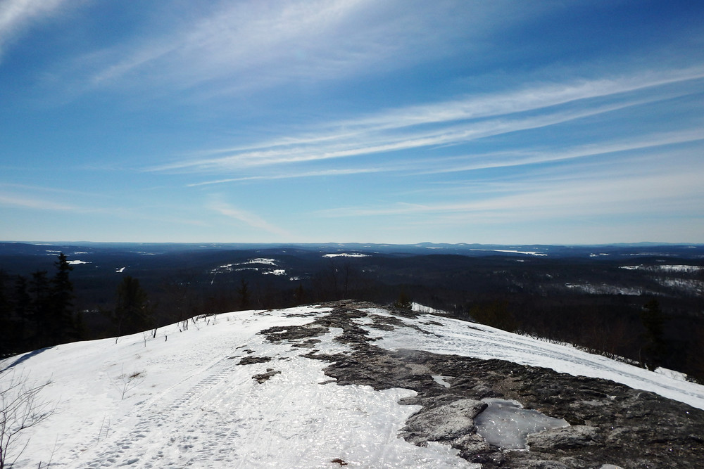
  • Brett Hill Trailhead: From the roadside parking, the trail follows the ATV signage pointing straight up the roped-off dirt road. After approximately 0.25 miles, the trail bears left to continue towards Singepole Mountain/Buckfield on the ATV multi-use trail. Immediately after this junction a large red storage structure sits on the right side of the trail and several junked Volkswagon buses and antique autos are parked on the left. From here, the trail follows a rough jeep road, ascending steadily through a mixed deciduous forest for a little over a mile to the summit. At several points the trail emerges from the woods onto wide granite outcropping which offer good views southwest over the Oxford Hills and the White Mountains. Near the summit of Singepole, the trail passes along the rim of a submerged granite quarry. 
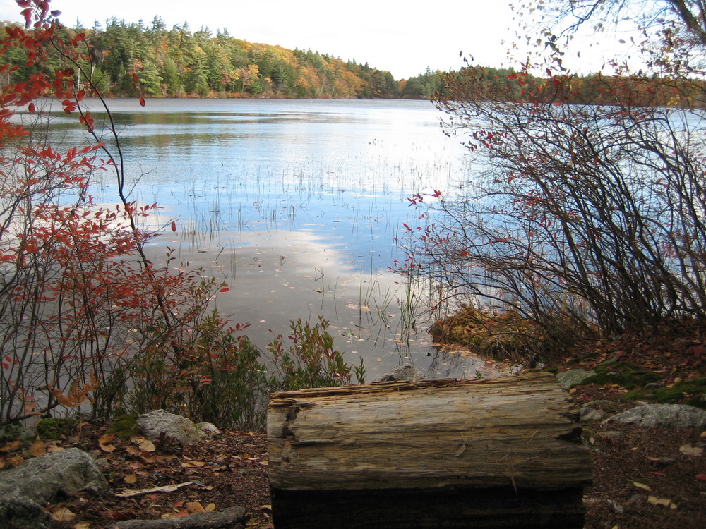
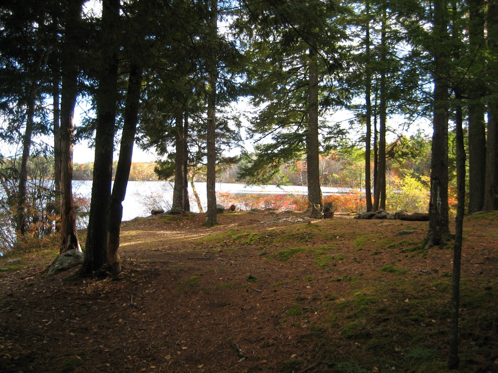
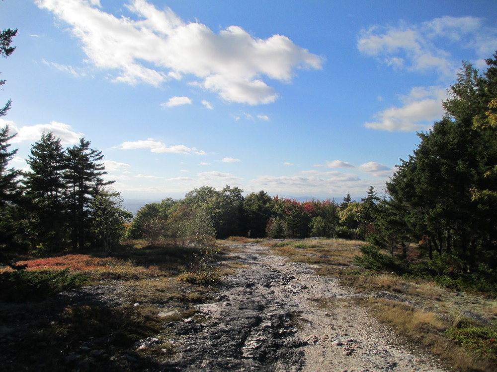
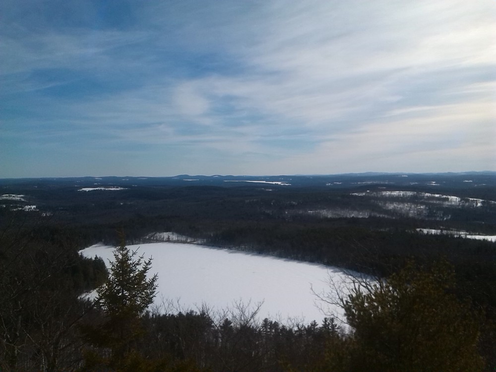
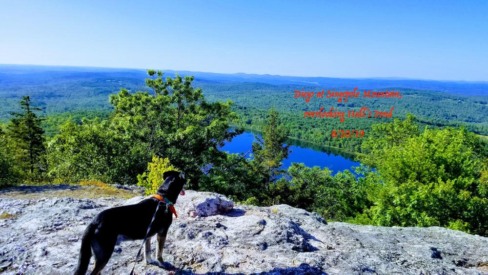
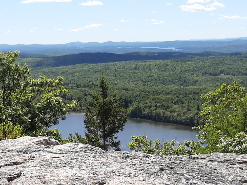
  • Hall's Pond Trailhead: From the small parking area near the boat launch on Hall's Pond, the Pond Loop Trail heads north, following the shore of the pond. Though this first section of the trail is unsigned and unmarked, it is well worn and easy to follow. In approximately 0.5-miles, the trail passes through an open old-growth pine grove which extends out into the pond. A small fire ring and idyllic views over Hall's Pond may be found here. A short ways past this grove, the Singepole Mountain trail departs the Pond Loop and begins to climb steeply. This junction is easy to miss for first time visitors, especially with leaves on the ground; look for two red metal bull's-eyes affixed to two trees on the left. Shortly after this junction, the Pond Loop passes over large exposed stones a few feet from the water; hikers that reach this point by mistake should turn back and look for the uphill trail. After the left turn onto the red-blazed Singepole Trail, the route becomes much more strenuous. The 0.5-miles of uphill trail after this junction are characterized by slippery rock banks, narrow ledges and one tight squeeze beneath an overhanging boulder. Past this section, the trail ascends out of the trees and attains the southern false summit of Singepole Mountain. Panoramic views to the south, west, and north include Pleasant Mountain, the lakes and towns of the Oxford Hills, and the White Mountains on the horizon. From here, it is a short walk along well worn jeep trails north to the granite quarry.
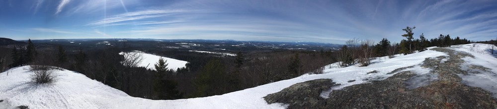
  • From the Quarry: Both trails meet at the southern end of the old granite quarry and follow meandering jeep trails east to the summit of Singepole Mountain. Past this point, the trail becomes challenging to follow and visitors may explore the wide granite faces freely. Excellent views of Streaked Mountain and the Mahoosucs may be found along the northeast ledges of the summit.


Other Information

These trails are on shared-use routes. Please be mindful of motorized vehicles and be respectful of other users.

Hall's Pond is a drinking water source. Internal combustion engines are prohibited on the pond and bodily contact with the water is not allowed.

The Maine Geological Survey provides additional information about the Singepole Mountain Quarries.

Trail Manager

For more information please contact Hebron Academy.

Hebron Academy

Hebron Academy
339 Paris Road
PO Box 309
Hebron, ME 04238
Phone: (207) 966-5223
View website

Nearby Events

VIEW EVENTS CALENDAR

Trail Tips

Plan Ahead and Prepare
Avoid hypothermia, even in warm weather, by limiting your sweat and exposure to cold water. Bring warm and dry clothes in case the shivers set in.
Legend
Hide All

Trailhead Information

Singepole Mountain may be accessed from both the north and the south.

  • Brett Hill Trailhead: [Shared-use Trail] Turn onto the east end of Brett Hill Road, 2.1-miles along ME-117 from South Paris or 7.5-miles along ME-117 from Buckfield. At the point where Brett Hill Road makes a sharp right turn (about 0.4 miles from ME-117), do not turn, instead proceed straight up Durrell Hill Road for a short ways until you reach a road intersecting from the left and a rope across Durrell Hill Road. Park well off the road. [Durrell Hill Road is rough and unpaved and may be unsuitable for cars with low clearance.]
  • Hall's Pond Trailhead: [Foot-traffic Only] Turn onto Hall's Pond Road, 2.1-miles along ME-119 from South Paris or 2.3-miles along ME-119 from Hebron. From the Paris end of Hall's Pond Road, continue for 0.6-miles and turn right to stay on Hall's Pond Road. The small dirt parking lot is on the left just before the boat launch and pond. From the Hebron end of Hall's Pond Road, continue straight up the hill for 0.8-miles. The small dirt parking lot is on the right just past the pond and boat launch.
Click on a parking icon to get custom directions
Please Log In or Create Account to add comments.
traildogs2
October 13, 2023
Hiked most of the Hall's Pond Trail. It's not a difficult hike especially using hiking poles. The views are spectacular for not a great deal of effort. The quarry was fun to see. What was disappointing was the lack of trail markers. You'd need binoculars to find the 1 red blaze on the trail that marks the start of the trail from the Pond Trail. Luckily, someone tacked a blue arrow to a tree. If you take your time you can follow the trail, although parts of it are difficult to see. You have to concentrate on where you are going. It's a beautiful hike in need of some attention. The Parking Lot by the Pond is unmarked. A few signs/blazes would make a huge difference.
terifleck721
May 22, 2021
I’ve hiked the Halls Pond side several times since my last post. I figured it out. Switchback after the ledge is a little tougher, but doable for those that hike and have good footwear.
terifleck721
July 30, 2020
So, after wanting to check out the Halls Pond side of Singepole, I was able to. Yes, it’s steep, but I was anle to do that and ledges and get under boulder. It was after the boulder where I got confused, as Trail went down the side of the mountain, and through what looked like more boulders. It was then that I got a severe thunderstorm warning on my phone, and turned around to head back. So if anyone can enlighten me on where to go after the ledges, that would be great. Thanks!
sampfeifle
June 15, 2020
We went up the Halls Pond side and it's just about a perfect hike for a family of four. Little kids might struggle a little bit in the last third, but the top is one of the best payoffs in central Maine - a big field of granite and a huge sweeping view. Still snow on Sunday River yesterday!
dc.mcneil
June 14, 2020
We hiked from Brett Hill Rd. It was a little confusing at first but we had a great hike. Great views and a beautiful quarry. Fairly easy trail overall. Looking forward to hiking it from Halls Pond next!
rustycrank
May 01, 2020
I hiked Hall's Pond Trail, April 29, 2020. The first half of the hike is a flat walk along water's edge, but it was very wet and muddy so wear boots or something mud-resistant at least in spring. After the trail leaves the pond and heads up, it becomes steep-ish but not difficult. The trail description makes this route sound perilous in spots but I didn't find it that way at all. Yes, there are switchbacks and tight lines across ledges but I never felt like I was going to fall off the hill or anything, so don't be deterred. Nothing technical. The views from the overlook (false summit I guess it's called) are broad and interesting ... a full-on look at Pleasant Mtn. and the White Mountains. So much to look at. Bring binoculars. A very good reward for not a lot of effort. Can't wait to explore further!
terifleck721
October 15, 2018
I hiked Singepole when I was younger, and started hiking again this year, a few short years later. It’s a beautiful hike, great workout, and great scenery and interesting rocks and gems from the top! Love it!
juliampowers
October 10, 2017
We hiked the Hall's Pond Trail, it was a stunning hike up and down. There is a steep incline to the top on this trail and you will need to watch your footing in a few areas. The view from the top was amazing! This is definitely one we will do again!
bmerrymtn1
November 14, 2016
I hiked up the Halls Pond Trail in daylight and had no problem staying on trail. I enjoyed it a lot and was challenging in some spots due to steep inclines and slippery leafs. I stayed at the summit to watch the sun set and the Full moon rise. The views were spectacular! But when it was time to hike back down, it was difficult to find the trail I had come up. I eventually found it but came to a point where I could not tell where it continued. I had came prepared with multiple flashlights and well dressed for the trip. I ended up back tracking and decided to use the ATV trail to get down. I had this as a back up, knowing that the trail is not clearly marked while going down hill. It made the hike much longer then expected but still enjoyable. If you plan on hiking at night, I suggest using a GPS device to track where you have gone as it is easily covered by leafs at this time of year. Going up the trail took about 35 minutes give or take a few minutes. The hike down took me a hour and half due to having to walk the roads back to where my car was parked. It is a beautiful hike and I would recommend it to any intermediate hikers due to the lack of marked trail.
These awesome businesses support our goal of connecting people to outdoor adventures in Maine!
Hang Tight!
Nearby services are loading
No Results
No Services Found
SHARE THIS TRAIL

Add Trail Log

Please wait…
Join In on the Fun!
Log in or create an account below to unlock all the great features of Maine trail finder: keep track of trails you want to do, preserve memories of trails you’ve done, earn badges, and more!
Your log in attempt was not successful. Please try again.
    Lost your password? Reset your password
    Don't yet have an account?
    There was an issue with your submission. Please try again.
      * Indicates required field
      Already have an account? Login here
      Enter your username, and we will send you a new, randomly generated password to your email account.
      There was an issue with your submission. Please try again.

        Success! A new password has been emailed to you.

        Log in now

        Please wait…