White Mountain National Forest - Caribou Mountain

The summit of Caribou Mountain is renowned for a spectacular 360 degree view of the Mahoosuc, Carter, and Presidential Mountain Ranges, Cold River Valley, and the Bethel area.
Trail Activity
Hiking
Length
8.80 miles, Network
Difficulty
Moderate, Advanced
Towns
Batchelders Grant Twp, Mason Twp
Surface
Dirt/Forest Floor
Pets
Permitted
Fees
No

Description

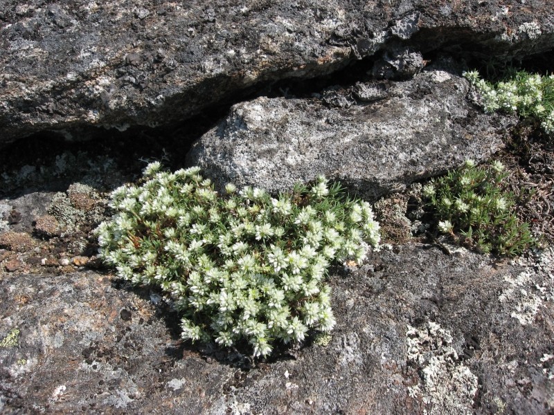
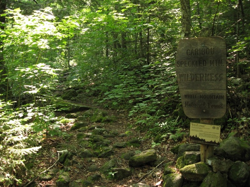
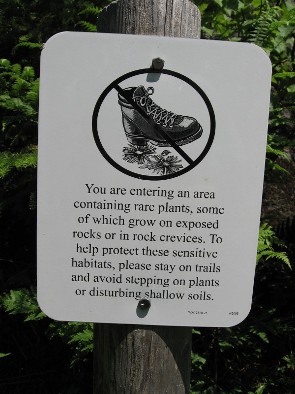
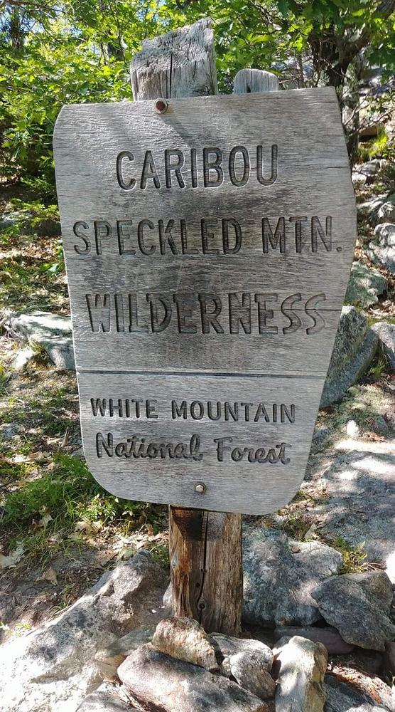
The Caribou Trail and Mud Brook Trail leave from a common trailhead parking area on ME Route 113 between Hasting Campground and the Basin Recreation Area. Both trails use parts of old logging roads to lead hikers through land that has a rich history as farmland and timberland. These trails also travel through part of the Caribou-Speckled Mountain Wilderness, which was designated by Congress in 1990 to be preserved for future generations. Hikers will notice narrower trails and fewer signs within the Wilderness.

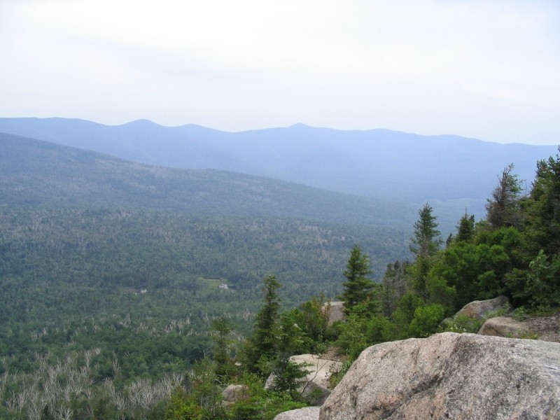
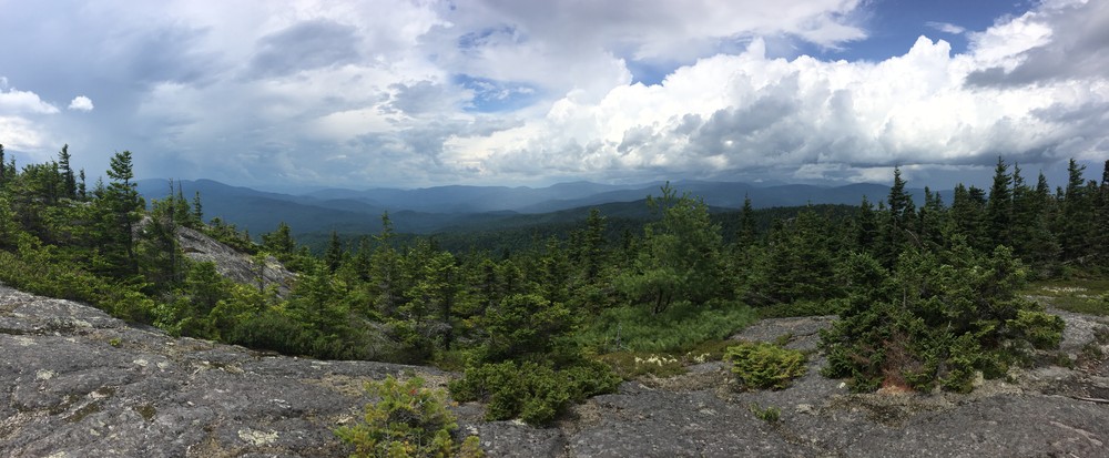
The Caribou Trail is a relaxing and scenic hike. It passes through a northern hardwood forest as it follows Morrison Brook, which treats hikers to several waterfalls, including the spectacular 25 foot Kees Falls (2.1 miles). The trail crosses Morrison Brook several times and intersects with the Mud Brook Trail at 3.1 miles before climbing over the col into the Bog Brook basin and ending at Bog Road (5.7 miles).

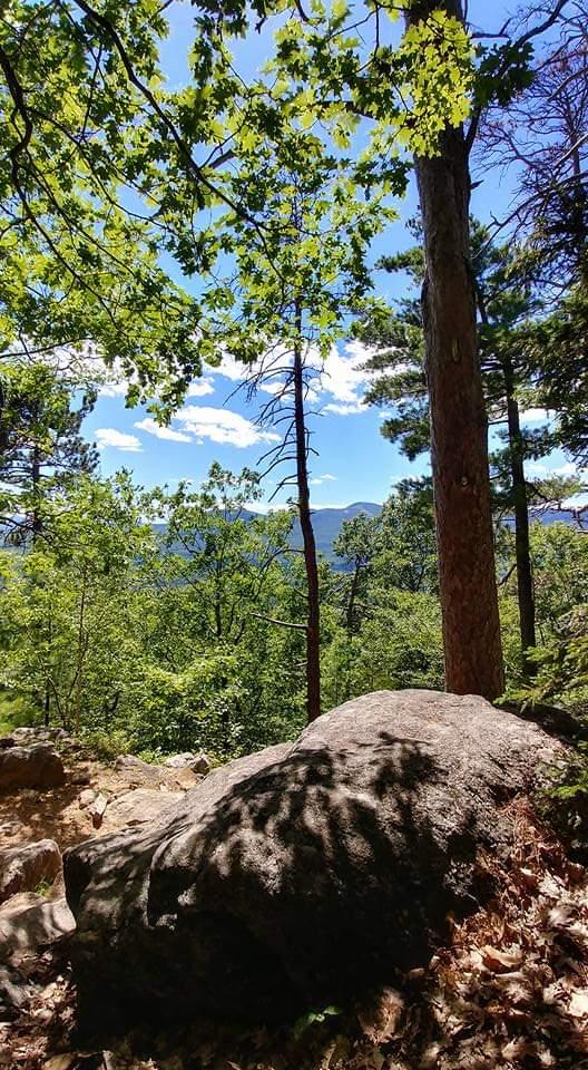
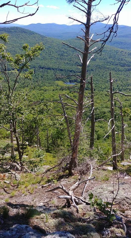
The Mud Brook Trail leaves the south side of the parking area and follows Mud Brook along an old woods road, ascending gradually for 1.7 miles. The trail then turns left, crosses Mud Brook several times, and begins to climb steeply over a small bare knob. It then descends to a small ravine, crosses ledges, and then reaches the summit of Caribou Mountain at 3.0 miles. Rock markers (cairns) clearly direct hikers over the rocky summit. The trail intersects with Caribou Trail at 3.6 miles allowing hikers to make a 6.7 mile loop back to the trailhead on ME Route 113.

Other Information

Caribou Mountain is part of the Caribou-Speckled Mountain Wilderness, please check with the Androscoggin Ranger Station for current information about maximum group size and camping and fire regulations. The section of ME Route 113 that the parking area is located on is closed during winter. The section of Bog Road which provides access to the parking area for the northern Caribou Trail trailhead is not maintained for winter travel. A White Mountain National Forest Recreation Pass is required at the Brickett Place Day Use Area. A self-serve pay station is located on site.

Natural Heritage HikesNatural Heritage Hikes is a project of the Maine Natural Areas Program in partnership with Maine Trail Finder. View the "Caribou Mountain - Caribou and Mud Brook Trail" guide online here

Trail Manager

Visit the White Mountain National Forest online for more information or contact:

White Mountain National Forest

White Mountain National Forest
300 Glen Road
Gorham, NH 03581
Phone: (603) 466-2713
tpellerin@fs.fed.us
View website

Nearby Events

VIEW EVENTS CALENDAR

Trail Tips

Minimize Campfire Impacts
Use only small pieces of dead and down wood for campfires and let them burn down to ash. Please extinguish your campfire before leaving.
Legend
Hide All

Trailhead Information

From US Route 2 in Gilead, travel south on Maine State Route 113 for 4.8 miles to the parking area at the Caribou/Mud Brook Trailhead on the east side of the road. From US Route 302 in Fryeburg, travel north on Maine State Route 113 for 24.8 miles to the parking area.

For the north end of Caribou Trail: From US Route 2 just west of West Bethel, travel south on Bog Road 2.8 miles to a small parking area where the road is gated.

Click on a parking icon to get custom directions
Please Log In or Create Account to add comments.
travelin light
May 27, 2020
Great trail. Went up Mud Brook and down Caribou. The trail was muddy in sections, but there was only one little patch of snow on the Caribou. The brooks were gorgeous as were the views at the top. Easy to follow even with few blazes. Only had to really pay attention near the top of the Mud Brook, but the cairns were found quickly.
207lance
September 03, 2016
Hiked up Caribou Mtn. yesterday and it was awesome! Went up Caribou Trail as many had suggested that was the way to do. I thought the Mud Brook Trail junction would be harder to find, given the comments, but there is a tall sign post that makes the turn onto Mud Brook Trail clear. Once on the summit, we had to try a couple of different tacks to get a hold of the Mud Brook Trail again to descend, but we did find it, and came down that way.

For Mud Brook from the summit head toward the south end of the ridge, staying slightly to the east side of center, and you'll start to see small cairns that people have built up. There are lots of little false trails up there, and just bare rock, too, but you'll be able to pick up the trail pretty easily if you look for the cairns. It would be great to have better markings on both trails, but as has been noted before, the trail is well worn in most places, and relatively easy to follow. In spring time, or after heavy rains, it could be a little trickier, for sure, to find the path easily. I'd be happy to head back up there to help with trail marking at some point this fall...

Myself and my 11 yr old son made the hike, and our timeframe was about 2 hr 20 minutes up, and an 1 hr 45 min down. The summit is amazing! So beautiful. it was about 75 degrees at the base, with a slight breeze, but up top was quite a bit chillier with a stiff breeze blowing, so pack a windbreaker, even on a warm day!

This is a great hike!
luv2hike
July 24, 2016
Enjoyed our hike up at Caribou mountain. We had a few concerns: despite the well-worn trail the markings were minimal (non-existent) making it difficult, at times, to follow especially when crossing the brook. Once we got to the summit we were unable to locate the Mud Brook Trail. There were no rock formations (cairns). Not sure if someone took them down or they blew away but there were also no other markings (paint markers). Everyone we passed that day had the same concerns (except for the one girl who hiked up mud Brook Trail and down Caribou Trail.) They had to hike up and down the Caribou Trail. The views from the summit were beautiful. We hiked it on a very hot humid day and left just in time for the thunderstorms to roll in. This would be a beautiful hike for all three seasons. I will definitely be contacting Mr. Maynard regarding helping in marking and maintaining this beautiful trail.
mehiker
September 19, 2015
Hiked up Caribou Trail today to the summit of Caribou Mountain, then down via Mud Brook Trail. The trails were in good shape the whole way and easy to follow. Any downed trees from last winter have been cleared, except for a few that are easy to step over. Going up Caribou and down Mud Brook is the easiest as the former is more rocky and the latter more rooty. The falls on Caribou were nearly dry as you would expect for September, but if they were fully flowing that might make the stream crossings troublesome.
bigeloafah
May 16, 2015
We did the loop, ascending via the Caribou Trail from 113 and descending on the Mud Brook Trail. Good call to do it that way: wonderful waterfalls and fun stream crossings on the way up; easier going on the way down. Great views from the ledges at the summit - Presidential peaks and ridge upon ridge this way, wilderness that way.

The only drawback was considerable blowdown at the higher elevations near the junction of Caribou and Mud Brook and above. That meant some patient picking one's way through undergrowth, off the trail.

It was apparent that folks had been working to clear the trail, but there's lots left to do. Next time we'll bring saws and work gloves. Thanks to everyone who has already helped make the trail easier going.
maynard
October 07, 2014
Caribou Trail is a delightful trail for water lovers and Caribou Mountain provides a wide expanse and 360"
degree vista. The trail is currently orphaned by the Forest Service and nearby trail associations. Looking to organize a group to work with the Forest Service or possibly Chatham Trail Association. Call Richard Maynard at (207) 583-8054 if interested.
Jrkakapa1
June 28, 2014
The guy who helped build, and maintain this trail as a kid, sent us here today! The water was flowing rich, and the falls were singing loud. And a third generation hence the steward, was gifted. Possibly a future steward, and trail volunteer of Caribou Mtn. Trail has been born? Thank you for this gift! 06/28/14 JRK
These awesome businesses support our goal of connecting people to outdoor adventures in Maine!
Hang Tight!
Nearby services are loading
No Results
No Services Found

Trail Alerts

Ecology
Fragile Alpine Vegetation
This trail passes an area containing rare and fragile alpine plants, some of which grow on exposed rocks or in rock crevices. Please stay on trails and avoid stepping on plants or disturbing shallow soils. Please keep your pets on leash.
SHARE THIS TRAIL

Add Trail Log

Please wait…
Join In on the Fun!
Log in or create an account below to unlock all the great features of Maine trail finder: keep track of trails you want to do, preserve memories of trails you’ve done, earn badges, and more!
Your log in attempt was not successful. Please try again.
    Lost your password? Reset your password
    Don't yet have an account?
    There was an issue with your submission. Please try again.
      * Indicates required field
      Already have an account? Login here
      Enter your username, and we will send you a new, randomly generated password to your email account.
      There was an issue with your submission. Please try again.

        Success! A new password has been emailed to you.

        Log in now

        Please wait…