The trail starts to the right of the Ranger’s cabin at the southern end of 4210-acre Allagash Lake–the headwater of the storied Allagash River. At approximately 0.1 miles, the trail begins a series of modest climbs through a mix of spruce, fir, beech, birch, and maple. Relatively flat sections are interspersed between these rises. Beginning about a third of a mile from the start of the trail, the climb begins in earnest. A final, steep climb is undertaken at roughly half a mile along the trail. All told, the trail gains a little over 750’ in 0.7 miles of trail.
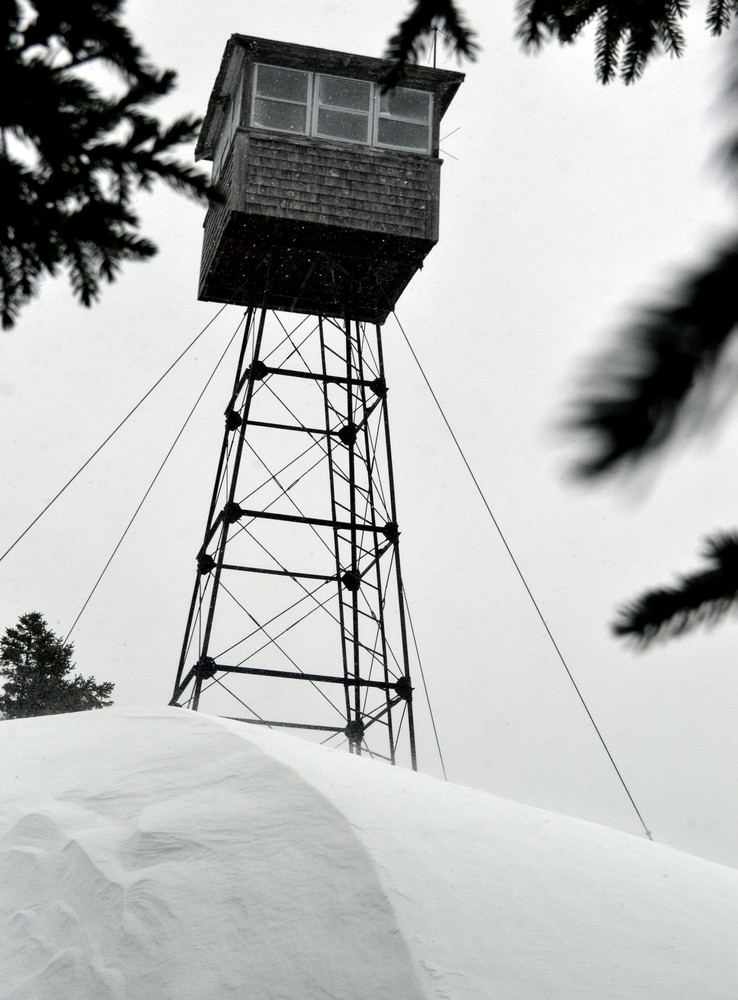
While the distance the trail covers is not great, it nonetheless provides access to a remote outcrop in a wild, remote area. A recently renovated fire tower sits atop the open peak, where soil is thin or non-existent and low spruce trees show the effects of being battered from harsh winds and long winters in the north country. Tightly grained volcanic rock (basalt) lies exposed under your feet at the summit area.
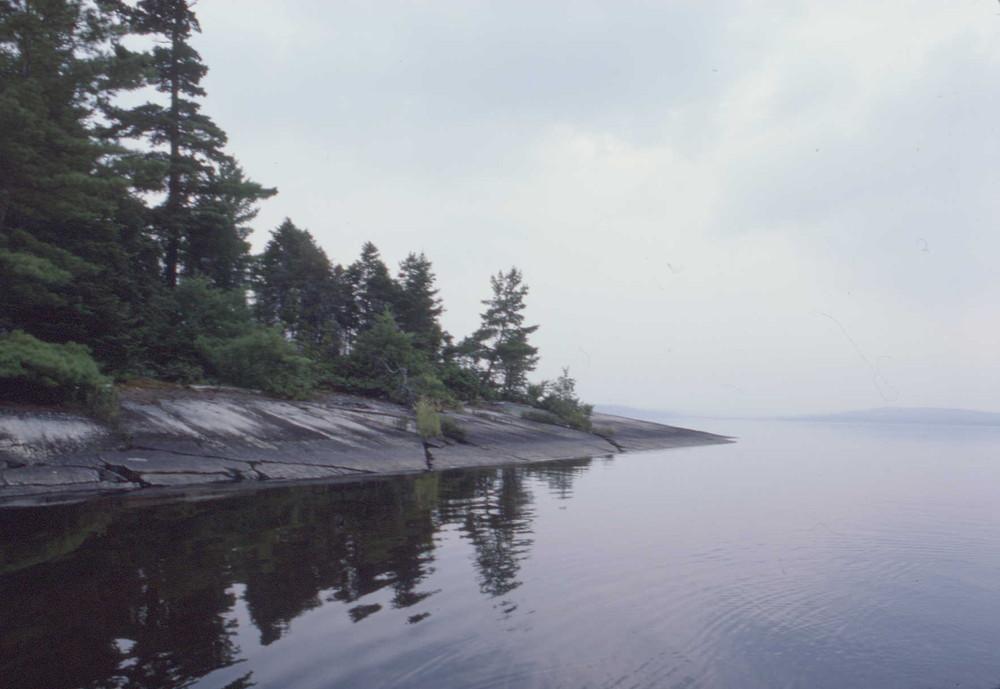
On a clear day, views are immense. Allagash Lake, arguably the wildest part of the entire 92 –mile Allagash Wilderness Waterway, is nestled below. Chamberlain, Eagle, and Churchill Lakes sit further to the east and north. To the west, the vast watershed of the Upper St. John River rolls before the eyes, and to the south, the lands drain away to the Upper West Branch of the Penobscot River.
A trip to the Allagash Wilderness Waterway (AWW), especially for new visitors, requires advanced planning. The AWW is within the North Maine Woods recreational system: visitors must pass through a checkpoint and pay the required day use or camping fees. Fees associated with visits to the Allagash Wilderness Waterway are transferred to the Bureau of Parks and Lands.
The ice caves behind the Ice Caves campsite are a unique, natural feature that can be explored when you are not out fishing or paddling. Ice remains in the caves on a year-round basis. Serious cave explorers should bring a hard hat, flashlight, and rope for safety.
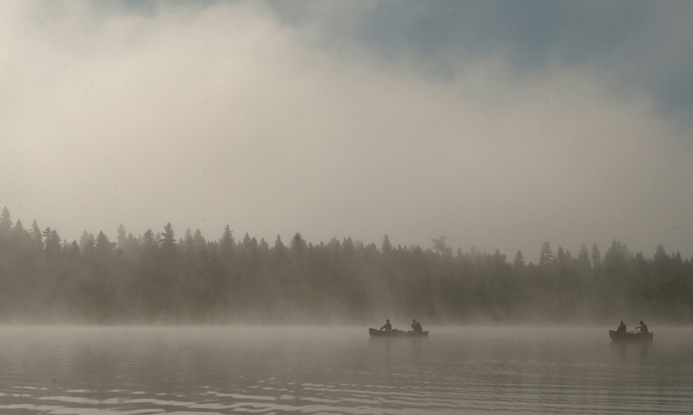
Allagash Lake is designated by Allagash Wilderness Waterway (AWW) rules as the most remote and quiet lake in the waterway. The operation of motor vehicles within 1 mile of the lake is prohibited between May 1 and Sept. 30. No power equipment of any kind is allowed to be used on Allagash Lake or Allagash Stream. Watercraft use is restricted to the use of canoes and kayaks only without motors.
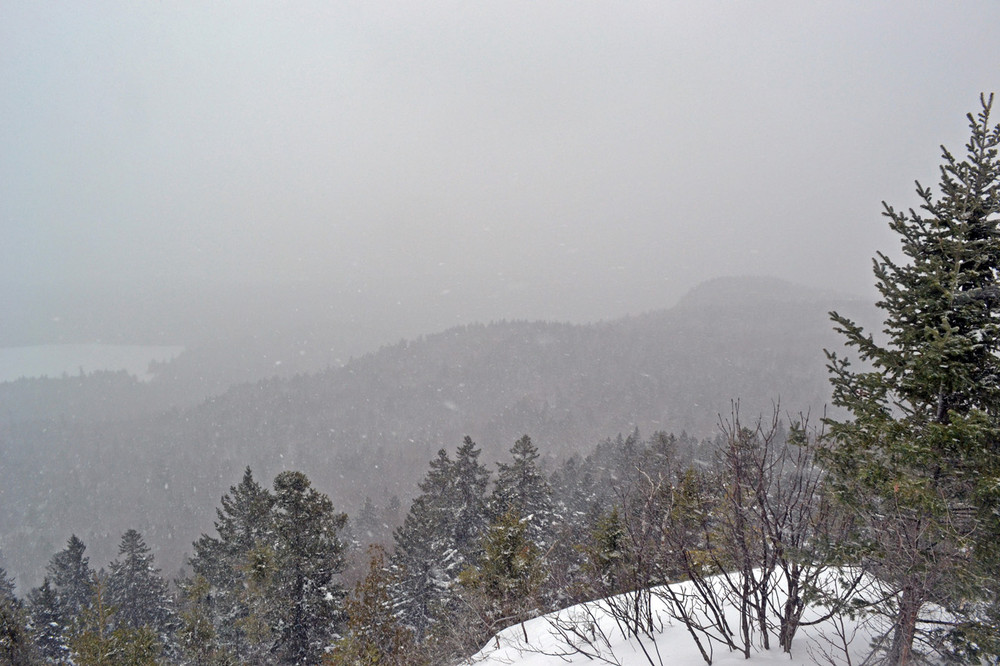
It is possible to snowshoe Allagash Mountain, though access is primarily via primitive, largely unmarked snowmobile routes which cannot by law include travel on the lake. Call for more information concerning winter use.
Rules & Regulations for the Allagash Wilderness Waterway
Visit Maine Bureau of Parks and Lands online for more information and a printable map or contact:
Maine Bureau of Parks and Lands, Allagash Wilderness WaterwayAccess to the Allagash Mountain Trailhead is off the southwestern corner of Allagash Lake. Access to Allagash Lake is restricted to three primary locations, two of which require canoe travel along streams to reach the lake. There is no drive-to access at Allagash Lake, and access to this remote region of Maine is by a mostly private network of gravel roads.
Upper Allagash Stream: There is a vehicle access location to Allagash Stream in T8 R15 WELS. From this point it is about four miles downstream to Allagash Lake, and then down the length of the western shore of the lake to the Ranger Station and trailhead.
Johnson Pond: From Johnson Pond in T8 R14 WELS (accessed by unimproved gravel roads), follow Johnson Stream to Allagash Stream, and then Allagash Stream down to Allagash Lake. Travel south along the length of the western shore to reach the Ranger Station and Trailhead.
The Carry Trail: The trail is 1 mile from the gate on the old road (now trail) to the Carry Trail campsite or the ranger station. This access route is reached via the Ledge Road in T7 R14 WELS (labeled Ellis Pond Road by Google Maps). The trail has a well maintained gravel surface and comes to the Allagash Lake in the southwest corner near the trailhead.
See page 55 of Delorme’s “Maine Atlas and Gazetteer” for a good map of the road network used to access Allagash Lake.
Success! A new password has been emailed to you.