At Maine Trail Finder we are working to make it easier for our users to search and discover the most appropriate trails to meet their interests, abilities, and locations. With over 1,000 trails on the site, we believe there is a great outdoor experience waiting for all Mainers and all visitors. Our job is to provide the best information in the most discoverable way so everyone has the chance to go outside.
We have created a series of tools and enhancements to better help our users to Search, Discover, Go!
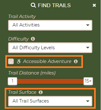
We now have an "Accessible Experience" checkbox in the Search Filter on our Find Trails page. If you check the box and click Search, trails that trail managers have reported as accessible will appear in the map. These can include both land and water trails.
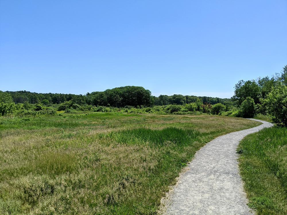
Surfaces are important to people who use mobility devices. You can now search by surface type and we developed a visual key to trail surface types listed on Maine Trail Finder.
Filtering adjustments are just one improvement that we hope will help users narrow down their choices from the over 1,000 trails currently featured on the site.
Many of the accessible trails in Maine are part of larger trail networks that have a wide variety of trails. We want to make sure that users can identify which trails are accessible within each system.
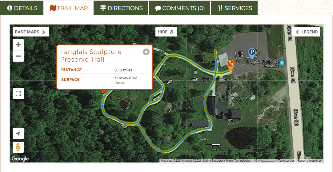
If you click on the ![]() button on the trail map tab of a trail posting we have marked accessible, the map will zoom in and highlight the accessible section of trail.
button on the trail map tab of a trail posting we have marked accessible, the map will zoom in and highlight the accessible section of trail.
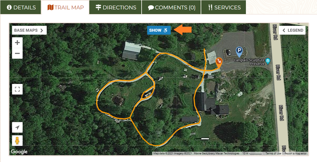
Click on the trail segment and you will see a pop up with trail name, trail surface, distance and any notes that might be relevant to the specific trail.
We created specific icons in blue and white for accessible features so that everyone can see at a glance where there is accessible infrastructure.
We also added geolocated photo pins so we can display what a trail or potential barriers look like at a specific location.
We also are working with trail managers to add more specific information about the accessible trails, such as surface, width, potential barriers and maximum slope (if known) to the Details tabs of all the accessible trails on our site.
Besides completing the information laid out above, we are also working with a variety of groups in Maine and a growing number of Accessibility Ambassadors to further enhance the information on the site. We are planning to add accessible trail recommendations and trip reports to MTF Stories with help from our partners, Maine Adaptive and the Adaptive Outdoor Education Center.
We have also connected with Enock Glidden, Public Speaker, Adaptive Athlete and Adventurer. Enock is serving as the MTF Accessibility Ambassador and is reviewing trails across the state. Check out the Enock's Adventures series on MTF Stories.
We also know that there are many other trails with limited barriers, that may not conform entirely to universal access guidelines, and a growing number of trail managers that are trying to develop trails that maximize trail accessibility within the confines of their natural settings. We are working to add more detailed information and photos to these trails to help people better understand the barriers they might encounter.
When you are out on a trail with limited barriers, please take photos and post them to the MTF page for that trail. Don't forget to take photos of parking lots, restrooms, and other facilities as well! Learn more.
Add trail comments to help those who come after you understand current trail conditions or issues.
If you would like to be more involved in this project or if you have information about or experience with accessible trails that you would like to share, please:
This is a significant and important undertaking. Thank you to the Maine Outdoor Heritage Fund, Sewall Foundation, and the Onion Foundation for supporting this facet of our work.
Success! A new password has been emailed to you.