East Grand Highlands Hiking Trail

This is the print view for this trail. View the full trail posting.

Scenic trails lead to expansive views from atop a ridge and to the shores of Sucker Lake, with picnic areas to rest, eat, and take it all in.
Trail Activity
Snowshoeing Cross-country-skiing Hiking
Length
4.00 miles, Network
Difficulty
Moderate
Towns
Danforth, Weston
Surface
Dirt/Forest Floor, Gravel/Crushed Stone, Rock/Ledge, Grass
Pets
Permitted on leash
Fees
No

Description

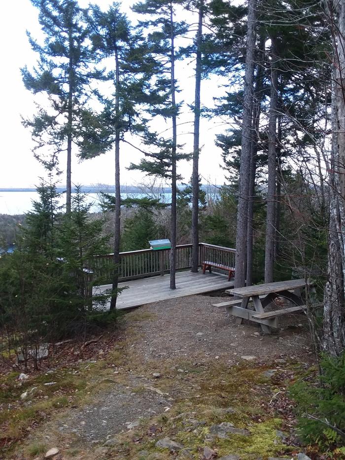
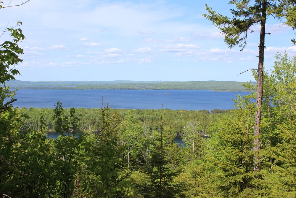
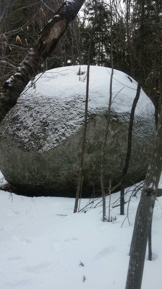
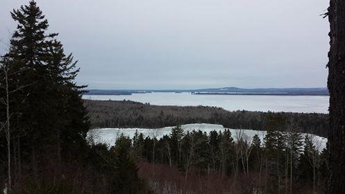
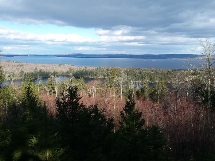
The Overlook Trail (1.6 miles) climbs a moderate incline towards a scenic overlook. The trail consists mostly of a grassed-in gravel logging road and has very good footing. A large glacial erratic, know as 'rolling rock' lies just off the trail on the left about one-third of the way up. At the overlook there is a viewing platform and picnic table. Views consist of Eastern Maine, East Grand Lake, and Western New Brunswick, Canada.

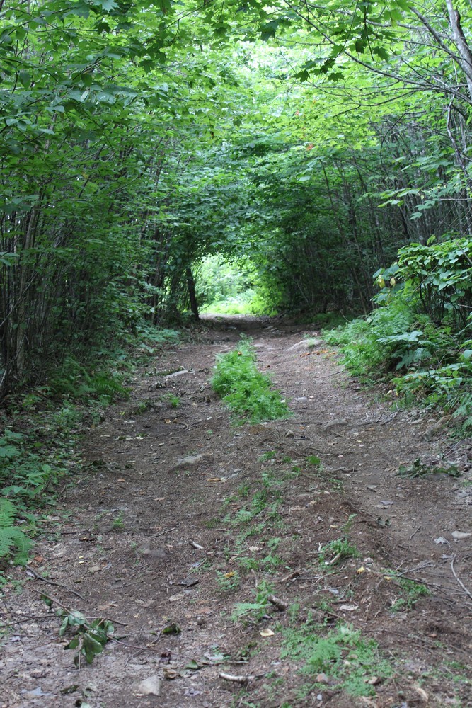
The Boulder Ridge Trail (0.9 miles) is a moderate trail that connects the Overlook Trail to the Sucker Lake Trail. The trail travels through dense tree stands with sections of steep inclines. There are also rocky areas with fern-covered boulders along narrow corridors, grassy areas, and a large pine forest.

The Sucker Lake Trail (1.6 miles) is a more difficult trail with several areas of steep incline that is accessed via the Overlook Trail or the Boulder Ridge Trail. The Sucker Lake Trail travels through regenerated timberland before reaching a large cedar swamp, where there is bog bridging to cross the wet areas. Hikers will be rewarded in their efforts by the quiet lakeside picnic area on Sucker Lake with a picturesque view of the lake and mountains, and the opportunity to swim.

Future trails will add additional miles, circumnavigating the glacial lake at the base of the ridge.

Other Information

TRAIL RULES

  • Stay on marked trails
  • Please sign in and out of trail log
  • Leave no trace
  • No hiking after dark
  • Leash and clean up after your pet
  • Respect the environment, and please do not remove any plants or wildlife
  • The following are prohibited: fires, ATVS/motorized vehicles, horses, overnight camping/parking, hunting or trapping

Trail Manager

For more information and a printable map of the preserve please visit Woodie Wheaton Land Trust's website.

Woodie Wheaton Land Trust
2 Grove Road
Forest City, ME 04413
Phone: (207) 448-3250
wwltoffice@gmail.com
View website

Nearby Events

VIEW EVENTS CALENDAR

Trail Tips

Plan Ahead and Prepare
Know your limits – it’s okay to turn back. Your home is the ultimate destination, not the summit.

Trailhead Information

From Danforth: take US-1 south about 2.5 miles to the trailhead on the left (east side) of US-1. The parking lot and trail kiosk are easily visible from US-1. If you reach the Greenland Cove Road you have gone too far.

Plenty of parking is available at this trailhead.

Legend
Hide All
Join In on the Fun!
Log in or create an account below to unlock all the great features of Maine trail finder: keep track of trails you want to do, preserve memories of trails you’ve done, earn badges, and more!
Your log in attempt was not successful. Please try again.
    Lost your password? Reset your password
    Don't yet have an account?
    There was an issue with your submission. Please try again.
      * Indicates required field
      Already have an account? Login here
      Enter your username, and we will send you a new, randomly generated password to your email account.
      There was an issue with your submission. Please try again.

        Success! A new password has been emailed to you.

        Log in now

        Please wait…