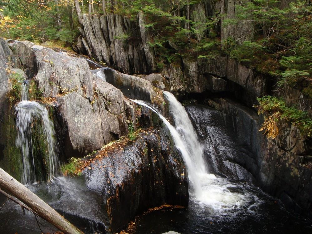
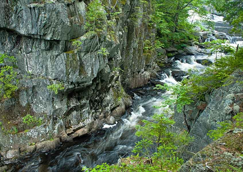
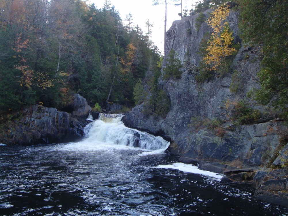
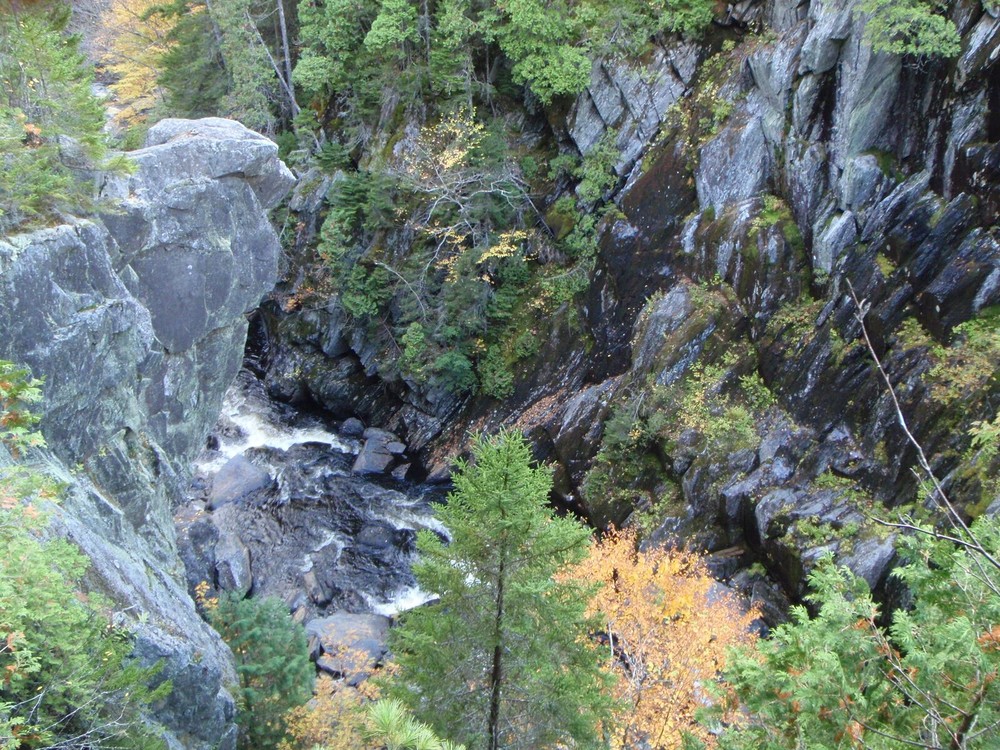
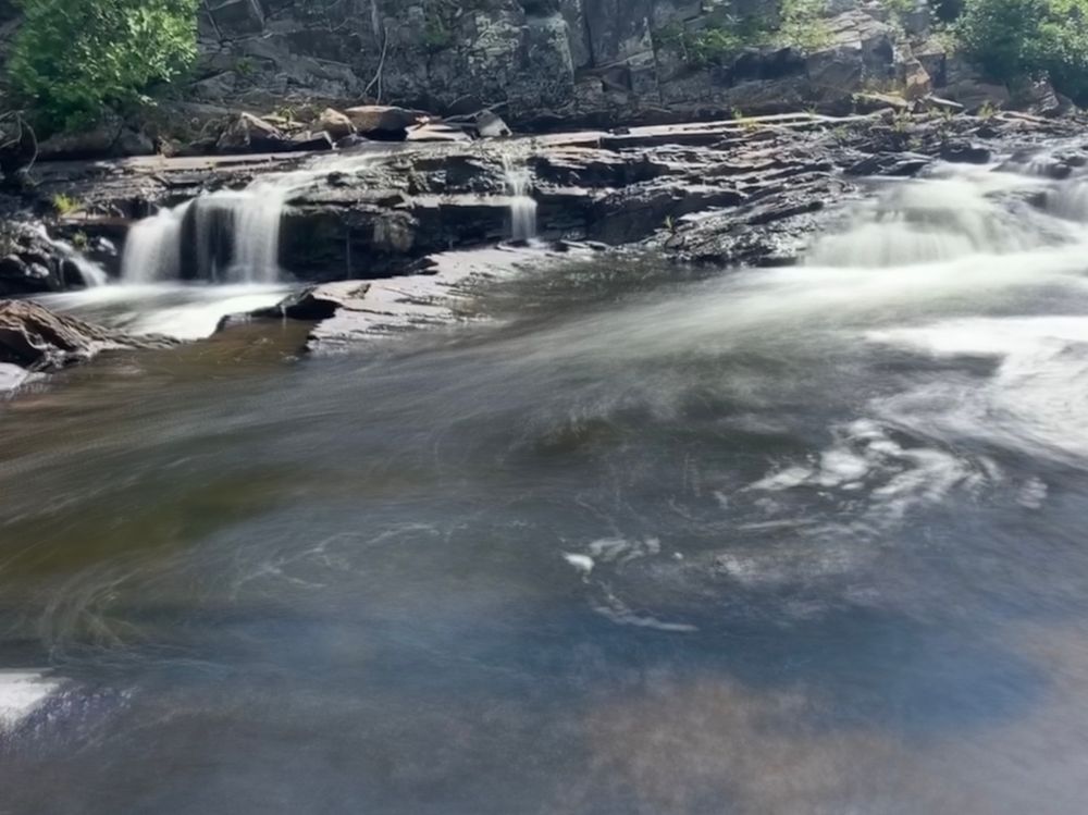
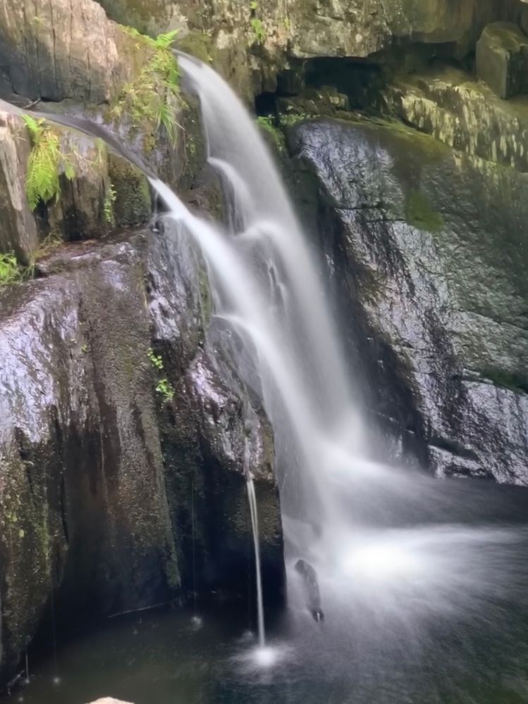
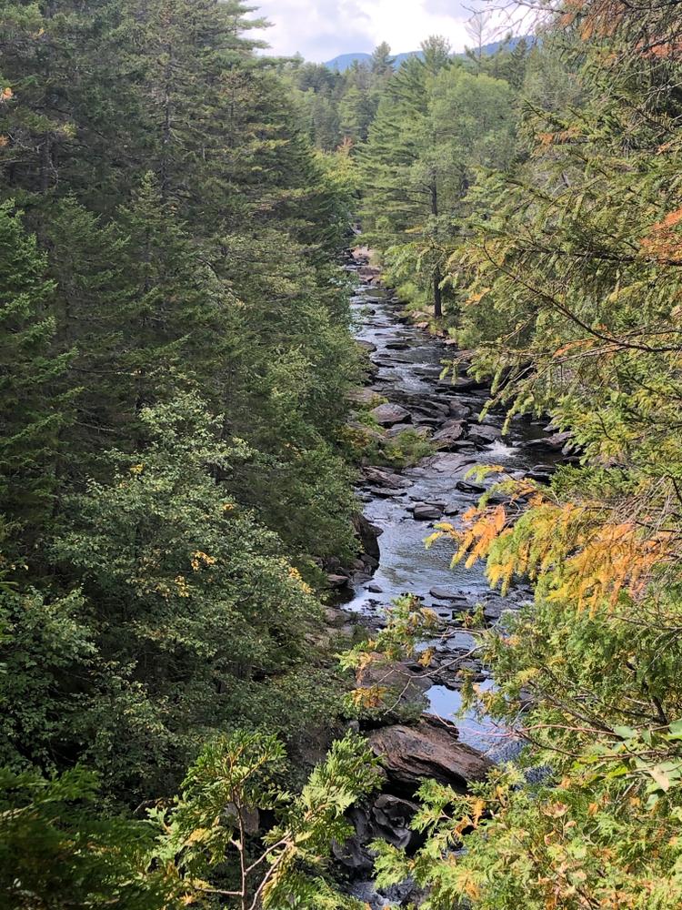
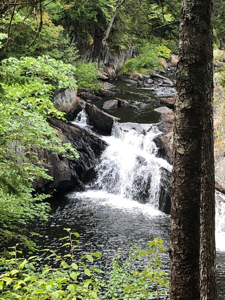
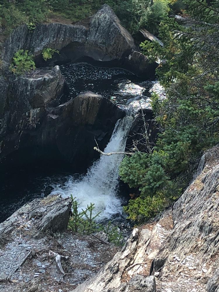
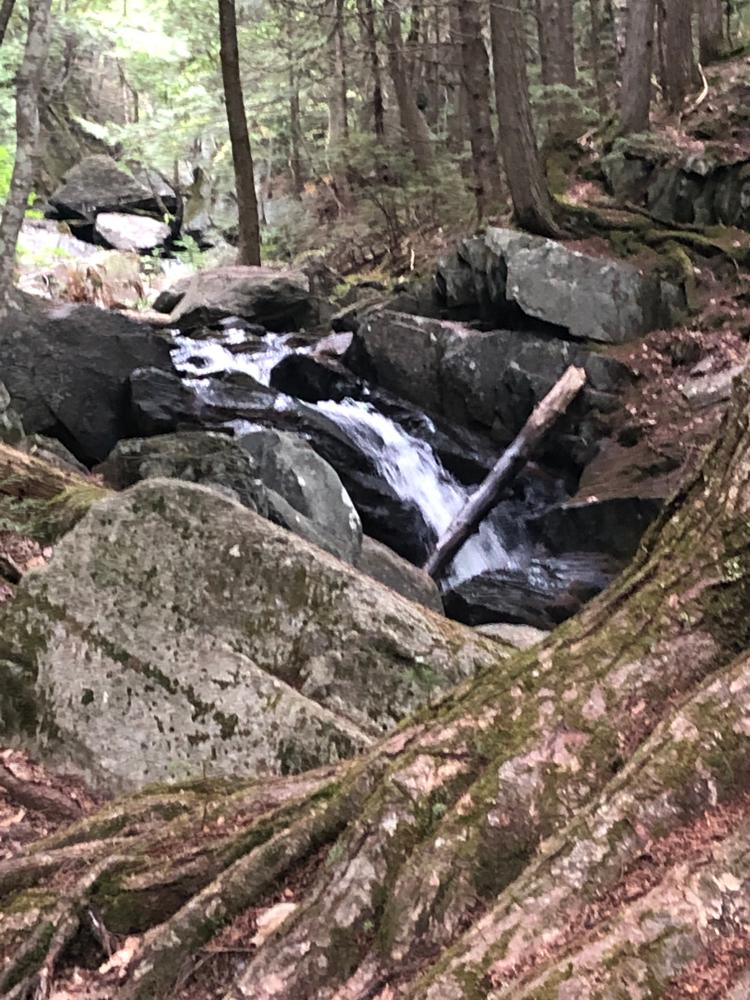
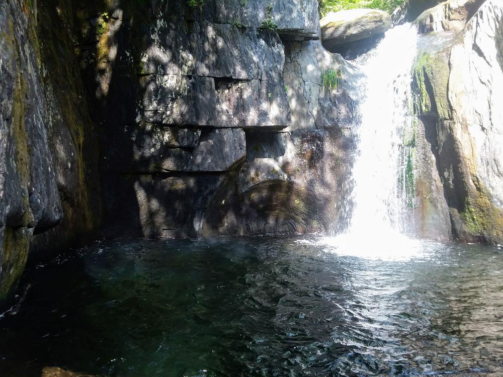
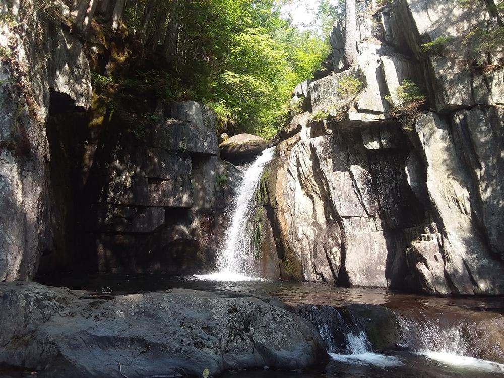
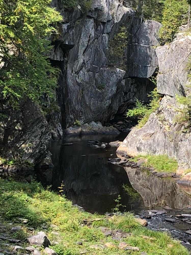
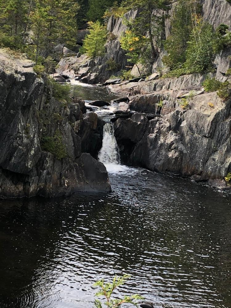
The West Branch of the Pleasant River descends 400 feet through Gulf Hagas over the course of 4 miles in a series of waterfalls. Despite its remote location, the Gulf Hagas trails are a popular hiking destination due to the sheer beauty of the area.
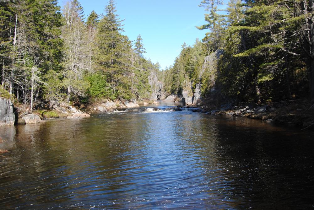
From the Gulf Hagas Parking Area, travel 0.2 miles on the blue-blazed trail to the Appalachian Trail (AT) junction. Gulf Hagas is to the right. The AT, which has white blazes, crosses the West Branch of the Pleasant River shortly after the intersection. This river must be forded as there is no bridge, and it is often knee-deep and 100-feet wide. In high water (such as during the spring, or after a large amount of rainfall), consider using the Head of the Gulf Parking Area instead to access Gulf Hagas, as that trailhead provides a bridge across the river. After the crossing, the AT goes through the Hermitage, a stand of old-growth white pine trees.
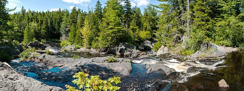
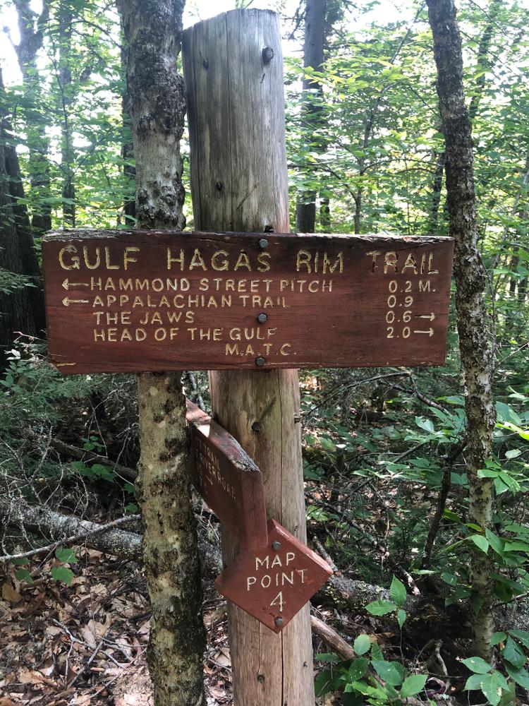
1.3 miles from the river, the blue-blazed Rim Trail branches to the left off of the AT. The Rim Trail provides numerous lookout points to multiple waterfalls as it traverses beside the gorge. The Rim Trail crosses Gulf Hagas Brook just after the intersection. This is usually a rock-hop, but could be a ford at high water. There is a short side trail to Screw Auger Falls 0.2 miles past the beginning of the Rim Trail, which is a good destination for a 3.5-mile round trip hike. Otherwise, many people continue along the length of the Rim Trail to view the entirety of the Gulf. There are many side trails to viewpoints and waterfalls. Running parallel to the Rim Trail is the blue-blazed Pleasant River Tote Road, which can be accessed at several points, and is often used on the way back, as it is easier and faster than the Rim Trail. A complete loop of the Rim Trail and the Pleasant River Tote Road is an 8-mile hike when accessed via the AT from the Gulf Hagas Parking Area, or 8.6 miles when accessed via the Head of the Gulf Trail from the Head of the Gulf Parking Area.
Hikers can create a longer loop by using the blue-blazed Gulf Hagas Cut-off trail. This trail connects from the Rim Trail and Pleasant River Tote Road to the AT 0.7 miles north of the Rim Trail - AT intersection.
The Gulf Hagas trails have rough footing, so some experience hiking and good sturdy footwear are needed. A walking stick for balance can be helpful for the river crossing. Some people opt to bring sandals for the river crossing so as to keep their hiking shoes dry, but note that this makes it easier to slip on the rocky river-bed. Additionally, the trail is in a remote location with very unreliable cell-service, so a physical map and compass and knowledge of how to use them are strongly recommended. Detailed maps of Gulf Hagas are available for purchase at the KI-Jo Mary Forest Checkpoint, or on the North Maine Woods website.
Fees - To access the Gulf Hagas area via vehicle, one must pass through private land which has an associated fee collected by North Maine Woods, Inc. The day use fee (as of 2021) is $11 for Maine Residents, $16 for non-Maine Residents with children under 18 or adults over 70 free (more info on their website). Only cash and checks are accepted. Camping and fires are prohibited within the Gulf Hagas area, though there are nearby sites that can be reserved with North Maine Woods for a fee. The access road is an unpaved and generally unsigned logging road, where logging trucks have right-of-way and bicycles are banned.
The Appalachian Trail - Do not underestimate the difficulty of hiking the Appalachian Trail (A.T.) and associated side trails in Maine. Be sure to carry equipment and supplies necessary for this undertaking and be prepared for challenging weather conditions. Please educate yourself before hiking, so that you can have the knowledge and skills necessary for an enjoyable and safe hike. Fires are only allowed in the provided fireplace ring at established campsites; it is illegal in Maine to build a fire elsewhere.
The Appalachian National Scenic Trail runs from Maine to Georgia along the spine of the Appalachian Mountains. It is managed cooperatively by the National Park Service, the Appalachian Trail Conservancy, and 31 trail-maintaining clubs along with other federal and state land managers whose land the trail crosses. Over 3 million people visit the A.T. every year. Since its inception in the 1920s, thousands of volunteers have worked tirelessly to maintain, manage, and protect the Appalachian Trail.
In Maine, the all-volunteer Maine Appalachian Trail Club (MATC) maintains and protects the 267-mile section of the Appalachian Trail extending from Katahdin in Baxter State Park to Grafton Notch at ME-26. In addition, MATC maintains over 60 miles of side trails as well as a system of regularly-spaced shelters and campsites to preserve access to wild, backcountry hiking in Maine. MATC publishes The Official Appalachian Trail Guide to Maine, which includes seven maps, please visit their website for information on how to purchase the guide or to learn more about becoming a member of MATC.
Additional Information for Head of the Gulf Trail:
 Natural Heritage Hikes is a project of the Maine Natural Areas Program in partnership with Maine Trail Finder. View the "Gulf Hagas - Head of Gulf Trail" guide online here.

This trail passes through a property that was acquired in part with funds from the Land for Maine’s Future program. For more information about the LMF program and the places it has helped to protect, please visit the LMF webpage.
The Gulf Hagas trails are managed by the Maine Appalachian Trail Club, as part of the Appalachian Trail Corridor. Visit Maine Appalachian Trail Club online for more information or use the contact information below.
Maine Appalachian Trail Club (MATC)There are two trailheads that can be used to access Gulf Hagas: the Gulf Hagas Parking Area, and the Head of the Gulf Parking Area.
Gulf Hagas Parking Area - The Gulf Hagas Parking Area is more commonly used, and also provides easy access to the Hermitage, an old-growth stand of white pine trees. However, hiking to Gulf Hagas from this trailhead involves fording a 150-foot wide river that is often knee-deep, and which is inadvisable to cross in high water. To reach this trailhead from the south, head north on ME-11 from Milo. After 12.5 miles, turn left onto Katahdin Iron Works Road (also referred to as KI Road). After 6.5 miles there will be the KI-Jo Mary Forest Checkpoint, where you must pay an entry fee (see Details > Additional Information). Take a right at the fork just past the gatehouse. After 3.4 miles, take a left at a fork in the road. After 3 miles there will be a parking area on the right.
Head of the Gulf Parking Area - The Head of the Gulf Parking Area is a good alternative trailhead to use during high water. To reach this trailhead, continue on Katahdin Iron Works road past the Gulf Hagas Parking Area, staying straight at the junctions at 0.9 miles, 3.2 miles, and 4.3 miles from the Gulf Hagas Parking Area. At this point the road may be referred to as either Upper Valley Road, or Katahdin Iron Works Road depending on the map, though the road itself is unsigned. At 5.2 miles from the Gulf Hagas Parking Area, or 11.7 miles from the checkpoint, there will be a trailhead with an information kiosk on the right, followed shortly by a parking area on the left.
Success! A new password has been emailed to you.