Katahdin Stream Falls

This is the print view for this trail. View the full trail posting.

Follow the Appalachian Trail in the shadow of Katahdin to the rolling cascades of Katahdin Stream Falls.
Trail Activity
Hiking
Length
2.00 miles, Round Trip
Difficulty
Moderate
Town
T3 R10 WELS
Surface
Dirt/Forest Floor
Pets
Not Permitted
Fees
Yes

Description

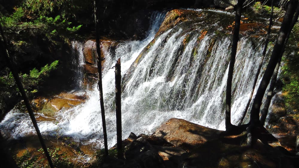
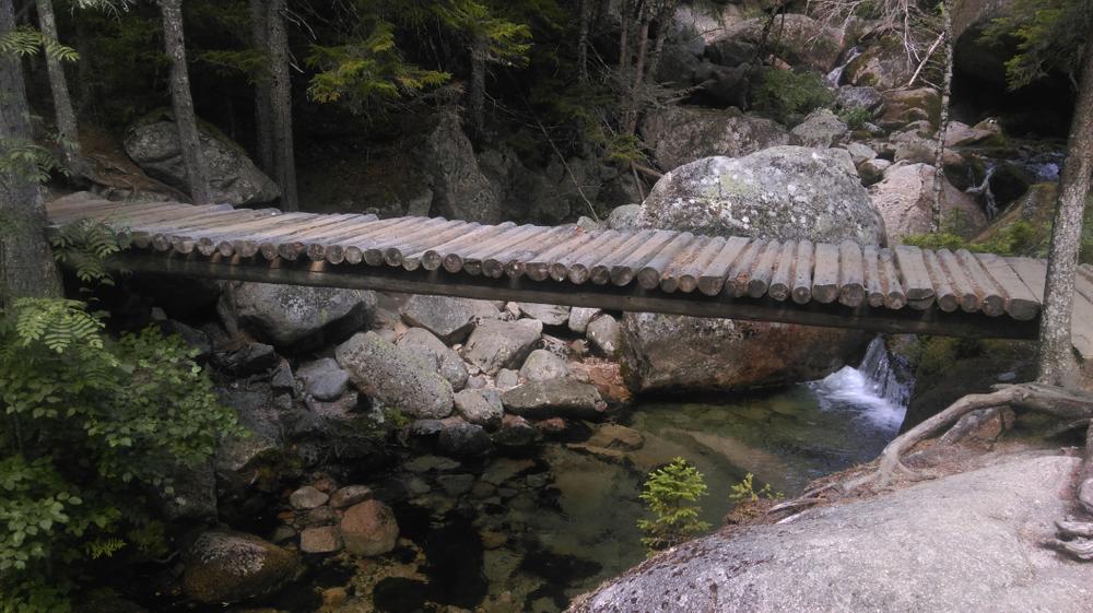
This scenic hike brings you right to the base of Katahdin where the waters of Katahdin Stream thunder beneath the northernmost bridge on the Appalachian Trail. Refreshingly cool in the summer, and especially spectacular during the snowmelt on the high peaks, Katahdin Stream Falls is well worth the hike.

Other Information

Park Fees: See website for entrance and camping fee schedule. [No entrance fee for Maine residents.]

Park Rules: See a more complete list here.

  • All persons entering the Park by road or trail must register their entrance at a gatehouse or self-registration station
  • The maximum size of hiking groups is 12 persons
  • All groups of five or more persons under 16 years of age must be accompanied by at least one adult, responsible for the supervision of a maximum of five youths
  • For all trash: Carry-in; carry-out
  • Where toilets are not available, human waste must be buried at least 200' from water or carried out
  • Pets or other domestic animals are not allowed in the Park
  • Camping is permitted by reservation only
  • Fires or other cooking or heating devices are permitted only in designated campsites or picnic areas
  • Hunting and trapping are prohibited within the Park (with some exceptions)
  • Maine fishing laws apply within the Park
  • No person may feed, bait, or disturb any animal within the Park
  • Power equipment is prohibited (including generators)
  • All vehicles must display an entrance permit while in the Park

Trail Manager

This trail is within Baxter State Park. For more information and detailed trail maps, please visit Baxter State Park Authority's website.

Baxter State Park Authority
64 Balsam Drive
Millinocket, ME 04462
Phone: (207) 723-5140
View website

Nearby Events

VIEW EVENTS CALENDAR

Trail Tips

Leave What You Find
Avoid the introduction or transport of non-native species. Use local firewood from within 50 miles and clean, drain, and dry water equipment when moving between water bodies.

Trailhead Information

Katahdin Stream Falls is on the Hunt Trail, the final stretch of the Appalachian Trail. The trailhead is located on the north end of Katahdin Stream Campground.

From Millinocket: Travel 16 miles northwest on the paved Baxter Park Road to the Togue Pond Gatehouse, passing buildings and Northwoods Trading Post on the right after eight miles. After entering the park at Togue Pond Gate, bear left and continue onto the Park Tote Road for 7.8 miles. Katahdin Stream Campground will be on the left. Park in the day-use lots.

Legend
Hide All
Join In on the Fun!
Log in or create an account below to unlock all the great features of Maine trail finder: keep track of trails you want to do, preserve memories of trails you’ve done, earn badges, and more!
Your log in attempt was not successful. Please try again.
    Lost your password? Reset your password
    Don't yet have an account?
    There was an issue with your submission. Please try again.
      * Indicates required field
      Already have an account? Login here
      Enter your username, and we will send you a new, randomly generated password to your email account.
      There was an issue with your submission. Please try again.

        Success! A new password has been emailed to you.

        Log in now

        Please wait…