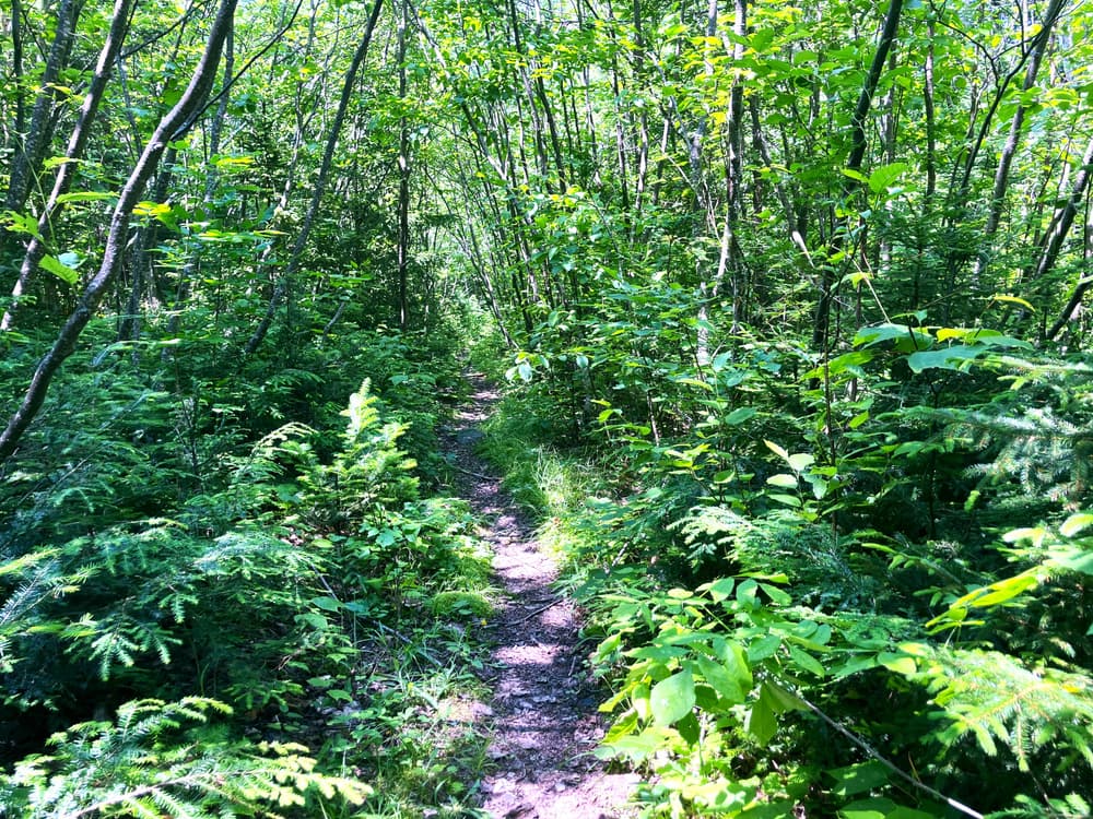
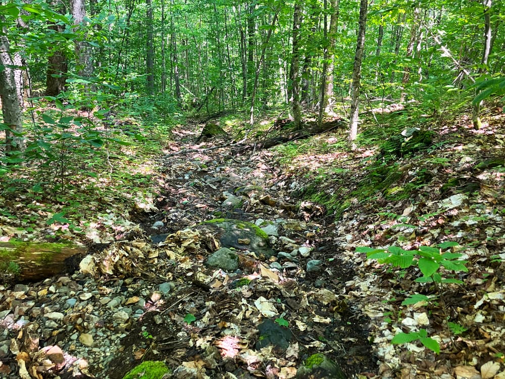
From the shore, the trail begins through deciduous woods with minimal grade and a relatively even trail surface. As the trail starts heading up the mountain in earnest, the grades become moderate, which they remain for most of the hike with just couple short steeper sections. The trail remains in the woods, occasionally passing through spruce trees at the higher elevations. The surface becomes more rocky the second half of the way up, at times traveling up dry (in June) stream beds.
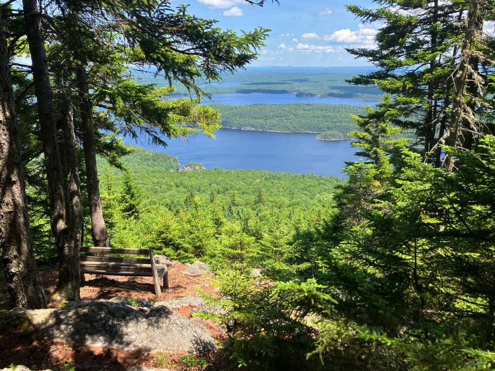
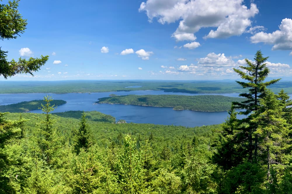
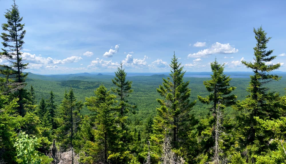
The trail ends at a pleasant overlook, with views over Lobster Lake and a bench on which to rest and enjoy the views. There is a 0.05-mile spur near the end of the trail that leads to views towards Moosehead Lake on the other side of the mountain. It's worth the short distance to check out, but the view here is somewhat obscured by trees and there is no good resting spot; the Lobster Lake overlook is the better of the two for resting and snacking.
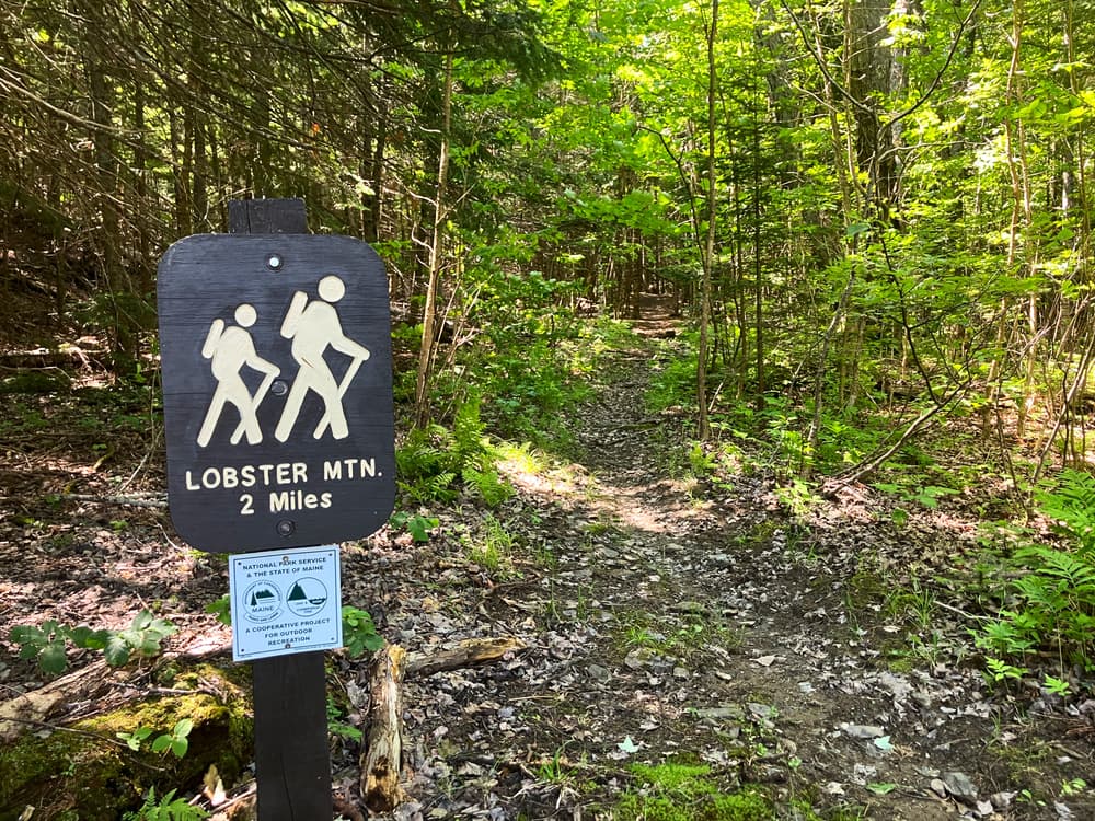
It is 1.5 miles from the trailhead at the lake to the lookout just past the summit (the trailhead sign states a distance of 2 miles, this is incorrect).
For additional information, visit the Maine Bureau of Parks & Land website, or contact:
Maine Bureau of Parks and Lands, Penobscot River CorridorThe trailhead is accessible only by boat, on the west shore of Loster Lake in Jackson Cove. You can lauch a canoe or kayak at the BPL boat launch on Lobster Stream at its confluence with the West Branch, then paddle 4 miles on Lobster Stream and Lobster Lake to the trailhead.
TO REACH THE BOAT LAUNCH
FROM GREENVILLE
This route is about half-hour longer than via Spencer Road, but much simpler. Take Lily Bay Road (which turns into Baxter State Park Road/Main Street, then the Golden Road, then the Greenville Road just before the turn) and go 32.9 miles. Stay left at Shauna Corner, go 0.2 miles, and take a sharp left at the south end of Caribou Lake. Go 15.3 miles on the Golden Road and take a left onto Poulin Road. Go 3.4 miles on Poulin Road to the boat launch and parking area at the confluence of the West Branch and Lobster Stream.
FROM MILLINOCKET
From ME-157/Central Street, past the center of town take a right onto Katahdin Ave. Go 0.2 miles and turn left onto Bates Street. Continue on this road as it changes to Millinocket Lake Road and then the Baxter Park Road for 8.4 miles to the Big Moose Inn. Take a left onto the Golden Road at this point, or optionally continue another 0.7 miles on the Baxter Park Road before connecting with the Golden Road on the left. Go 29 miles on the Golden Road to the intersection with Greenville Road at south end of Caribou Lake at and bear right to continue on the Golden Road. Go 15.3 miles on the Golden Road and take a left onto Poulin Road. Go 3.4 miles on Poulin Road to the boat launch and parking area at the confluence of the West Branch and Lobster Stream.
MAINE NORTH WOODS CHECKPOINT
9.6 miles north of the turn at the bottom of Caribou Lake is the Katahdin Ironwork Maine North Woods checkpoint. Users must stop here to pay a NMW fee.
TRAILHEAD
Upon entering Little Claw from the main section of the lake, stay right (north) to go to Jackson Cove. At the south end of Jackson Cove, look for the Jackson Cove campsite. There is a grassy section of the campsite to the right of the campsite sign, picnic table, and fire ring. It is at the right end of this grassy area that you will find the trailhead, marked with a trailhead sign.
Success! A new password has been emailed to you.