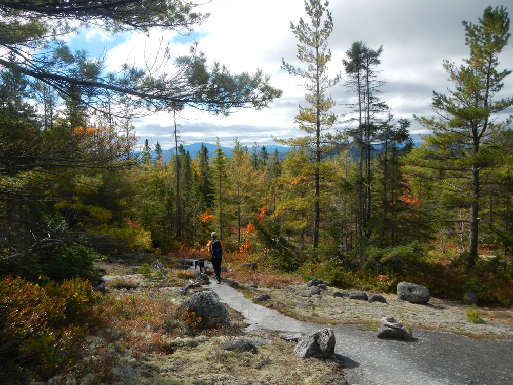
From the trailhead, the trail enters the 100 Mile Wilderness, a section of the Appalachian Trail with no public road access. The trail meanders through classic northern Maine forests, across bogs and over small ridges on its way to Hurd Brook Lean-to, just over halfway to Rainbow Ledges. Hurd Brook Lean-to is one of the oldest in Maine and still sports the "baseball bat" decking once common in lean-tos in New England. From the lean-to the trail crosses over Hurd Brook. The rocks can be slippery so hikers should take care when crossing.
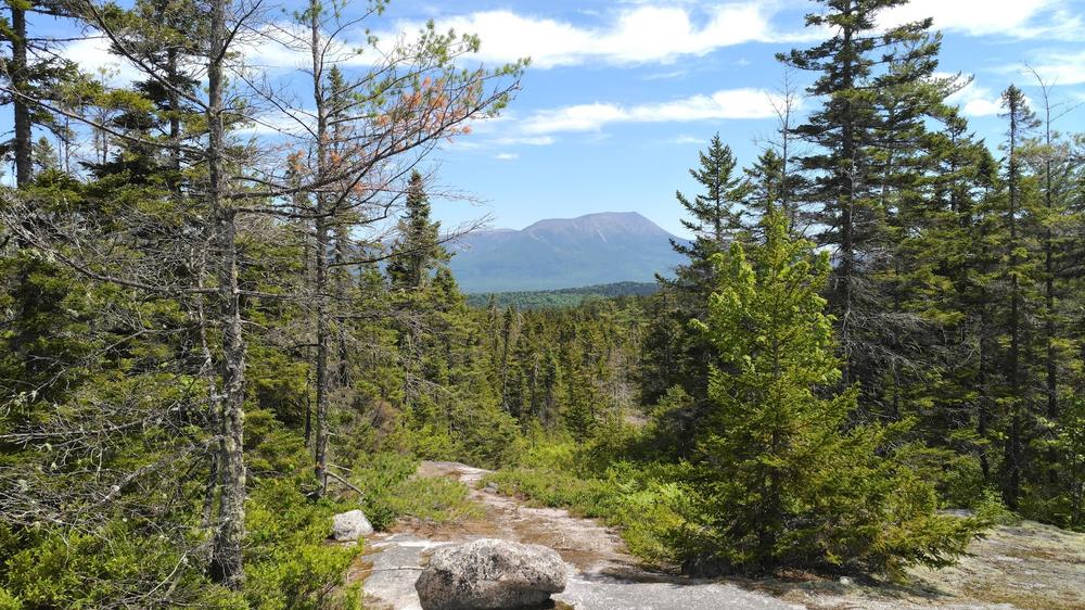
After Hurd Brook, the trail steepens to a moderate grade interspersed with some short, harder sections and then emerges onto Rainbow Ledges. Look to the north for a beautiful view of Katahdin just after the trail pops out into the open. Expansive views are available in multiple directions for the 0.3 miles the trail follows the ledges. The ledges are particularly spectacular in fall when the huckleberries turn bright red.
This section of of the Appalachian Trail is encompassed by The Nature Conservancy’s ~46,000-acre Debsconeag Lakes Wilderness Area, learn more about the area at DLWA.
Do not underestimate the difficulty of hiking the Appalachian Trail (A.T.) in Maine. Be sure to carry equipment and supplies necessary for this undertaking and be prepared for challenging weather conditions. Please educate yourself before hiking, so that you can have the knowledge and skills necessary for an enjoyable and safe hike. Fires are only allowed in the provided fireplace ring at established campsites; it is illegal in Maine to build a fire elsewhere.
The Appalachian National Scenic Trail runs from Maine to Georgia along the spine of the Appalachian Mountains. It is managed cooperatively by the National Park Service, the Appalachian Trail Conservancy, and 31 trail-maintaining clubs along with other federal and state land managers whose land the trail crosses. Over 3 million people visit the A.T. every year. Since its inception in the 1920s, thousands of volunteers have worked tirelessly to maintain, manage, and protect the Appalachian Trail.
In Maine, the all-volunteer Maine Appalachian Trail Club (MATC) maintains and protects the 267-mile section of the Appalachian Trail extending from Katahdin in Baxter State Park to Grafton Notch at ME-26. In addition, MATC maintains over 60 miles of side trails as well as a system of regularly-spaced shelters and campsites to preserve access to wild, backcountry hiking in Maine. MATC publishes The Official Appalachian Trail Guide to Maine, which includes seven maps, please visit their website for information on how to purchase the guide or to learn more about becoming a member of MATC.
Visit Maine Appalachian Trail Club online for more information or contact:

Yield to Others on Trails: Uphill hikers, equestrians, and working vehicles or equipment have the right of way.
From Millinocket, follow the Baxter Park Road toward Baxter State Park. After about 13 miles, turn left on Pockwockamus Road (dirt road immediately before the painted Pockwockamus Rock). After less than a mile, turn right on to the Golden Road. Go past the Abol Store and Campground and across Abol Bridge. There is a pull-off for parking 0.2 miles past the bridge directly across from the trailhead. It is also possible to park in the gravel pit on the left just after the bridge. Always yield to logging trucks on private roads.
Success! A new password has been emailed to you.