Cobscook Bay Wildlife Management Area - Horan Head Unit

This trail network provides an array of options for discovering the 330-acre Wildlife Management Area. Trails provide open views of Straight Bay, more intimate access to Federal Harbor. and a feel for the coastal spruce-fir forest.
Trail Activity
Snowshoeing Walking Hiking
Length
3.20 miles, Network
Difficulty
Easy, Moderate
Town
Lubec
Surface
Dirt/Forest Floor, Rock/Ledge
Pets
Permitted
Fees
No

Description

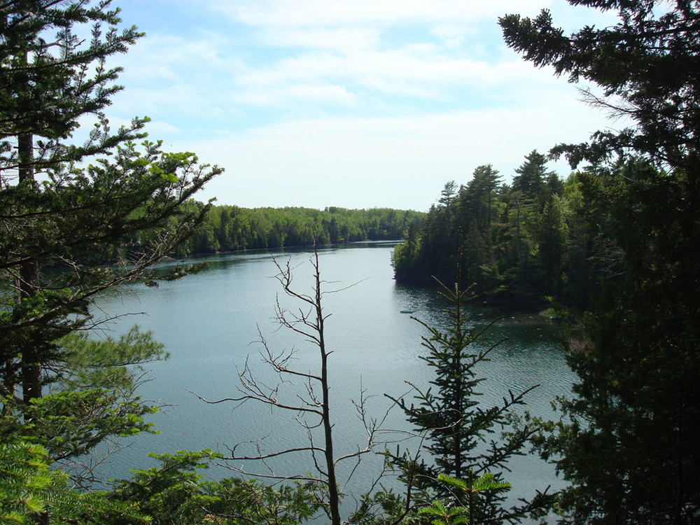
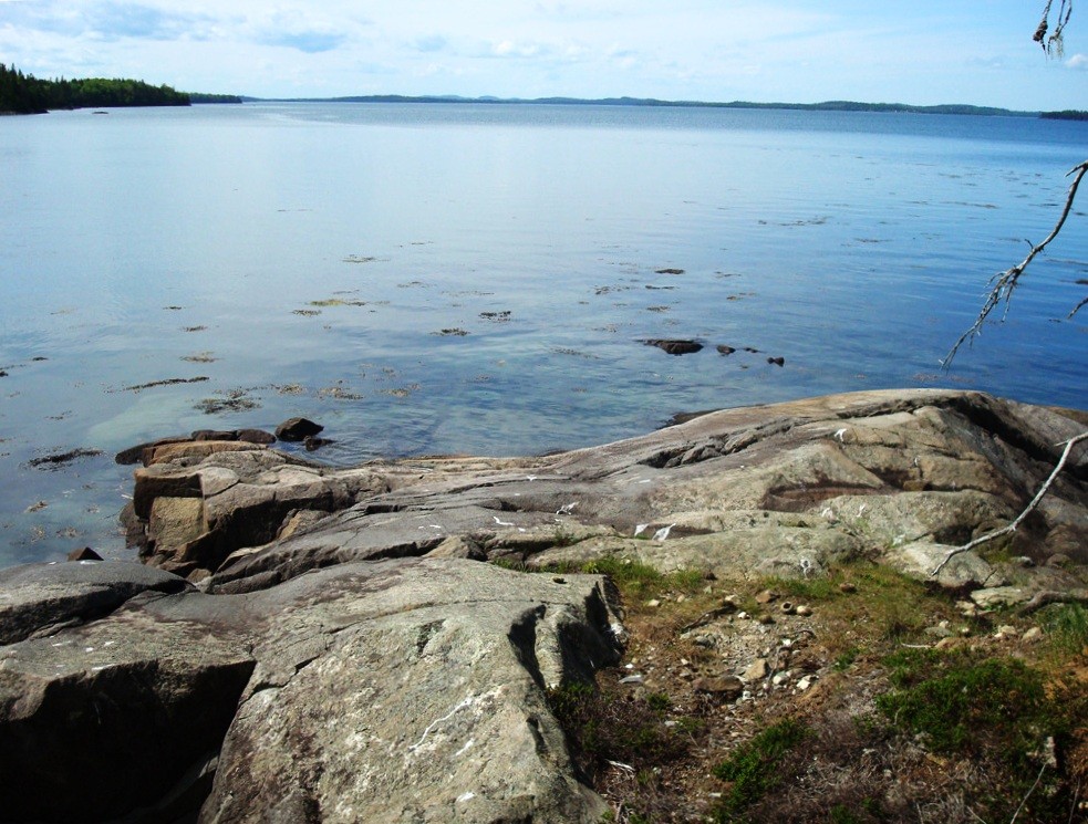
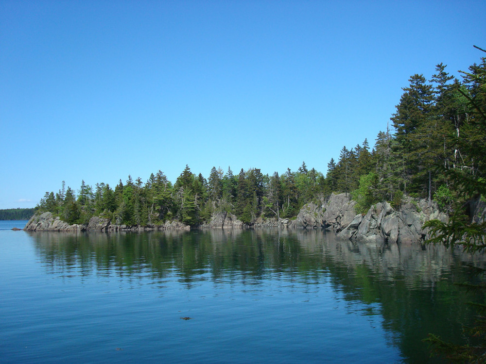
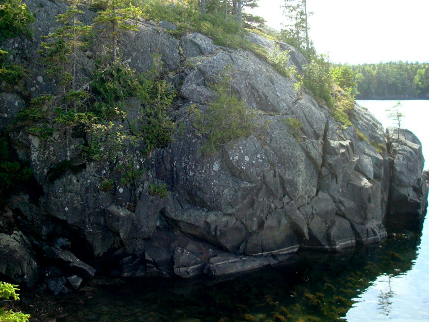
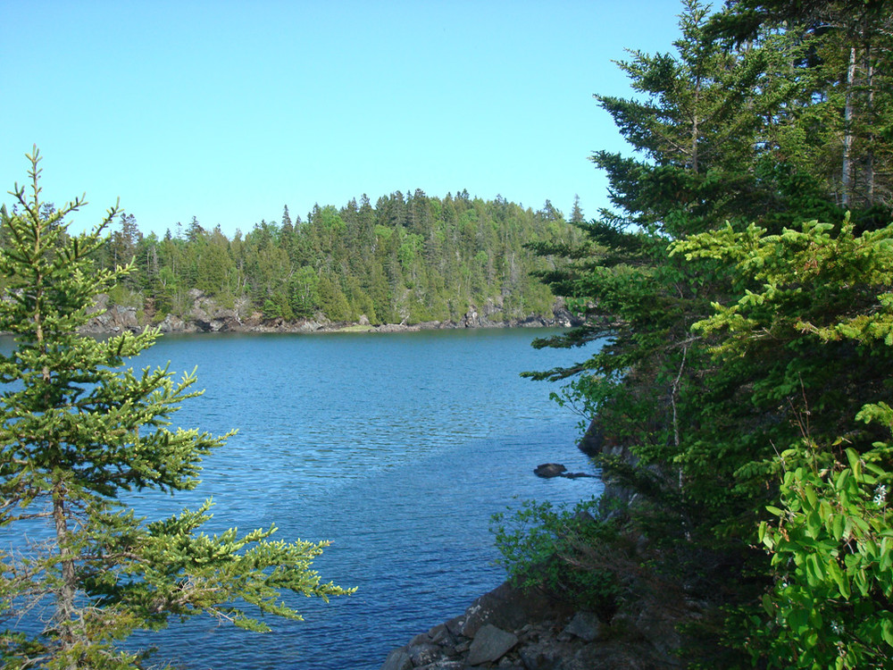
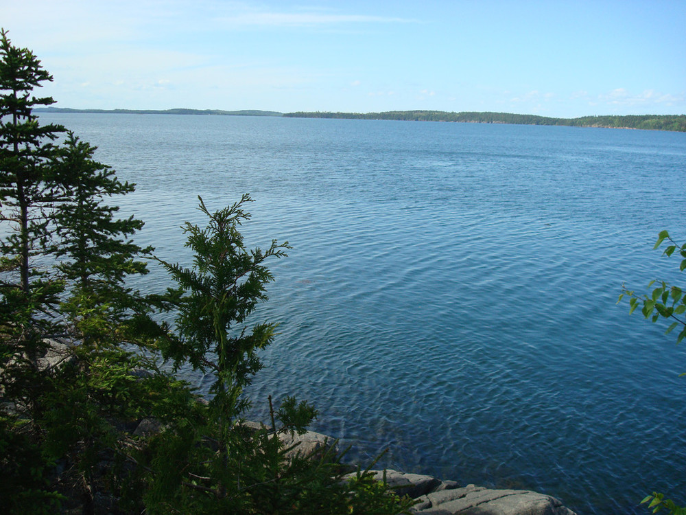
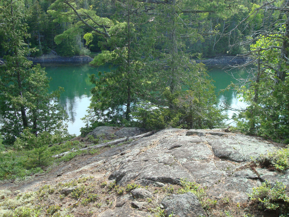
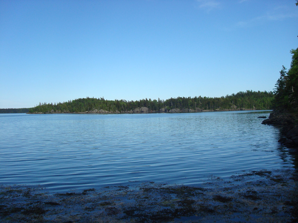
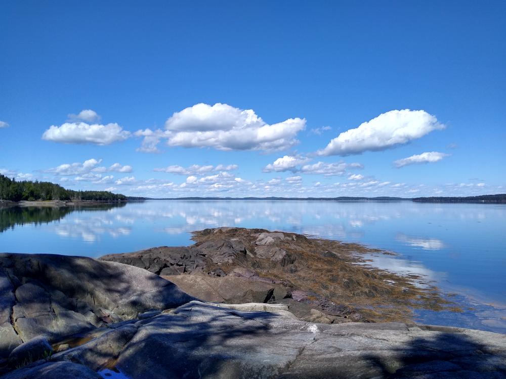
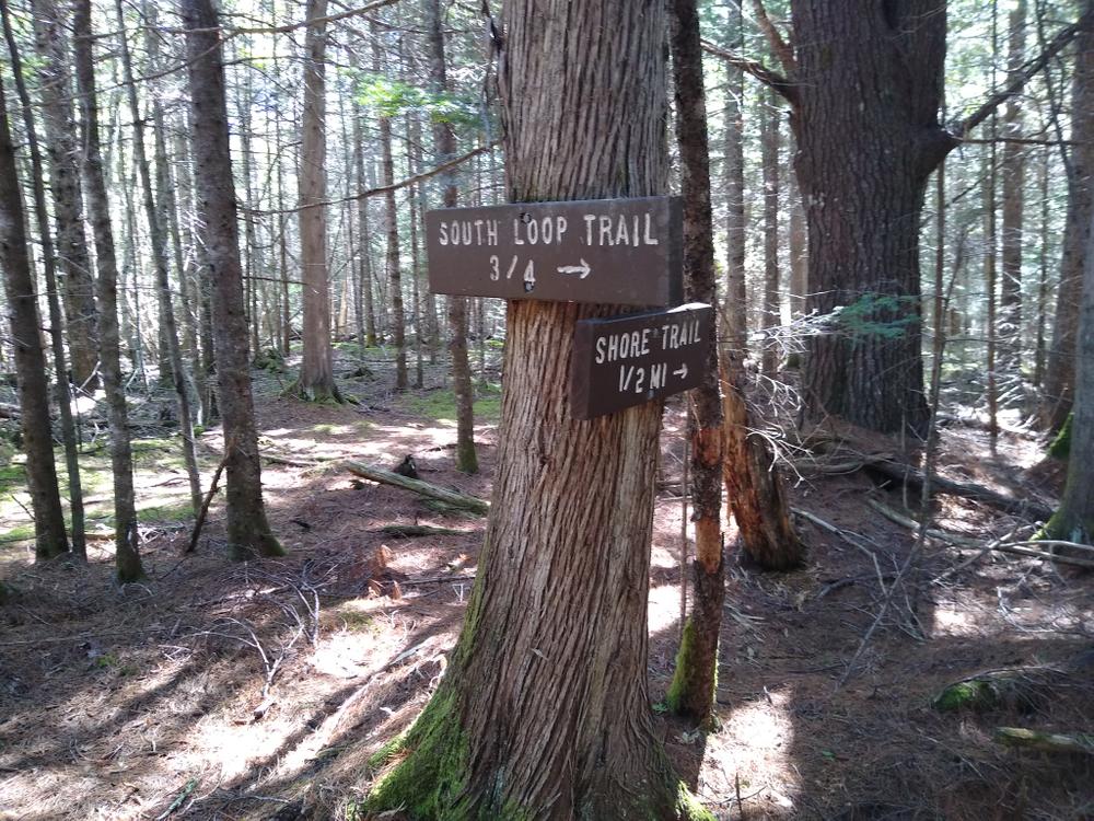
There is a primary trail that leads to a rocky ledge on South Bay (2.5 miles round-trip) and several secondary trails that when combined create a 6-mile hike with a variety of views and ways to experience some of the inner coves of Cobscook Bay. Trails receive sporadic maintenance and directional signs may be sparse, so visitors may have to make their own way. Most of the hiking is on relatively flat ground, though much of the trail is covered by rocks or roots and there are frequent re-routes around fallen trees. Visitors should be prepared for wet trail conditions for much of the year.

Despite the sometimes difficult conditions described above, competent and prepared hikers are rewarded by beautiful spruce-fir forest inland, majestic pines along the shoreline and opportunities to watch seals, waterfowl, ospreys and eagles on the water. Tracks and sign of deer, coyote, fox, black bear, snowshoe hare and fishers are much more common than human boot prints on the trail.

Other Information

Some of the side trails may be temporarily closed to protect sensitive wildlife. Please watch for notices at the trailhead and at trail intersections for directions. When possible, trail closures will also be posted on this website.

The Horan Head Unit is part of the Cobscook Bay Wildlife Management Area, a network of conserved lands owned and managed by the Maine Department of Inland Fisheries and Wildlife. Composed of over 2,000 acres of mainland and islands in and around Cobscook Bay and more than 23 miles of shoreline, the Management Area provides valuable wildlife habitat as well as public access and recreational opportunities. For more information, please contact the Regional Wildlife Biologist at (207) 434-5927.

The Horan Head Unit was purchased in part with support from the Land for Maine's Future program.

Cobscook Trails Project

The trails on Horan Head are part of a larger network of hiking trails in known as Cobscook Trails. Cobscook Trails is a cooperative project of conservation landowners and community partners that seeks to expand opportunities for nature-based recreation and tourism in eastern Washington County. The group produces "Cobscook Trails: A Guide to Walking Opportunities around Cobscook Bay and Bold Coast Region," a 55 page booklet describing walks on 19 area properties. Find more information about Cobscook Trails, including how to purchase the guidebook, visit: The Cobscook Trails Project.

LMF Logo

This trail passes through a property that was acquired in part with funds from the Land for Maine’s Future program. For more information about the LMF program and the places it has helped to protect, please visit the LMF webpage.

Trail Manager

Visit Maine Department of Inland Fisheries and Wildlife for more information or contact:

Maine Department of Inland Fisheries and Wildlife

Maine Department of Inland Fisheries and Wildlife
41 State House Station
Augusta, ME 04333-0041
Phone: (207) 287-8000
View website

Nearby Events

VIEW EVENTS CALENDAR

Trail Tips

Leave What You Find
Avoid the introduction or transport of non-native species. Use local firewood from within 50 miles and clean, drain, and dry water equipment when moving between water bodies.
Legend
Hide All

Trailhead Information

Take US Route 1 to ME Route 189 toward Lubec. Travel 5.6 miles east on ME Route 189 and turn left onto Crow's Neck Road. Turn right after 0.4 miles onto Lead Mine Road. Make a quick left turn after 0.2 miles onto Straight Bay Road. The trailhead parking area is 3.2 miles up Straight Bay Road on the right side. A short gravel road leads to the parking area, which is marked by several brown metal signs identifying the area. A diamond-shaped "Cobscook Trails" sign is at the roadside. The trailhead lies beyond the gate at the parking area and through the fields following the ground path leading to the woods.

Click on a parking icon to get custom directions
Please Log In or Create Account to add comments.
scottcom36
September 10, 2020
This used to be one of my favorites in the Lubec area, but the last time I went (around 2013) I was discouraged by the lack of maintenance. I heard that some work had been done so I gave it another try. If you don't want to wade through deep grass in the fields at the beginning, wait until later in the season. On Labor Day weekend 2020 I was glad to see the field mowed. The trail goes into the woods at the left rear corner of the field. I found evidence of lots of chainsaw work and very few reroutes around blowdowns. Most of the trails were well blazed and relatively easy to follow. Every trail junction had signs. A couple were in poor condition and on the ground, but most were new. The sign at the far end of East Shore Trail is oriented the wrong way; the arrow points back toward the parking lot instead of toward the trail denoted. East Shore Trail had an ocean of blowdowns and there were a couple of places where I had to search for a few minutes to find the way forward. The previous day was a gusty one, many of the blowdowns may have been that recent. Despite those issues, I had a wonderful time. The scenery is fantastic, and the fact that few people get to see it makes it feel more special. There is a nice contrast of up-close views on the Federal Harbor side and wide open views across Cobscook Bay to the north. It was very quiet. It's also one of the longer hikes in the area. Well worth the effort.
apr40p
July 22, 2019
DO NOT USE THIS TRAIL! I am an experienced day hiker and frequently hikes 3 to 6 mile trails easily . That was not the case for this trail. On Sunday I tried this trail and it was tough. I should have turned around when I saw that there was no path through the field but I thought...why not. The trail markers are scarce and broken. At one point, my hiking partner and I circled the same trail trying to get to the main trail out because the signs were not correct. There are many trees down and it hasn't been cared for. It should not be used until these things are taken care of as folks could easily get hurt or even lost as the trees with markers are down. Again...DON'T USE IT!
These awesome businesses support our goal of connecting people to outdoor adventures in Maine!
Hang Tight!
Nearby services are loading
No Results
No Services Found

Trail Alerts

Trails
Wildlife Management Area
This Wildlife Management Area is maintained by the Maine Department of Inland Fisheries & Wildlife primarily for the purpose of maintaining and enhancing wildlife habitat. Recreational trail use by the public is welcome, but users should be prepared to encounter others hunting and trapping on this property.
SHARE THIS TRAIL

Add Trail Log

Please wait…
Join In on the Fun!
Log in or create an account below to unlock all the great features of Maine trail finder: keep track of trails you want to do, preserve memories of trails you’ve done, earn badges, and more!
Your log in attempt was not successful. Please try again.
    Lost your password? Reset your password
    Don't yet have an account?
    There was an issue with your submission. Please try again.
      * Indicates required field
      Already have an account? Login here
      Enter your username, and we will send you a new, randomly generated password to your email account.
      There was an issue with your submission. Please try again.

        Success! A new password has been emailed to you.

        Log in now

        Please wait…