Georges Highland Path - Ragged Mountain Area

The Ragged Mountain section of the Georges Highland Path in Camden and Rockport offers some of the steepest and most strenuous hiking in the midcoast region. The reward, however, is worth it.
Trail Activity
Hiking
Length
9.80 miles, Network
Difficulty
Moderate
Towns
Camden, Rockport, Warren
Surface
Dirt/Forest Floor
Pets
Permitted
Fees
No

Description

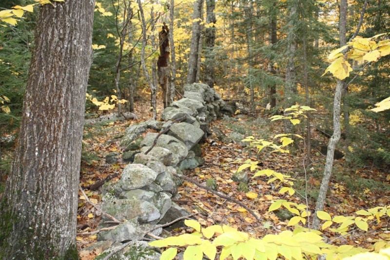
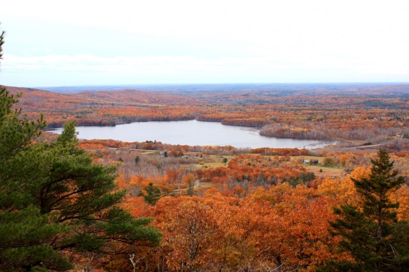
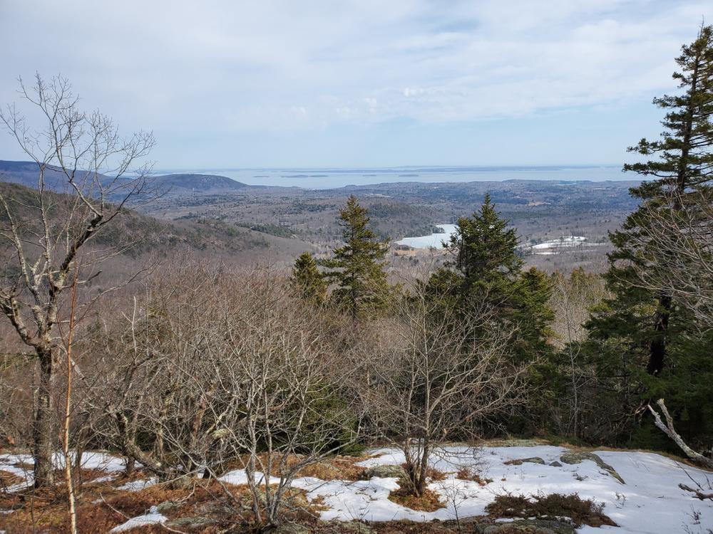
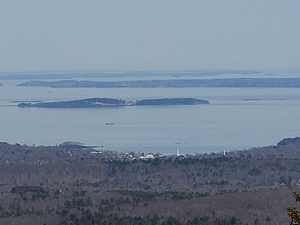
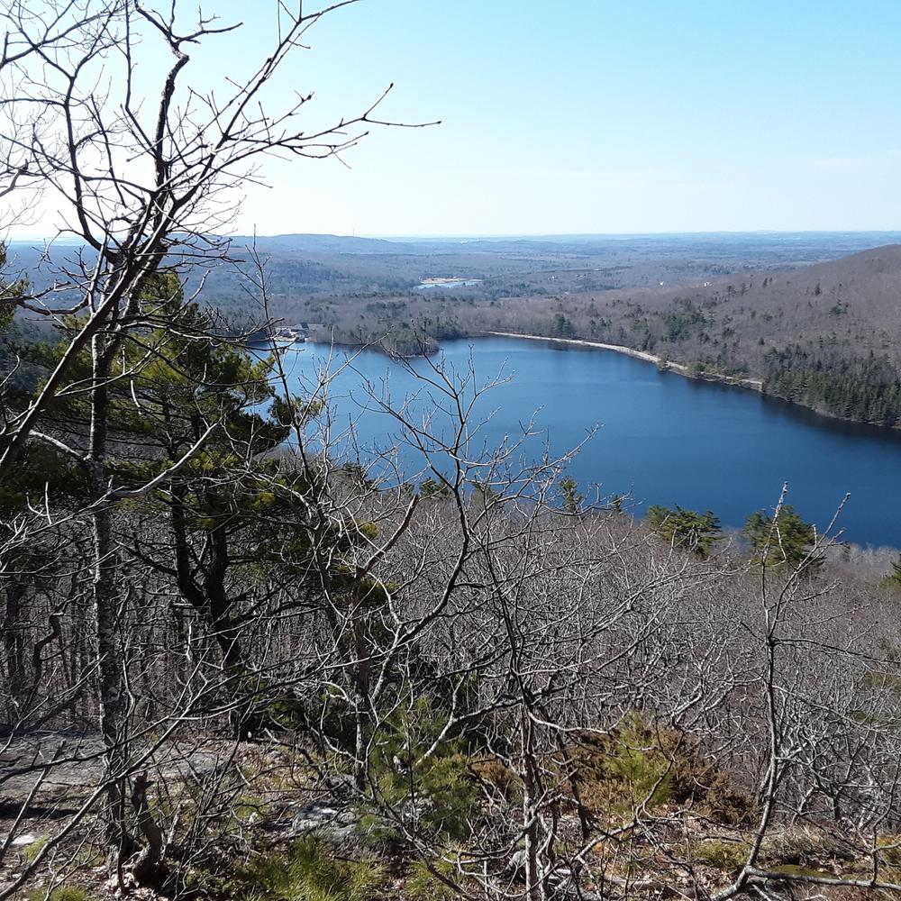
The Ragged Mountain Area section of the Georges Highland Path trail system in Camden and Rockport offers some of the steepest and most strenuous hiking in the midcoast region. The reward, however, is worth it. From the rocky ledges along the ridgeline of Ragged Mountain, hikers are greeted with westerly vistas across the Georges River watershed all the way to Mt. Washington, the White Mountains, and Maine’s western mountains, while island-speckled Penobscot Bay lies to the east, with the Acadian and Downeast mountains framing the horizon.

Ragged Mountain, rising up 1,200 feet, has an extensive, open summit supporting wild blueberry and fragile alpine flora, and is presently the focus of an ambitious conservation effort undertaken by our neighbor, Coastal Mountains Land Trust (CMLT).

The Georges Highland Path network of conservation trails is a project of the Georges River Land Trust.

Other Information

Please respect that this trail is on privately owned property. No overnight camping is allowed.

Trail Manager

Visit Georges River Land Trust online for more information or contact:

Georges River Land Trust

Georges River Land Trust
8 North Main Street, Suite 200
Rockland, ME 04841
Phone: (207) 594-5166
info@grlt.org
View website

Nearby Events

VIEW EVENTS CALENDAR

Trail Tips

Plan Ahead and Prepare
Respect trail closures.
Legend
Hide All

Trailhead Information

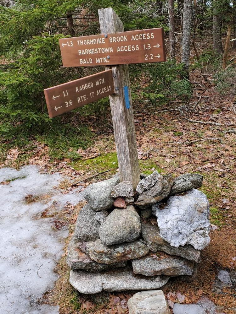
There are three trailheads that hikers can use to access Ragged Mountain: Barnestown Road (north), Hope Street (west), and ME Route 17 (south).

Barnestown Road Trailhead: This trailhead also serves the Bald Mountain Trail, a former section of the Georges Highland Path that is now maintained by Coastal Mountains Land Trust. The parking lot here is 1,000 feet south of the intersection of Barnestown and Gillette Roads in Camden.

Western Trailhead: Also known as the Thorndike Brook Junction trail, the trailhead is on Hope Street in West Rockport. From the intersection of ME Routes 17 and 90 in West Rockport, travel 2.5 miles north on ME Route 17 and turn right onto Hope Street. Travel 0.5 miles to the parking lot on the right.

ME Route 17 Trailhead: The trailhead directly off ME Route 17 also serves the Spruce Mountain and Mount Pleasant trails to the west of Ragged Mountain. The parking lot here is 2 miles north of the intersection of ME Routes 17 and 90 in West Rockport.

Note: The ME Route 17 trailhead is our most popular launch point for hikers and as a result, parking is often difficult on summer weekends. If you want to hike Ragged during this time, we suggest using the Hope Street trailhead. It’s also an easier hike to the top from here!

Click on a parking icon to get custom directions
Please Log In or Create Account to add comments.
senseik
May 15, 2022
Hiked with my husband and sister in law on a warm spring day. Leaves and black flies just coming out. We went up the Georges Highland Trail from Route 17, ate lunch at the summit, and made a loop down the Thorndike trail to the Round the Mountain Trail, just retracing a bit of the GHT to the parking lot. Lots of May wildflowers. Lovely hike.
macdragon
March 10, 2020
Hiked from Hope Street trailhead up the Thorndike Brook Trail and on as far as the Buzzard's Ledge. Beautiful 50 degree weather, but had to watch footing as last of the snow and ice melting made some spots quite slick with mud and wet leaves, but still quite enjoyable. Beautiful views of Mirror and Grassy Lakes and of Camden and Penobscot Bay and islands.
annjulezz
September 25, 2016
Hiked this mountain yesterday, following the Thorndike trailhead, what a gorgeous fun hike. The terrain is constantly changing and the outlook points along the way offer spectacular views of several nearby lakes/ponds and the ocean!!!
badgerinmaine
August 22, 2016
My wife and I hiked to the top of Spruce Mountain yesterday (August 21, 2016). The trails are in excellent condition. The parking area is across Maine Rt. 17 from the Spruce Mountain trail; be careful crossing the busy road. The trails are marked with blue blazes. We found both blueberries and blackberries along the way.
earnald
November 10, 2015
Trailhead on Barnestown needs to be relocated up the road to where it actually is.
These awesome businesses support our goal of connecting people to outdoor adventures in Maine!
Hang Tight!
Nearby services are loading
No Results
No Services Found
SHARE THIS TRAIL

Add Trail Log

Please wait…
Join In on the Fun!
Log in or create an account below to unlock all the great features of Maine trail finder: keep track of trails you want to do, preserve memories of trails you’ve done, earn badges, and more!
Your log in attempt was not successful. Please try again.
    Lost your password? Reset your password
    Don't yet have an account?
    There was an issue with your submission. Please try again.
      * Indicates required field
      Already have an account? Login here
      Enter your username, and we will send you a new, randomly generated password to your email account.
      There was an issue with your submission. Please try again.

        Success! A new password has been emailed to you.

        Log in now

        Please wait…