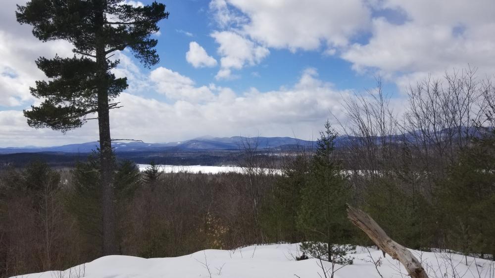
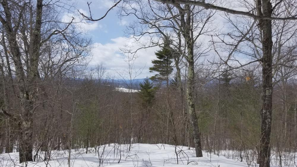
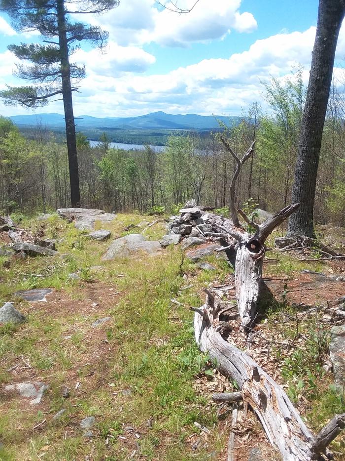
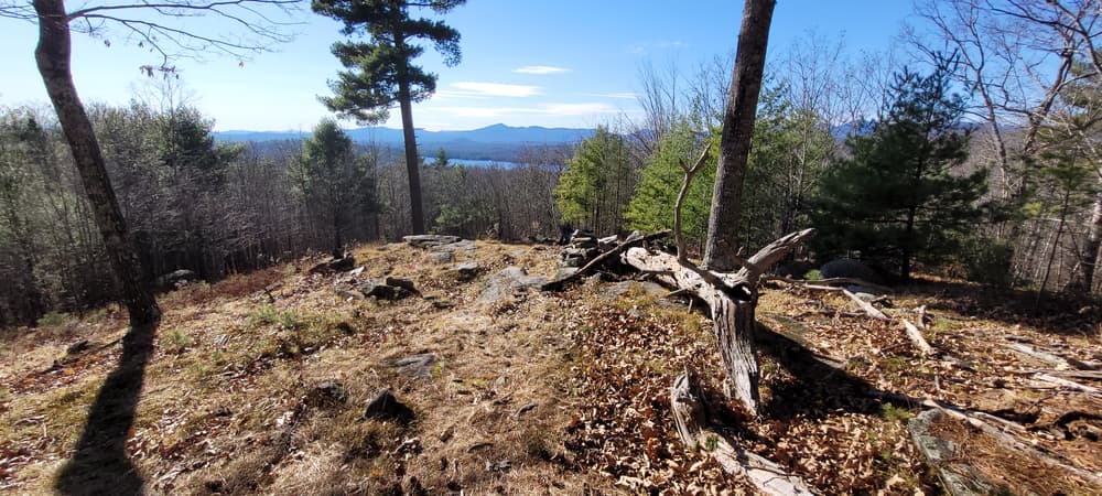
The GLLT manages the property for many public benefits including outdoor recreation, scenic vistas, forest products, and native wildlife. The summit of Whiting Hill (801 feet) offers excellent views of the White Mountains and Amos Mountain (955 feet) currently offers limited White Mountain views. The summit of Flat Hill (891 feet) offers a fine view of Amos Mountain, Evergreen Valley and associated hills. The scenic vistas rival those of nearby Sabbatus Mountain and other area destination points.
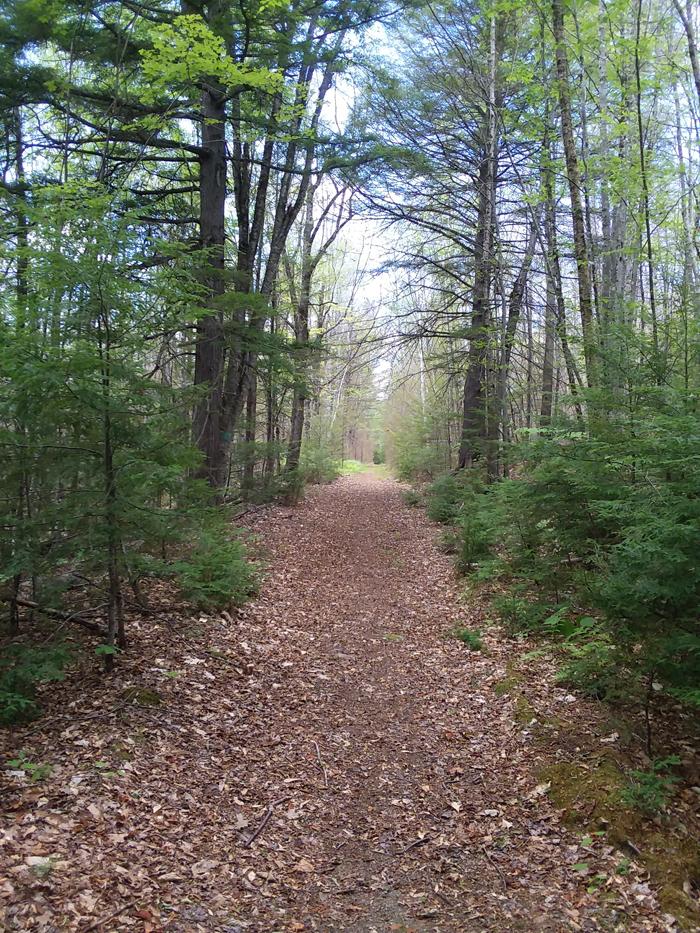
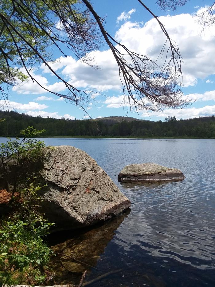
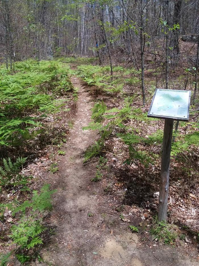
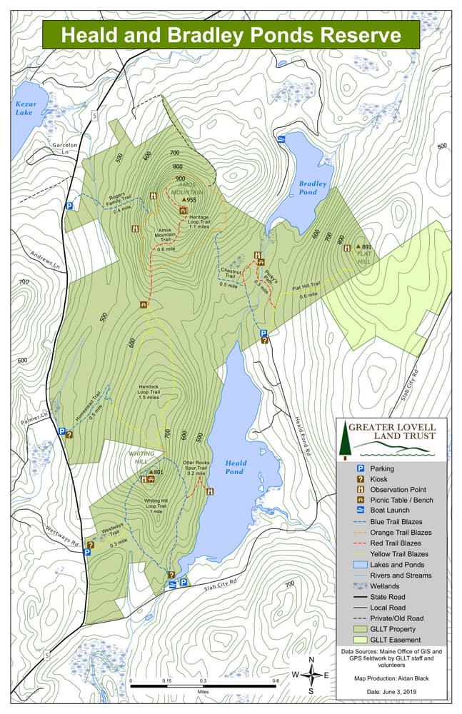
The reserve has an extensive network of trails for all abilities. Part of the Blue and Red Loops Trails parallel Heald Pond and is flat and easy walking for all age groups. Otter Rocks Spur is .08 miles off of the Red Trail Loop and is a perfect spot for picnicking and nature observation. Directly across the lake from Otter Rocks is a shallow cove where moose are commonly seen. Otters, beaver, and a large variety of bird species are also seen from the rocks.
The trails to Amos Mountain are moderate and have a elevation gain of 400 feet. The upper pastures trail to Amos Mountain has many old rock walls within eyesight of the trail and travels through a beautiful northern hardwood forest. There is a series of summit trails that lead visitors to places of interest along the summit such as the Devil's Staircase and special White Mountain views from "El Pulpito", the pulpit. The summit of Amos Mountain is a geo-cache site.
Perky's Path trail is a loop trail that crosses over a small brook twice and loops around a bog. The bog provides an excellent opportunity for bird and beaver enthusiasts, animal photography, and a chance to observe nature in a relatively uncommon wetland ecosystem. Perky's path also crosses into a one-way trail to the top of Flat Hill.
The reserve was acquired by the Greater Lovell Land Trust (GLLT) in 1996 through the generosity of several hundred individuals, public agencies, and organizations that support conservation to preserve the water quality of the Kezar Lake watershed. An additional 198 acres was purchased in 2009 from long term stewards, the Rogers family. The GLLT manages the property for many public benefits including outdoor recreation, scenic vistas, forest products, and native wildlife.
Allowed on the property are fishing and hunting in season, hiking and picnicking, horseback riding, cross-country skiing, snowshoeing, and snowmobiles on marked trails. Not allowed on the property are fires, motorized vehicles other than snowmobiles, cutting/removal of vegetation, camping (except for no-trace camping by prior permit only), and mountain biking. Please carry out all waste.
Visit the Greater Lovell Land Trust online for more information or contact:

If You Pack It In, Pack It Out: Carry out all trash, including food scraps and biodegradable waste like fruit peels. Bonus points for packing out trash you find along the way.
From ME Route 5: Take Slab City Road for .65 miles where you will see a parking lot on your left shortly after crossing the stream and passing the public boat launch to Heald Pond. For the next trailhead, follow Slab City Road for another 1.4 miles until you see Heald Pond Rd on the left. Take Heald Pond road for .75 miles, past the cul-de-sac and into the Parking lot.
Coming from ME Lovell Village: Take ME Route 5 North. Pass Slab City Road on the right and travel for .5 miles, the parking lot is on the right, or travel 0.85 miles further to the next parking lot is on the right.
Success! A new password has been emailed to you.