Mount O-J-I lies across the Nesowadnehunk Valley from Doubletop Mountain, with an elevation of 3,410 feet. Its unusual name originated from three prominent slides on the southwest face that at one time formed the rough outline of the letters O-J-I. Since 1932, smaller slides have altered the shape of these letters.
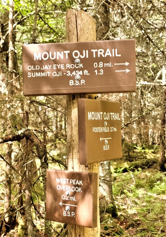
In 2012-13, this trail was relocated to avoid the hazardous footing of the slide path the trail formerly used to reach the summit. The relocation is longer, but less steep, and includes a very nice short side hike to a viewpoint on West Peak - the prominent peak visible directly south of the Marston trailhead parking lot. The trail then approaches O-J-I from the northwest via Old Jay Eye Rock.
This trail can be hiked as a pleasant up-and-back day hike. As an alternative itinerary, one can utilize the O-J-I Link Trail allowing the hiker to descend the north side of the mountain and connect with the Mt. Coe Trail. One can then descend to the Park Tote Road via the Marston Trail. A car or bike would have to be left at the Marston trailhead to avoid a road walk back to the starting point at Foster Field. This alternative loop makes a hike of 7.8 miles.
TRAIL DETAILS
0.0 Miles: The trail enters the woods and passes a small brook to left. It then immediately enters and passes through a cedar swamp for 100 yards.
0.4 Miles: The trail passes a blowdown area from a 1974 storm that swept the southwest part of the Park.
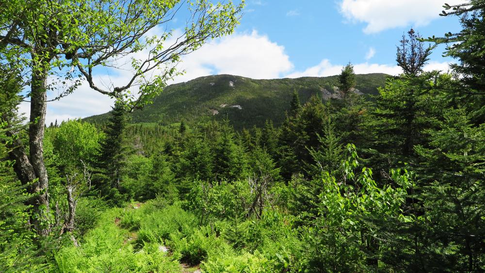
1.1 Miles: The trail passes through beautiful mature beech forest and commences a moderate climb.
1.4 Miles: The trail turns northwest and ascends gradually through mature forest.
1.8 Miles: A stream is crossed, followed by a graded ascent to the saddle between West Peak and O-J-I Ridge.
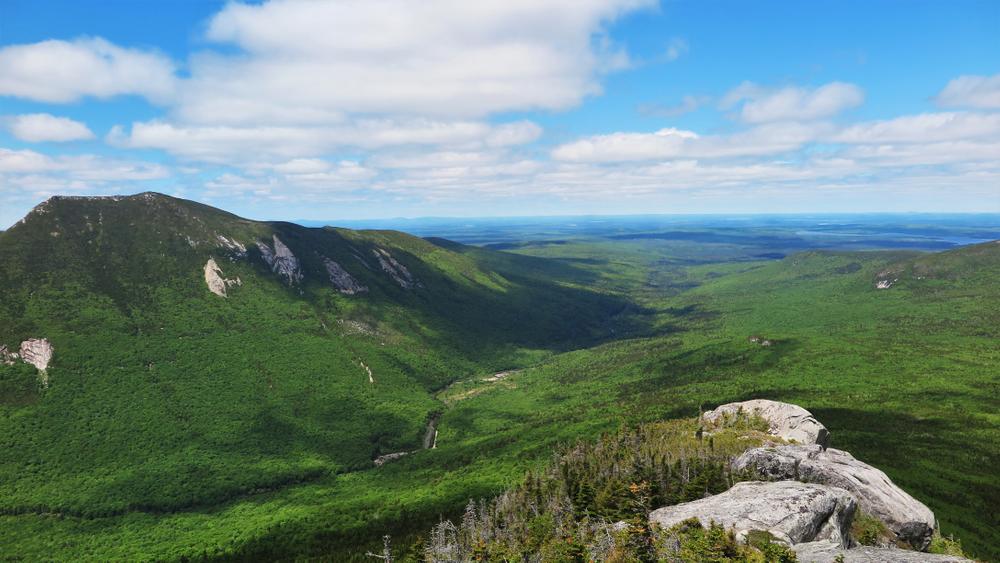
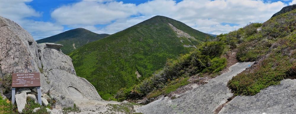
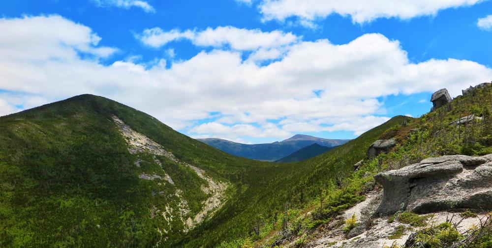
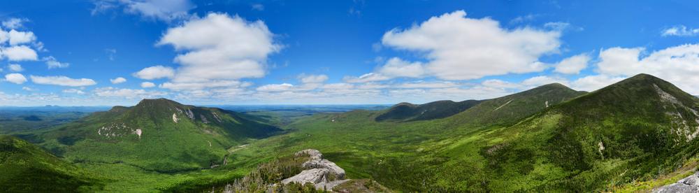
2.7 Miles: The saddle between West Peak and OJI Ridge. To the left (southwest), a short 0.2 mile spur trail leads to West Peak, an excellent viewpoint of the southern Nesowadnehunk Valley. To the right (northeast), the trail continues a graded ascent toward the northwestern ridge of O-J-I.
3.2 Miles: The trail turns to the southeast and ascends steeply up the ridge.
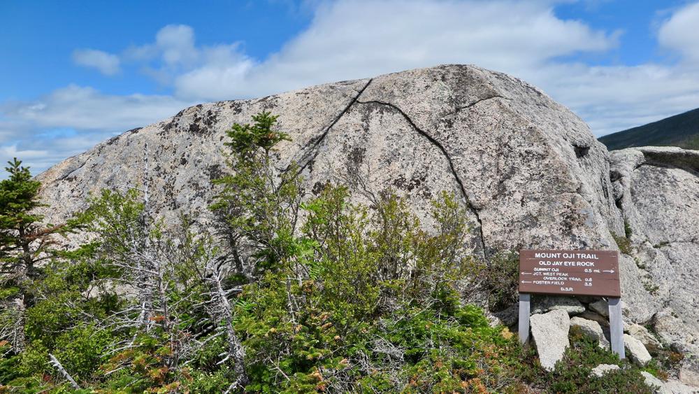
3.4 Miles: The trail passes through a narrow, 30 foot-long cleft in a large rock outcrop.
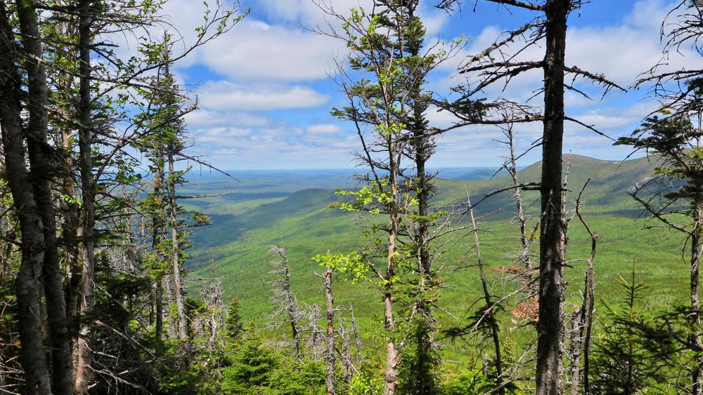
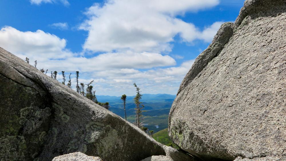
3.5 Miles: Old Jay Eye Rock, which offers excellent views of West Peak, Doubletop Mountain, and the Cross Range.
4.0 Miles: The trail reaches the forested summit of O-J-I.
4.2 Miles: The trail reaches O-J-I Link Trail that descends 0.5 miles north to the valley between O-J-I and Mount Coe. After reaching the Mount Coe Trail at the base of the Coe Slide, this trail can be used as a descent loop via the Mount Coe and Marston Trails, 3.1 miles to the Park Tote Road at the Marston Trail parking lot.
Park Fees: See website for entrance and camping fees. [No entrance fee for Maine residents.]
Park Rules: See a more complete list here.
For more information and detailed trail maps, visit the Baxter State Park Authority website, or contact:

Respect Seasonal Closures: Avoid muddy trails to prevent lasting damage. If you have to pass through wet or muddy trails, walk down the middle of the trail to avoid widening the path and causing further damage.
Travel northwest on the paved Baxter Park Road to the Togue Pond Gatehouse, which is 8 miles from the Golden Road Crossing. After entering the park at Togue Pond Gate, bear left and continue onto the Park Tote Road for 10.3 miles to the Foster Field picnic area. Park at Foster Field. The trailhead is located on the southeast side of the Park Tote Road at Foster Field, directly opposite the junction with the Kidney Pond Road.
Success! A new password has been emailed to you.