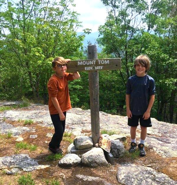
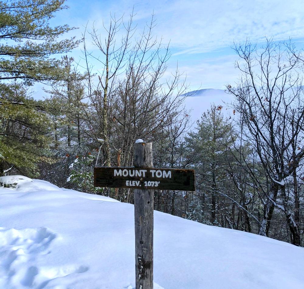
The Mount Tom summit (1,073 ft) can be reached via the West Ridge Trail, as an out-and-back trip of 3 miles total hiking distance from the Preserve parking lot on Menotomy Road. Mount Tom can alternatively be hiked as a 3.7-mile loop hike, by continuing after the summit to the Mount Tom Trail, then returning south along Menotomy Road, which is usually relatively quiet, to the trailhead at the Preserve parking lot.
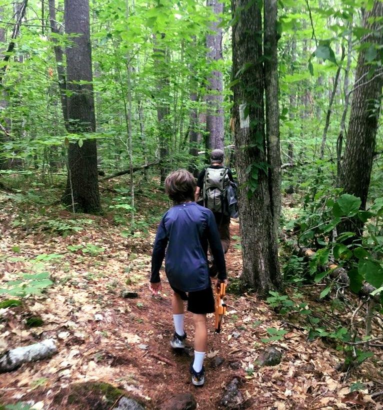
The West Ridge Trail is 1.5 miles one-way. Marked by white blazes, the trail starts at the TNC parking lot and meanders through several distinct habitats; a mixed oak forest, northern hardwood forest, red pine stand, oak-hickory forest with eastern red cedars, a relatively uncommon shrub in Maine. The trail crosses small brooks and follows a large rock ledge formation. Evidence of past human activities in the area are evident; an old homestead site, historical stone walls, and a large sawdust pile from past timber harvesting provides a glimpse of the past.
The trail continues to ascend the western ridge, becoming steeper after about a mile, where frequent views of the Saco River valley can be seen through natural clearings in the trees. Further up the trail, the junction of Old Mount Tom Trail (taking hikers off TNC-owned land) comes in from the left. Stay right to reach the summit and its rocky ledges and views. From the top, the long ridge of Pleasant Mountain is visible to the east, with the Saco River Valley and Kezar Pond to the south.
After descending the summit 0.1 miles to the trail junction, the Mount Tom trail heads to the right (north) 1.1 miles to the northern trailhead on Menotomy Road, 2 miles north of the Preserve parking lot. Or hikers may opt to head to the left (west) to return to the southern trailhead at the Preserve parking lot, back down the the same route ascended along the West Ridge Trail.
PRESERVE GUIDELINES
Please,
Thank you for your understanding and cooperation.
ABOUT THE PRESERVE
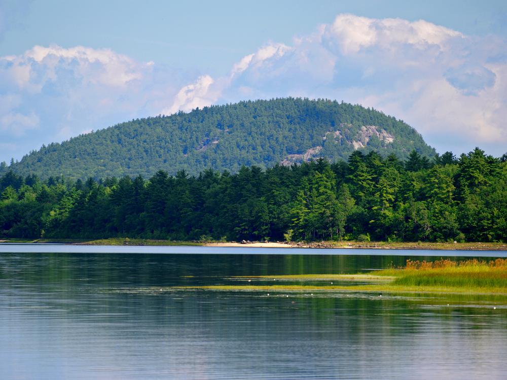
The 995-acre Mount Tom Preserve, owned and managed by The Nature Conservancy, spans the Saco River and boasts over 3,500 feet of river frontage. Several day-use hiking trails provide recreational opportunities, as does a 1.14-mile snowmobile trail that is part of a larger network maintained by the Interstate Sno-goers. Visitors can summit Mt. Tom, canoe along the Saco River, or just walk through the beautiful forests!
River terrace forests support clean water for resident native fish, invertebrates, and other animals that use river beaches. The floodplains provide excellent habitat for spotted salamanders and several species of turtles, with a lush understory of sensitive fern and royal fern. Two regionally rare birds --t he golden eagle and peregrine falcon -- have been regularly sighted near the rocky cliffs of Mt. Tom, during the breeding season. Two rare plants -- the fern-leaved false foxglove and smooth sandwort -- have also been found within the dry oak-hickory forest on the south facing slope of the mountain, and old eastern red cedars dot the hillside.
For additional information, please visit the The Nature Conservancy website, or contact:

Stop Invasive Species: Buy firewood locally, clean your boots and gear, and clean, drain and dry watercraft before and after visiting.
From ME-302, turn north on Menotomy Road (on the left when traveling from Fryeburg; right when traveling from Bridgeton). In about one mile, look for the Fire Lane 31B and the TNC Preserve signs at the preserve parking area on the right.
Success! A new password has been emailed to you.