Over a hundred years ago when construction began on Lower Dam, the Rapid River was nearly unknown. Tucked away in dark forests miles from even primitive land travel routes, very few made it to the banks of the river to appreciate the piece of beauty that we know today. The advent of log driving on the Rangeley Lakes chain brought logging camps and eventually sporting camps to the Rapid River lands. Among them are the settings of Louise Dickenson Rich’s books, including “We Took to the Woods”. Mrs. Rich’s books capture the historical use of the lands surrounding the Rapid River, as well as the rural-life experiences of her family, neighbors and visitors.
Rangeley Lakes Heritage Trust acquired approximately 320 acres at Upper and Middle Dams and along the Rapid River in June 2004 as part of a Settlement Agreement with Union Water Power Co. and FPL Energy during the licensing of Upper and Middle Dams. Protective covenants were placed on the lands to ensure traditional access for recreational and sporting activities.
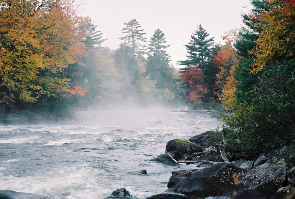
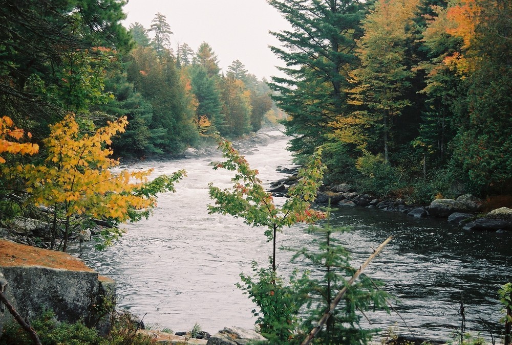
The Rapid River itself is located between Lower Richardson and Umbagog Lakes and is part of the Androscoggin River drainage basin. The Rapid River, which contains approximately 3 ½ miles of nearly continuous Class III-IV rapids, is one of the most spectacular whitewater rivers in Maine. Containing a variety of individual rapids that are regionally and nationally recognized by whitewater enthusiasts, the most impressive of these are Cluley’s Rip, Elephant Rock, and Cold Spring Rapids, all downstream of Long Pool. These “rips” are approximately 250 yards long each with 50 yards of fast moving water separating them. Other rapids include Smooth Ledge, Island Rip and the Devil’s Hopyard. Smooth Ledge is a widely popular boater’s “playground”, where hundreds of boats congregate during scheduled whitewater releases. The river flows in a northwesterly direction and drops approximately 155 feet in 3 miles.
Rapid River is located in an exceptionally scenic area, but sparsely populated and with limited road access. The infamous “Carry Trail” is the historic primary foot travel route that serves access from Middle Dam to Umbagog Lake. Several foot trails divert from the Carry Trail, leading to legendary river access for fishing, paddling, picnicking and more.
There is no cell phone service in this REMOTE area. Please be prepared and use caution in the wilderness of the Rapid River.
Camping is allowed at Cedar Stump campsites. Reservations can be made by calling North Waters Canoe and Kayak at: (603) 482-3817. Camping and campfires are prohibited elsewhere along the shores of both the Rapid River and Pond in the River.

This trail passes through a property that was acquired in part with funds from the Land for Maine’s Future program. For more information about the LMF program and the places it has helped to protect, please visit the LMF webpage.
For more information and a print map, please visit Rangeley Lakes Heritage Trust on the web or contact:
![]()
Set Up Smart: Use established campsites to avoid damaging new areas.
Boat access only. Land at Middle Dam on Richardson Lake or at Cedar Stump on the north end of Umbagog Lake.
Success! A new password has been emailed to you.