West Branch Preserve

This extensive, wooded network of trails connects across North Mountain Road to provide a diverse variety of outdoor recreation opportunities from wide open, former roads to scenic overlooks on banks of the West Branch of Davis Stream.
Trail Activity
Cross-country-skiing Hiking
Length
7.50 miles, Network
Difficulty
Moderate, Advanced
Towns
Jefferson, Somerville
Surface
Dirt/Forest Floor, Snow - Groomed
Pets
Permitted
Fees
No

Description

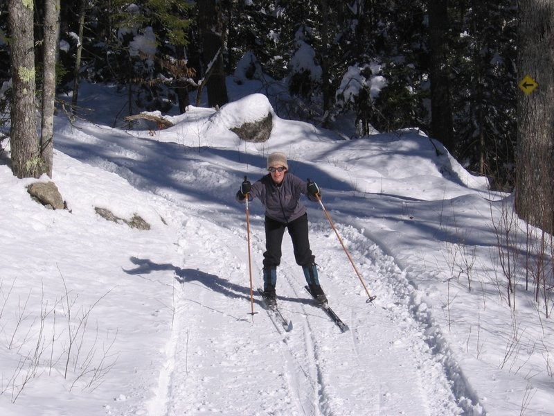
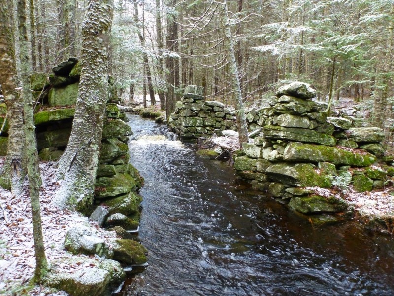
Several hiking trails are flat and wide and perfect for multi-use. Mountain bikers, snowmobilers, cross-country skiers, horseback riders are all welcome. A historic stonework mill site foundation offers a glimpse back into the history of this property.

NORTH OF THE TRAILHEAD

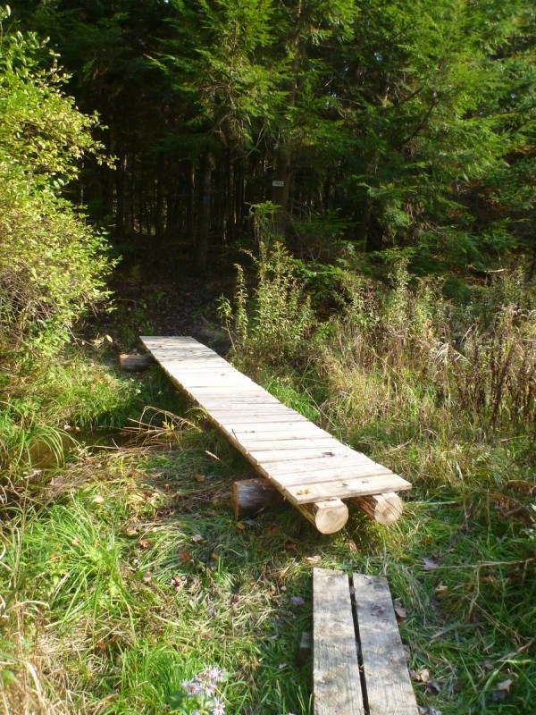
Katy's Way West (0.85 miles) is an easy trail leading north from the parking area to the Lean-To Loop, passing among wetlands along the way. The Lean-To Loop circles an easy 1 mile at the northern-most end of the Preserve. In addition to providing access to the lean-to, passes by an old mill site, evidence of which is still visible. Katie's Way East (0.85 miles) runs alongside a beaver meadow. In the winter, this trail creates a loop with Katy's Way West, but please note the northern half of this trail that allows for the loop is only accessible in winter. The Overlook Spur (0.35 miles) connects Katy's West and Katy's East farther to the south, allowing for a shorter loop, and passing by old observation blinds which remain from this portion of the property's former days as a big game park for bison, elk, and red deer.

SOUTH OF THE TRAILHEAD

Tracy's Mill Loop (2.25 miles) is a moderate trail beginning at the parking area on North Mountain Road and winding south along an old woods road towards the Dyer Stream, where beaver activity has created many small ponds and dams. A spur trail here, about a half mile from the trailhead, takes walkers to a beaver pond and a small waterfall. From the spur the loop turns east, passing by the Everlasting Spring. After crossing North Mountain Road the loop heads back up to the north, along which vernal pools are abundant in the spring.

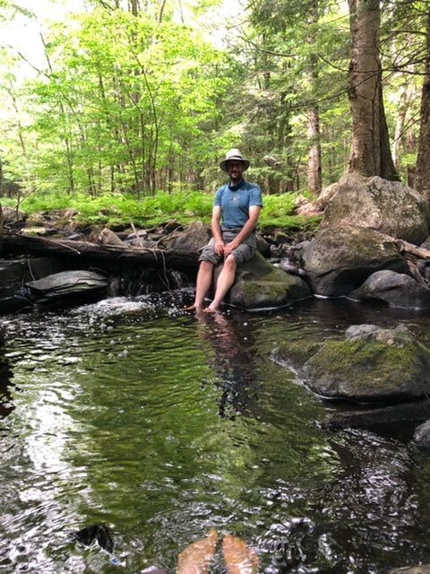
Joe's Trail (1.5 miles) is accessed from the east side of Tracy's Mill Loop. Consisting mostly of two short loops connected by a spur, Joe's Trail winds up and down hills to scenic overlooks of the West Branch. On a clear day, the Camden Hills are visible from the power line clearing.

Other Information

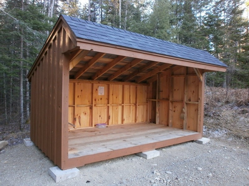
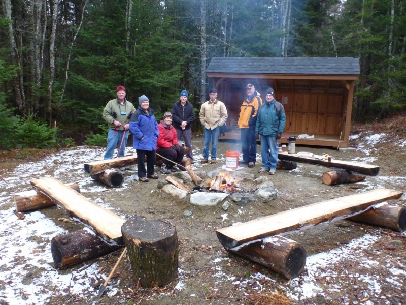
In 2012, local Boy Scout Lucas Kostenbader constructed a camping lean-to on the Somerville section as part of an Eagle Scout project. This site is now available for reservation by individuals and groups. Call Midcoast Conservancy for further information, using the phone number below. Please follow a leave no trace policy and stay on the trail to minimize your impact on the preserve. Deer and turkey hunting is allowed on the preserve. Please wear appropriate clothing and hunter orange in season.

Trail Manager

Visit the Midcoast Conservancy website for more information or contact:

Midcoast Conservancy

Midcoast Conservancy
290 US Route One
PO Box 439
Edgecomb, ME 04556
Phone: (207) 389-5150
View website

Nearby Events

VIEW EVENTS CALENDAR

Trail Tips

Be Considerate of Other Visitors
Be aware of and limit the noise you and your group generate. Enjoy the sounds of nature.
Legend
Hide All

Trailhead Information

From US-1 in Nobleboro, take East Pond Road for 6.9 miles to ME-32. Turn left onto ME-32 and follow it for 0.7 miles. Turn right onto Washington Road and continue 0.4 miles. Turn left onto ME-126/Village Street for 0.1 miles. Turn right onto North Mountain Road, and continue for 1.6 miles to a parking lot on the left.

From ME-17/Rockland Road head south on Jones Road for 1.7 miles. Turn left onto North Mountain Road and continue for 0.6 miles to the parking lot on the left.

Click on a parking icon to get custom directions
Please Log In or Create Account to add comments.
bicksjr
January 10, 2021
There was about 5" of soft snow covering the trails but easy to follow in previous footsteps.
We hiked Kate's Way East but didn't see the trail to make the shorter loop so we just backtracked.
badgerinmaine
October 12, 2020
Visited here Sunday for the first time since 2015, and brought my wife along. We took the Tracy's Mill Loop and a side trip up to the top of Haskell Hill. We both had a fine time. Here are some new notes:
1. While in some places the trail is well marked with blue blazes--and some of the trails going through meadows now have wooden sticks marking the trail--there are places where one can lose the trail. It happened twice to us.
2. The side trail to the beaver dam certainly showed past evidence of beaver activity (such as the dri-ki seen along the way), but we didn't see anything that looked like a beaver dam.
3. Probably because it was October, we had zero problems with bugs.
4. Interesting sidelight: there is a meadow area where the Midcoast Conservancy is letting a farmer raise sheep (fenced in and protected by a dog). Signs encourage hikers not to bother the sheep.
5. Great view to the east along the powerline corridor on the eastern part of the loop.
6. The gravel parking area at the trailhead can accommodate three cars.
7. The trail names used by Midcoast Conservancy now are different from the ones listed here. There's a good map with trail names and other information here: https://www.midcoastconservancy.org/wp-content/uploads/2018/05/MC_Bro_WestBranch_lores.pdf
8. There are a number of trees blown down on the trails, the most major of which is on the side trail to the beaver dam. But they all can be worked around.
badgerjim
June 28, 2015
I hiked here yesterday and enjoyed it. A few notes:
1. I was there on a perfect Saturday afternoon and didn't see anyone else the whole time.
2. Some of the wooden footbridges are missing some boards or have loose ones, so step carefully.
3. I recommend bug spray. Some of the lower, wetter areas are particularly buggy. Also, be alert to ticks. I had four land on me.
4. Some of the trails are tricky to follow because they cut through large meadows where there aren't blazes or markings.
These awesome businesses support our goal of connecting people to outdoor adventures in Maine!
Hang Tight!
Nearby services are loading
No Results
No Services Found
SHARE THIS TRAIL

Add Trail Log

Please wait…
Join In on the Fun!
Log in or create an account below to unlock all the great features of Maine trail finder: keep track of trails you want to do, preserve memories of trails you’ve done, earn badges, and more!
Your log in attempt was not successful. Please try again.
    Lost your password? Reset your password
    Don't yet have an account?
    There was an issue with your submission. Please try again.
      * Indicates required field
      Already have an account? Login here
      Enter your username, and we will send you a new, randomly generated password to your email account.
      There was an issue with your submission. Please try again.

        Success! A new password has been emailed to you.

        Log in now

        Please wait…