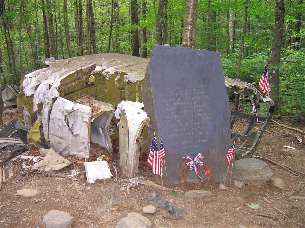
On the slopes of Elephant Mountain, this wide and clear path meanders through the plane wreckage left from the crash of a B-52C Stratofortress that occurred on January 23, 1963, when turbulance caused the vertical stabilizer to fail, sending the plane on its low-level radar mission into the mountain. The pilot and navigator survived the crash, while the other seven people aboard died in the wreck. The navigator, Gerald Adler, is the only person to survive an ejection from an aircraft without his parachute opening.
A sign at the entrance to the trail asks visitors to treat the area respectfully and leave it intact. As the trail heads into a dense pine forest, it encounters the first fragments of debris almost immediately. The smooth footpath continues through the woods among torn and shredded bits of metal in every direction. After 0.2 miles the trail reaches the fuselage of the plane, where a black slate memorial honoring the survivors and the seven men who lost their lives in the crash has been erected.
The pieces of the B-52 were once removed from the site, but most of the pieces were later returned to the woods as a memorial. The site has been designated off limits to all future salvage operations and the area surrounding the crash site designated as a no harvest zone. Visitors are asked to treat the area respectfully and leave the wreckage intact.
From the blinking light at the center of Greenville, head north on Lily Bay Road for 6.7 miles. Turn right onto Prong Pond Road. Follow the signs for the memorial, and after about 8 miles you will see the trailhead and a parking area. These back roads are rutted and rugged, a tough car with high clearance is helpful.
Success! A new password has been emailed to you.