The hiking trails at Bethel Community Forest start from the same parking lot and travel through adjacent conserved parcels - the Bingham Forest, owned by the Town of Bethel, and the Bethel Community Forest, owned by Inland Woods + Trails. All trails are managed by Inland Woods + Trails.
Summit Ridge Trail
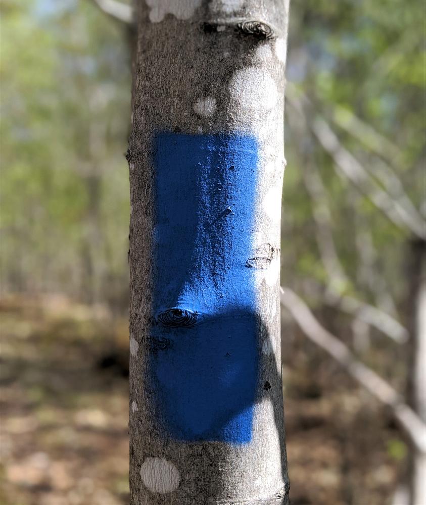
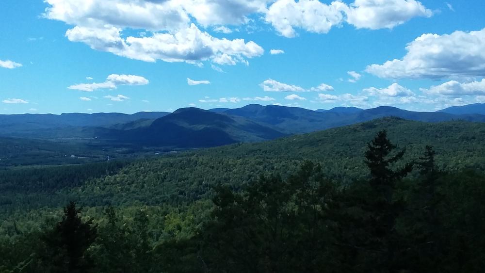
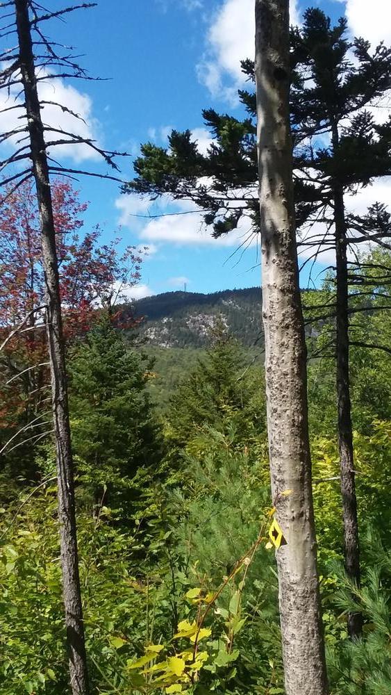
The Summit Ridge Trail is designed to be easy to moderate, following the contours of the terrain as it ascends the ridge where it takes in sweeping views to the south and west. It follows blue blazes through a diverse set of landscapes before ending at a scenic overlook.
The trail begins in the the parking lot and coincides with a mountain bike trail for 100 feet before continuing straight ahead (the mountain bike loop trail leaves on the left and returns on the right--caution should be used at this intersection). The Summit Ridge Trail then passes through mixed hardwoods and over a few bog bridges for 0.25 miles before emerging at a road where additional mountain bike trails diverge. The hiking trail continues straight across the road and reenters the woods. The trail then heads north and then gradually climbs west and crosses several old logging roads until it reaches a stone wall, and turns east up through softwoods.
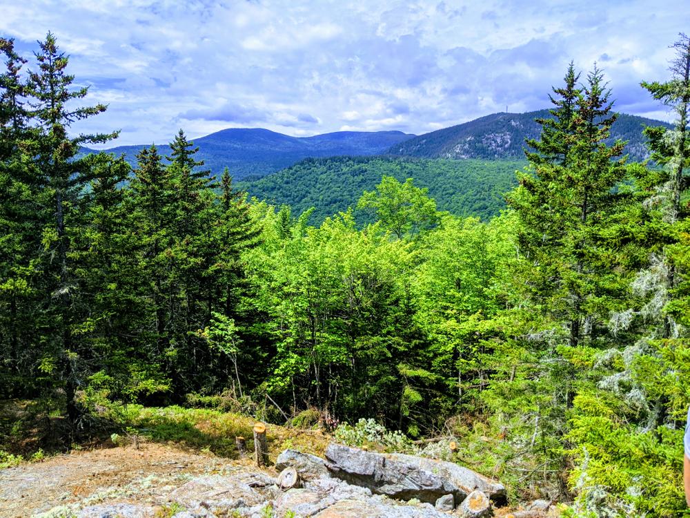
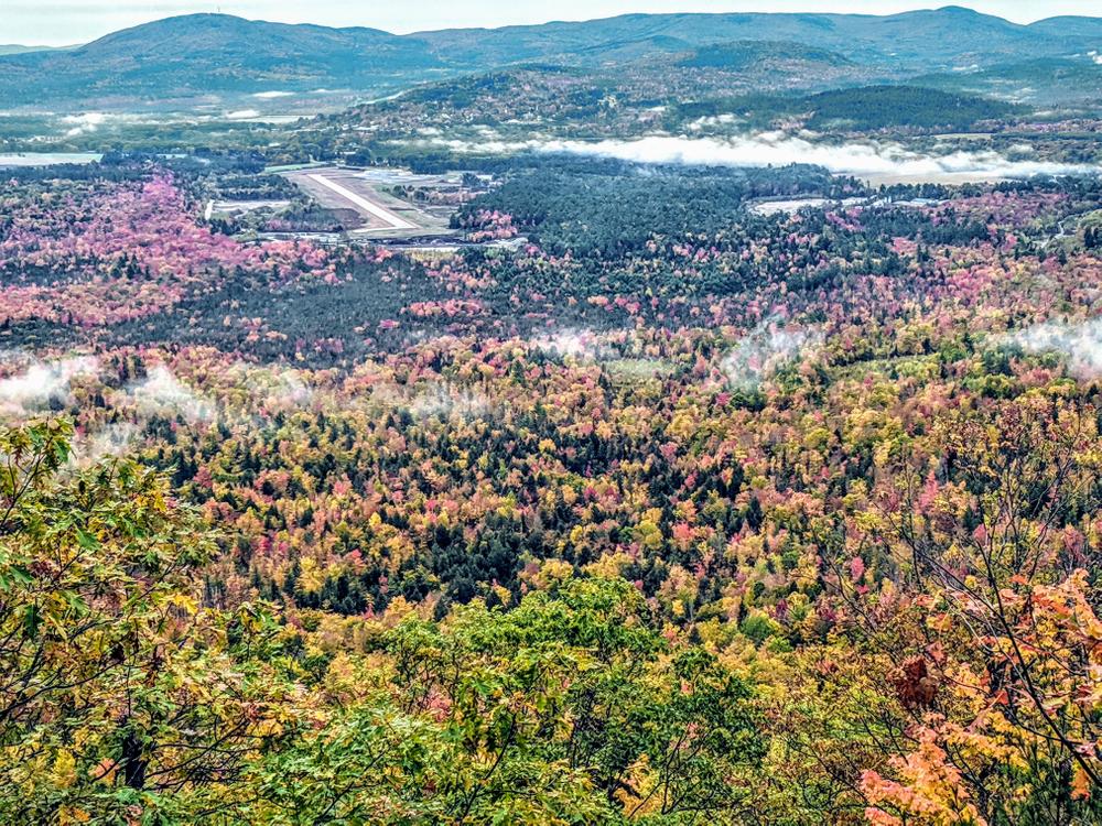
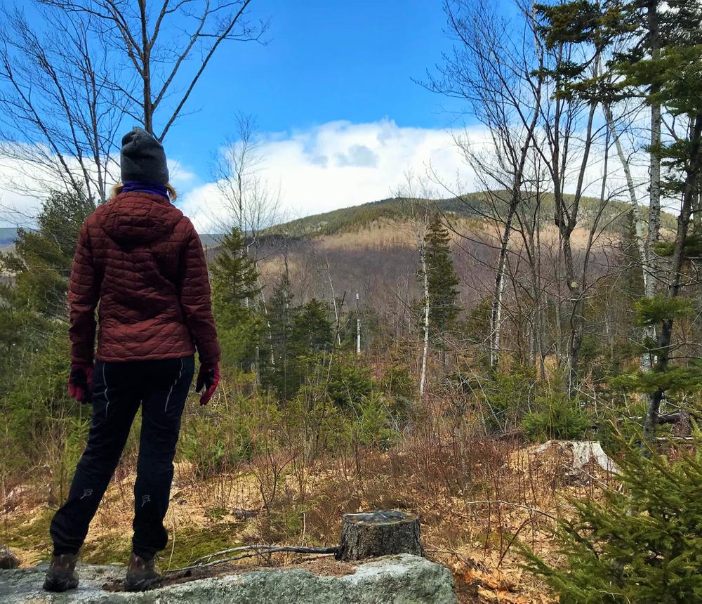
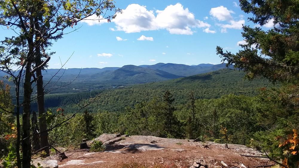
The trail emerges at Picnic Knoll, 0.6 miles from the trailhead. There are two picnic tables and Adirondack chairs at which to enjoy a snack or take in the views of the Bingham Forest and high peaks of the back of the Sunday River ski area. From Picnic Knoll the trail steadily ascends a ridge with a mix of terrain on rocks before emerging at another logging road. The Summit Ridge Trail crosses the road and ascends through more rock and small ledge openings before emerging at the West Ledges at 1.2 miles. The trail continues climbing from the West Ledges in a sub-alpine forest and then to the final view point, Ridgetop View. There are views intothe BinghamForest and this is where the trail ends at 1.7 miles. Return the way you came.
Bingham Cascades Trail
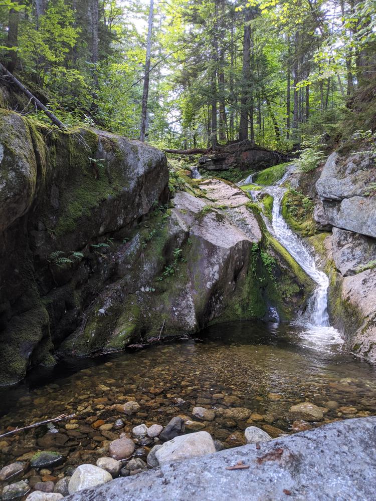
The Bingham Cascades Trail is a 5.7 mile round trip hiking trail that travels into the heart of the Bingham Forest valley. The trail is built in honor of Brent Angevine, who served as the founding Chair of the Bingham Forest Authority and Trustee of the Bethel Water District. Brent always asked us to build this trail to the cascades located in the heart of the Bingham Forest. In his honor we have built this trail for the community to experience the splendor of the Bingham Forest. The trail has blue blazes. It crosses and uses several old woods roads as it winds its way to the center of the Bingham Forest valley.
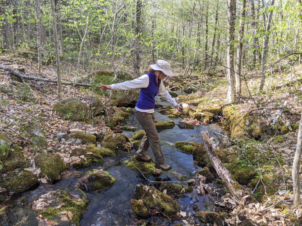
The trail leaves the Summit Ridge 0.1 miles after Picnic Knoll (.8 miles from the parking lot) winding through a low lying evergreen forest. Bog bridges aid hikers through this section. The trail then joins an old woods road for a short stretch. The trail cuts into the woods, crosses a stream, and then rejoins the road for a few hundred yards through hardwoods before turning slightly west into the woods as hikers enter the Bingham Forest traveling through a stand of mixed hardwoods with larger aspens along the trail. About this point, hikers also cross the invisible line between the towns of Bethel and Newry.
The Bingham Cascades trail contours slightly downhill and to the north and east before running parallel to a more substantial stream which the trail crosses soon after. After crossing the stream the trail climbs briefly to a well built woods road and passes through a clearing before heading downhill, across a stream before turning right off the road where a climb begins.
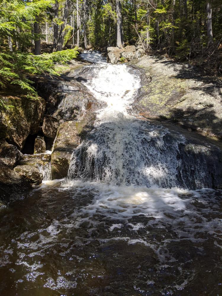
The trail climbs at a moderate grade up through a young and open hardwood forest. There are several points at which the grade flattens briefly before climbing again. The trail the contours westward and crosses several depressions, streams, and old roads before traveling through a coniferous forest. The trail then deposits the hiker onto a well established woods road. The trail turns right (NW) and follows this road for 0.5 miles. The Bingham Cascade Trail then reaches the loop portion. From here hikers can access the three unique cascades along the loop. Traveling counter-clockwise, first is the large Chapman Cascade, 0.1 miles off the main trail. In the middle of the loop is a 0.3 mile side trail to Upper Cascades. It is a steep climb to several large and unique cascades before reaching a signed turnaround at the last cascade. The small but picturesque Library Cascade is the last falls on the loop before hikers descend back to the beginning of the loop and return the way they came in.
Caution is advised at the stream crossings and the cascades as footing may be difficult or slippery.
USE GUIDELINES
For a safe and enjoyable hike, please be prepared. For more information on how to get ready for your hike and what to bring, visit Hike Safe. Inland Woods + Trails is also happy to answer your questions about this trail network.

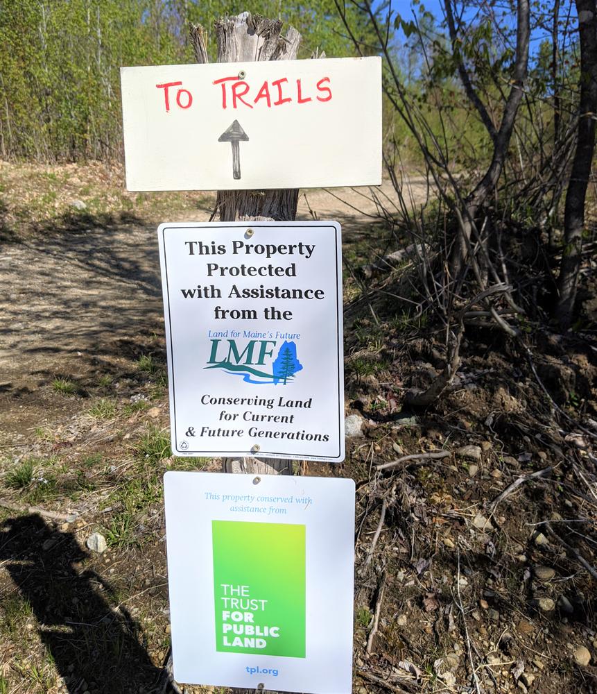
This trail passes through a property that was acquired in part with funds from the Land for Maine’s Future program. For more information about the LMF program and the places it has helped to protect, please visit the LMF webpage.
For additional information, visit the Inland Woods + Trails website, or contact:
Inland Woods + TrailsFrom Bethel, take US-2 E, and immediately after crossing the Androscoggin River take a left on North Road. From Rumford, head west on US-2 for 22 miles, and just before the Androscoggin River on US-2, take a right on North Road.
Follow the North Road 2 miles to where the road takes a sweeping 90 degree turn to the west. At the beginning of this corner merge slightly right onto Daisy Bryant Road, go 0.2 miles, and turn right on Locke Mountain Road. Passing through the gate follow the single lane Locke Mountain Road for 0.6 miles until reaching the parking lot at the end of a field. The trail starts in the northeast corner of the parking lot.
The GPS address is 121 Locke Mountain Road in Bethel.
Success! A new password has been emailed to you.