The Eastern Trail is a 62-mile multi-use, greenway for non-motorized uses, that connects Bug Light in Casco Bay, South Portland to Kittery, Maine. Approximately thirty percent of the trail is off-road. The Eastern Trail is currently composed of 21 miles of off-road trails on the former Eastern Railroad bed with the remainder 41 miles on public roads. The Eastern Trail is the Maine section of the East Coast Greenway which will eventually connect Calais, Maine to Key West, Florida, approximately 3,000 miles.
The entirety of the Eastern Trail is built to ADA standards. The trail surface varies between pavement and stone dust/gravel. Most of the trail is 10-12 feet wide, with some sections with an 8-foot width. There are smaller openings between the bollards at entrances and at road crossings to keep out motorized vehicles, ranging from 18-32 inches. Occasional benches are placed alongside the trail.
The typical slope is 0-4% with the exception of bridge approaches. The trail is built like a street with a small crown in the middle resulting in cross slopes that are 3-5% on either side of the midline but are 0-2% for most of the width of the trail.
The off-road section connecting Biddeford, Arundel, and Kennebunk provides over six miles of trail for walking, running, biking, cross-country skiing, and snowshoeing. The trail passes through unique forests along the former Eastern Railroad bed. The trail is extremely flat, the surface is hard packed stone dust and is suitable for road bikes or mountain bikes. The trail crosses the Maine Turnpike in Kennebunk on a uniquely designed bridge that was opened in 2011. This is the only pedestrian bridge that crosses the Maine Turnpike.
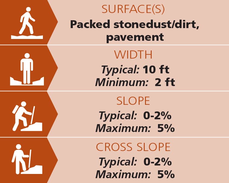
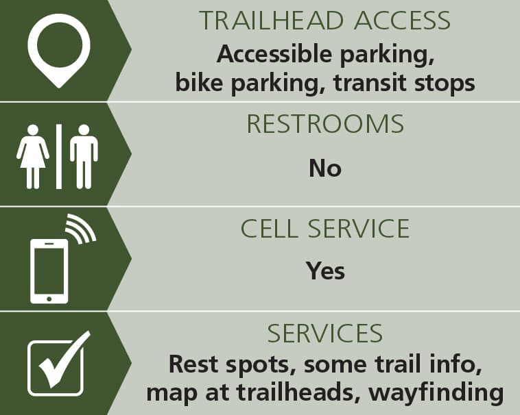
Trail conditions can change without warning. Trail last assessed: 7/1/2026.
Equestrian use is allowed in some areas during the spring through fall seasons.
 Natural Heritage Hikes is a project of the Maine Natural Areas Program in partnership with Maine Trail Finder. View the "Eastern Trail" guide online here.
Visit the Eastern Trail Alliance online for more information and a printable map or contact:
Eastern Trail AllianceThe trail can be accessed from multiple points along the trail, with the two primary access points being at either end of the trail in Biddeford and Kennebunk.
Biddeford access is from the parking lot of Southern Maine Medical Center (SMMC). Follow ME-111, east of the I-95 Exit 32 for 0.2 miles and turn right into SMMC. West Cole road is 0.4 miles from the Biddeford Exit at the second light, also on the right. Park in the back lot.
Kennebunk access is via the Kennebunk Elementary School located off ME-35 approximately 0.6 miles north of the I-95 Exit 25 in Kennebunk.
Success! A new password has been emailed to you.


