Mount Kineo has gentle slopes to the northwest and steep southeast faces shaped by a mile-thick ice sheet that moved across the region from northwest to southeast. The trails on Mount Kineo highlight the results of this glacial movement which occurred between 18,000 and 12,000 years ago.
Indian Trail (0.9 miles, moderate): climbs steeply along open ledge, making it the shortest but most strenuous route to the summit and fire tower. While more challenging, The Indian Trail also provides the best views of any trail. It is typically 6 feet wide with a 12% grade, and a mimimum 2.5-foot width and maximum 60% grade.
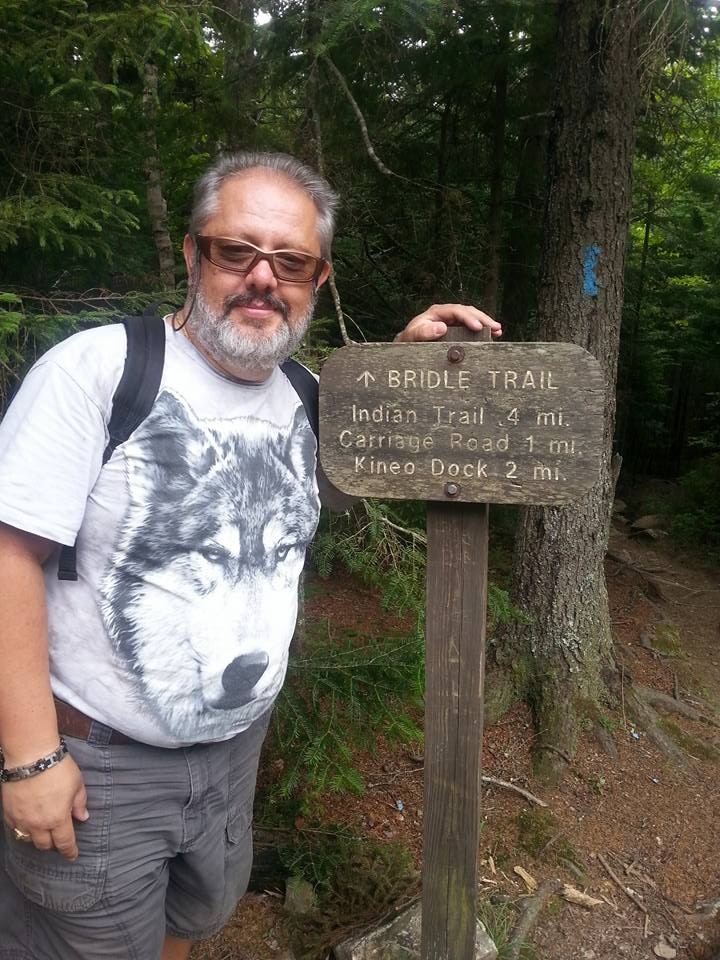
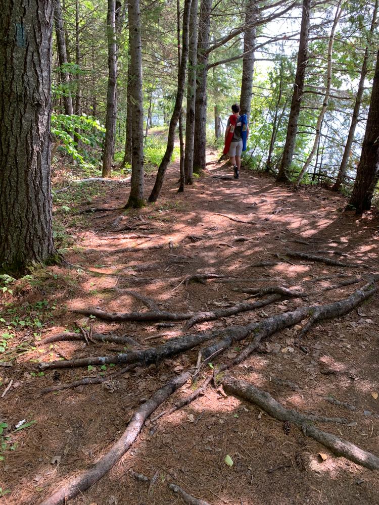
Bridle Trail (1.1 miles, easy): is the original fire warden trail and provides a less steep route to the summit for hikers. It begins 0.3 miles along the Carriage Trail, traversing through stands of maple and birch before converging with the Indian Trail just shy of the summit. It is typically 6 feet wide with an 8% grade, and a mimimum 3-foot width and maximum 37% grade.
Carriage Trail (2.2 miles, easy): parallels the west shore of the peninsula, following the waters of Moosehead Lake to Hardscrabble Point. The Carriage Trail then connects to the North Trail creating a perimeter hike of the peninsula. It is typically 4 feet wide with a 1.3% grade, and a mimimum 1.3-foot width and maximum 5.4% grade.
North Trail (1.9 miles, moderate): offers a view of the eastern peninsula and when combined with the Carriage Trail, the longest hike to the summit of Mount Kineo. From Hardscrabble Point, the North Trail winds through the low level mixed hardwood forest and then rises more steeply up Mount Kineo's southeastern cliffs. It is typically 2.3 feet wide with a 5% grade, and a mimimum 1.3-foot width and maximum 60% grade.
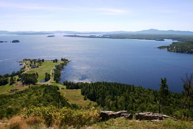
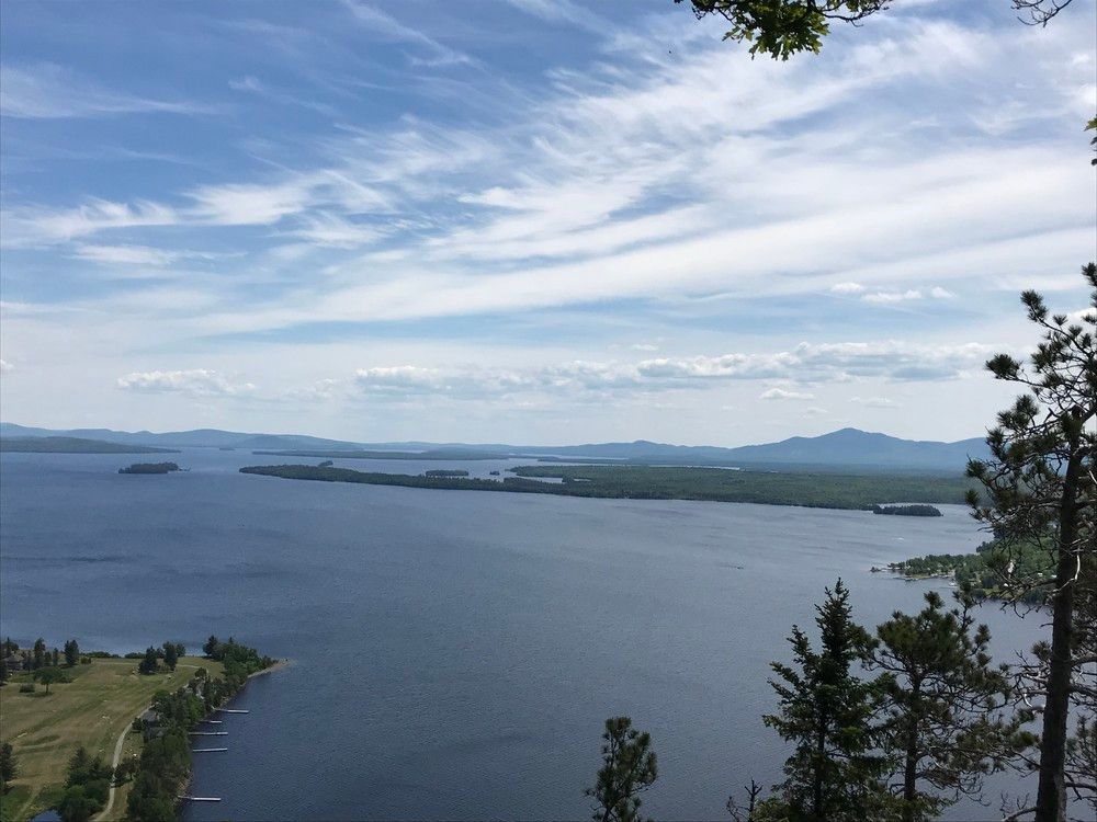
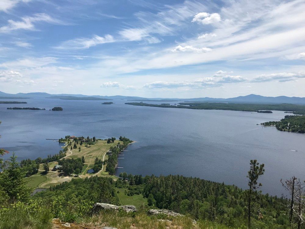
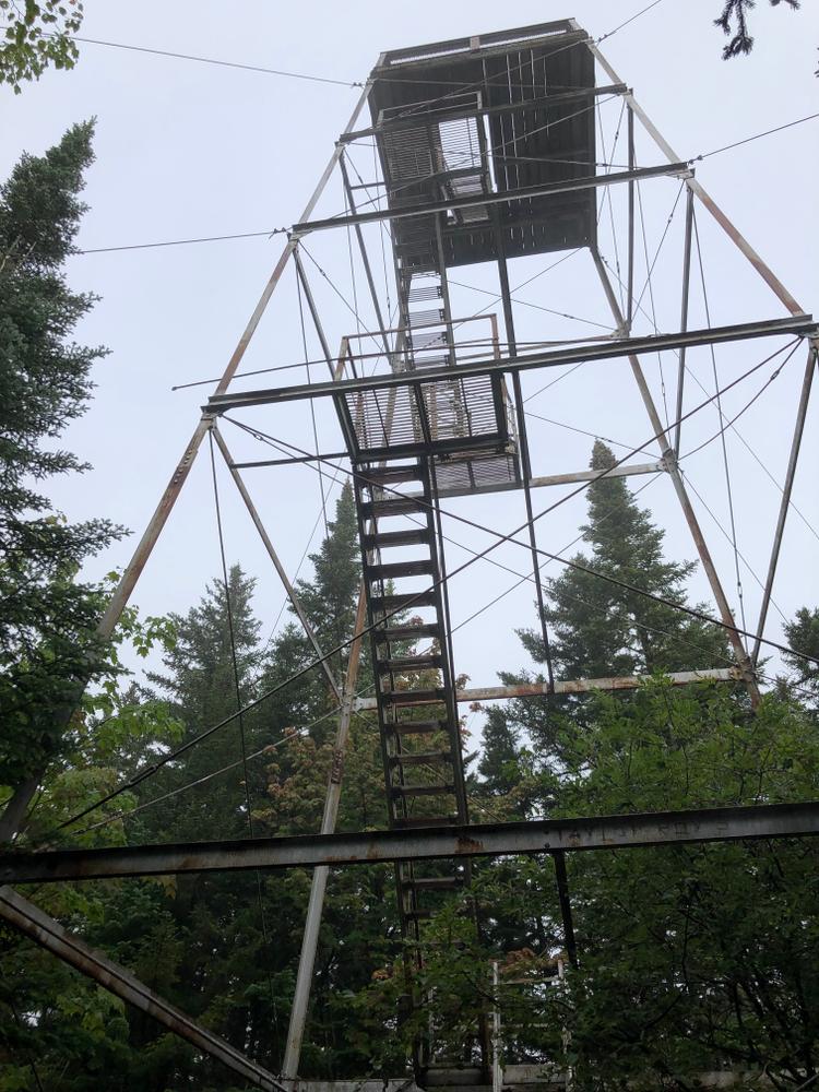
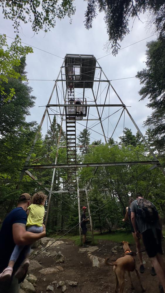
Eventually, all trails lead to the summit, which has a converted fire tower, used until about 1960 by the Maine Forest Service. From the summit, hikers can indulge in 360-degree views: Little Kineo, Big and Little Spencer Mountains in the northeast; the Lily Bay Mountains in the southeast; Big Moose in the south; the peak of Coburn in the southwest and Boundary Bald Mountain in the west. Of course, all around Kineo is the magnificent expanse of Moosehead Lake.
In addition to the breathtaking views offered by the summit of Mount Kineo, the peninsula is permeated with historical and natural significance. The name Kineo derives from a Wabanaki warrior of legendary power, Kinneho. The geological attributes of Mount Kineo also provided utilitarian purposes for original inhabitants. Native Americans utilized the flint-like felsite and rhyolite from Mount Kineo to craft stone tools. Today Mount Kineo is peregrine falcon territory. After near extinction in the 1960s, the first wild pair of peregrine falcons returned to nest on the cliffs of Mount Kineo in 1987.
View BPL's map and guide for the Moosehead Lake Shoreline Public Land.
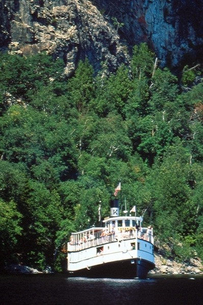
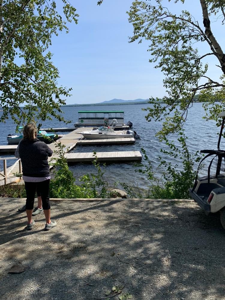
When traveling to Mount Kineo via the boat shuttle in Rockwood, confirm departure times before hiking and gauge plans accordingly. Moosehead Lake water is cold and winds can arise suddenly and create dangerous conditions for boats. Children 10 years of age and under must, by law, wear a Type I, II, or III PFD while on board all watercraft. All boaters should wear a PFD at all times in small boats; notify someone of your intended route and time of return; and monitor conditions carefully (particularly when crossing open waters, including the crossing to Mount Kineo). Exercise caution near cliffs, particularly in damp and slippery conditions.

This trail passes through a property that was acquired in part with funds from the Land for Maine’s Future program. For more information about the LMF program and the places it has helped to protect, please visit the LMF webpage.
Visit Maine Bureau of Parks and Lands online for more information and a detailed trail guide or contact:
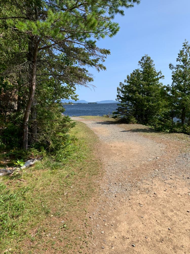
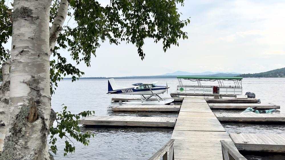
Maine Bureau of Parks and Lands, Lily Bay State ParkMount Kineo is accessible by water only, with the nearest public boat launch site in Rockwood. Take ME Routes 15/6 through Greenville (also known as the Rockwood Road). Rockwood is 15 miles northwest of Greenville. Turn right on a road marked with signs for the Rockwood town landing and docks. A commercial boat shuttle (fee charged) to Mount Kineo leaves routinely from Rockwood in summer months. From the Mount Kineo docks, turn left and follow the shoreline path, an old carriage road, for 0.8 miles leading past private property to the State lands. Bear right on the Indian Trail or left for the other trails.
Success! A new password has been emailed to you.