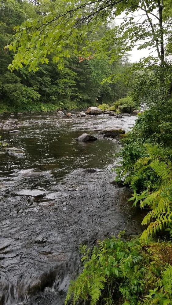
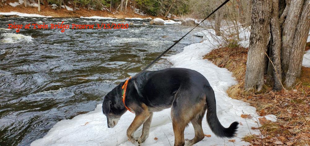
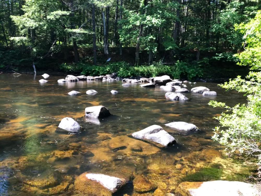
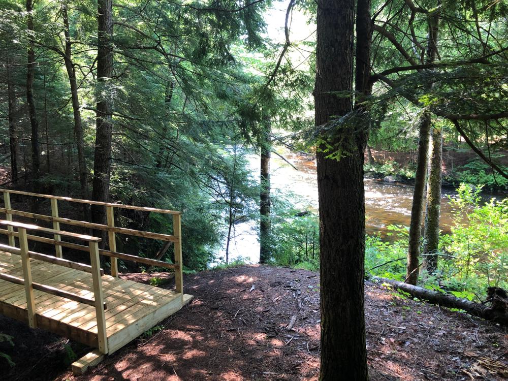
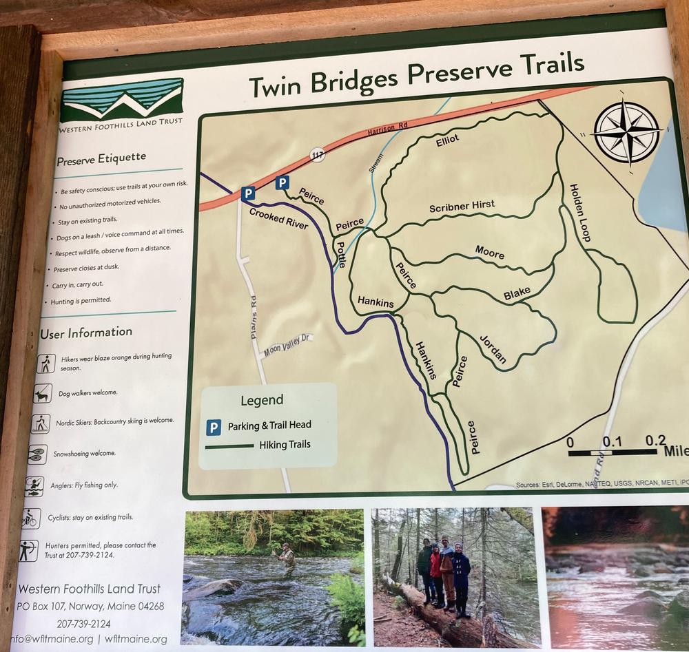
Many short, wooded trails offer unlimited options for exploring this property. From the parking lot, the Pierce Trail heads south, paralleling the river for 0.15 miles before coming to the junction. To the right, a short spur, the Pottle Trail, leads to a view point along the river; the Pierce Trail continues to the left, giving access to the rest of the trail network. From the Pierce Trail, five other trails cross the property to the trail on its east boundary, the Holden Loop. The 0.4 mile Harkins Trail, the first right after the Pottle Trail, heads to and then along the river before meeting back up again with the Pierce Trail.
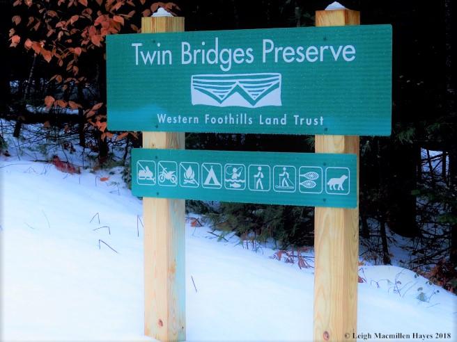
The Twin Bridges Preserve is one of many preserves that are a part of the Crooked River Forest. WFLT continues to partner with other organizations to protect lands in the Crooked River watershed, with an over-arching goal of protecting a forested watershed for a variety of ecosystem services including water quality. Over 200,000 households, 1/6th of Maine, rely upon clean drinking water from the Sebago Lake Reservoir, which is fed by the Crooked River and other tributaries within the greater Sebago Lake Watershed
For more information, please visit the Western Foothills Land Trust website, or contact:
Western Foothills Land TrustFrom the south, head north ME-121. At the junction of ME-121 and Bolsters Mill Road in Otisfield, take a left onto Bolsters Mill Road. Go 4.9 miles, and take a right on Plains Road just after crossing the river. Go 2.8 miles on Plains Road to ME-117 and take a right. The parking area for the preserve is 0.2 miles ahead on the right.
Success! A new password has been emailed to you.