This is a guest post written by Enock Glidden, MTF Accessibility Ambassador, Public Speaker, Adaptive Athlete, and Adventurer. To learn more about Enock, please visit his website.
Hey fellow hikers - I am back for another beautiful hiking season in the great state of Maine! I hope you all had a great winter season snowshoeing, cross country skiing, downhill skiing, and just enjoying the outdoors of Maine any way you could.
My goal this season is of course to do a lot more hiking. I am also working on a better rating system so I can give you all the best information possible. I will be using the same words to describe trails as the current rating system easy, moderate, advanced, and strenuous. There will be better, more objective descriptions for each of these ratings. When you see the rating you should be able to get an idea in your mind as to what you will encounter. I won't be replacing my usual descriptions though. I still want to make sure everyone has as much information as I can give.
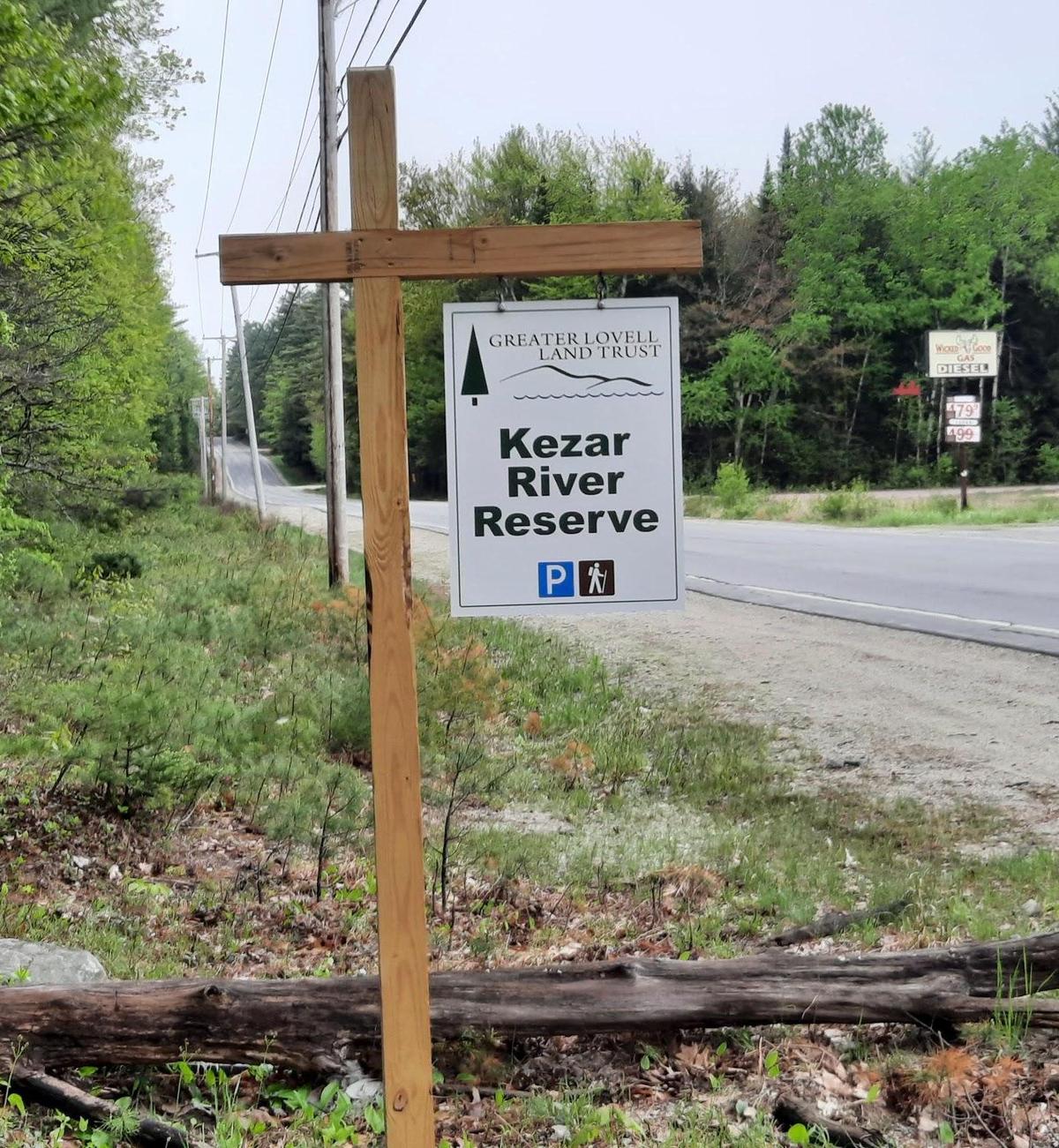
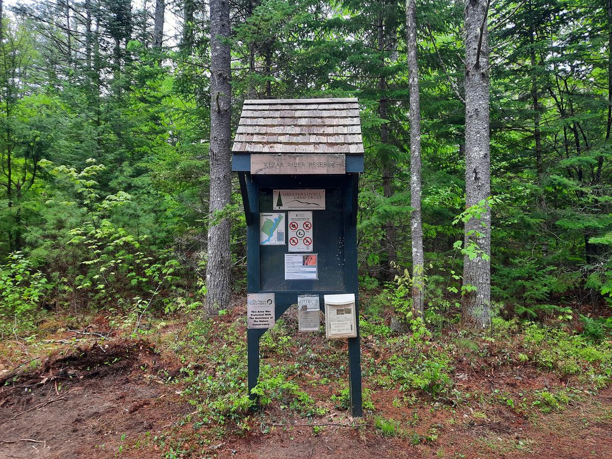
For my first official MTF hike of the season, I decided to check out a couple of local hikes I have been driving by now for the last year. The first property I checked out is the Kezar River Reserve in Lovell, Maine. This stunning little property is preserved by the Greater Lovell Land Trust.
The sign at the end of the access road is a bit small so you may miss it. I am pretty sure I had driven by quite a few times before it caught my eye. I always seem to have a destination to get to when I am headed in that direction. I finally decided to make this reserve my destination.
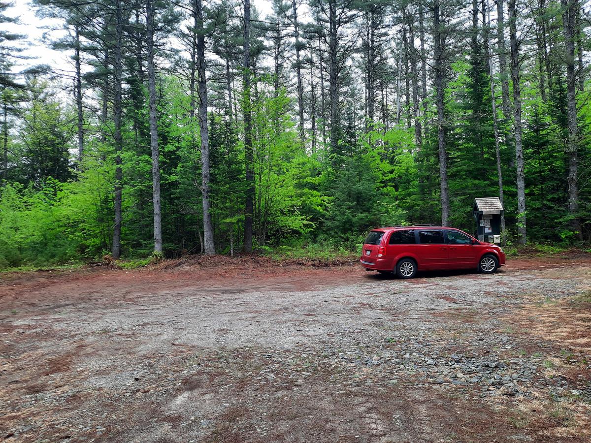
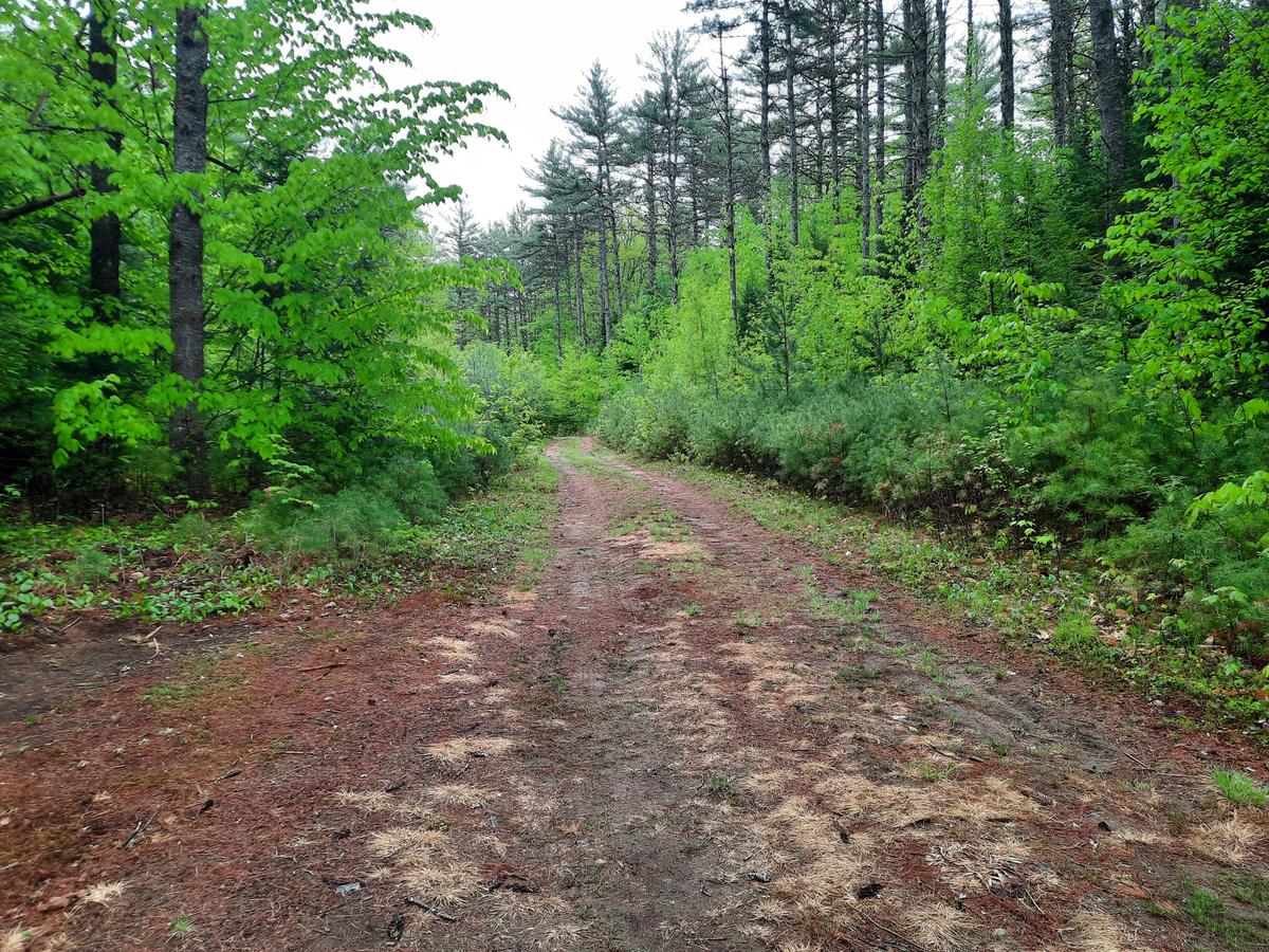
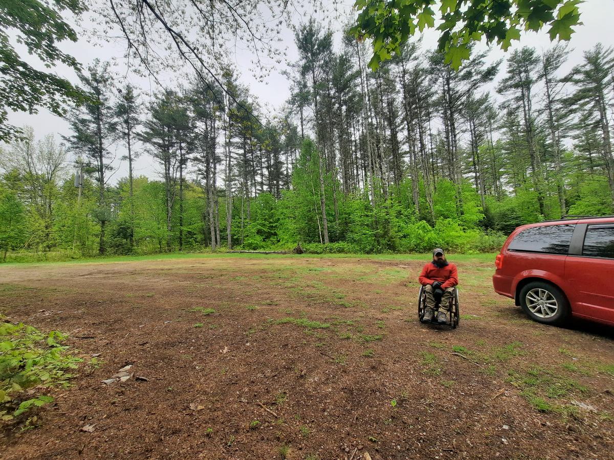
Once you turn onto the access road you will need to go about a quarter of a mile to find the parking area. The parking area is dirt/forest floor but still quite firm. My wheels didn't really dig into the ground.
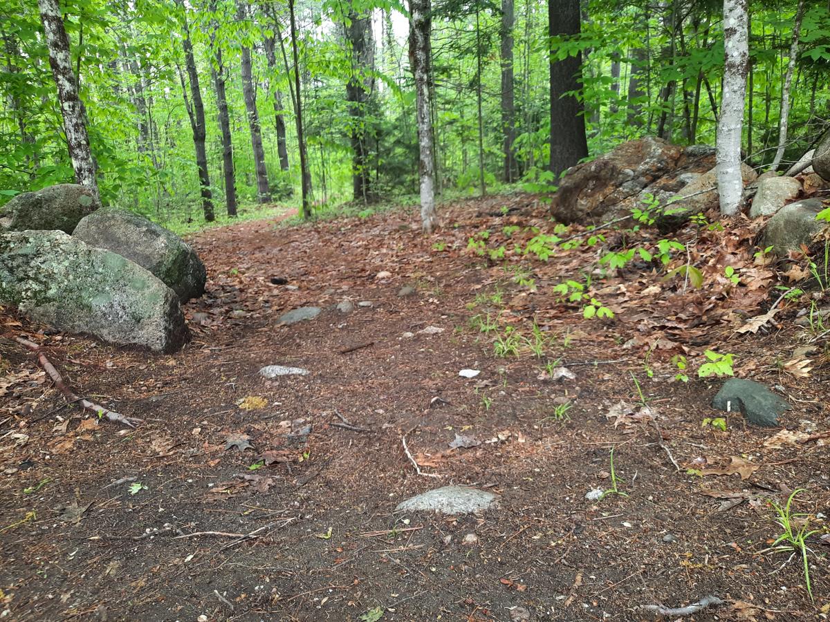
I found that the newly constructed trail loop was too narrow and not as flat as it says in the description:
“The 1.0 loop trail is relatively flat and designed to provide users with a diverse walk through multiple forest and wildlife habitats. The trail is not flat where it enters and exits one of five ravines. A geological feature uncommon to the eastern U.S., known as “headwall erosion” is believed to have formed the five ravines. These deep v-shaped features occur when underground streams erode their banks and “roofs” slowly collapsing, widening from the pond to further upstream. An area marked “quicksand” is a serious precaution as it is very fine, wet, and deep sand.”
So I chose to explore the access road to the kayak/canoe launch.
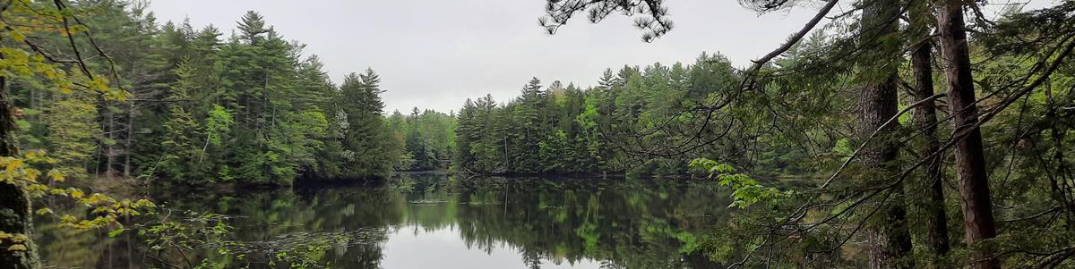
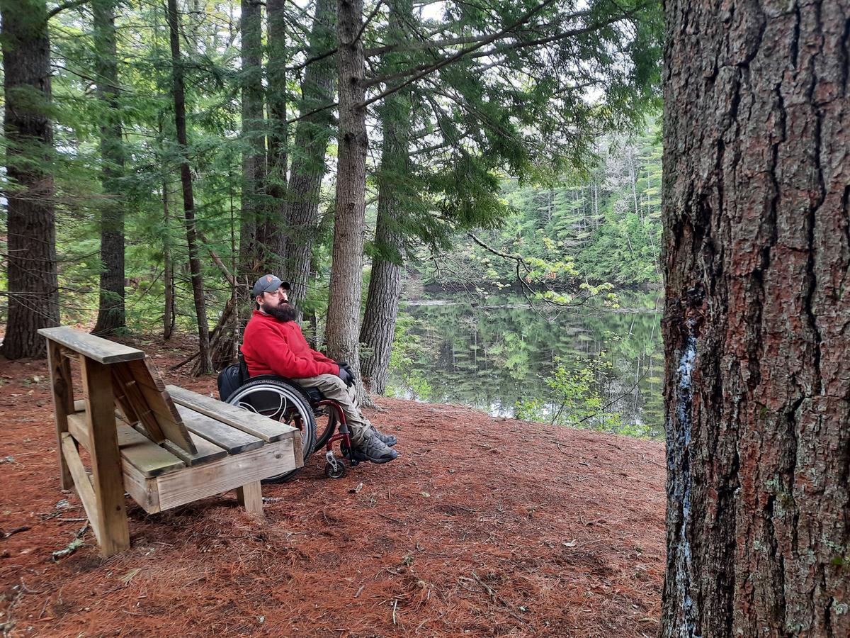
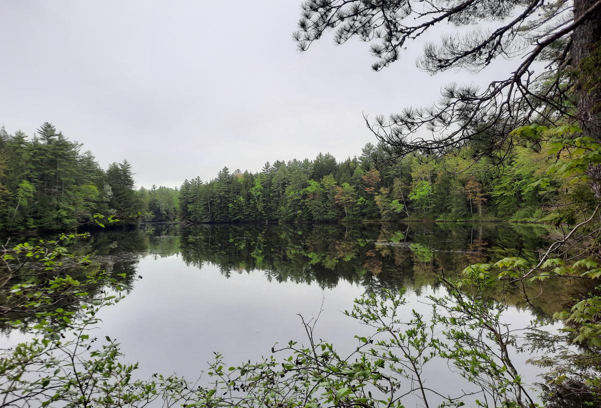
The trail gets very steep right at the end before arriving at one of the most beautiful and peaceful spots I have found in this area of Maine. I was quite stunned by the beauty and sounds of the birds. I wish I could have captured it.
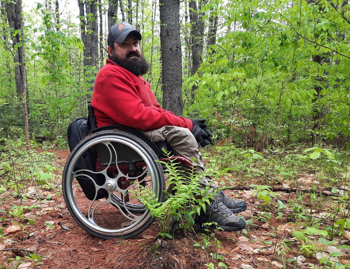
I would highly recommend checking this out if you just want a quick trip to a peaceful spot to unwind. There is a really big bench to sit and enjoy the view. I definitely am planning to go back with a kayak and cruise around the water. A wheelchair user may need some help getting back up the hill when leaving. I chose to have Sandy help me at the very top of the hill where it gets steep. Unfortunately, we don’t have the gear yet to get a shot of that but that should be coming soon.
My rating for this one starts out as Wheelie Easy and then becomes Wheelie Moderate at the end. I am going to do another post explaining these ratings in detail but Wheelie Easy essentially means I didn't have to push very hard and was able to navigate on my own with almost no obstacles. Wheelie Moderate means I needed some help due to steep terrain but also was able to do some on my own.
The second location I had been wanting to check out is the Fryeburg Town Forest. Based on the description I thought this was going to be a very easy hike.
“This easy loop passes by historic stone walls and a number of small streams. In just one mile, it weaves through many different forest types, including the unique Silver Maple Floodplain Forest, which is an endangered habitat. The forest also contains a pure Black Oak stand, a rare size. The average grade of the trail is 8%."
There is a caution warning on the MTF site stating “As of summer 2021, the trail is a work in progress, and there is one stream crossing without a bridge. Please use extreme caution at this stream, as it is a sensitive natural area. You can either turn around and return to the trailhead the way you came or cross slightly upstream of the trail very carefully on foot.”
I went into it with an open mind since it is a work in progress I wasn’t expecting perfection. You also can't really expect perfection in nature.
The parking lot is soft but negotiable. It is definitely forest floor material.
The first part of the trail was very easy although it definitely had some hazards and obstacles that made it less accessible. It started out with some rocks protruding from the ground. There are also a lot of stumps small and large in the middle of the trail which could definitely be a tripping hazard for both people walking and using wheelchairs. I had no problem negotiating all of this.
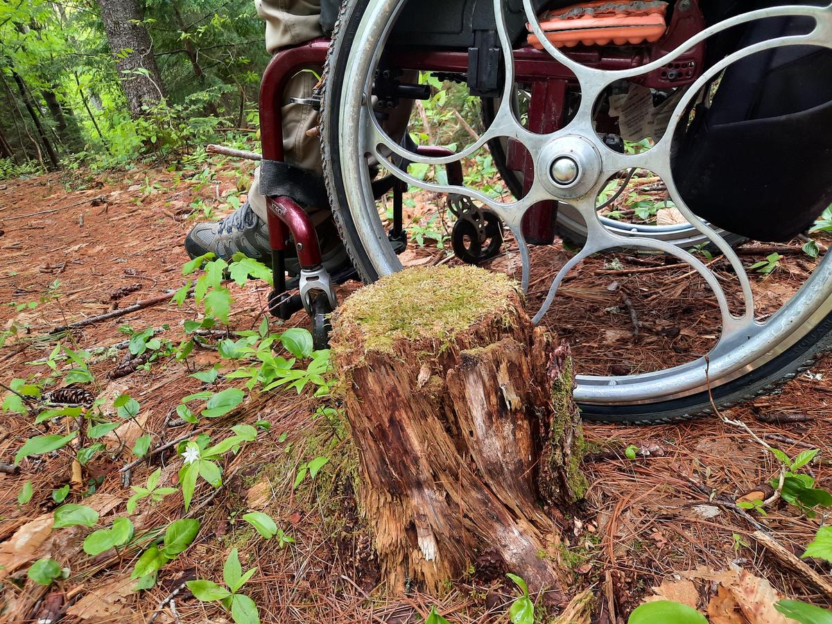
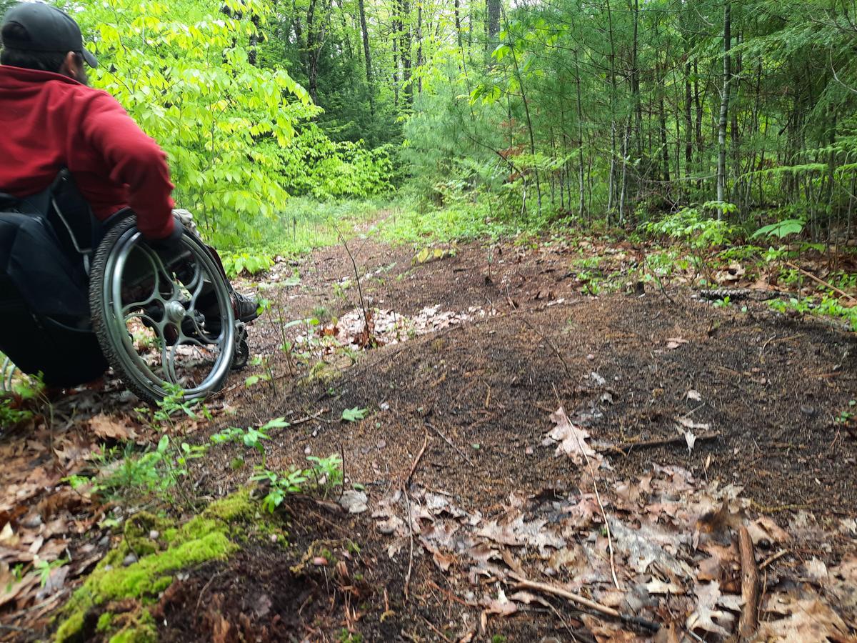
When we got to the start of the loop, things got a bit more difficult. The trail became very rough with a lot of ruts and an extreme cross slope. It also had a lot more small stumps sticking out of the ground. My front tires got caught a few times and threw me forward. This trail is still in early development having only been in existence for about a year. I am sure it will greatly improve as time and funds are available. For now, just use some caution and be mindful of where you roll or step -- good advice for any trail!
I wouldn’t necessarily rate this one as doable yet. I turned around not too far after passing the right and left loop signs. It was apparent that it was going to be an arduous hike on a hot day so I opted to cut it short. If I had to rate it right now it is Wheelie Moderate due to obstacles at the beginning and Wheelie Advanced around the loop due to the terrain.
I will be looking forward to monitoring the progress on this one to see how it turns out.
This year I am hoping to get some group or one on one hikes together. I would love to interview other people with disabilities about their experiences in the outdoors. The more perspectives we can get the better the information will be and the more progress we can make. Please contact us if you are interested in collaborating or joining me on a hike!

If you have a different type of mobility issue or a different disability and you visit this trail or others, please comment on this post and give us your feedback. If you would like to visit a trail with Enock feel free to reach out. He would love to have people join him in the outdoor spaces of Maine. The more knowledge we gather and share, the more people we can get outside using the trails of Maine!
Success! A new password has been emailed to you.