The 1.0 loop trail is relatively flat and designed to provide users with a diverse walk through multiple forest and wildlife habitats. The trail is not flat where it enters and exits one of five ravines. A geological feature uncommon to the eastern U.S., known as “headwall erosion” is believed to have formed the five ravines. These deep v-shaped features occur when underground streams erode their banks and “roofs” slowly collapsing, widening from the pond to further upstream. An area marked “quicksand” is a serious precaution as it is very fine, wet and deep sand.
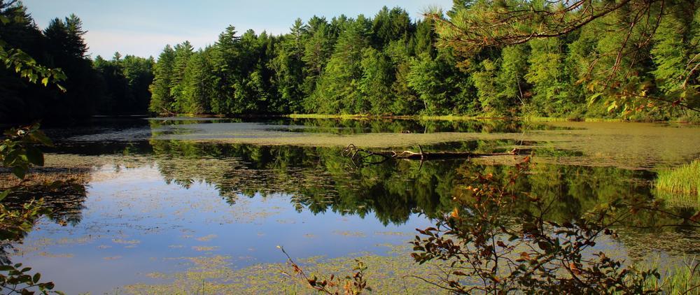
The 114 acre reserve is divided by the Mill Pond where waterfowl are abundant and beaver and otters frequent its shores. The diverse forest of mixed ages and types is a working forest managed for forest products and wildlife habitat. It includes a 26 acre preserve area, along the east shore of the Mill Pond which can be accessed by canoe or kayak. This preserve forest is approaching an old growth condition including black spruce peat bog, an unusual natural community for the area.
Habitats support deer, moose, fox, black bear, owls, hawks, wood peckers, songbirds, and a large variety of waterfowl and native species. The colorful “chicken of the woods” and other interesting mushrooms are common. The local elementary school students have created trail markers with their own personal art work, making for an interesting experience for entire families.
Read about MTF Accessibility Ambassador Enock Glidden's visit to the reserve using his wheelchair at MTF Stories.
Visit Greater Lovell Land Trust online for more information or contact:

The Kezar River Reserve is on ME Route 5 across from the “Wicked Good Store”, 0.8 miles north of the intersection of ME Routes 5 and 93 in Lovell Village. A good forest road enters the land on the east side of ME Route 5, if travelling from Lovell Village. Look for the GLLT Trail sign at the road entrance. Proceed carefully to an open parking area near the kiosk in the old log landing.
The Canoe/Kayak launch is beyond the parking area and boaters are asked to carry in from the sign at the top of the hill—a carry of approximately 100 feet.
Success! A new password has been emailed to you.