The Appalachian Trail crosses the Logan Brook Road 0.4 miles past the gate. It is easy to miss the crossing! Hikers should keep a look out for the footpath coming down the hill to their right and for the brown and white MATC signs just off the road.
The trail to Whitecap begins by traveling upward through hardwoods and over a series of ledges. The grade then moderates for the remaining mile to the Logan Brook shelter. A small cascade and pool near the shelter can offer hikers respite during their climb. After the shelter, the trail steepens significantly as it climbs through spruce-fir forest to the open summit area. The Maine Appalachian Trail Club's Maine Trail Crew put significant effort over many years to stabilize the trail in this section. The hundreds of rock steps were installed using just hand tools and teamwork!
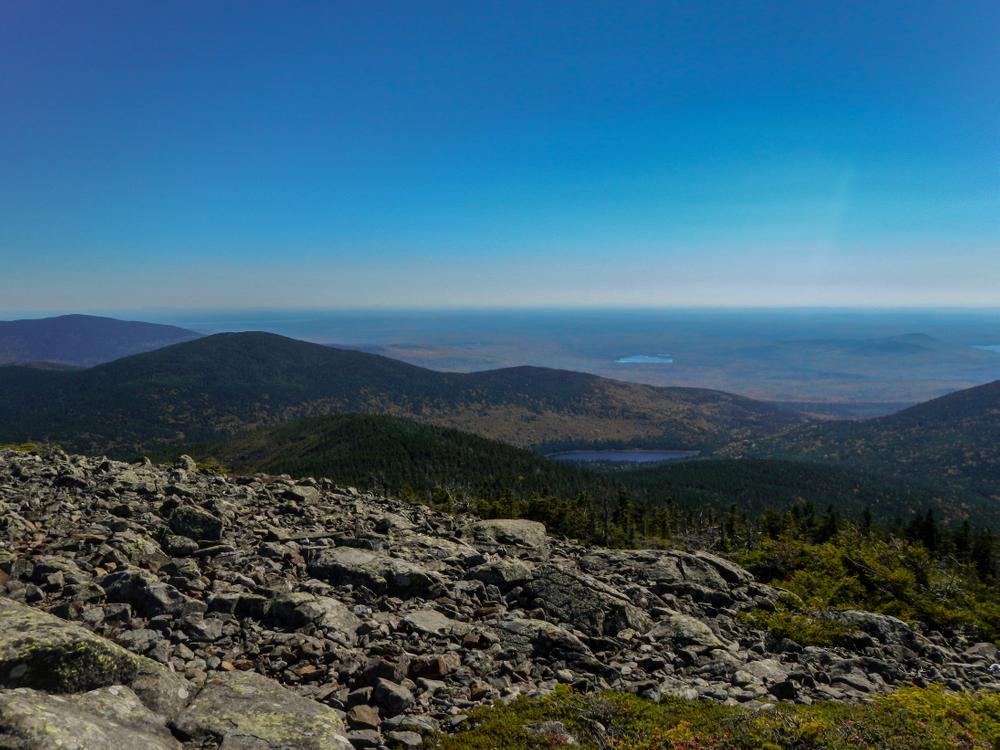
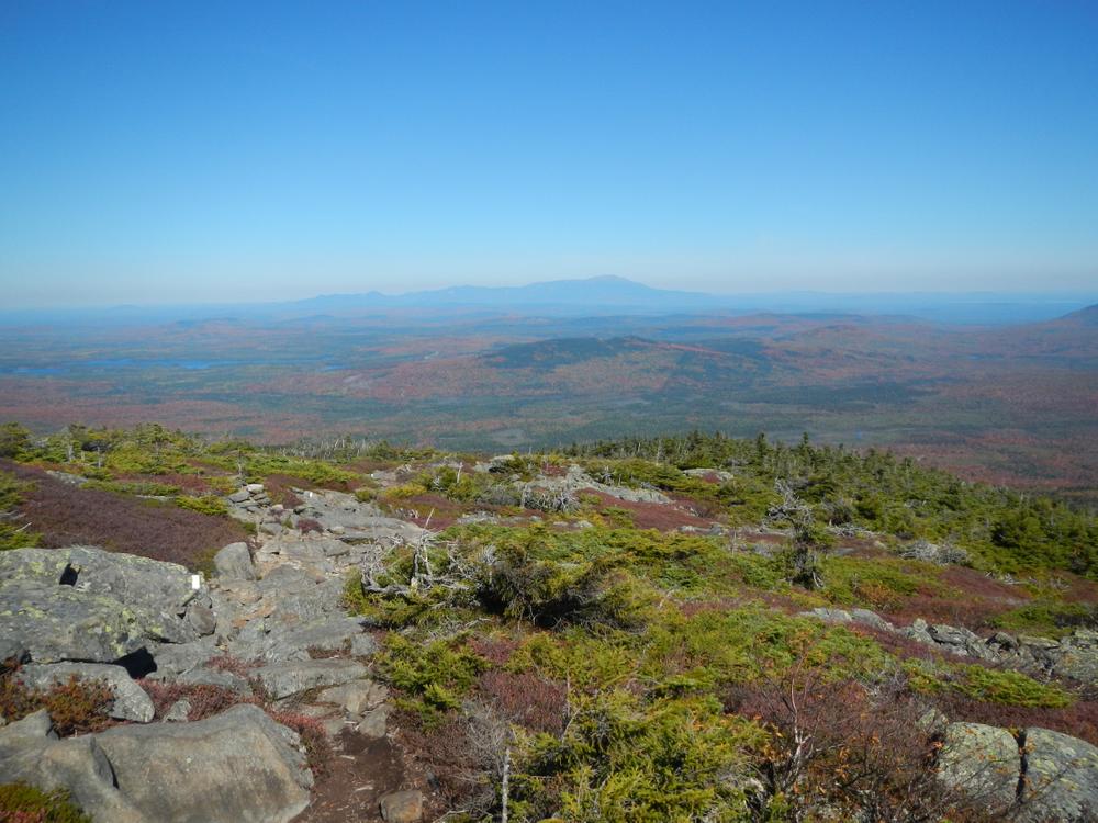
The summit area rewards hikers with incredible views in all directions. Hikers can look to the south toward the Barren Chairback range, to the east toward Greenwood Pond, to the north to Katahdin and to the west toward Moosehead Lake. Please stay on the main trail and established side trails in order to protect the fragile high-elevation vegetation.
Do not underestimate the difficulty of hiking the Appalachian Trail (A.T.) in Maine. Be sure to carry equipment and supplies necessary for this undertaking and be prepared for challenging weather conditions. Please educate yourself before hiking, so that you can have the knowledge and skills necessary for an enjoyable and safe hike. Fires are only allowed in the provided fireplace ring at established campsites; it is illegal in Maine to build a fire elsewhere.
The Appalachian National Scenic Trail runs from Maine to Georgia along the spine of the Appalachian Mountains. It is managed cooperatively by the National Park Service, the Appalachian Trail Conservancy, and 31 trail-maintaining clubs along with other federal and state land managers whose land the trail crosses. Over 3 million people visit the A.T. every year. Since its inception in the 1920s, thousands of volunteers have worked tirelessly to maintain, manage, and protect the Appalachian Trail.
In Maine, the all-volunteer Maine Appalachian Trail Club (MATC) maintains and protects the 267-mile section of the Appalachian Trail extending from Katahdin in Baxter State Park to Grafton Notch at ME-26. In addition, MATC maintains over 60 miles of side trails as well as a system of regularly-spaced shelters and campsites to preserve access to wild, backcountry hiking in Maine. MATC publishes The Official Appalachian Trail Guide to Maine, which includes seven maps, please visit their website for information on how to purchase the guide or to learn more about becoming a member of MATC.
Visit Maine Appalachian Trail Club online for more information or contact:

Know the Rules and Be Prepared: Research local regulations, including permits and fire restrictions, on sites like Visit Maine. Pack plenty of food, water, and the other Ten Essentials before heading out on your adventure.
From Greenville, head north on Lily Bay Road. Turn right onto Frenchtown Road. After West Branch Ponds Camp, the road becomes very bumpy. A high clearance vehicle is necessary. Bear right onto Logan Brook Road (unsigned). Park on the right before the large gate. Please be respectful of private landowners - DO NOT block gate or drive through the gate if it is open and always yield to logging trucks.
Note that there is limited cellular service in this area. It is always a good idea to have a backup paper map in case your cell phone directions fail.
Success! A new password has been emailed to you.