Bald Mountain

The Bald Mountain trail offers hikers the opportunity to visit a summit with striking views of the Weld region's surrounding peaks and lakes.
Trail Activity
Hiking
Length
2.00 miles, Round Trip
Difficulty
Advanced
Towns
Perkins Twp, Washington Twp
Surface
Dirt/Forest Floor, Rock/Ledge
Pets
Permitted
Fees
No

Description

**Please note: the former Saddleback Wind Trail has been decommissioned; please respect the landowners and do not proceed past the Bald Mountain summit.**

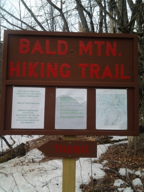
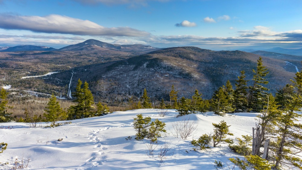
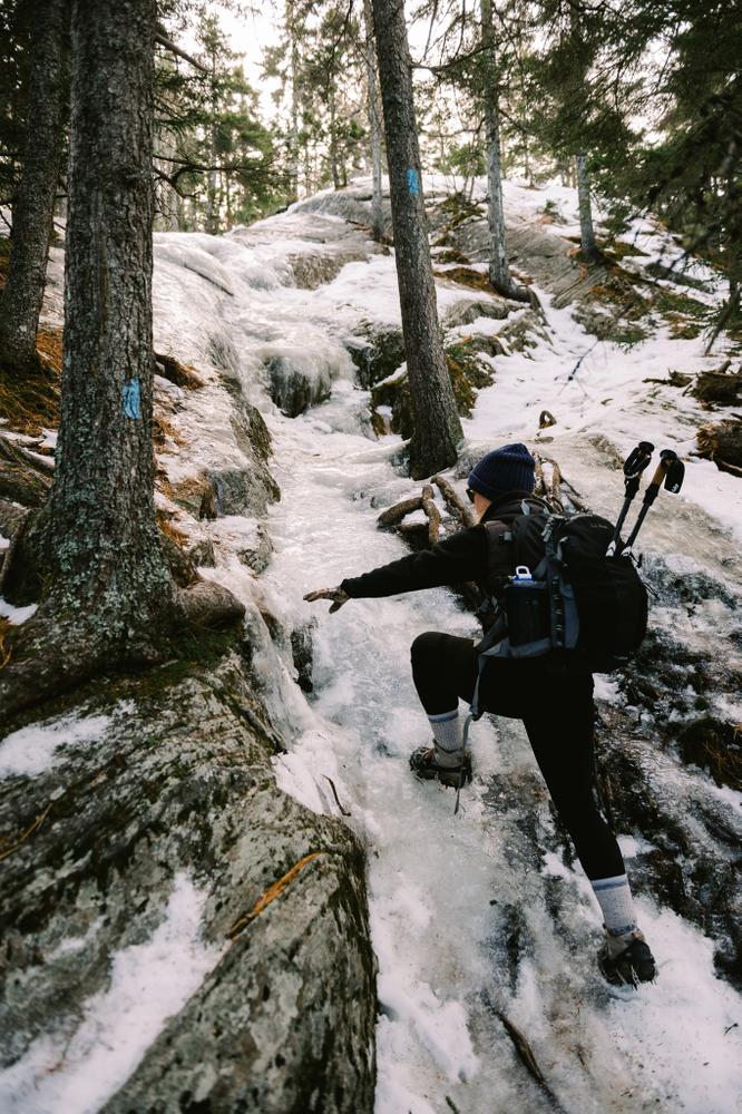
The Bald Mountain Trail provides picturesque views of the Weld area. It is a local favorite with steady, steep hiking. The trailhead - along the road's sandy apron - is very simply marked. Thirty yards from the trailhead is a small brook crossing. Though there is not a footbridge, large rocks allow hikers to keep their feet dry. During the early spring season, with snow and ice melting, the stream crossing may be challenging due to high and fast water. Always wear appropriate footwear as rocks and ledges may be slippery when wet or still snow covered or icy.

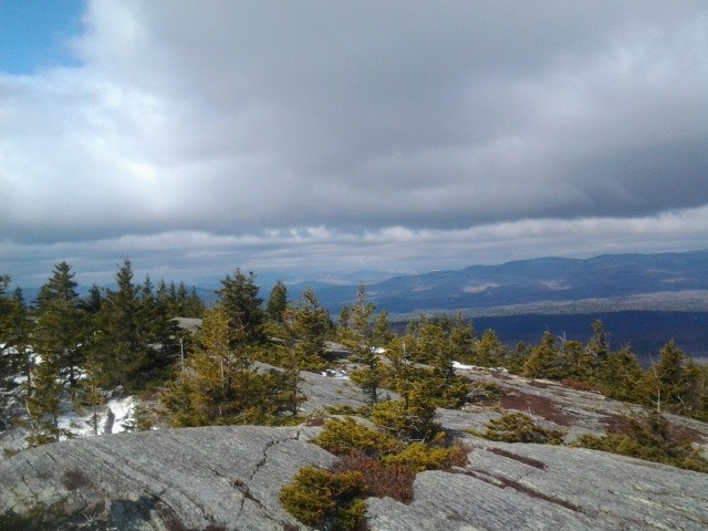
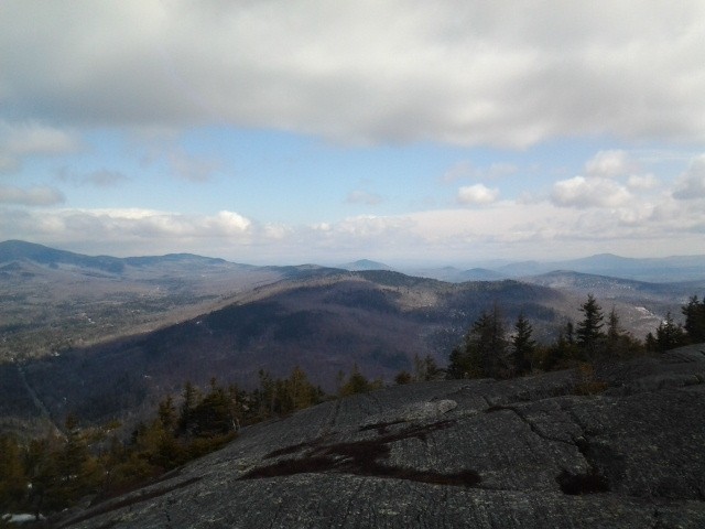
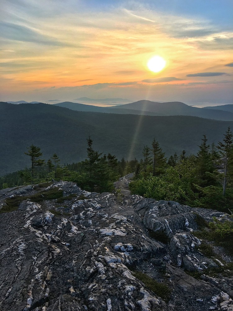
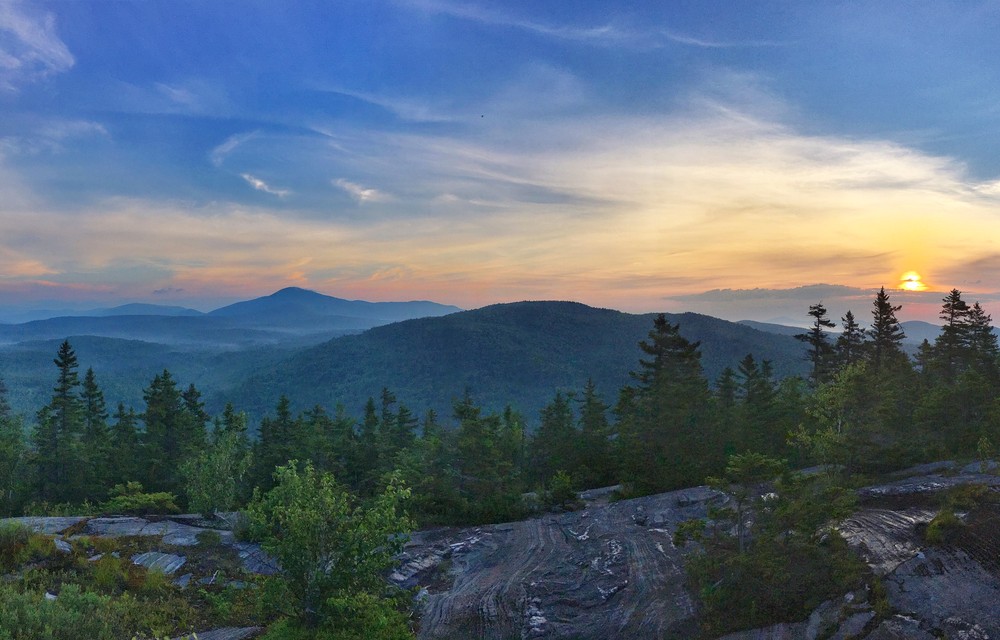
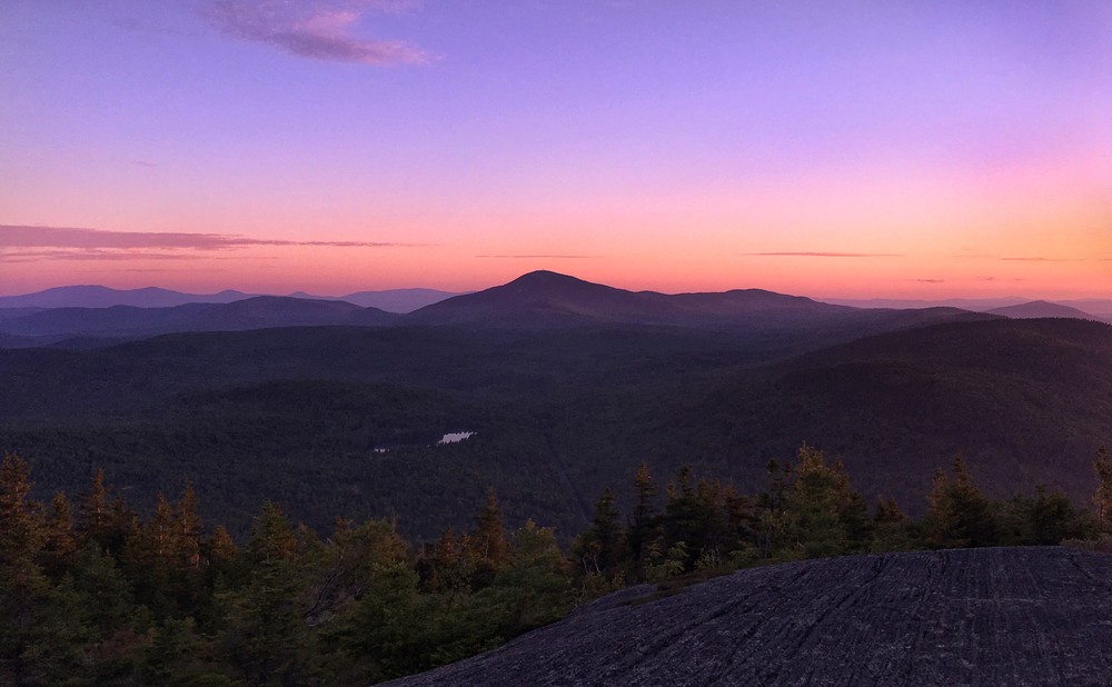
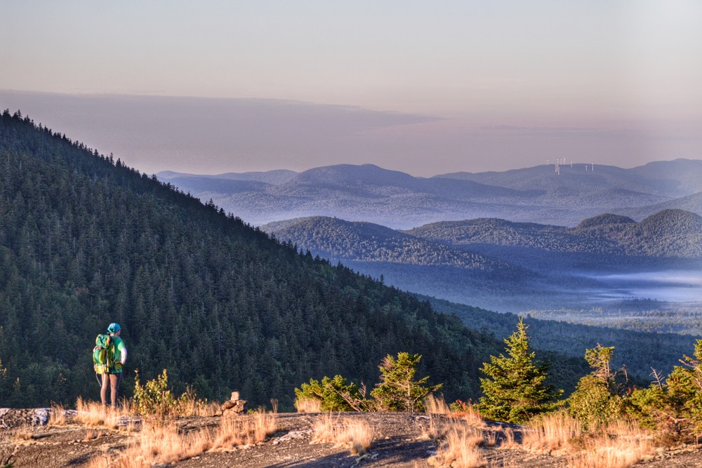
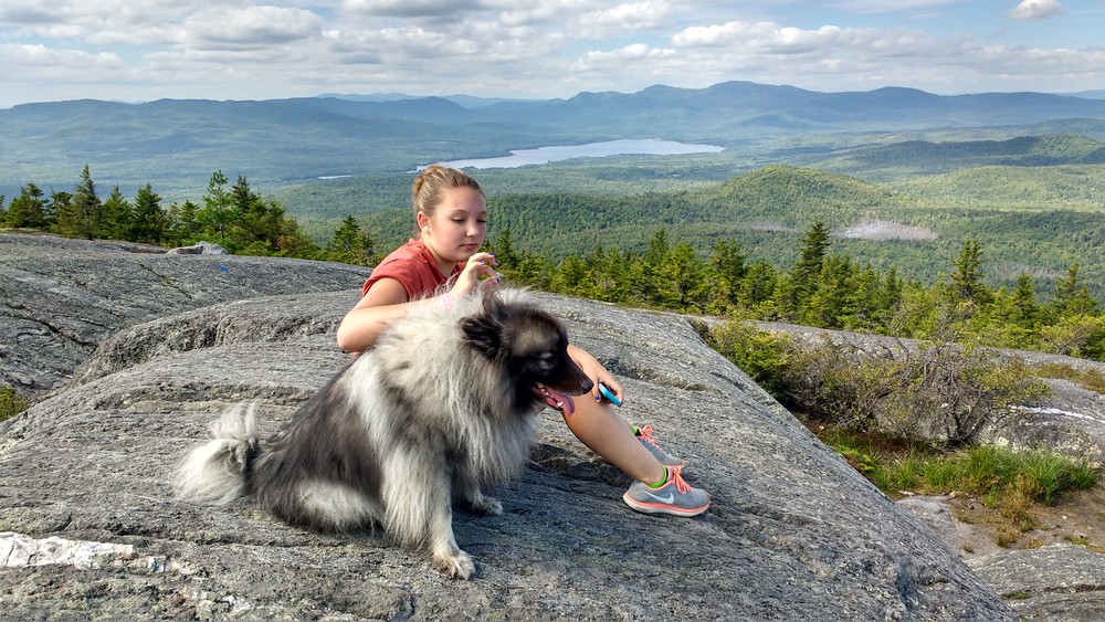
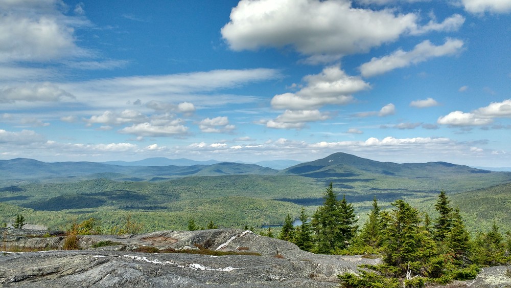
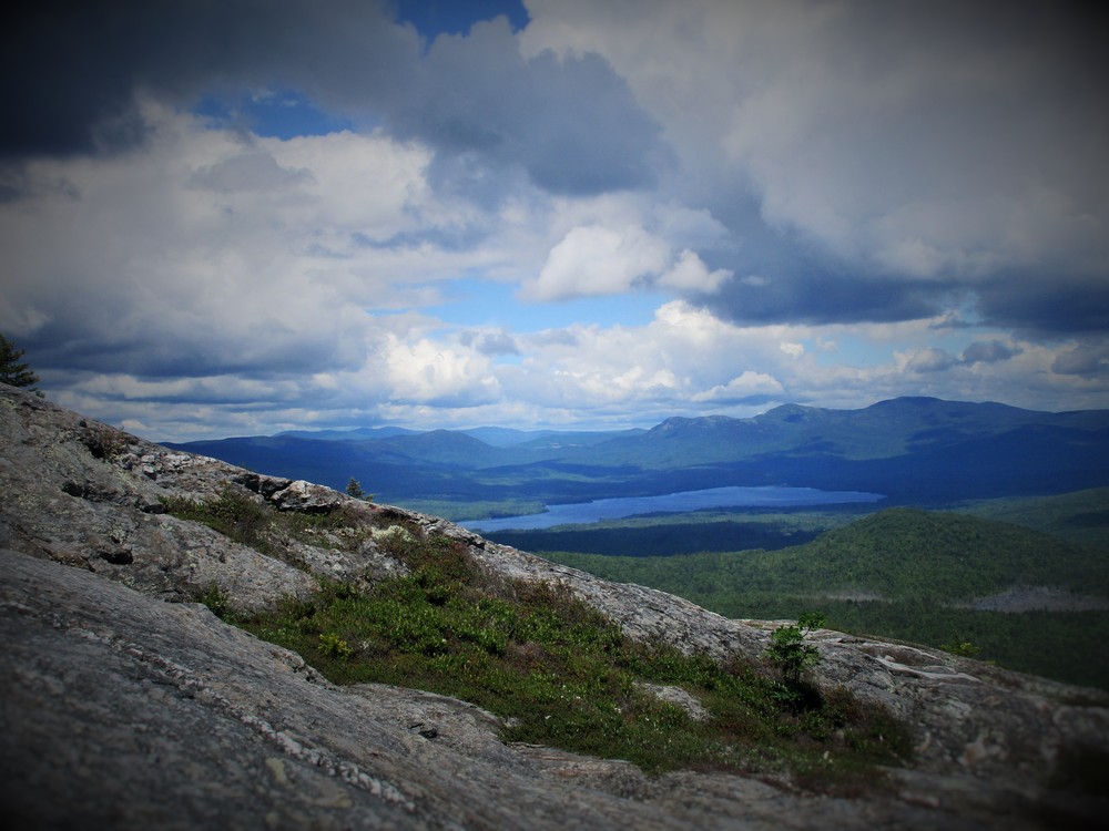
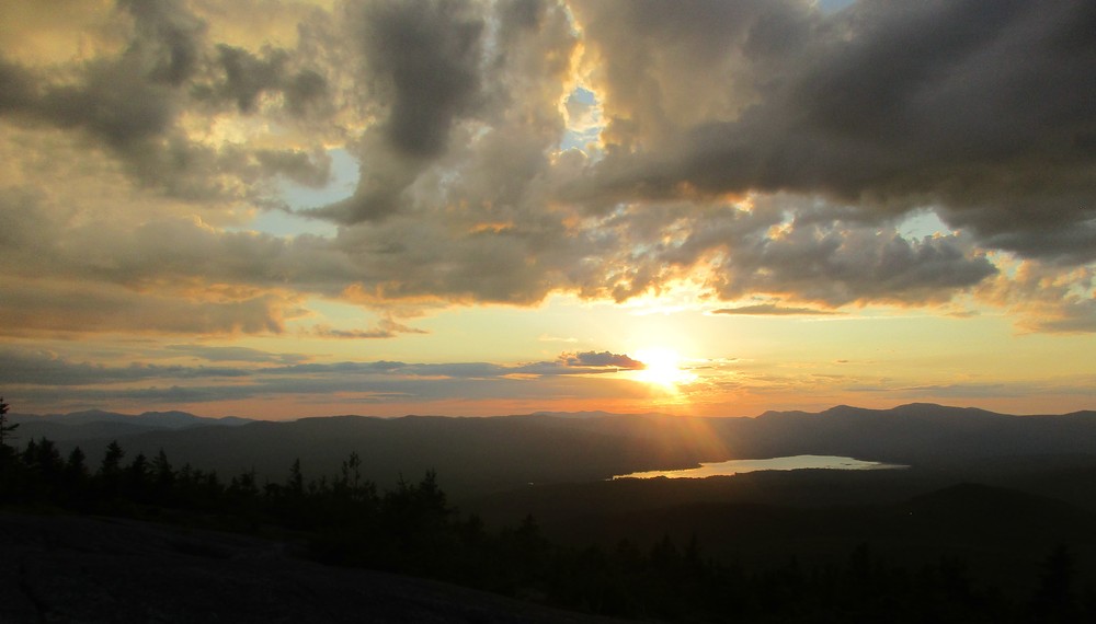
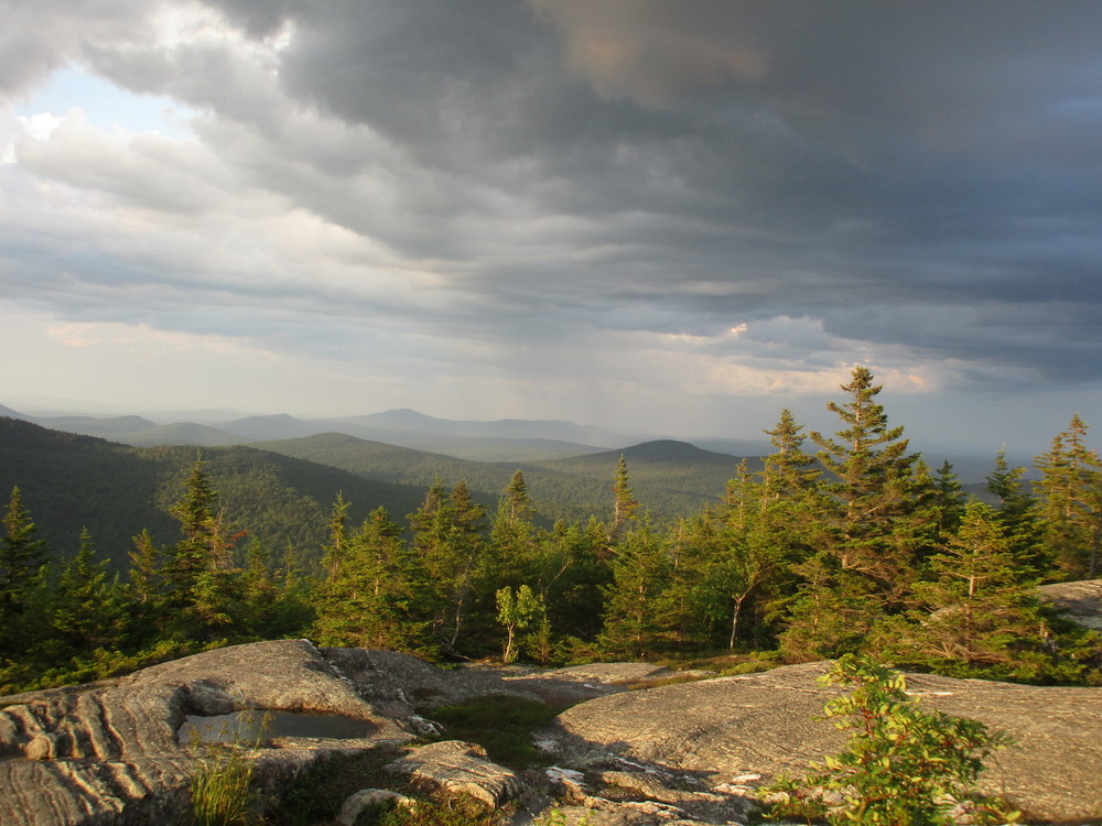
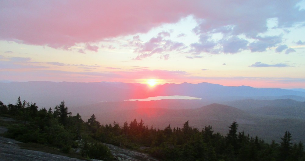
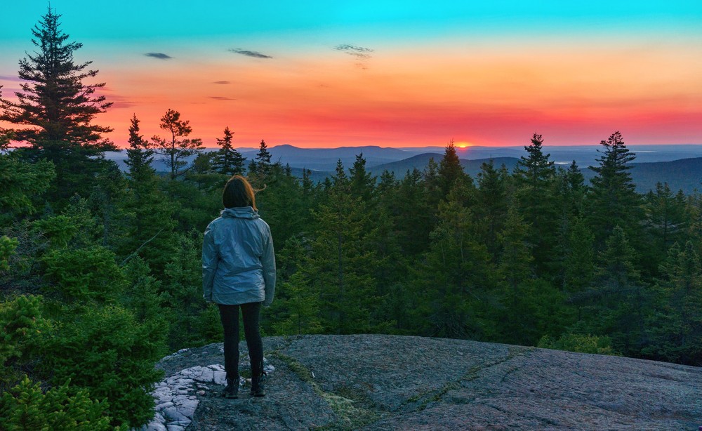
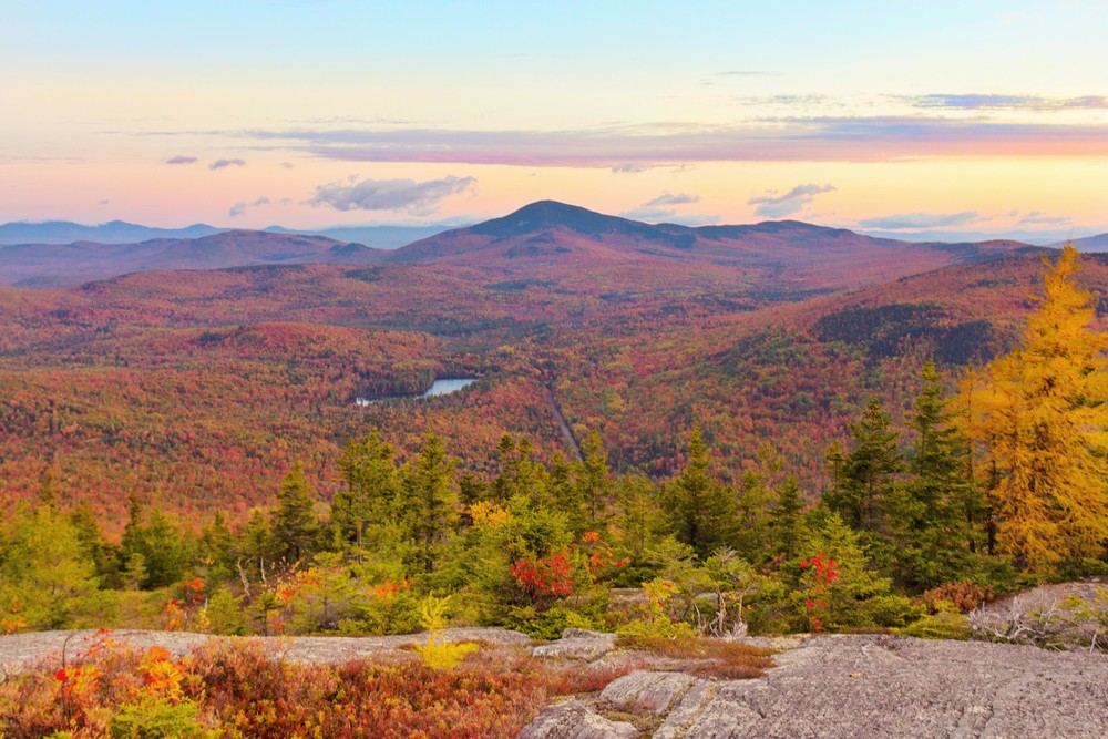
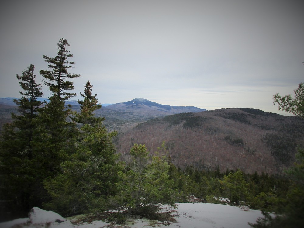
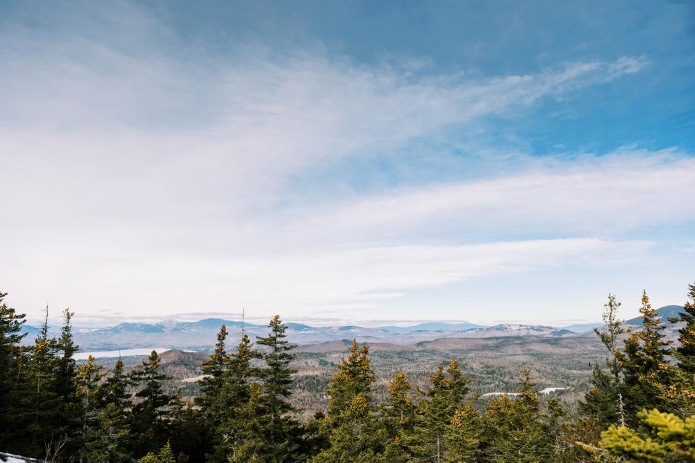
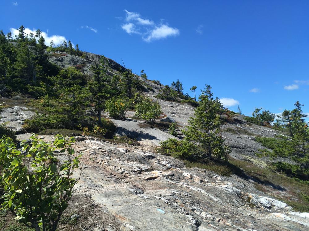
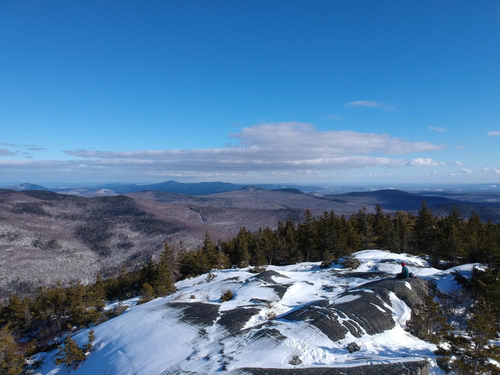
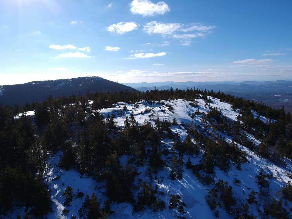
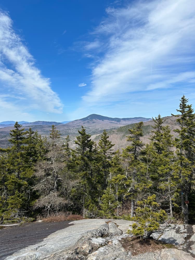
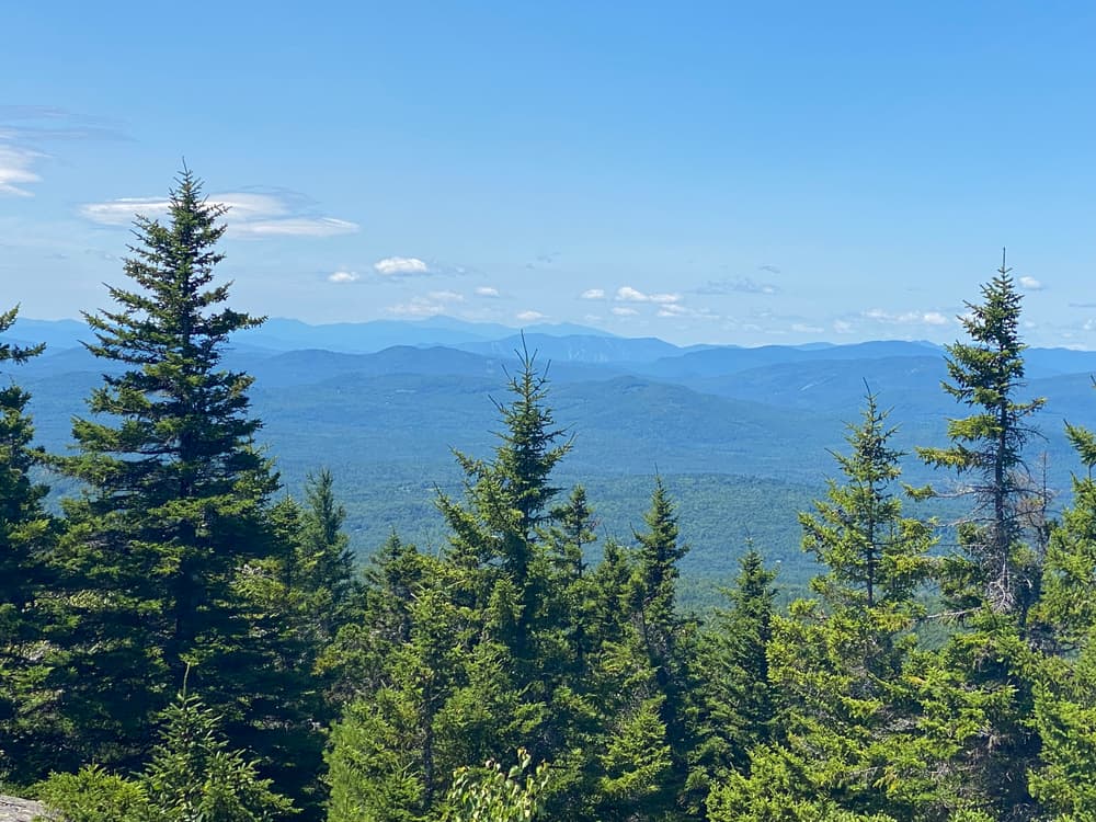
Most of the trail is forested. Short, marked spur trails provide alternative ways up (down) two especially steep sections of trail. Approaching the summit, the dirt trail turns into wide slabs of granite, marked with blue trail blazes and occasional cairns. Appropriately named, the top of Bald Mountain is bare, exposing breathtaking views of local and distant mountains. On a clear day, the rocky top's 360-degree view of Maine's conspicuous beauty is a sweet reward. 

Other Information

LMF Logo

This trail passes through a property that was acquired in part with funds from the Land for Maine’s Future program. For more information about the LMF program and the places it has helped to protect, please visit the LMF webpage.

Trail Manager

Bald Mountain is privately owned by Carrier Timberlands.

Nearby Events

VIEW EVENTS CALENDAR

Trail Tips

Travel and Camp on Durable Surfaces
Camp at least 200 feet from lakes and streams.
Legend
Hide All

Trailhead Information

From Wilton, follow ME-156 for approximately 9 miles to the trailhead. Unofficial parking is on the left side of the road along a wide, sandy shoulder. The trail starts at a red sign.

Click on a parking icon to get custom directions
Please Log In or Create Account to add comments.
ajmorgan82014
September 25, 2023
Hiked Bald today. The trail between Bald and Saddleback Wind is closed. Not sure why.
mqs1542
April 28, 2021
I picked this trail for my first hike of the year. I won't say it was a mistake, but Bald Mountain is a formidable hike. And the effort is well worth it; the views are stunning and the trail is a challenge. Right out of the gate is a stream crossing. I thought it was a bit intimidating, but I crossed no problem. Not long after the stream crossing the trail takes shape; steep, rocky and full of tree roots. There are two marked locations nearing the tree line where the trail gets challenging. Leaving the tree line the trail is exposed rock slab with good traction. Great views from the top. Most of the trail is dry and in good condition with only a short section of mud. This is a tough hike if you haven't been out in a while. It's also a great trail to bust thru quarantine torpidity
toneman10
August 06, 2020
A well-used trail as evidenced by the erosion and loose rocks on the lower half of the trail. A pretty steady climb up for about a mile. The views of Webb Lake to the north and Wilson Pond to the south were very nice. Some interesting striations about 2/3rds the way up.
jon.richard
June 04, 2019
Hiked the Eastern Ridge trail this past weekend. Awesome views of the back 3/4 of Bald. Easily the best view on the entire trail. I highly recommend it. Thanks to Nick Demillo for the awesome work!
mfrank
May 19, 2019
Hiked this trail several times this winter. We did a night hike on 03/05/19, cold but a lot of fun. The night sky on bald is amazing. We stuck around for the sunrise, I have posted a picture.
ajmorgan82014
February 27, 2019
This is a great hike that I did for the first time this past August. Definitely challenging doing both summits and then back. I was exhausted when I reached Bald the second time, but startled a bear nearby, which motivated me to hurry down.
ndemillo
August 15, 2018
NEW TRAIL ALERT: The Saddleback Wind East Ridge Trail opened last week. This trail splits from the Saddleback Wind trail near the Saddleback Wind summit. There are signs posted where the trails split. It is approx. 1/2 to 3/4 of a mile in length one way and is easy to moderate in difficulty. This is a return hike. I think this trail makes a nice addition to the Bald Mountain Trail system. Happy Hiking!
snowman
September 14, 2017
Have hiked Bald many times but just had the chance to extend the hike to this next peak. Very nice trail with a variety of terrain. I will say that it was a bit grueling-basically 2 miles uphill and one mile downhill on the way out and the opposite on the way back. Most of the terrain is reasonably steep so it is a workout- 6 mile round trip, plus or minus, in 4 hours which included a 45 minute lunch at the top. Awesome day!
ksnyder1086
August 17, 2017
Bald Mountain is probably my favorite smaller hike in Maine. I finally was able to continue on and hike to Saddleback Wind today as well. Easy to follow trail and a neat summit. My pup and I truly enjoyed it! Thank you!
navyswomom
September 10, 2016
Finally had the opportunity to hike to Whisper. What an amazing trail!

A word of warning...neither Bald or Saddleback are difficult trails on their own...HOWEVER, descending half-way down Bald through several ups and downs to Whisper then descending again then re-ascending Bald definitely extends the hike and increases its difficulty. Combined would rate it easy side of advanced, little tougher on old knees than say, Little Bigelow. Beautiful nonetheless, well worth the Advil
englest
August 23, 2016
ndemillo thank for all your work on this trail! We didn't get to walk the Saddleback Wind Trail last evening but look forward to coming back.
navyswomom
August 09, 2016
@ndemillo, the Saddleback Whisper continuation trail is beautiful!
ndemillo
July 24, 2016
Saddleback Wind Trail is now open. This is an extension of the Bald Mt. Trail. It extends the trail by approx. 1.4 mi. There is a new map and more information about the trail posted at the trail head sign. Give it a try. Happy Hiking!
navyswomom
July 16, 2016
One of my favorite short hike for families. My daughter (13) loves this hike because the views and the quiet (most tackle tumbledown nearby). Would highly recommend this trail for active families. 3 miles moderate round trip with only real rock scrambling at Step I (recommend rocks up, alternate spur down)
ndemillo
August 20, 2015
To gopackgo: Bald Mtn. does not have a USGS marker. Chances are you were at the summit. Sorry for this late comment. I just checked this site yesterday.
egilbe
July 04, 2015
This is a nice hike. The sign at the bottom says a round trip is 3 miles.
gopackgo
June 06, 2015
Does anyone know if Bald Mountain has a USGS marker? We did the hike this weekend but after poking around for a while in the area that seemed like the top we weren't able to find one.
ndemillo
May 12, 2015
Thanks for the trail update switchback. I hiked up on May 10 and did some cleanup. I wish I could get up there more often. Happy Hiking!
switchback
March 02, 2015
Very cool views from the top - thank you ndemillo for your maintenance work! The trail is nicely broken out by snowshoers. Only a couple easily-negotiated blow-downs, and not much exposed ice (mostly crusty snow on the ledges).
ndemillo
August 20, 2014
Glad to see that this trail has finally made it onto this website. About a year ago I had asked for and received permission from the landowner to maintain this trail. The sign and some water breaks were my first improvements. My future goal is to extend this trail beyond Bald to the other ridge Saddleback Wind.
These awesome businesses support our goal of connecting people to outdoor adventures in Maine!
Hang Tight!
Nearby services are loading
No Results
No Services Found

Trail Alerts

Trails
Private Property
This trail passes through private property. Please respect the landowner and protect future access by staying on the marked trail and following all rules.
SHARE THIS TRAIL

Add Trail Log

Please wait…
Join In on the Fun!
Log in or create an account below to unlock all the great features of Maine trail finder: keep track of trails you want to do, preserve memories of trails you’ve done, earn badges, and more!
Your log in attempt was not successful. Please try again.
    Lost your password? Reset your password
    Don't yet have an account?
    There was an issue with your submission. Please try again.
      * Indicates required field
      Already have an account? Login here
      Enter your username, and we will send you a new, randomly generated password to your email account.
      There was an issue with your submission. Please try again.

        Success! A new password has been emailed to you.

        Log in now

        Please wait…