Bethel Area Ponds Paddle

Take a scenic, relaxing paddle through three interconnected ponds with spectacular mountain views in the distance.
Trail Activity
Paddling
Length
7.50 miles, Network
Difficulty
Easy
Towns
Greenwood, Woodstock
Surface
Water - Lake/Pond
Pets
Permitted
Fees
No

Description

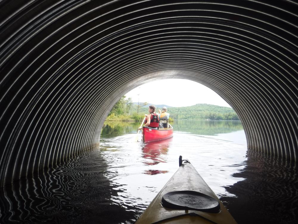
The paddle begins on Round Pond, the smallest of the three ponds. There are two culverts on the east side of the pond that lead to the other two ponds. The more northerly culvert (to the left) leads to North Pond and more southerly culvert (to the right) leads to South Pond. This is the only connection between the ponds. You must pass through Round Pond to go between North and South Pond.

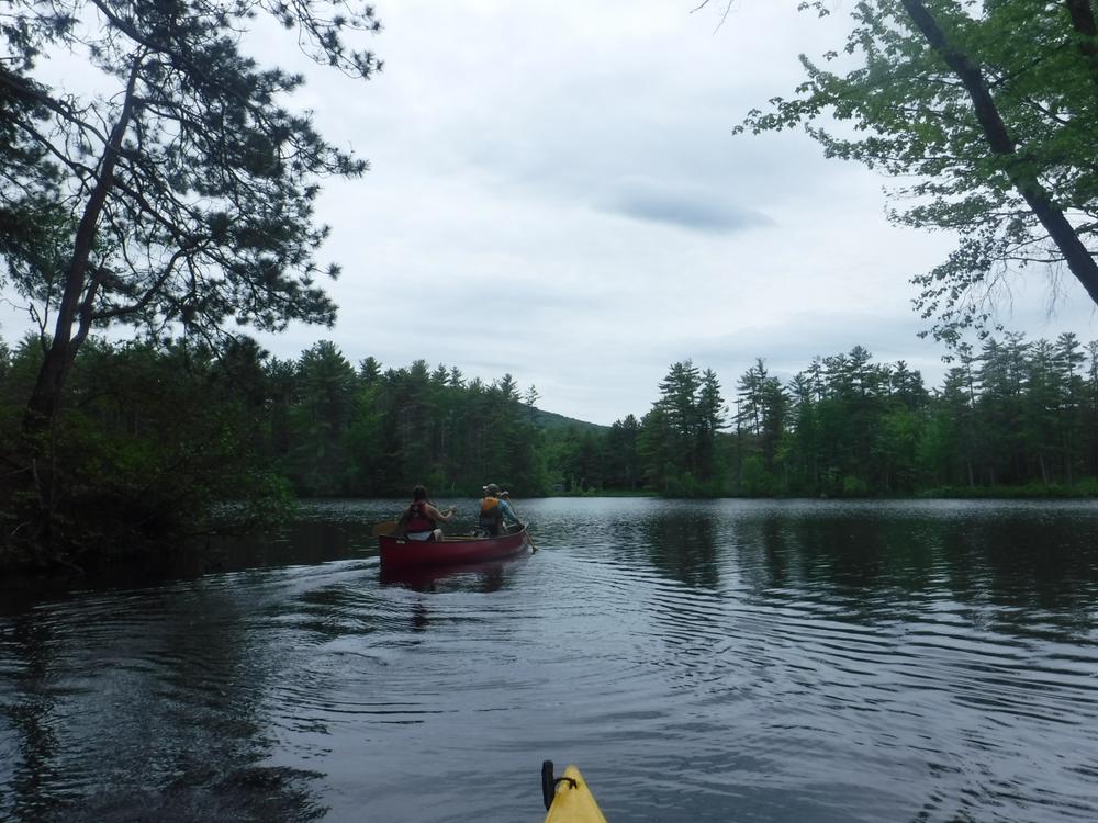
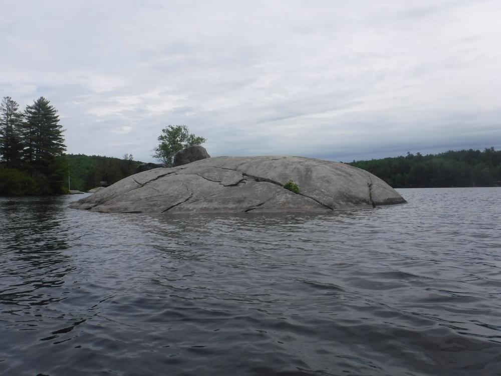
North Pond is smaller than South Pond, and offers often calm and always beautiful waters. Spend some time here paddling around, but don’t land on the shore or the islands with houses on them as they are private property. There is a large rock in the middle of the pond, known as “Rock Island” that is a great place to land and enjoy lunch.

To get to South Pond, return to Round Pond through the same culvert, then proceed through the second culvert. South Pond is the largest of the ponds and its shore is lined with private cabins. After going through the culvert, continue to the left of the island to get to the main body of the pond. South Pond features open water and pretty views of mountains in the distance. 

Other Information

A downloadable map of the route is available at the Northern Forest Canoe Trail website (free for members!). 

Trail Manager

For more information, contact:

Northern Forest Canoe Trail

Northern Forest Canoe Trail
PO Box 565
Waitsfield, VT 05673
Phone: 802-496-2285
Fax: 802-329-2239
info@northernforestcanoetrail.org
View website

Nearby Events

VIEW EVENTS CALENDAR

Trail Tips

Plan Ahead and Prepare
Be prepared to find your way home. Familiarize yourself with the area before you set out and bring your map and compass along.
Legend
Hide All

Trailhead Information

Put-in/Take-out: Howe Hill Road Public Boat Access. From Bethel, drive southeast on ME-26 for 5 miles. Turn left onto Howe Hill Road just past the Local Hub. Before a set of train tracks, there is a large gravel parking lot on the left with a boat ramp that is open to the public.

Note that there are not many access points on the ponds. The Howe Hill Road Public Boat Access is the best place to put in and take out.

Click on a parking icon to get custom directions
Please Log In or Create Account to add comments.
These awesome businesses support our goal of connecting people to outdoor adventures in Maine!
Hang Tight!
Nearby services are loading
No Results
No Services Found

Trail Alerts

Safety
Be a Safe and Respectful Paddler
Paddling conditions will vary according to the weather and season, so always exercise caution and always wear a lifejacket. With good judgment and proper equipment, the risk associated with paddling can be minimized. Respect the natural world and the rights of landowners, and be considerate of other outdoor enthusiasts. Paddlers should seek to avoid causing erosion, trampling vegetation, disturbing wildlife, and harming water quality.
SHARE THIS TRAIL

Add Trail Log

Please wait…
Join In on the Fun!
Log in or create an account below to unlock all the great features of Maine trail finder: keep track of trails you want to do, preserve memories of trails you’ve done, earn badges, and more!
Your log in attempt was not successful. Please try again.
    Lost your password? Reset your password
    Don't yet have an account?
    There was an issue with your submission. Please try again.
      * Indicates required field
      Already have an account? Login here
      Enter your username, and we will send you a new, randomly generated password to your email account.
      There was an issue with your submission. Please try again.

        Success! A new password has been emailed to you.

        Log in now

        Please wait…