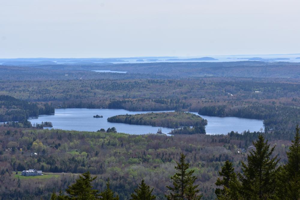
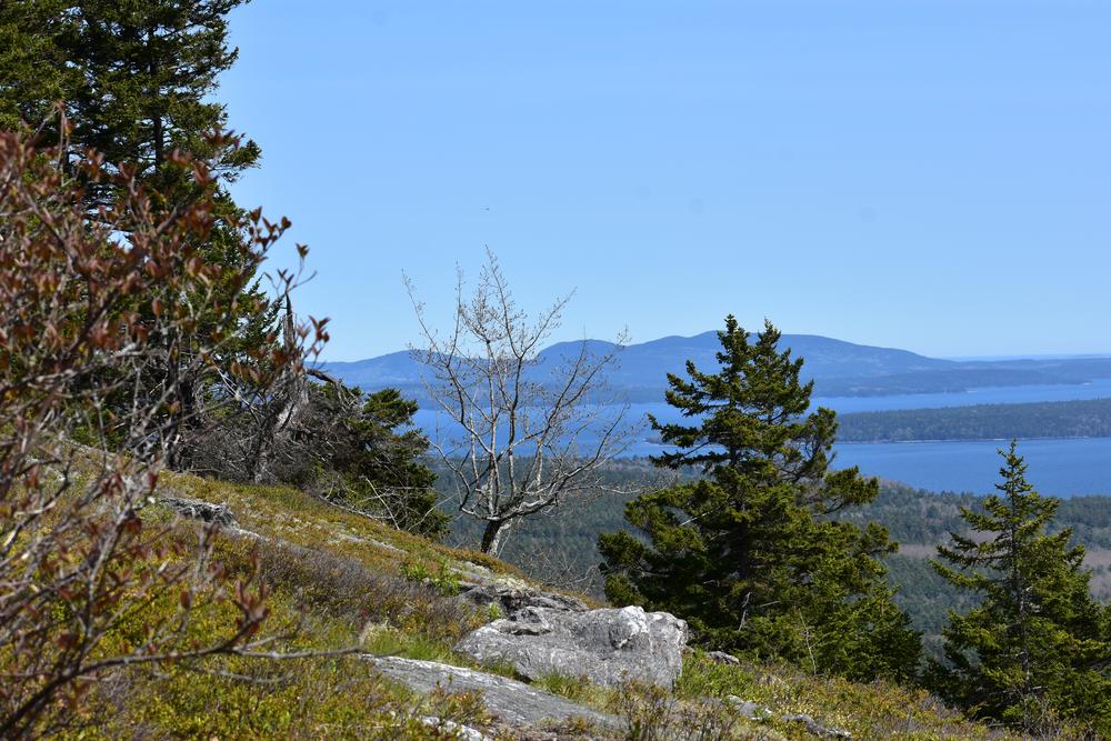
Blue Hill Mountain is a popular hike just north of the town of Blue Hill. The open summit affords excellent views over the Blue Hill Peninsula, Acadia, and Camden Hills.
The Osgood Trail is approximately 1 mile to the summit, taking about 35-45 minutes each way. This trail is easy to moderate and mostly wooded with loose rock, exposed roots and some ledges and several sets of stone stairs.
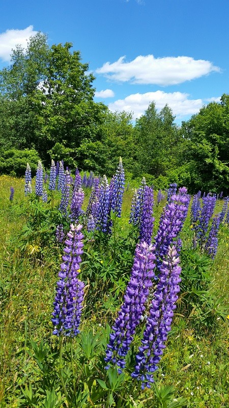
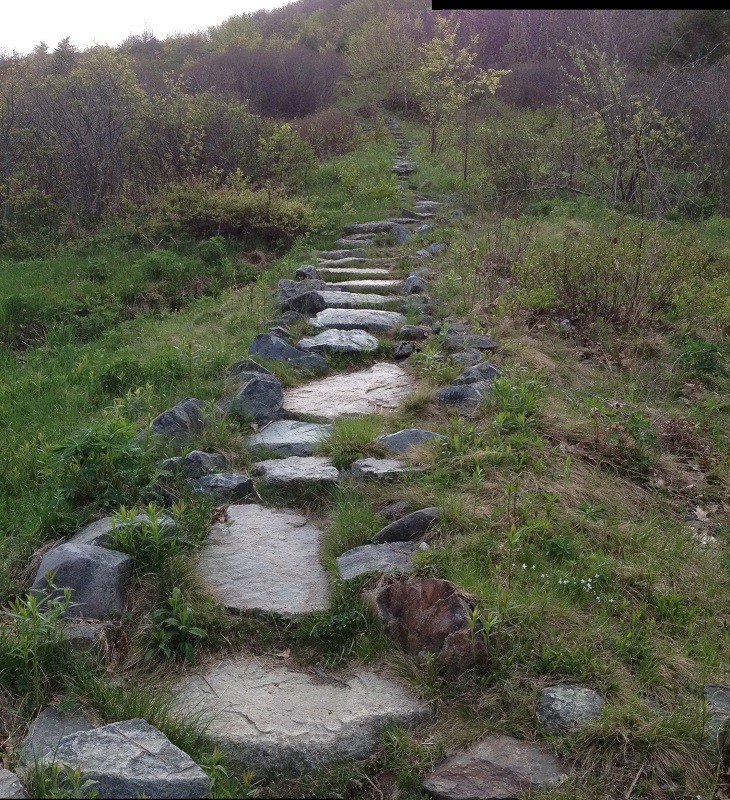
The Hayes Trail is about 1 mile in length. It begins in an open field, climbs a stone stairway, and ascends through a stand of oaks into mature spruce and fir near the summit. This trail is moderate to challenging in difficulty. While offering open views to the south, the re-routed section of this trail crosses an exposed ledge and climbs a steep rock talus slope as it nears the communication tower. Use caution.
The South Face Trail links the Osgood Trail with the Hayes Trail, creating the opportunity for a loop hike without having to walk along the Mountain Road.
The Post Office Trail connects Blue Hill village to the Mountain via a 1 mile trail that starts at the Blue Hill Post Office and leads to the beginning of the Osgood Trailhead on Mountain Road.
The Becton Trail offers hikers another way to climb Blue Hill Mountain. An easy to moderate 2-mile hike, the trail travels through softwood forest, dominated by large spruce and pine, before ascending the northwest slope of the mountain and intersecting with the Osgood Trail near the summit. Watch for views to the north of Toddy Pond and Great Pond Mountain as the trail nears the summit.
The Tower Service Trail was built by and at the expense of Blue Hill Mountain Leasing, the local company that owns the tower. Hikers are welcome. This trail provides the most gradual ascent.
Larry's Summit Loop is a 1,000-foot extension loop that was completed in April of 2016 and offers another wonderful view from the southern side of the summit.
Use guidelines:
Downeast Phenology Trail
While visiting this beautiful trail take part in our scientific research project, which is part of the Downeast Phenology Trail. Millions of songbirds migrate south every fall along the northeast coastline. To get from here to there they need stopovers to refuel on fruits and insects. This hiking trail is one of those stopover locations.
As the climate changes, temperatures are going up. And as things heat up, fruits ripen and insects emerge earlier and earlier. But, birds are migrating south later and later. Will there be any fruits or insects left for the birds when they fly through our region? You can help us answer this question--check out our project website before you go for your hike.
Schoodic Institute is an independent 501c3 nonprofit organization committed to advancing ecosystem science and learning for all ages through a unique partnership with Acadia National Park. Schoodic Institute and Acadia National Park are national leaders in the development of new techniques to involve the public in science, education and conservation.
For more information and a print map, please visit Blue Hill Heritage Trust's website or contact:
![]()
Parking is available at the following trailheads:
Becton Trailhead: From Blue Hill village, take ME-172 north toward Surry. Turn left onto Turkey Farm Road. The trailhead is located 0.6 miles on left.
Hayes Trail/Tower Service Road: From Blue Hill village, take ME-15 north. After one mile, turn right onto Mountain Road. Continue on Mountain Road three quarters of a mile to the Hayes trailhead (parking lot on right, trail begins on left).
Blue Hill Mountain, Osgood Trail: From Blue Hill village, take ME-15 north. After one mile, turn right onto Mountain Road. Continue on Mountain Road for 0.5 mile to the Osgood trailhead (parking on right, trail begins on left).
Post Office Trail: Heads south from Mountain Road across from the Osgood Trailhead and leads to the Post Office in Blue Hill village. Hikers may start at the trailhead from the Post Office, but please do not use this parking lot during business hours.
Success! A new password has been emailed to you.