UPDATE: The Hogback Mountain Connector Trail is temporarily closed per landowner request. The Highland Path between ME-220 and Hogback Mountain is also closed. Please respect the landowner's request to ensure future use of the trail.
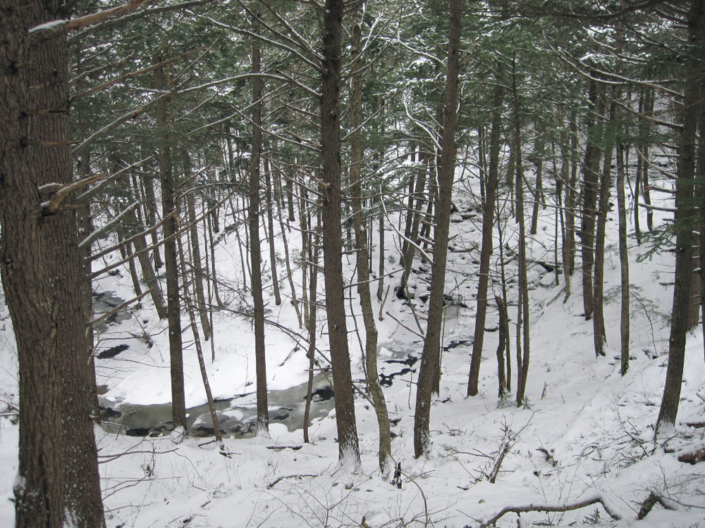
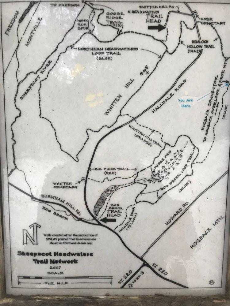
Bog Brook Trailhead (2.5 miles blue blazes) - is on the Halldale Road next to Bog Brook Marsh. The trail can also be accessed from the Whitten Hill parking lot and using the Whitten Hill Trail. The trail traverses a wide range of woods, glades and wetlands. Animal tracks and beaver activity are common. On a north facing slope are mature hemlocks that generations of woodcutters have spared.
Eric Bruun Trail (0.4 mile blue blazes) - named for the former landowner and modern-day hermit, the trail begins in a mixed northern hardwood forest with a scattering of large white pines. It continues through an extensive hemlock forest with an open understory.
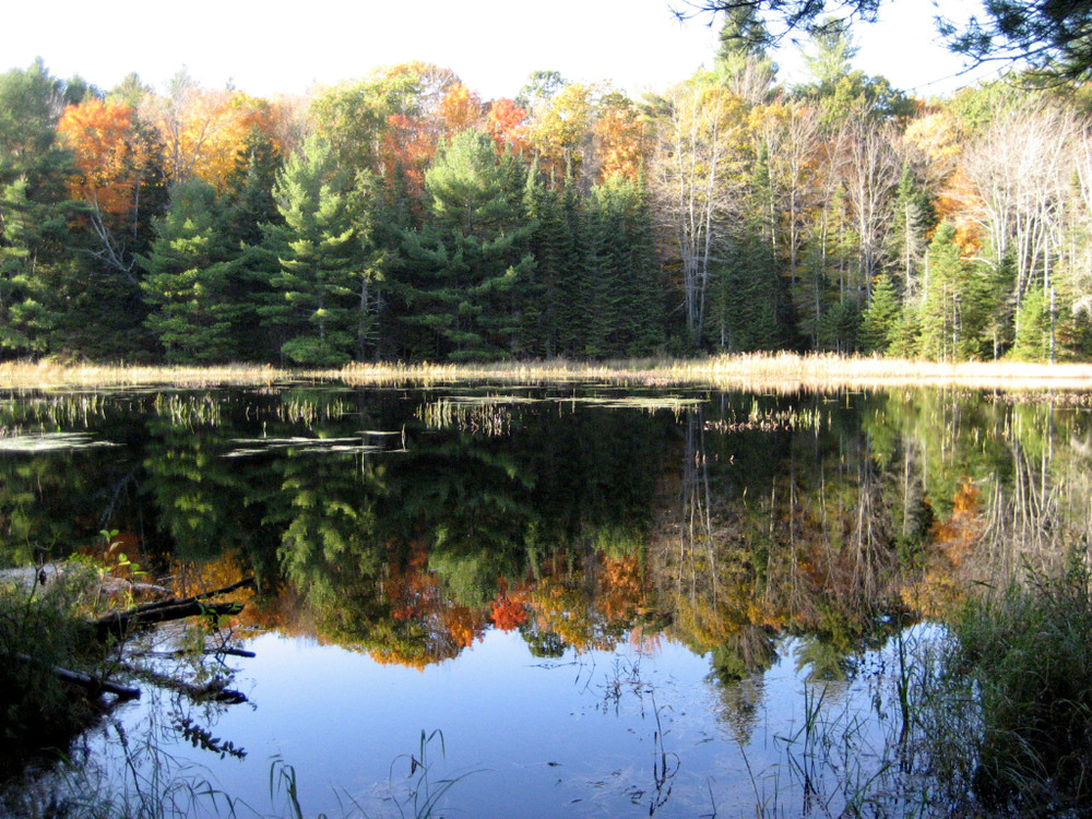
Big Pines Trail (0.5 miles red blazes) - named for several large pine trees along the route this flat, easy trail ends near a quiet marsh and a nearby small stand of stately pines. Hikers can follow the Bog Brook Trail back to the Bog Brook trailhead for an easy one mile loop.
Arnold Trail (0.3 mile yellow blazes) - named for the landowner, artist Anne Arnold, this flat, easy trail winds through an stand of hemlocks stretching nearly its entire length to where it intersects Bog Brook trail.
Hemlock Hollow Trail (east section 0.8 mile blue blazes) - this trail crosses Halldale Road; on the east side of the road, the trail skirts the edge of a deep ravine, eventually crossing the uppermost section of the Sheepscot in a quiet, mature mixed forest. The stream here is excellent rearing habitat for Brook trout and Atlantic salmon. The eastern section of the trail ends at the junction with the Hogback Connector Trail.
Hogback Connector Trail (1.5 miles blue blazes) - links SWLA trails with 11 miles of trails on Hogback and Frye Mountains maintained by the Georges River Land Trust. Where the “Hog” Connector leaves Bog Brook Trail it is .8 mile to the junction with Hemlock Hollow Trail. The trail then turns southeast and travels 0.7 mile up Hogback Mountain to the Hogback Loop Trail.
Hogback Loop Trail (1.8 miles blue blazes) - the Hogback Loop trail winds through a variety of multi-aged forest types. A rocky outcrop on the east side of Hogback that offers fabulous views all the way to Penobscot Bay. This trail and the section of Hogback Connector that ascends Hogback Mountain are closed during deer hunting season except on Sundays.
Please respect that portions of this trail network are on privately owned property and help keep this open to the public. The Bog Brook Trail is listed in the Maine Birding Trail guide.
No overnight camping is allowed. Because hunting is allowed on many Midcoast Conservancy properties, we recommend that hikers wear blaze orange when using the trails during deer hunting season.
Visit the Midcoast Conservancy website for more information or contact:

Avoid Trampling Fragile Areas: Vegetation and soils in Maine’s alpine zones and coastal islands can take years to recover from a single step.
From the junction of rte 220 and rte 3 in Montville, travel north on route 220 for 3.2 miles. Where 220 makes a sharp right turn, turn left onto Halldale/Burnham Hill Road. Follow for 0.6 miles, staying right at the fork to stay on Halldale Rd. The trailhead marker is just before Bog Brook, visible from the road as a small pond, on the right.
From the intersection of 220 and 137 in Freedom, follow 220 south for 8 miles. At a sharp left-hand turn in 220, turn right at Burnham Hill/Halldale Rd. Follow for 0.6 miles, staying right at the fork to stay on Halldale Rd. The trailhead marker is just before Bog Brook, visible from the road as a small pond, on the right.
Trails can also be accessed via the Whitten Hill trailhead (see Northern Headwaters Trail Cluster for directions).
Success! A new password has been emailed to you.