Glassface Ledges Trail

A short, moderately strenuous hike through lowland forest ending at a rocky outcrop with a spectacular view of the Androscoggin River valley.
Trail Activity
Hiking
Length
1.60 miles, Round Trip
Difficulty
Moderate
Town
Rumford
Surface
Dirt/Forest Floor, Rock/Ledge
Pets
Permitted
Fees
No

Description

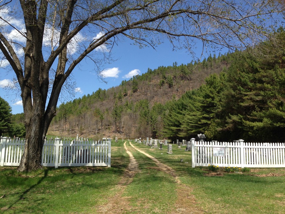
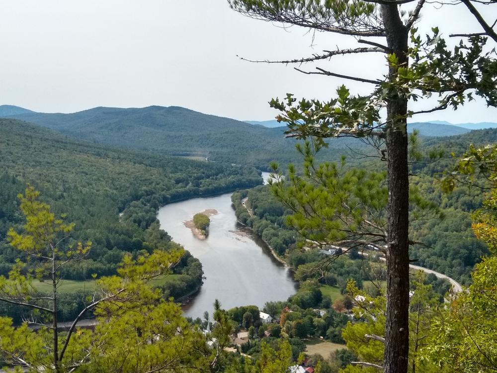
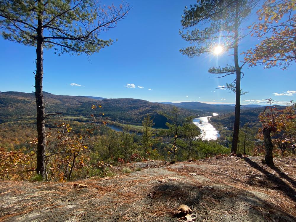
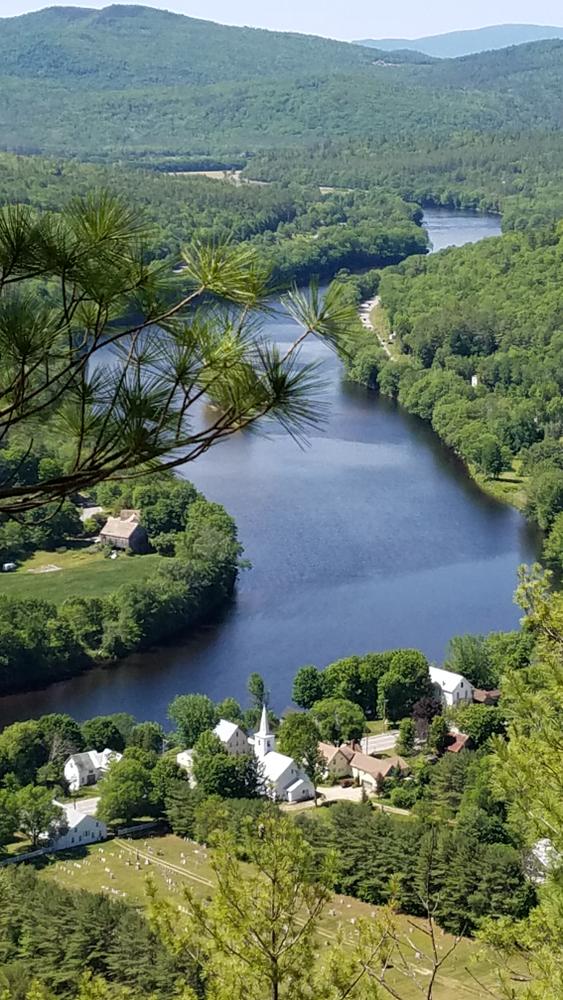
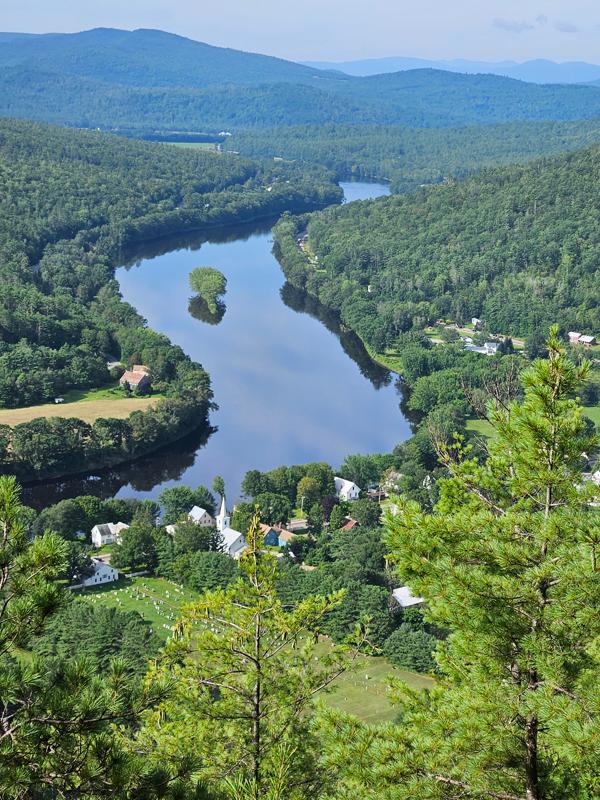
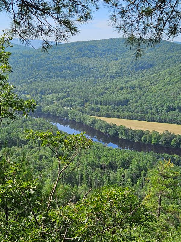
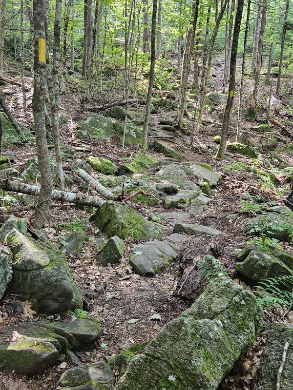
Begin the hike by walking on the grass path through the center of the cemetery. Off to the right at the back of the field is a small sign marking the trailhead. The trail meanders through lowland forest. The trail has boardwalks and water bars at major wet areas, but small spots are muddy. As you climb, the trail changes from dirt to boulders and well-placed steps. The trail ends at a rocky outcrop with a beautiful view of the farms and woodlands of the Androscoggin River valley.

Trail Manager

For more information, please visit the Mahoosuc Land Trust website or contact:

Mahoosuc Land Trust

Mahoosuc Land Trust
PO Box 981
162 North Road
Bethel, ME 04217
Phone: (207) 824-3806
info@mahoosuc.org
View website

Nearby Events

VIEW EVENTS CALENDAR

Trail Tips

Travel and Camp on Durable Surfaces
Walk single file in the middle of the trail. Wear the right shoes and enjoy the mud – you're in the great outdoors!
Legend
Hide All

Trailhead Information

Parking for Glassface Ledges Trail is located at Hastings' Landing boat launch, on US-2, in Rumford Center approximately 6 miles west of Rumford and 17 miles east of Bethel. Please do not park in the cemetery.

To access the trail, cross US-2 and walk through the cemetery. There is a sign for the trail at the back of the cemetery on the right.

Click on a parking icon to get custom directions
Please Log In or Create Account to add comments.
toneman10
August 12, 2023
Beautiful summer day with temperatures in the 70s. I had the trail to my self on this Saturday morning. The trail was a moderately strenuous hike that switched between steeper pitches and more gradual pitches. It was nice becuase you'd hike a steep section and then it would level off to give you a bit of a break and it did this off and on.
toneman10
August 12, 2023
Beautiful summer day with temperatures in the 70s. I had the trail to myself on this Saturday morning. The trail is moderately strenuous, but there is a nice balance of steeper and more gradual pitches. The trail is well marked, but also well trodden so it was easy to follow. There were steps in some places that were helpful.
toneman10
August 12, 2023
Beautiful summer day with temperatures in the 70s. I had the trail to myself on this Saturday morning. The trail is moderately strenuous. The trail switched off between steeper grades and more moderate grades. Usually, after a steep part the trail leveled out a bit to provide a breather. Very pretty views of Rumford Center the the Androscoggin River Valley. The trail is well marked, but also well trodden so it was very easy to follow and the yellow markers were very clear.
tryingnottogetlost
May 19, 2022
I didn't get the exact distance but it seemed a bit further than 1.6 round trip, it might be closer to 1.6 one way. The trail is steeper than you'd think and easy to follow but I tried to follow a rock face once - so just double check you are going where you intended to. No one else was there, the view was beautiful and had a perfect hammocking spot at the terminus which I took advantage of
tracy chartier
February 21, 2021
Bring snowshoes! We had to break trail in hiking boots only and it was really tough! View is really pretty when river is like a mirror in the fall. We went in the fall and in the winter.
xavi
November 29, 2019
Steep and icy but a great view from the ledge
dprotaganist
September 08, 2019
I'm fairly certain that there is an additional trail from Andover road that goes to the summit.
tigger_5015
May 05, 2019
Between the rain from the day before and all the fallen leaves there were some slippery spots near the end, but it was doable even with my kids. What a gorgeous view! Glad we decided to go and will likely go again once things turn green.
These awesome businesses support our goal of connecting people to outdoor adventures in Maine!
Hang Tight!
Nearby services are loading
No Results
No Services Found
SHARE THIS TRAIL

Add Trail Log

Please wait…
Join In on the Fun!
Log in or create an account below to unlock all the great features of Maine trail finder: keep track of trails you want to do, preserve memories of trails you’ve done, earn badges, and more!
Your log in attempt was not successful. Please try again.
    Lost your password? Reset your password
    Don't yet have an account?
    There was an issue with your submission. Please try again.
      * Indicates required field
      Already have an account? Login here
      Enter your username, and we will send you a new, randomly generated password to your email account.
      There was an issue with your submission. Please try again.

        Success! A new password has been emailed to you.

        Log in now

        Please wait…