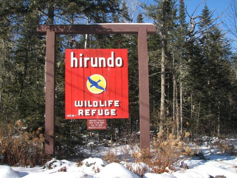
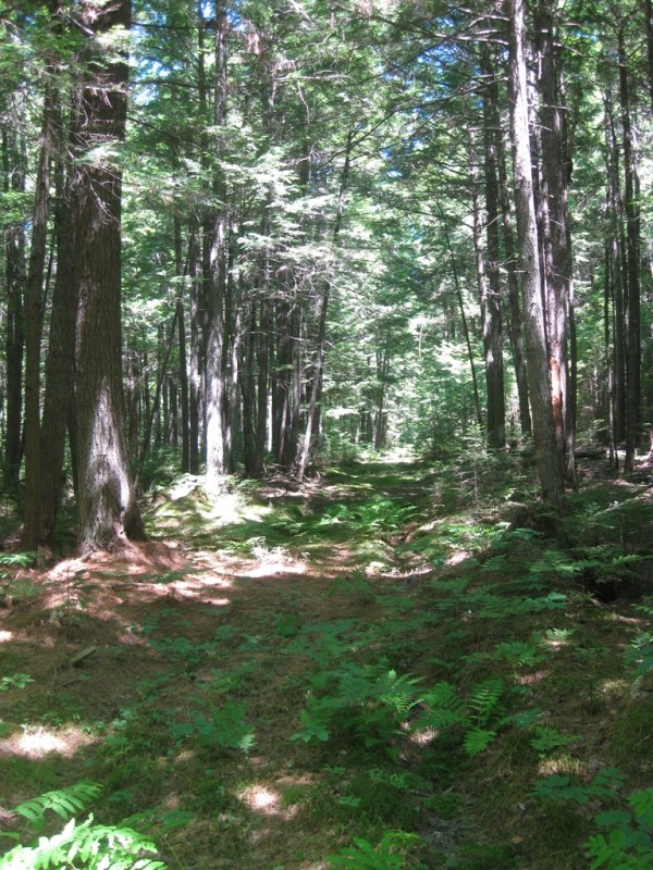
Hirundo is a 2,400-acre nature preserve, spanning Pushaw and Dead Streams, Lac D’Or (lake), vast wetlands, including domed bog and maple and juniper swamps, and mixed hardwood and evergreen forests. Only 10 miles from the University of Maine, Orono Campus and 18 miles from Bangor, visitors paddle canoes for a modest donation and watch playful river otters, mink, breeding Wood Ducks, Bald Eagles, and listen to the American Bittern in the tranquil beauty.
While hiking, snowshoeing, and cross country skiing, one might encounter moose, deer, red fox, muskrat, beaver, black bear and fisher. Birdwatchers enjoy such breeding and migrating birds as Virginia Rail, Pileated Woodpecker, Northern Goshawk, Northern Harrier, Blackburnian and Nashville Warblers, Scarlet Tanager, Common Snipe, Woodcock, Barred Owl, Belted Kingfisher, Great Blue Heron, Northern Waterthrush, Northern Rough-winged and Tree Swallows, and Olive-Sided, Yellow-Bellied, Alder, Great Crested and Least Flycatchers.
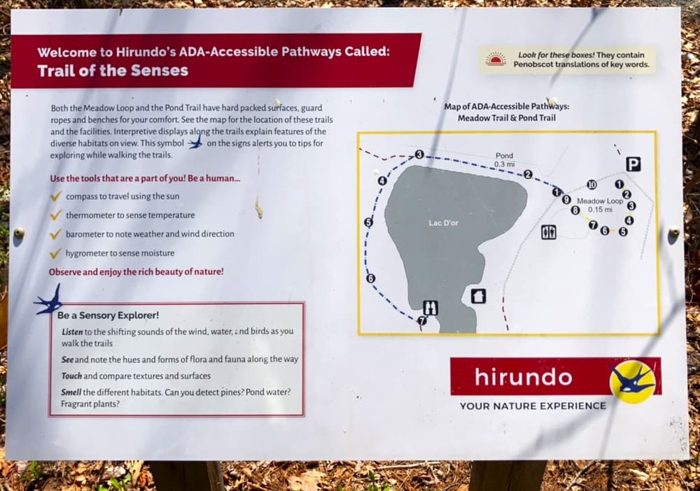
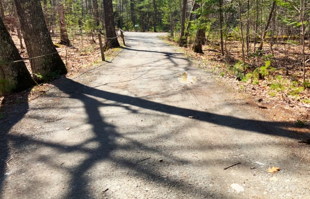
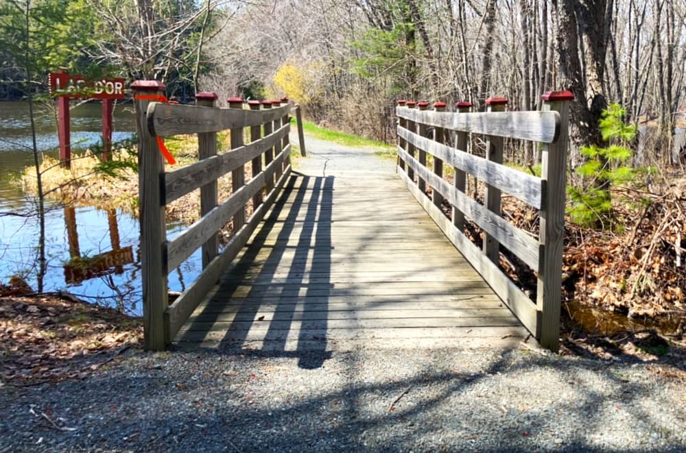
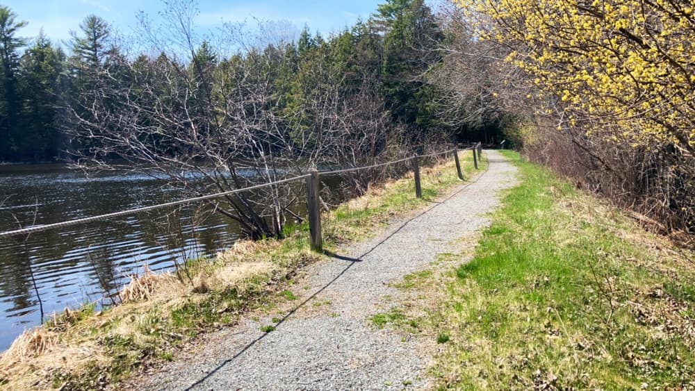
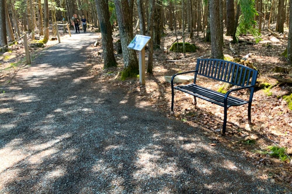
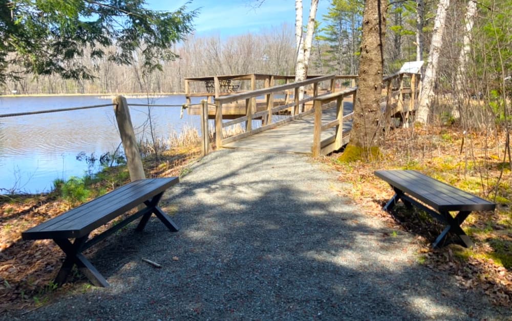
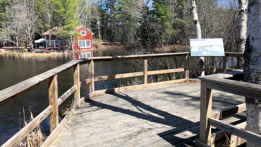
Pond Trail (0.3 miles, easy): The Pond Trail is an ADA trail that circles the northwest shore of Lac D'or. Together with the Meadow Trail it comprises the Trail of the Senses. The trail has a hard-packed surface with grades varying primarily between 0% to 5% and one location mid-trail with an 8% grade. A guide rope runs along the entire length to assist those with visual, physical or mental limitations. There is a 24-foot long, 6-foot wide bridge near the beginning of the trail, with railings and a smooth uninterrupted transition between the gravel surface of the trail and the bridge surface. Interpretive trail signage and interactive stations describing the varied habitats along the trail encourage a multi-sensory exploration of nature through sight, touch, and smell. The trail ends at an accessible wildlife viewing platform, accessed via a ramp with a 9% grade. The viewing platform includes benches and interpretive signage.
Meadow Loop (0.1 miles, easy): The Meadow Loop is an ADA trail that meanders through the woods to a wide open field, where many swallows and other birds swoop across the sky. Together with the Pond Trail it comprises the Trail of the Senses. The trail is wide and of minimal grades, with a hard-packed surface. A guide rope runs along the entire length to assist those with visual, physical or mental limitations. Interpretive trail signage and interactive stations encourage a multi-sensory exploration of nature through sight, touch, and smell.
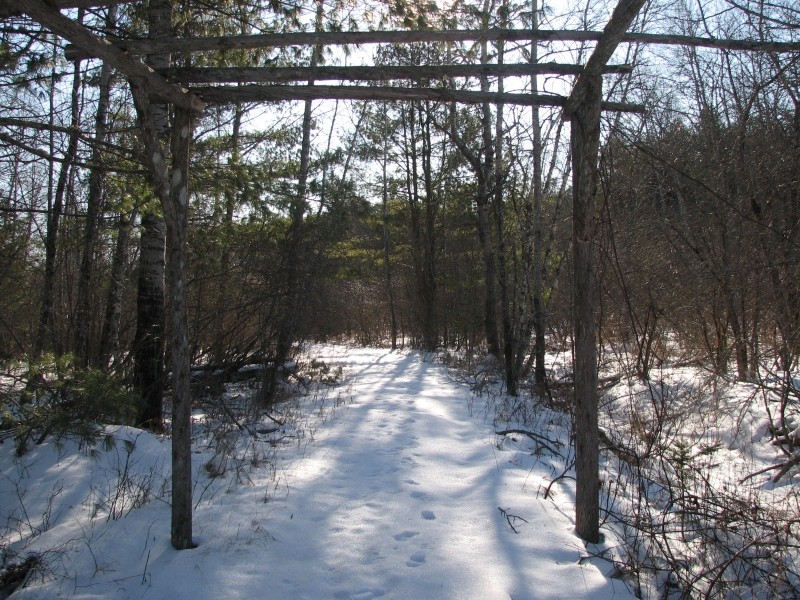
Wabanaki Trail (0.4 miles, easy): This interpretive trail's terrain is mostly level and has a short, uneven section. It passes through floodplain and coniferous forest and includes a short boardwalk alongside a newly created beaver dam. Additional highlights are the site of a former Red Paint people village (approx. 7000 years old), and a muskrat lodge. The trail intersects with the Field to Forest Trail creating loops of 0.6 or 0.8 miles. Time commitment approximately 30-45 minutes, depending on route chosen. Note: trail portion by the floodplain forest floods during high water conditions.
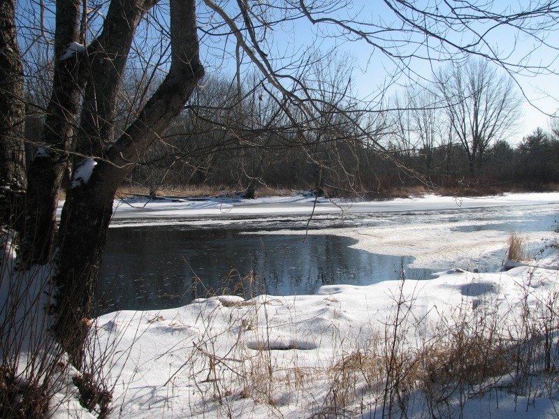
Pushaw Trail (0.9 miles, easy): The Pushaw Trail follows the stream and has a short steep portion on the southern end. The trail has interpretive signs and connects with the Pond, White Pine, Conifer, and Lady Slipper Trails creating loops between 0.9 to 1.7 miles. Time commitment approximately 45-60 minutes, depending on route chosen. All of these trails are forested and easy. Note: trail portion by the floodplain forest floods during high water conditions.
Lady Slipper Trail (0.8 miles, easy): The Lady Slipper Trail passes through the forest on a relatively flat trail. The trail intersects with the White Pine, Pushaw, and Conifer Trails creating loops of 0.9 to 1.7 miles. Note: trails may wet and freeze during different times of year; we recommend good footwear and/or ice grippers.
Thornplum Trail (0.3 miles, easy): The Thornplum Trail combines travel along a dirt road and a mowed path through a meadow featuring pioneer species. The trail intersects with the White Pine and Field to Forest Trails creating loops of 1.1 to 1.9 miles. A bench is in the middle of meadow for bird watching. Time commitment approximately 45 minutes, depending on route chosen.
Field to Forest Trail (0.5 miles, loops): The Field to Forest Trail travlers through some of the various habitats of Hirundo including fields, mixed forests, pine grove, and a glacial moraine. The trail intersects with the Wabanaki and Thornplum Trails creating loops of 0.6 to 1.5 miles. It passes through a field studded with Tree Swallow nesting boxes, into the woods and over a moraine to a pine grove where the trail is blanked with soft pine needles. This trail passes the Big Spring, where you might hear frogs croak or spot a turtle, and returns back to open meadow. Interpretive signs along this trail highlight geological, wildlife, and ecological topics. Note: parts of this trail can be wet in the spring or after heavy rains.
Conifer Trail (0.3 miles, easy): The Conifer Trail conforms to the wooded, rolling landscape which extents southward up to the Beech Trail. The trail intersects with the Pushaw, Pond, and Lady Slipper Trails creating loops of 0.9 to 1.7 miles. Watch for the cedar tree on eastern end of the trail. It has a variety of woodpecker holes and callus tissue that formed around the holes in response to the injury. Time commitment approximately 30-45 minutes, depending on route chosen.
White Pine Trail (0.3 miles, easy): Along the White Pine Trail, west of the Pond Trail, are the largest white pines in the refuge. Toward the east, the White Pine trail's forest floor has many exposed roots and passes through a cedar swamp via footbridge. People with balance issues may find it difficult. The trail intersects with the Pushaw, Thornplum, and Lady Slipper Trails creating loops of 0.9 to 1.7 miles. Time commitment approximately 30 -45 minutes, depending on route chosen.
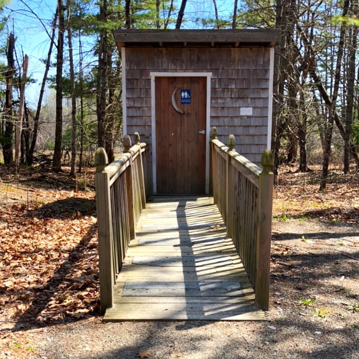
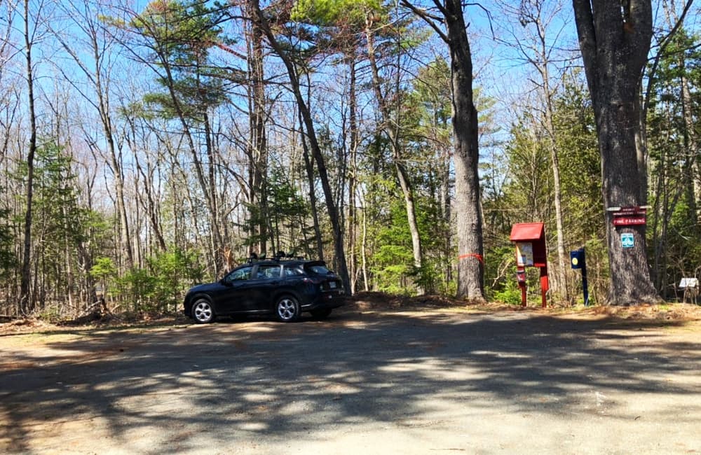
Trappers Trail (1 mile, easy): The Trappers Trail is an old, wooded logging road, as are most of the trails south of ME-43 and easy to walk. The first section of the trail (0.5 miles) is known as the Kids Trail and features information about creatures that live at Hirundo, a natural playscape, and a barefoot sensory path. The trail ends at a small shelter (a geocache site), and includes two outhouses along the trail. Three loop trails branch off
from this trail (Needle & Leaf, Hemlock, and Beech). Time commitment depends on route chosen.
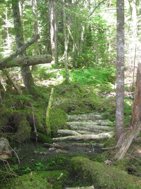
Hemlock Trail (0.8 miles, moderate): The Hemlock Trail (0.8 miles) is one of the 'wildest' trails at the Refuge. It leads through predominately hemlock forest, includes several footbridges and a bench to enjoy the high Hemlock canopy. Trail can be wet especially in the spring; we recommend good footwear. Time commitment approximately 60-90 minutes, depending on route chosen. Interpretive Trail.
Beech Trail (0.9 miles, moderate): The Beech Trail, like the Hemlock trail, includes wet areas, particularly on the southern and western side where it skirts a wooded wetland. Exposed rock, roots and hammocks along the western side of the trail require attention while walking and good footwear (no flip-flops). Highlights along this trail are a well-used deer scrape, large area of Christmas ferns, and a resting place with bench (off-trail) on a mount. From there the trail turns into an old logging road with smoother terrain and a beech forest. Time commitment approximately 60-90 minutes, depending on route chosen.
Needle & Leaf Trail (0.5 miles, easy): The Needle & Leaf Trail (0.5 miles) is an interpretive trail that traverses in the only hardwood forest on the refuge. It features bright sunshine and the rustling of beech leaves during the winter and dabbled sunlight in the summer month. Look for the porcupine den and the bear claw marks. Time commitment approximately 60-90 minutes, depending on route chosen.
(Applies to Meadow Trail & Pond Trail)

Trail conditions can change without warning. Trail last assessed: 5/5/2026.
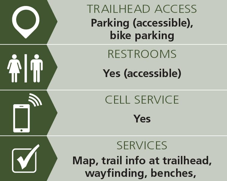
A visitor center is located at Gate 3, as well as a canoe/kayak launch and equipment rentals. Pets are not welcome at the refuge to protect nesting birds. There are three outhouses accessible on the property; at the parking area past Gate 1, at Gate 2, and at the second intersection of the Hemlock and Trappers trails. Picnic Tables, benches, and a screened observation room are available here. The refuge features a 5,000-year-old Wabanaki campsite located along the Wabanaki trail.
Hirundo is the Latin word for swallow. Scores of tree swallow nest boxes attract swallows and bluebirds, breeding in the Spring. Hirundo Wildlife Refuge was founded by Oliver Larouche from his parents’ 3-acre camp in 1976, expanding to its present 2,400-acre size. In 1982 the Refuge was donated as a trust to the University of Maine. It is not supported financially by the University of Maine or any other institution. Hirundo is a living laboratory, where much past research and scientific studies continue.
The public is welcomed to visit Hirundo Wildlife Refuge 7 days a week 9 AM to dusk. Gate 1 is closed on Mondays, but there is still access to trails by parking outside the gate. Visitors should sign the log books available at the parking areas at the Gates.
There are no charges, admission fees, or membership, but donations are strongly encouraged. The public should call ahead for canoes. There is a clearly marked trail system on 300 acres. Trail maps are available at the Gates and may be downloaded from the maps section of Hirundo's website.
Visit Hirundo Wildlife Refuge online for more information and a printable map or contact:

Consider Using a Stove: It’s safer, easier, and reduces impact. Lanterns and string lights make for great campsite ambiance instead of a campfire.
Take I-95 Exit 197 to Old Town/Hudson. Go 0.3 miles to the end of the off ramp. At the stop sign, turn left onto ME-43 (Hudson Road). Go west 5.2 miles and look for the large red signs on your right (north side of ME-43).
Gate 1 is the main entrance, and leads to the Pine Tree parking lot, Wabanaki and Pushaw Stream Interpretive Nature Trails, and the Parker Reed Shelter at Lac D’Or. Please note, Gate 1 is closed on Mondays, but there is still access to trails by parking outside the gate.
Gate 2, located across from Gate 1, offers 5 additional trails. Gate 3 has parking for the canoe trails and Pushaw Stream Trail.
Success! A new password has been emailed to you.