This 60-acre island lies at the northern end of Ebenecook Harbor in the Sheepscot River, not far from Boothbay Harbor. It was used extensively by Native Americans as evidenced by significant artifacts found during an archaeological dig conduced after Indiantown came under BRLT protection. Extensive shell middens were excavated as well as centuries old remains indicating that the island also became an important base for local fishermen in the colonial period. The island was used for farming in the 19th and early 20th centuries. Rachel Carson, who summered nearby, wrote of her particular love for this magical place and its abundant wildlife. Shore birds such as herons and ospreys, owls and eagles, songbirds, deer and small mammals make Indiantown their home.
Over the years there were occasional schemes for building a bridge to Indiantown from the mainland and creating a seasonal development. Fortunately an anonymous donor as well as other supporters made it possible in 1995 for BRLT to acquire the northern 27 acres. About the same time, BRLT was also granted an easement over the remaining southern 33 acres. The land trust established a 0.9 mile loop trail on the northern half actually owned by the organization, as well as an in-and out trail on the private owners’ portion of the island. Please respect their generosity in sharing their land and do not stray from the trails nor use their personal dock on the southwestern end of the island.
The Boothbay Region Land Trust (BRLT) manages the preserve and has worked to preserve the scenic beauty of the Boothbay region since 1980 through conserving land for the benefit and enjoyment of the residents and visitors.
BRLT properties are open for quiet, low impact activities. When visiting this BRLT property, please observe the following rules:
Visit Boothbay Regional Land Trust online for more information and a printable map or contact:
![]()
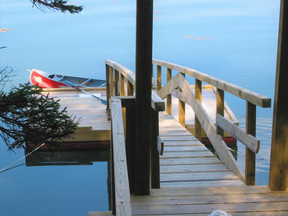
The island is accessible only by water via the Boothbay Region Land Trust dock on the northwestern end of the island. Boats can be launched at Knickercane Ramp off Barters Island Road and at the McKown Point Boat Launch. Canoes,kayaks, and dinghies can use the dock, and there is also a mooring for larger boats. GPS coordinates for the land trust’s dock are N43°51.823’W69°40.030’.
Success! A new password has been emailed to you.