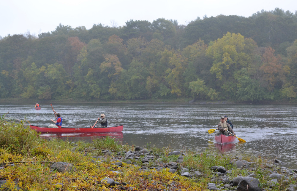
The Kennebec River Paddle Trip is an up to 18.5-mile journey through one of Maine's most historic rivers. The beautiful scenery, historic significance, watchable wildlife, and quickwater paddling make the trip well-suited for many skill levels. The route described here begins in Waterville and travels through the towns of Sidney and Vassalboro to its finish in the capital city of Augusta. There are some areas where small rapids do appear but are easily navigated, and the width of the river allows the paddler to easily access both banks.
The History of the Kennebec River between Waterville/Winslow and Augusta includes Native Americans, Pilgrims, French & Indian War soldiers, loggers and mill workers, and even those working for the environment - culminating in the nationally significant removal of Edwards Dam in the late 1990s. These stories are on display along the route. Look for remnants from log drives. Observe and visit Fort Halifax (State Historic Site in Winslow) and Fort Western (Augusta). Watch in awe as massive sturgeon leap from the river. Note the spire of St. Augustine Church and the Capitol Dome as you near Augusta. The river powered industry, drew immigrants who shaped these towns, and continues to attract people and wildlife who seeks its gifts.
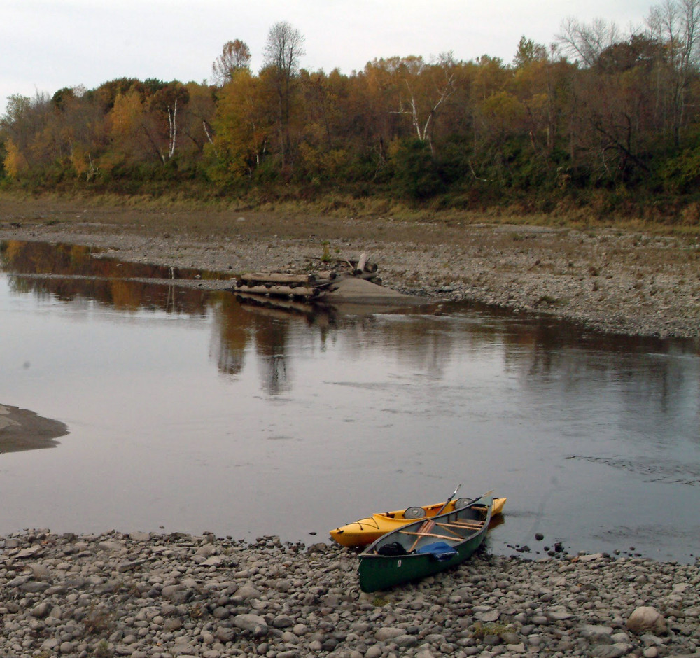
The river in Waterville is marked by generally quicker water than closer to Augusta. To visit Fort Halifax, paddle upstream 0.75 miles from the boat launch (provided by Messalonskee Stream Hydro LLC). Downstream from the boat launch, the scenery transitions to become more rural. At roughly one mile downstream, Messalonskee Stream enters on the river's right shoreline. There is a modest set of rips here. Approximately another 4 miles downstream, there is another mild set of rips. As the river continues, several low, sandy islands appear just above the river surface. The Sidney Boat Launch is reached roughly 8 miles below the Waterville Boat Launch. This can serve as a take-out, put-in, or rest spot.
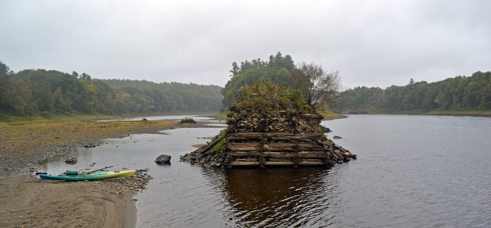
Nearly 1 mile downstream from the Sidney Launch on the eastern (river left) shoreline, Sevenmile Stream enters beneath a railroad trestle. In roughly another mile, a string of massive timber and rock piers create a line to Sevenmile Island, where the water narrows and quickens before emptying into a large eddy below the island. Around the wide bend, a set of rips with small standing waves waits for paddlers. Further towards Augusta, the river flows steady and flat and the Capitol Building and other man-made landmarks become visible.
Paddlers can take out at the Mill Park Hand-Carry Boat Launch in Augusta (west-side, river right) before reaching the railroad trestle bridge and downtown Augusta. Conversely, paddlers can continue to the East Side Boat Launch (river left) across from downtown. Note, during low tides, there are several modest rips in the vicinity of the trestle/Bond Brook (Class I). These are easy to navigate and non-threatening, but the current is strong here on an outgoing tide.
Occasionally strong winds can slow paddling; plan ahead and prepare by knowing the weather and having a backup plan.
Fort Western (America's oldest wooden fort) in Augusta or Fort Halifax (Fort Western's partner fort) in Winslow are both ideal side trips to gain appreciation for local history and how the river has shaped that history.
Maine Department of Inland Fisheries and Wildlife fishing regulations apply about 4,200 feet above the Calumet Bridge in Augusta (head of tidewater). The Maine Department of Marine Resources manages recreational fishing regulations in tidal and marine areas (downstream of MDIFW jurisdiction).
Augusta Trails compiled this trip information; numerous partners manage access to the river. Please follow low-impact practices, respect private shorelines, and leave sites at least as clean as you found them.
Recognize Working Forests and Waters: Maine’s landscapes are not just for recreation—they’re also active, productive environments that support local livelihoods and communities. Forests may be actively logged; waterways are used for lobstering, clamming, aquaculture, and transport. For everyone’s safety, maintain a safe distance from active logging operations, and do not disturb working docks, fishing equipment, traps or buoys.
To access the Waterville Boat Launch take Exit 127 off I-95. Head east on Kennedy Memorial Drive. After about 2 miles turn left onto Grove Street (just past Maine State Credit Union). Follow Grove Street down to Water Street where you take a right. The boat launch is just past the softball fields. This boat launch gives access to the Kennebec River downstream through Sidney and Augusta.
To access the Sidney Boat Launch take Exit 120 off I-95. Head east onto Lyons Road until the road ends and then turn right onto ME-104/West River Road. Follow West River Road to Recreation Drive. Pit Fields are located here with two baseball fields, ample parking and access to restrooms. The boat launch is at the end of the road past the fields and gives you access to the river for put-in towards Augusta or take-out from Waterville.
To access Mill Park Hand-carry Boat Launch take Exit 109A off I-95. Merge onto US-202/Western Ave and follow this until you hit the traffic circle. At the traffic circle take the 3rd exit onto Water Street. Stay on Water Street until you see Mill Park on your right and take the second right at the entrance onto Canal Street. Follow Canal Street down to the end of the road and the boat launch will be on your right.
To access the East Side Boat Launch take Exit 109A off I-95. Merge onto US-202/Western Ave and follow until the traffic circle. Take the 2nd exit onto Memorial Drive until you hit a second traffic circle. Take the 4th exit here onto Cony Street, then your first left onto Arsenal Street. Follow Arsenal Street down to the boat launch. The East Side Boat Launch intersects with the historic Greenway Trail giving access to Old Fort Western and the Kennebec Arsenal.
Success! A new password has been emailed to you.