The three different trailheads provide distinct hiking opportunities on a connected system of primitive hiking trails. Seven primitive campsites (first come, first serve) with outhouses are situated on the ponds in this trail network.
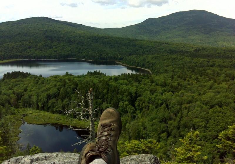
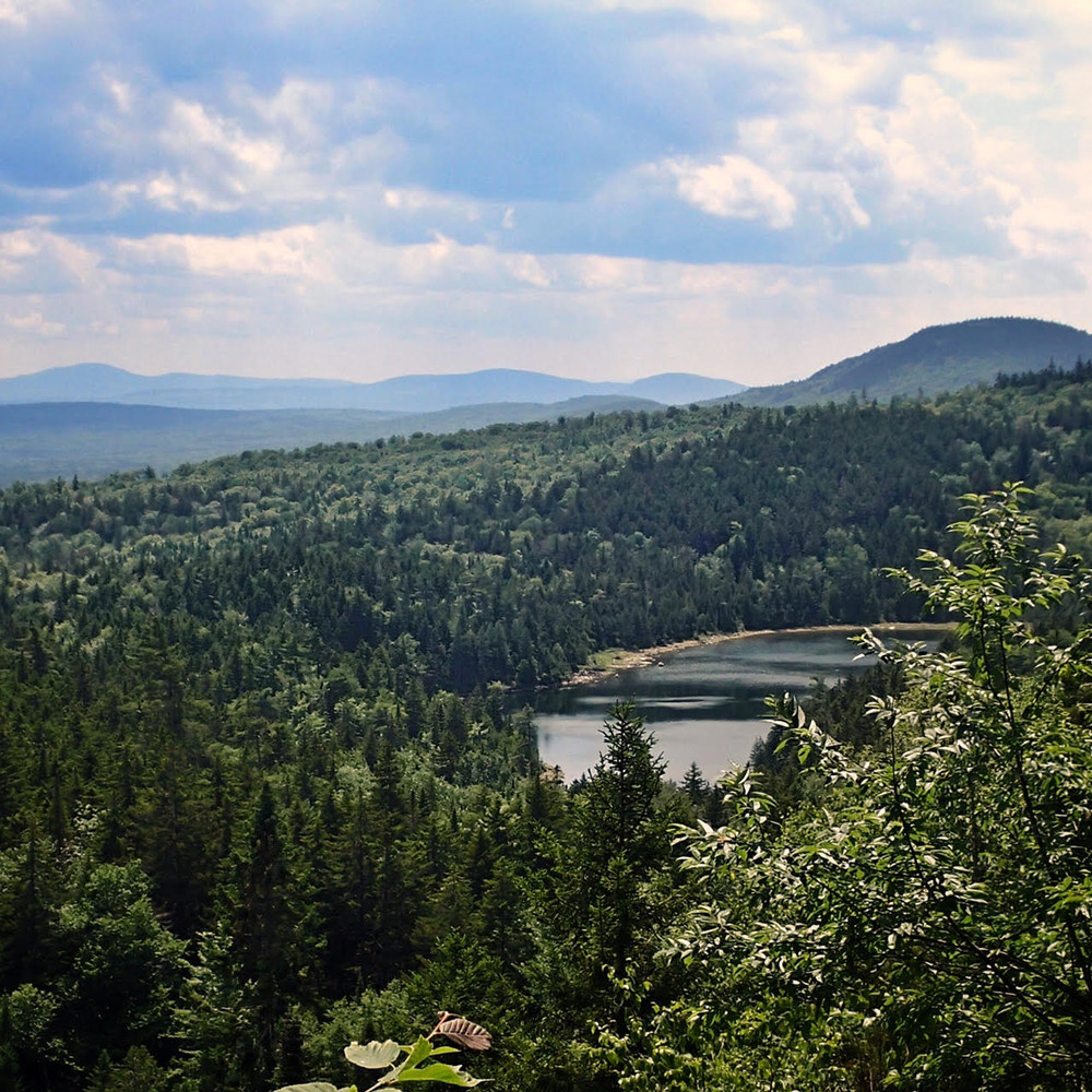
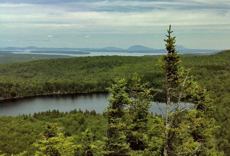
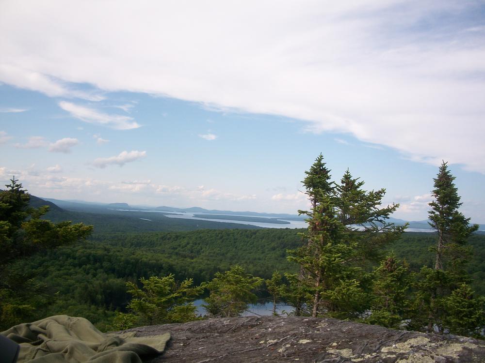
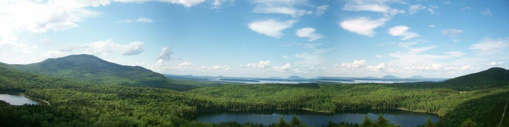
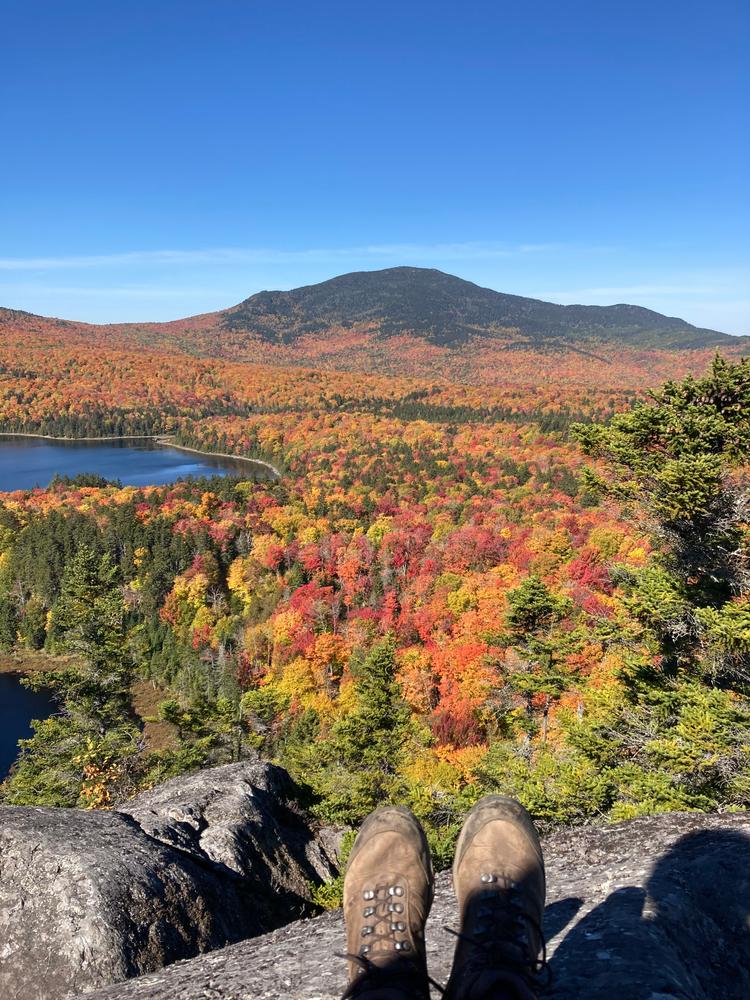
Loop option - For those interested in a shorter overall hike looping around two ponds, the loop trail sweeping past the eastern shore of Big Moose Pond and back around the northern shoreline of Little Moose Pond is approximately 3.8 miles of hiking and returns to the central trailhead for Big and Little Moose Ponds (see above). This loop includes excellent views from the ledges overlooking the two ponds. These vistas provide a sweeping view northward to Big Moose Mountain and beyond to Moosehead Lake, Mount Kineo, and both Little and Big Spencer Mountains. Partial views of other mountains extend in other directions.
The trail from the Big and Little Moose Ponds trailhead leads downhill about 0.4 miles to an intersection with a short spur to two pond-side campsites. Another 0.3 miles leads to an intersection with the loop. Head east to skirt Little Moose Pond's northern shore. It is approximately 0.9 miles to a junction where one can continue east 2.5 miles to the trailhead at the former Greenwood Motel (now Moose Mountain Inn - ME Route 15). If staying on the loop, avoid the aforementioned 2.5 mile segment and instead turn southward and hike roughly 0.8 miles along the ridgeline of Little Moose Mountain. Look for a short spur trail to a scenic overlook perched atop Little and Big Moose Mountains. Near this overlook spur, look for a trail junction where the Notch Trail joins. Do not take the Notch Trail unless you want to hike 2.75 miles one-way to the Notch Trail trailhead. Bear northward passing along the eastern shore of Big Moose Pond until reaching the initial point where the loop began.
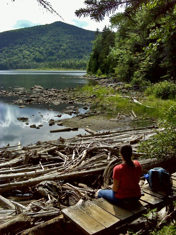
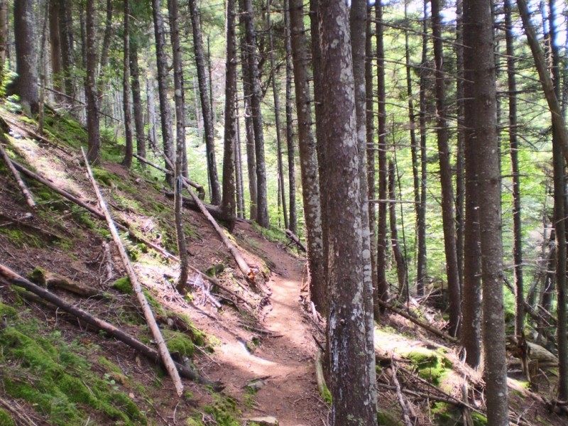
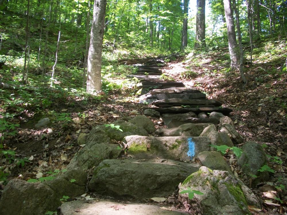
The loop is well-suited for most hikers and provides a mix of hardwood tree species around the ponds and stands of spruce and fir at points along the ridge. Expect trail conditions typical of primitive hiking trails (roots, rocks, etc.). There are two campsites at Big Moose and three campsites at Little Moose Pond; all are found on the north shores of the ponds and are within 0.5 to 1.5 miles from the trailhead.
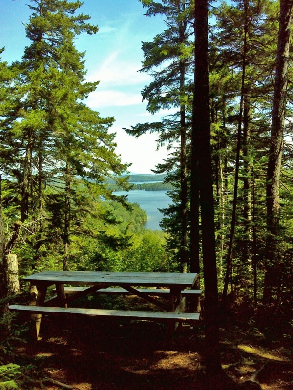
From Moose Mountain Inn (formerly Greenwood Motel) - The hike from this easternmost trailhead immediately begins to rise through mixed woods as it travels towards a series of pleasant viewpoints. Shortly after beginning, the trail crosses an ATV/snowmobile trail. Not long after that point, the first viewpoint presents an open view of the southern tip of Moosehead Lake. A picnic table makes this vista a relatively easy destination for a quick picnic. Further along the trail, periodic views open in a variety of directions. The trail is moderately steep and quite bony (rocky with ledges). Sounds from truck traffic can be heard some through the attractive, predominantly spruce and fir forests of this section.
The trail continues down from a crest of approximately 2000' towards Papoose Pond (reached at a little over 2 miles). This section becomes quieter, with more frequent hardwood tree species such as beech, birch, and maple. The junction with the loop trail around Big and Little Moose is reached at approximately 2.45 miles.
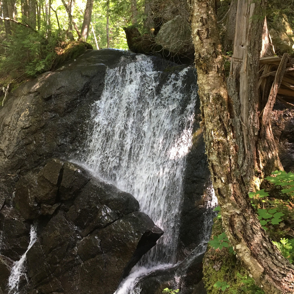
From Notch Ponds trailhead - Starting at the westernmost trailhead puts you roughly 1.2-miles from campsites on Little and Big Notch Ponds. These sites, particularly the one at Big Notch Pond, are attractive places to camp in a remote location a little less than half-way to the intersection with the trail loop in the heart of the trail network. Starting at the Mountain Road trailhead a little further east makes the campsites roughly 0.7 miles from the starting point. An advantage of starting further west is that a small but attractive waterfall sits along the trail between the two trailheads.
Northern hardwood trees including yellow birch as well as plants and bushes such as clintonia, hobblebush, and bunchberry are encountered along this section. After the ponds, the trail steepens and then provides occasional, filtered views. The trail begins to drop as it heads for the intersection with the loop trail just east of Big Moose Pond. In total, it is approximately a little over or under 3 miles from the trailhead to this intersection, depending on which trailhead is chosen.
View BPL's map and guide for Little Moose Public Land.
At more than 13,500 acres, the Little Moose Public Land is managed for multiple uses including wildlife, recreation, and timber. Timber harvesting is certified as sustainable and financially supports the management of Maine Public Lands (such as Little Moose). Camping, fishing, hunting, snowmobiling and ATVing, and wildlife watching are other activities enjoyed here.
While access to the trails does not require as much travel on logging roads as some destinations, take care traveling along area logging roads, pulling over and stopping for trucks regardless of which direction they’re headed. Do not block side roads and never stop where visibility is poor. Roads can be dusty in dry weather and washed out in wet weather. Gravel roads are hard on tires (and suspension systems): travel slowly and carry a spare tire.
Don't count on your cell phone in an emergency as coverage is not reliable across all of the trails.
Visit Maine Bureau of Parks and Lands online for more information and a detailed trail guide or contact:
![]()
Stop Invasive Species: Buy firewood locally, clean your boots and gear, and clean, drain and dry watercraft before and after visiting.
Access to the trail network on Little Moose Mountain can be had at three distinct locations. The easternmost trailhead (formerly known as Greenwood trailhead), located at a parking lot next to the Moose Mountain Inn, can be reached by travelling north from Greenville. The inn is located on the left about 1.0 mile after the railroad trestle on ME Routes 6/15 in Greenville Junction. The trail and parking can be found in the south corner of the parking lot by the Maine Public Reserve Lands sign.
The Big and Little Moose Ponds trailhead, which provides a starting point for the loop option (see below), can be reached by continuing past the Moose Mountain Inn and turning left onto the North Road, just past Moose Brook. The North Road passes a sign board shortly after leaving the paved ME Route 6/15. Continue straight past the trailhead for Big Moose Mountain Shortly after passing the Big Moose Mountain trailhead and parking, turn south (left) to reach the trailhead, which is marked by a sign board.
To reach the Notch Pond trailhead, there are two options. Option one is to NOT turn left for the Big and Little Moose Ponds trailhead and instead head straight (west) staying on the North Road towards Big Indian Pond. Veer left at the junction of the East Moore Bog Road and stay on the North Road until you take the left at an intersection near Big Indian Pond (approximately 6.4 miles from the beginning of the North Road). At a little over 0.5 miles, take a right onto a spur road heading south slightly less than 0.2 miles to the westernmost trailhead – at the site of a former stream crossing. The trail, marked by a sign board, crosses the stream then turns left into the forest. If you do not turn onto the spur road, another trailhead directly on the main road (Mountain Road) is roughly another 0.4 miles to the east. Look for a parking lot on the north side of the road, with the trail leaving from the south side of the road.
Option two is to head to the Big and Little Moose Ponds trailhead (Mountain Road) and continue on this road westward a little under 3 miles to the easternmost Notch Ponds trailhead described above. Again, a more western trailhead is another located off a spur road 0.4 miles further west.
The North and Mountain Roads connect making a loop within the Little Moose Public Lands.
Success! A new password has been emailed to you.