Little Wilson Falls Trail

Hike up a gradual incline along Little Wilson Stream to a beautiful steep slate gorge waterfall on the Appalachian Trail. 
Trail Activity
Hiking
Length
2.40 miles, Round Trip
Difficulty
Moderate
Town
Elliottsville Twp
Surface
Dirt/Forest Floor, Rock/Ledge
Pets
Permitted
Fees
No

Description

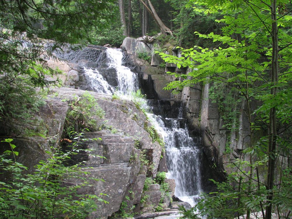
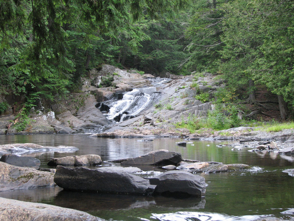
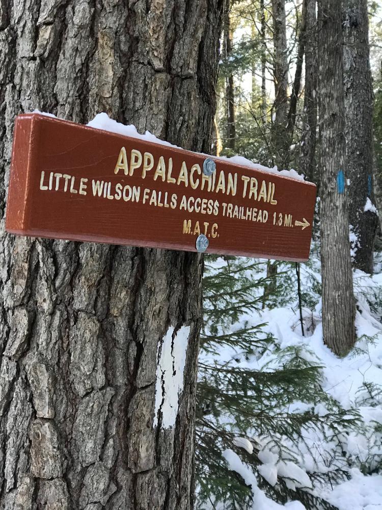
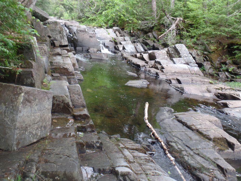
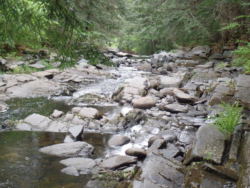
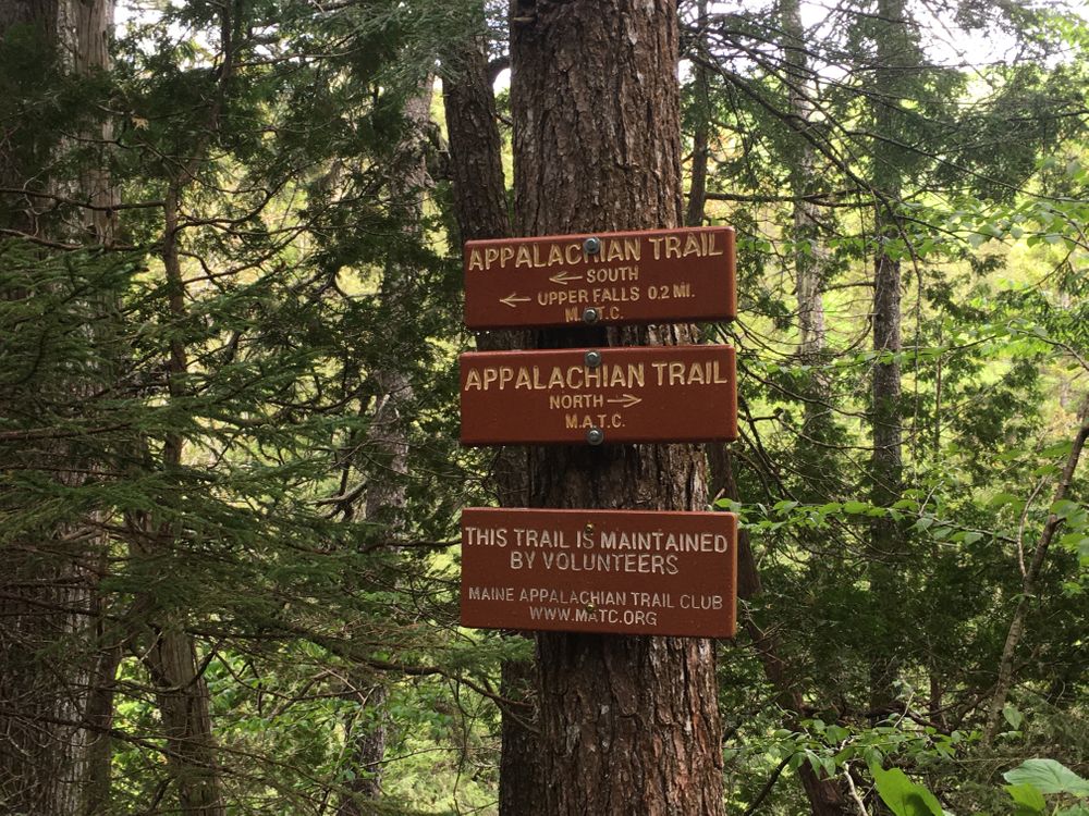
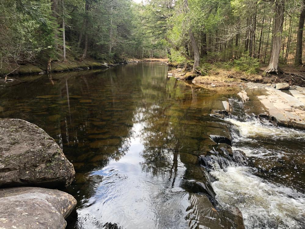
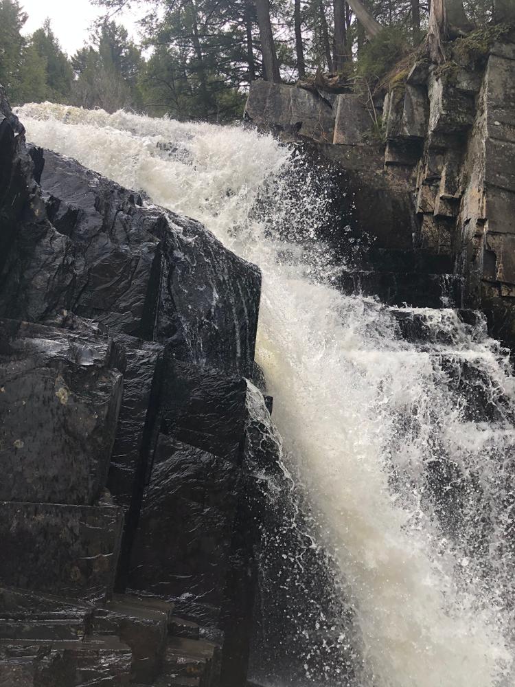
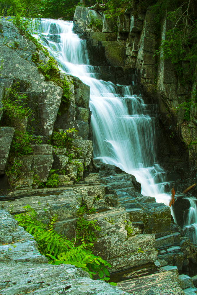
The access trail to Little Wilson Falls begins just above the open area near the lower falls. The blue-blazed trail hugs the banks of Little Wilson Stream closely at first and then follows a couple steep switchbacks to gain higher ground. After approximately 0.8 miles the access trail reaches the Appalachian Trail (AT), which has white blazes. Little Wilson Falls is to the left at this intersection. As the AT approaches Little Wilson Falls use extra caution in walking as the trail sits at the top of a steep drop off down to the stream. There are two short paths to view the falls, one above and one below the falls. 

Other Information

Do not underestimate the difficulty of hiking the Appalachian Trail (AT) and its associated side trails in Maine. Be sure to carry equipment and supplies necessary for this undertaking and be prepared for challenging weather conditions. Please educate yourself before hiking, so that you can have the knowledge and skills necessary for an enjoyable and safe hike. Fires are only allowed in the provided fireplace ring at established campsites; it is illegal in Maine to build a fire elsewhere.

The Appalachian National Scenic Trail runs from Maine to Georgia along the spine of the Appalachian Mountains. It is managed cooperatively by the National Park Service, the Appalachian Trail Conservancy, and 31 trail-maintaining clubs along with other federal and state land managers whose land the trail crosses. Over 3 million people visit the A.T. every year. Since its inception in the 1920s, thousands of volunteers have worked tirelessly to maintain, manage, and protect the Appalachian Trail. 

In Maine, the all-volunteer Maine Appalachian Trail Club (MATC) maintains and protects the 267-mile section of the Appalachian Trail extending from Katahdin in Baxter State Park to Grafton Notch at ME-26. In addition, MATC maintains over 60 miles of side trails as well as a system of regularly-spaced shelters and campsites to preserve access to wild, backcountry hiking in Maine. MATC publishes The Official Appalachian Trail Guide to Maine, which includes seven maps, please visit their website for information on how to purchase the guide or to learn more about becoming a member of MATC.

Trail Manager

Visit Maine Appalachian Trail Club online for more information or contact:

Maine Appalachian Trail Club (MATC)

Maine Appalachian Trail Club (MATC)
PO Box 7564
Portland, ME 04112
info@matc.org
View website

Nearby Events

VIEW EVENTS CALENDAR

Trail Tips

Minimize Campfire Impacts
Follow the Maine Forest Service fire regulations and check the current fire danger level before you go camping.
Legend
Hide All

Trailhead Information

From Monson, head north on ME-6/15. Turn right onto Elliotsville Road. After 7.6 miles and before the bridge over Wilson Stream, there is a turn to the left. This road section has large potholes. High clearance vehicles are strongly recommended. There is parking on the left immediately after the turn for low clearance vehicles. There is also parking at a large gravel lot where the dirt road splits 0.8 miles after the turn off from Elliotsville Road. Finally, there is limited parking at the trail head, which is 0.3 miles up the left spur. 

Click on a parking icon to get custom directions
Please Log In or Create Account to add comments.
ellen64
July 15, 2023
Lovely trail along Wilson Stream and to the falls. Some mud, and slippery roots, especially since the rain. Lots of flat rootless sections but they are short lived. Gradual uphill trail with a small steeper section when you go left from the stream near the beginning and again when you get to the falls. You save 3/4 mile each way by driving into the day use area. We did not have a high clearance vehicle and did not have an issue. You can get by the few larger potholes with care. People were swimming near the day use area but the water is very high and swift; not advisable.
lunksoos@gmail.com
July 10, 2023
This is a terrific hike but may be challenging to some hikers especially after a rain due to the roots and slippery rocks. Please note that the access road called the Campground road is on private property that is open to the public ,as are the primitive campsites on the way in and the day use areas. There is one vault toilet part way in on the Campground road. Please leave no trace and if you see something say something. The Friends of Wilson Streams area have made a difference in keeping an "eye" on the land recently.
For many years vandalism and abuse has been prevalent on this property and the owner has made some measures to improve it ,such as picnic tables , fire rings and revegetation. More road improvements hope to be made during summer 2023 . Two new cedar picnic tables have been taken from sites , one was the handicap access table at the day use area. Always leave these spaces better than you found them. Also note there is no overnight parking in the Day use areas and a Maine Forest Service Fire permit is required for a campfire in the fire rings at the primitive campsites ,which are first come first served and have a maxim stay limit. Thank you all for keeping these private land spaces open to everyone in the future.
balakay612
July 11, 2022
Short, easy hike from the lower falls to the upper falls. Pay attention to the blazes: the switchbacks can be disorienting if you're traveling quickly! Beautiful "square" rocks form natural steps (often slippery!) toward the base of the falls. There's no good position to photograph the falls in their entirety, but even just a piece of it is gorgeous.
These awesome businesses support our goal of connecting people to outdoor adventures in Maine!
Hang Tight!
Nearby services are loading
No Results
No Services Found

Trail Alerts

Trails
100 Mile Wilderness
This hike is within the "Hundred Mile Wilderness," a section of the Appalachian Trail without any public road crossings. Despite the name, this section is very popular for day hikers or backpackers. Trail use is at its highest in August and September. All hikers should follow Leave No Trace principles and expect to share the Trail with other users.
SHARE THIS TRAIL

Add Trail Log

Please wait…
Join In on the Fun!
Log in or create an account below to unlock all the great features of Maine trail finder: keep track of trails you want to do, preserve memories of trails you’ve done, earn badges, and more!
Your log in attempt was not successful. Please try again.
    Lost your password? Reset your password
    Don't yet have an account?
    There was an issue with your submission. Please try again.
      * Indicates required field
      Already have an account? Login here
      Enter your username, and we will send you a new, randomly generated password to your email account.
      There was an issue with your submission. Please try again.

        Success! A new password has been emailed to you.

        Log in now

        Please wait…