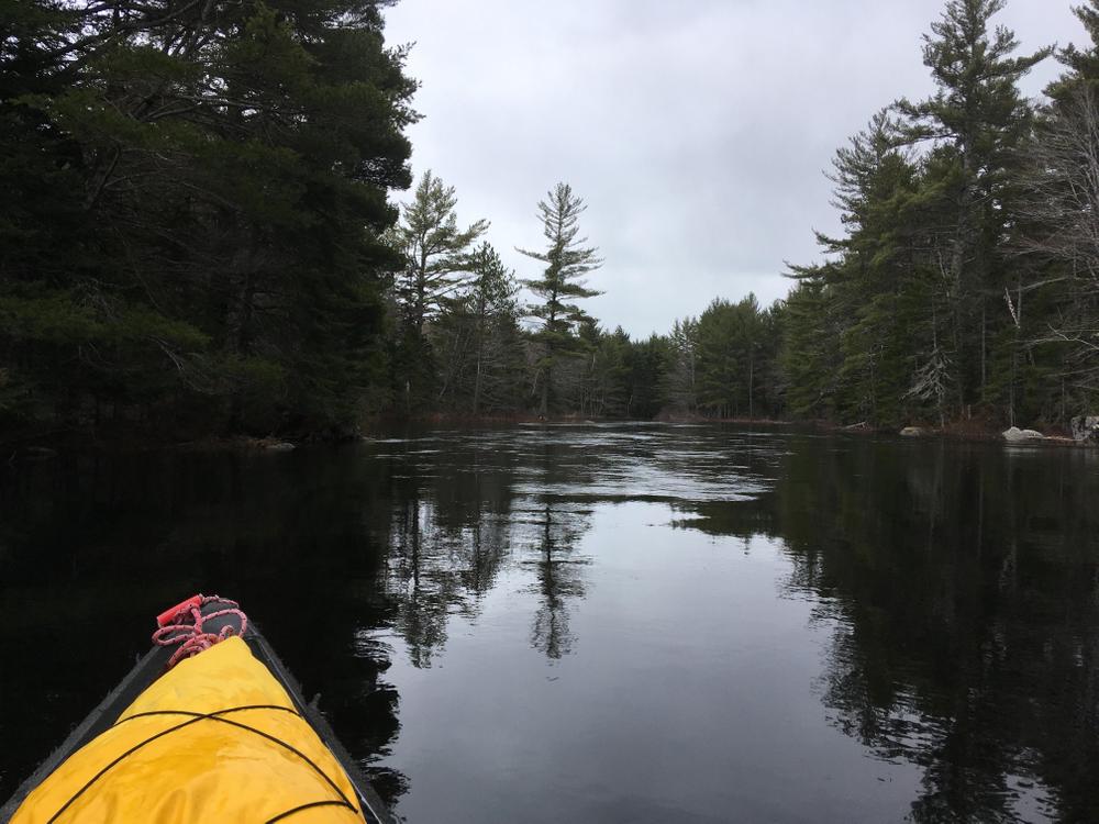
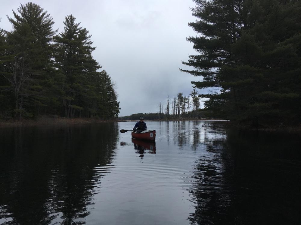
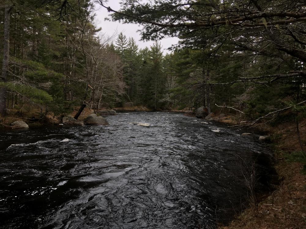
The Machias River race used to be called The Machias Wilderness River Race and it really does deserve that name to this day. The 10-mile stretch of the river traversed by paddlers during the race is stunningly beautiful, its very dark water meandering though coniferous forests and wetlands. It is a small river, but deep and dark where it pools and shallow and fast in its rapids. It is truly a wilderness experience, very much worth the drive to share with your fellow paddlers on a special day each April.
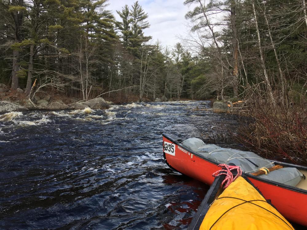
The racecourse starts at the north end of First Machias Lake, at the junction of the CCC and Stud Mill Roads. Racers access the waterfront through the gated driveway of a privately owned camp. It’s very important that the property be used in a respectful manner. For the mass start, the paddlers line their boats up along the north shore of the lake and, at the sound of the gun, charge south down the lake. The first mile of the race takes paddlers to the outlet, followed by four miles of beautiful meandering flatwater. Paddlers pass a few camps along this stretch, and the scenery for the leaders often includes eagles, osprey, and moose. Carrick Pitch, the first rapid, marks the midpoint of the racecourse, five miles in. The scenic beauty continues through the second half of the racecourse, from Carrick Pitch to the wilderness campground just downstream of Route 9, and features the occasional rapid culminating with the 0.25-mile long Route 9 Rips that takes paddlers from the Route 9 bridge all the way to the finish line at the campground.
This racecourse is friendly for families and for those paddlers with beginner whitewater skills (though true beginners will want to consider portaging the first and last rapids and using a buddy-boats system throughout to help maintain safety). The tradition of the annual race in April includes a potluck cookout at the finish.
Rapid Information:
The rapids are: Carrick Pitch at the midpoint of the race, followed by Boot Rips and the Others (which are several Class II rapids spread through the miles 7 and 8), and ending with Route 9 Rips (Class II+/III). The rapids are wide enough to allow for some choice of line, and only Carrick Pitch and Route 9 Rips can be scouted ahead of time from the roads.
The descriptions below are based on racers’ experiences from having run the river at a wide variety of flows. Racers are required to wear hard-shell paddling helmets, and the race director strongly encourages all boats to contain properly secured flotation bags. This is truly a wilderness paddling experience, and the confidence and skills associated with self-rescue are important.
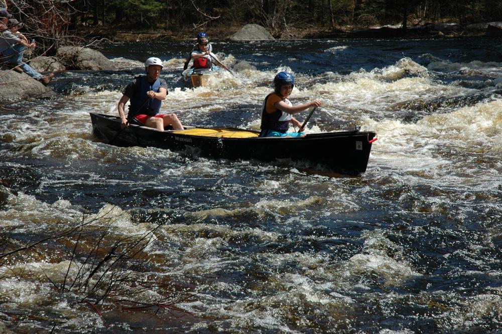
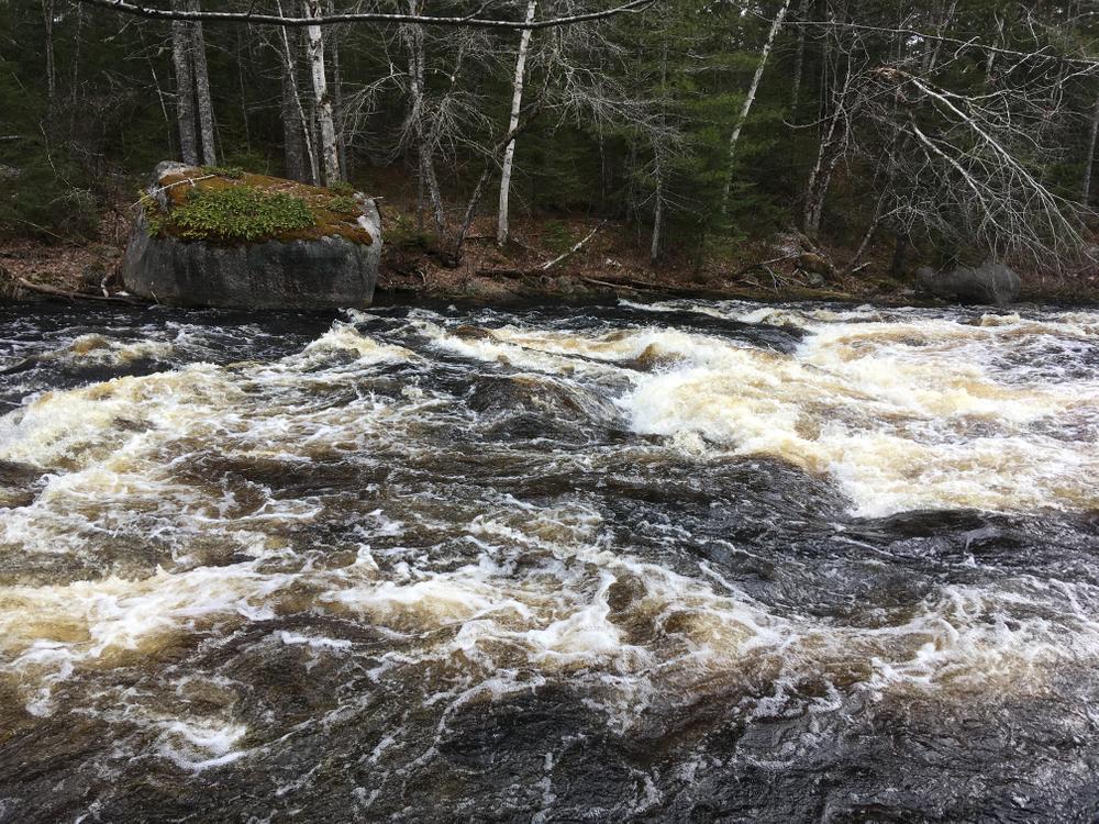
Carrick Pitch: Carrick Pitch can be scouted ahead of time, accessed from the CCC Road, for those willing to walk the 0.25 miles to do so. About 3.8 miles up the CCC Road from Route 9, the road bends sharply to the right, crosses a stream, then bends left and heads uphill. Park on the right where the road bends to the left, and walk the dirt camp road present on the right. There is a privately-owned camp on river right at Carrick Pitch and those either scouting or portaging, as well as safety personnel and spectators, will all have to cross that property. Please be very polite and respectful, and leave only footprints behind.
The approach - After racing in flatwater for roughly an hour the paddlers might notice the river narrowing a bit, with some sharper turns marked by the appearance of some very large boulders. These features signal to paddlers that they’ve almost reached the midpoint of the race, Carrick Pitch. Paddlers will see a Portage Here sign, and sometimes a warning buoy, on river right above the pitch. It is not an easy portage, but portaging is the correct choice for some paddlers.
For those who run the rapid, be aware that the opening is blind as the river bends sharply to the right immediately above the rapid. Entering with a very tight right-hand turn, hugging the right bank at the entrance, is generally the preferred line. Around the corner, stay tight right for only a few heartbeats, then work hard to move to the center for the chute through the exit. Staying right too long can cause a boat to be swept into a large river right boulder, which is the leading cause of people joining the Carrick Pitch Swim Team. There are other lines, starting either river center or far left, but those are very dependent upon water level. The line described above is available at all passable water levels.
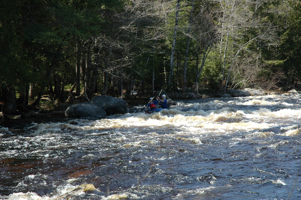
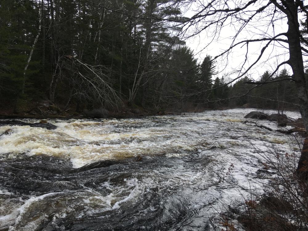
Boot Rips and the Others: Below Carrick Pitch, the river returns to flatwater for about a mile. Eventually paddlers will enter the series of Class II rapids that characterize the middle of the second half of the racecourse. These rapids are not accessible from the road and consequently there is no race safety provided at them and they cannot be scouted ahead of time. Paddlers unfamiliar with the river, as well as beginner whitewater paddlers, are encouraged to use the buddy-boat system and partner with another boat or two to provide each other with assistance if necessary. Generally speaking, these are read-as-you-go Class II rapids, which provide for excellent excitement and entertainment.
Route 9 Rips: Boot Rips and the Others carry on and off for quite a while, but eventually the river settles back into flatwater for a mile or so, all the way to the Route 9 bridge. The bridge marks the beginning of the rapid that carries paddlers (both those in their boats as well as those who have been ejected) all the way to the finish line.
Route 9 Rips can be scouted ahead of time by parking at the bridge and walking downstream on river right. This is also the portage trail, though the take out for the portage is on river right immediately upstream of the bridge. For racers choosing not to run this rapid, the race director urges extreme caution with respect to the traffic on Route 9, which moves very fast and includes both cars and large trucks. To portage, carry the boat across Route 9 and down the portage trail on river right. This is a long and difficult portage; so difficult that often the race director provides an unusual option. That choice is to leave your boat at the bridge, run across the bridge and on up Route 9, turn right onto the campground road, and run to the timer at the finish line who will record your finish time. Then use your vehicle to go back and get your boat, after you’ve warmed up and had some food.
For those running the rapid, enter by staying right of center as you pass under the bridge. Over the next 100 or so yards, angle toward the right bank and stay tight there until you reach the right hand corner. Most paddlers then stay to the right around the corner, and a bit longer, before moving to the center for the river’s big, left hand corner (but aggressive paddlers at some water levels will not stay right around the right hand corner choosing instead to bust across to the bigger, faster line on river left). Both lines converge left of center as the river turns left and the rapid peters out at the finish line.
Finishers are required to do Two Boat Safety at the finish – There must always be two boats in the water at the finish line to provide safety for paddlers experiencing difficulty.
Flow information: Flows in mid-April can vary quite a lot on the Machias River. Depending on the snow pack and the timing of its melt, and the abundance of rainfall, flows on race day can vary so much that the fastest race times can be anywhere from about 1.5 to almost 2 hours. In higher flows, there will be noticeable current throughout the flatwater sections, and Carrick Pitch and Route 9 Rips can become Class III. At lower flows, the flatwater sections become nearly deadwater and all of the rapids become bony. Later in the season as the water drops, this stretch of river becomes unrunnable.
Information on this paddling route is provided by the Maine Canoe & Kayak Racing Organization (MaCKRO). MaCKRO promotes paddling & racing for paddlers of all ages and abilities throughout Maine and New England. Join MaCKRO to help expand the sport of racing canoes, kayaks, and SUPs.

Success! A new password has been emailed to you.