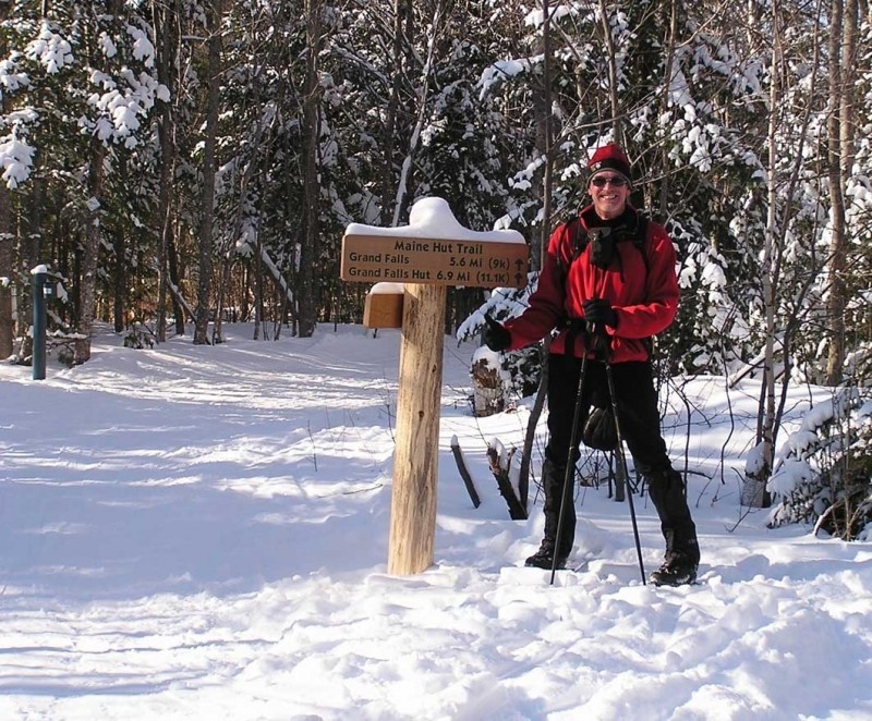
This section of the Maine Hut Trail provides year-round access to the Maine Huts & Trails Grand Falls Hut, located in Lower Enchanted Township just one mile east of the confluence of Spencer Stream and the Dead River.
As with all sections of the Maine Hut Trail, the trails accessing the Grand Falls Hut are groomed 8' wide throughout the winter with a classic track set on one side of the trail and the rest of the trail set in corduroy, perfect for winter hiking, snowshoeing, fat biking, and Nordic skiing.
From West Forks Trailhead: The Enchanted section of the Maine Hut Trail is 14.2 miles long from the West Forks Trailhead to Grand Falls Hut.
This will be a long trip for most and, in winter, is only recommended for intermediate and advanced Nordic skiers. During the summer and fall, the Enchanted section is not maintained for use, though it is open to the public.
From the designated parking area on US-201, the trail follows the Dead River east between its confluences with the Kennebec River and with Spencer Stream. This trail has several ascents and descents of 300-500 feet along this section and crosses several notable tributaries including: Salmon Stream, Gulf Stream, Enchanted Stream, Stony Brook and Alder Pond Brook. Some of these streams are purported to contain excellent habitat for native Brook Trout and landlocked Atlantic Salmon.
Maine Huts & Trails offers a gear-shuttle service for visitors to Grand Falls Hut. The drop-off location is located at Effie's Salon, a short ways north of the trailhead on US-201.
From Big Eddy/Grand Falls Trailhead: The Dead River section of the Maine Hut Trail is 7.5 miles long from its intersection with Long Falls Dam Road to the Grand Falls Hut.
Though this approach to the Grand Falls Hut is shorter than the one from West Forks, winter use is still recommended for only intermediate and advanced Nordic skiers. For hikers, the Dead River section offers a moderate day's hike to Grand Falls Hut.
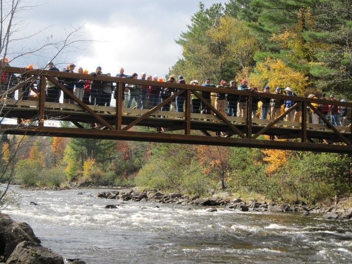
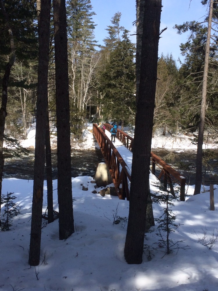
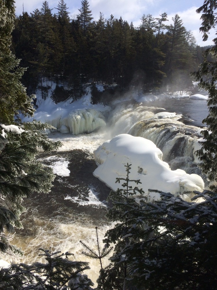
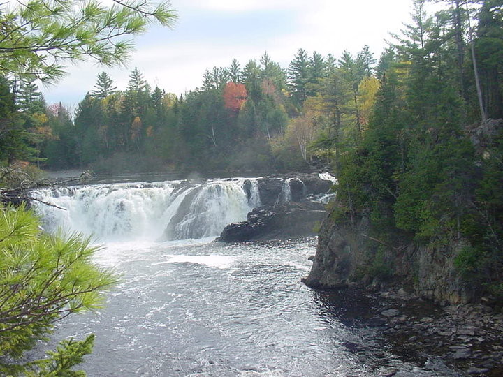
From the trailhead on Long Falls Dam Road the Maine Hut Trail follows the Dead River north to its confluence with Spencer Stream, passing through extensive wetlands and crossing the Dead River several times. In just over 5 miles from Long Falls Dam Road is the Chapel Bridge which crosses over the Dead River and provides a unique opportunity for scenic views of the river. Immediately after the bridge the Dead River Trail leaves to the right and leads to Grand Falls, an impressive waterfall about 40-feet tall and 120 feet across.
From the falls it is just over a mile to the remote Grand Falls Hut where visitors can rest before heading out or, with advanced planning, spend the night.
The wide Maine Hut Trail is low-lying through much of this area and is wet in the warmer months; summer and fall trail users should follow the blue-blazed side trails that parallel this section of the Maine Hut Trail. The one exception to this is during dam releases on the Dead River when the Maine Hut Trail remains unsubmerged. The dam release schedule may be found here.
Maine Huts & Trails is comprised of four ‘huts’ connected by about 80 miles of trail. Each hut is open to the public year-round, offering potable water and bathrooms at no charge. There are overnight accommodations for up to 40 people, but reservations must be made in advance. During full-service season, meals are included with overnight lodging, Beer and wine is available for purchase, and lunch is open to the public on Saturdays & Sundays.
The groomed primary Maine Hut Trail is marked with white diamond-shaped markers and other ungroomed side trails are marked with blue blazes. Grooming information can be found online at Maine Huts & Trails website. Information on hut services and lodging, as well as printed maps for purchase, are available at the Maine Huts & Trails office in Kingfield. Check out their website below for more detailed information.
No dogs are allowed on the Grand Falls section of the Hut Trail at any time.

This trail passes through a property that was acquired in part with funds from the Land for Maine’s Future program. For more information about the LMF program and the places it has helped to protect, please visit the LMF webpage.
Visit Maine Huts & Trails online for more information or contact:

Don’t Disturb Rock Cairns: Those stacked rock formations? They mark the trail—don’t move or build new ones.
Trail users have two primary parking options to access this section of the Maine Hut Trail.
Maine Huts & Trails West Forks Trailhead: This access point is located approximately 1 mile north of the bridge over the Kennebec River in The Forks, along US Route 201. The parking facility is located on the south/west side of the road (on the left if coming from the south).
Big Eddy/Grand Falls Trailhead The State of Maine owned and managed Big Eddy area is at the end of Long Falls Dam Road in Somerset County. From ME Route 16 in North New Portland, follow Long Falls Dam Road west/north out of the town approximately 26 miles. The trailhead is located 0.3 miles east along Long Falls Dam Road from the designated parking area.
Directions from other locations are available at Maine Huts & Trails' website.
Success! A new password has been emailed to you.