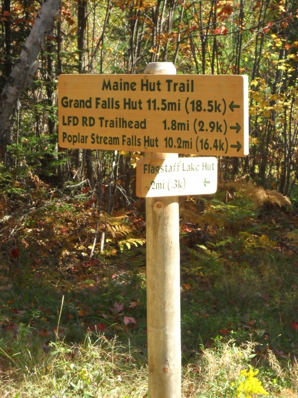
The Maine Hut Trail is an 80-mile trail network stretching from ME-27 west of Carrabassett Valley to US-201 north of The Forks. Maintained for year round use by Maine Huts & Trails, this unbroken stretch of trail features 4 full-service huts, groomed skiing in the winter, excellent mountain biking in the summer, ample terrain to explore on foot, and beautiful views of the mountains, Flagstaff Lake and waterfalls throughout. This posting is intended as an overview of the MH&T trail system. Many details, including side trails, features of interest, and specific use and safety guidelines are not included in this overview. If you are planning a visit to Maine Huts & Trails, or a thru-hike on the Maine Hut Trail, please consult the in-depth postings on Maine Trail Finder as well as the information on the Maine Huts & Trails website, where you can download or print a detailed map of the whole trail system.
The Maine Hut Trail is open to skiing, hiking, biking, snowshoeing, and paddling. Side trails may have use limitations, please follow all posted information. The Maine Trail Finder pages linked below contain more specific use information for individual trails.
ME-27/Stratton Brook Trailhead to Airport Trailhead: This westernmost section of the Maine Hut Trail includes over ten miles of trail, looping high above the valley to Stratton Brook Hut and following an historic narrow gauge rail bed along the Carrabassett River.
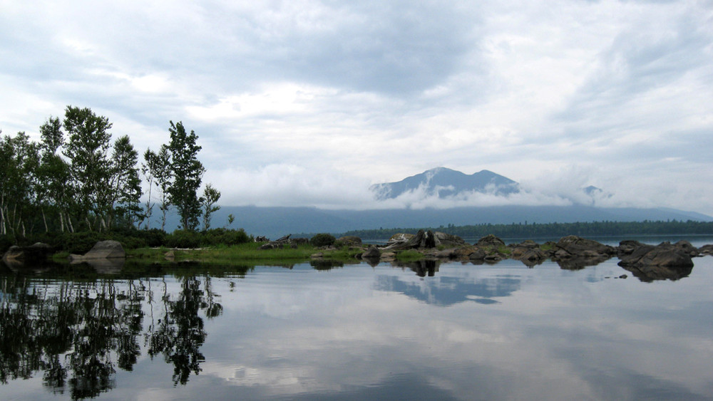
Airport Trailhead to Flagstaff Trailhead: This section of the Maine Hut Trail travels 12 miles northeast from the airport on ME-27, passing Poplar Stream Falls, Maine Huts & Trails' Poplar Hut and Halfway Yurt, and arriving at grand views of the Bigelows from the shores of Flagstaff Lake.
Flagstaff Trailhead to Big Eddy Trailhead: This short section of the Maine Hut Trail provides access to Flagstaff Hut and travels 5.7 miles along the shore of Flagstaff Lake before reaching the northern outlet at Long Falls Dam.
Big Eddy Trailhead to Lower Enchanted Trailhead: The Maine Hut Trail follows the Dead River for 7.5 miles north, crossing over on the Tom and Kate Chappell Foot Bridge just above Grand Falls and crossing Spencer Stream just below. The Lower Enchanted Trailhead provides immediate access to Grand Falls Hut.
Lower Enchanted Trailhead to West Forks/ME-201 Trailhead: Not maintained for hiking in the summer. This final easternmost section of the Maine Hut Travel follows the Dead River northeast for 14.4 miles, terminating on US-201 north of The Forks.
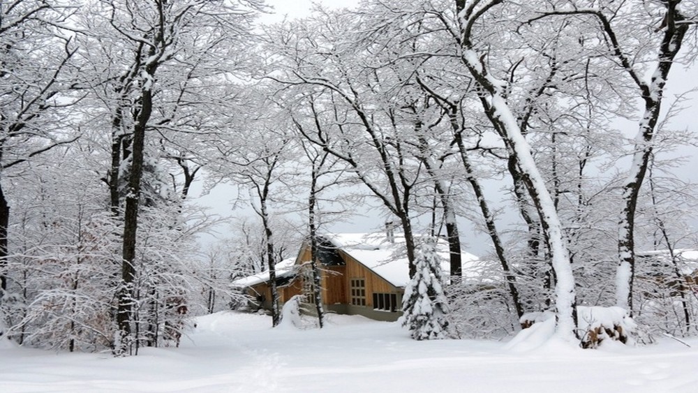
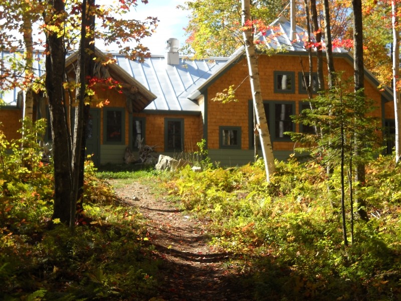
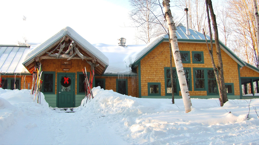
Maine Huts & Trails is comprised of four ‘huts’ connected by about 80 miles of trail. Each hut is open to the public year-round, offering potable water and bathrooms at no charge. There are overnight accommodations for up to 40 people, but reservations must be made in advance. During full-service season, meals are included with overnight lodging, Beer and wine is available for purchase, and lunch is open to the public on Saturdays & Sundays.
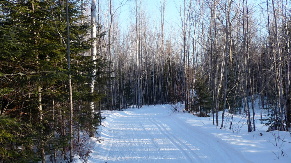
The groomed primary Maine Hut Trail is marked with white diamond-shaped markers and other ungroomed side trails are marked with blue blazes. Grooming information can be found online on the Maine Huts & Trails trail conditions page. Information on hut services and lodging as well as printed maps are available at the Maine Huts & Trails office in Kingfield. Check out their website below for more detailed information.
Dogs are allowed on the trails from April 15th to November 30th. Dogs are not allowed inside the huts.

This trail passes through land that was acquired in part with funds from the Land for Maine’s Future program. For more information about the LMF program and the places it has helped to protect, please visit the LMF webpage.
For more information and detailed trail maps, please visit the Maine Huts & Trails website or contact:

Give Back: Look for ways you can give back to the communities and organizations that make Maine’s outdoors great. Consider integrating volunteer work into your trip, or make a donation to local conservation groups.
Maine Huts & Trails maintains seven parking areas with direct Trailhead access to the Maine Hut Trail. For more detailed directions to a trailhead, please visit the Maine Huts & Trails website or explore a specific section of the Maine Huts & Trails network on Maine Trail Finder using the 'View Connector Trails' links immediately below the map.
Success! A new password has been emailed to you.