Maine Hut Trail - Poplar Hut

Access Poplar Hut and Poplar Stream Falls along the Maine Huts & Trails network, managed for a range of non-motorized activities including hiking, snowshoeing and cross-country skiing. This section of trail leads to spectacular waterfalls and a full-service back-country hut.
Trail Activity
Snowshoeing Mountain-biking Cross-country-skiing Hiking
Length
6.20 miles, Network
Difficulty
Moderate
Town
Carrabassett Valley
Surface
Dirt/Forest Floor, Gravel/Crushed Stone, Snow - Groomed
Pets
Permitted
Fees
No

Description

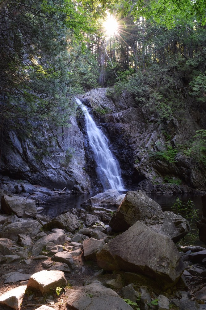
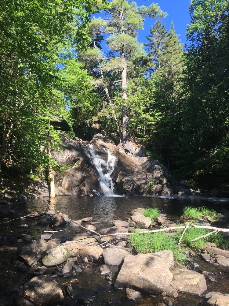
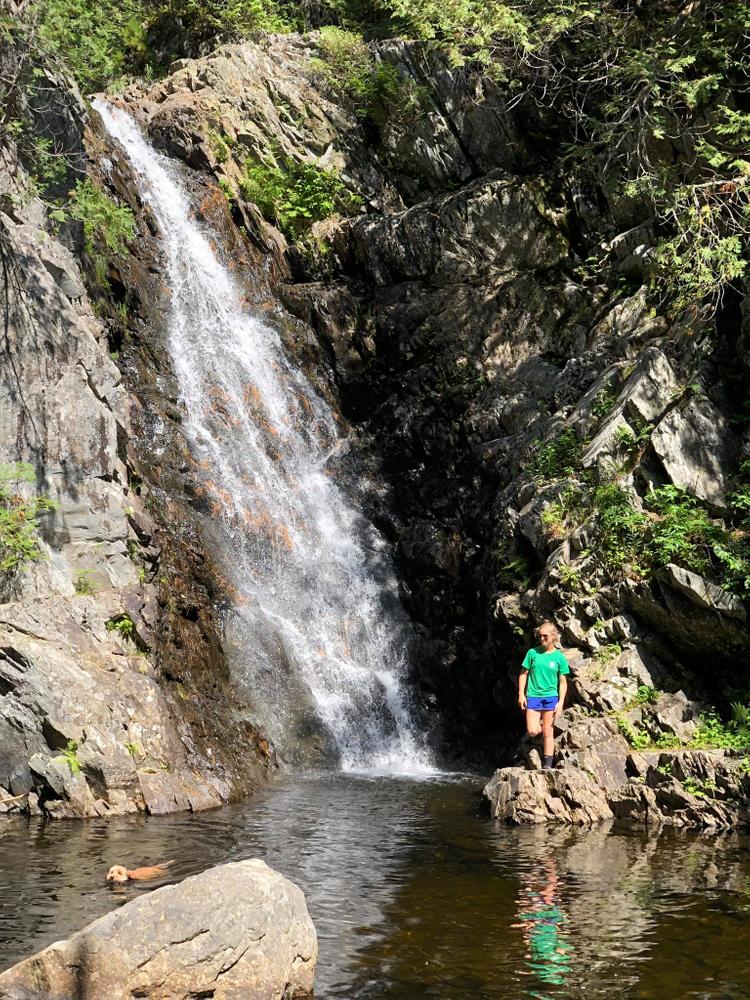
The trails to Poplar Hut are part of the larger trail network managed by Maine Huts & Trails. At the Airport Trailhead in Carrabassett Valley, follow the trail into the woods at the end of the airport runway. Continue to the multi-use footbridge that crosses the Carrabassett River. After the bridge, you’ll encounter a five-way intersection. Be sure to read all trail signs closely and refer to your map as needed; this intersection can be tricky. There are two trails on the right; the Huston Brook Road (sharp right along the river) and the Maine Hut Trail (slight right into the woods above and to the left of Huston Brook Road). Follow the Maine Hut Trail into the woods. The trail starts out flat and then increases to rolling terrain with a small uphill climb. After a quick downhill, the trail crosses the Carriage Road (watch for traffic) and continues to a large bridge over Poplar Stream. You now have three options for getting to Poplar Hut (see below). Distance from the Airport Trailhead to the footbridge is 1.1 miles; about 1 hour on foot.

  • Poplar Hut via the Maine Hut Trail (easternmost trail): Continue across the large bridge over Poplar Stream. The trail bends sharply left, starts out flat and begins to gain elevation as you traverse the base of Little Poplar Mountain. In the winter, be on the watch for descending skiers. The trail levels off for the last mile, exposing nice views of Little Bigelow. Continue over a foot bridge and you’ll come to a Maine Huts & Trails sign. Take a right to the hut. Distance is about 3.2 miles.
  • Poplar Hut via Warren’s Trail (westernmost trail): Just before the large bridge after crossing the Carriage Road, take an uphill left onto Warren’s Trail, following the west side of Poplar Stream. This trail winds up and down through old growth forest and makes for a great loop to see waterfalls and wildlife. Continue on Warren’s Trail until you pop out onto the Hut Service Road; take a right onto the service road and over Poplar Stream Bridge. Turn right shortly after the bridge back into the woods. Continue along the trail to the intersection of Larry's Trail. To continue to Poplar Hut, take a left, uphill, following blue diamond blazes to an intersection with the Maine Hut Trail; turn right. You'll pass a hydro pump house and climb one last steep pitch before taking the next left at a t-intersection and finding Poplar Hut nestled among the trees.
  • Poplar Hut via Larry’s Trail (central trail): Continue across the large bridge after crossing Carriage Road over Poplar Stream. The trail bends sharply left and starts out flat with an uphill rise to the intersection with Larry’s Trail. Take a left onto Larry’s Trail, following the east bank of Poplar Stream. Continue up Larry’s Trail as it winds through the forest, where you’ll encounter rolling hills until you come to a native cedar bridge crossing the South Branch of Poplar Stream. Approximately 100 yards after crossing the bridge, a spur trail on the right leads to the pool of one of Poplar Stream's two waterfalls. A stone staircase ascends the terrain next to the waterfall; at the top is the intersection with Warren's Trail. Stay straight on Larry’s trail; it will continue uphill. Turn right at the next intersection, onto the Maine Hut Trail, just 0.03 miles to Poplar Hut.

Other Information

Maine Huts & Trails is comprised of four ‘huts’ connected by about 80 miles of trail. Each hut is open to the public year-round, offering potable water and bathrooms at no charge. There are overnight accommodations for up to 40 people, but reservations must be made in advance. During full-service season, meals are included with overnight lodging, Beer, wine, and retail is available for purchase, and lunch is open to the public on Saturdays & Sundays. During self-service season, reservations are still made in advance, but guests pack in their own food and lodging is at a discounted rate. Check their website below for season dates.

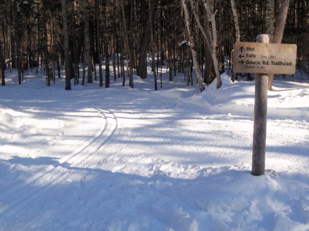
The groomed primary Maine Hut Trail is marked with white diamond-shaped markers and ungroomed side trails are marked with blue blazes and/or blue diamond-shaped markers. Grooming information can be found online at the Maine Huts & Trails trail conditions page. Information on hut services and lodging as well as printed maps are available at the Maine Huts & Trails office in Kingfield. Check out their website below for more detailed information.

Dogs are allowed on the trails from April 15th to November 30th. Dogs are not allowed inside the huts.

LMF Logo

This trail passes through a property that was acquired in part with funds from the Land for Maine’s Future program. For more information about the LMF program and the places it has helped to protect, please visit the LMF webpage.

Trail Manager

Visit Maine Huts & Trails online for more information or contact:

Maine Huts & Trails

Maine Huts & Trails
496C Main Street
Kingfield, ME 04947
Phone: (207) 265-2400
Fax: (207) 265-2209
lodging@mainehuts.org
View website

Nearby Events

VIEW EVENTS CALENDAR

Trail Tips

Minimize Campfire Impacts
Consider using a cooking stove and alternative light source (flashlight, candle, lantern) instead of building a campfire.
Legend
Hide All

Trailhead Information

From the intersection of ME-27 and ME-16 in Kingfield: drive north on ME-27 10.1 miles and turn right just past the Sugarloaf Regional Airport to reach the Airport Trailhead. A sign directs visitors to the Maine Huts & Trails trailhead parking.

Click on a parking icon to get custom directions
Please Log In or Create Account to add comments.
tc8080
July 16, 2019
Looks like the residents of Gauge road rightfully do not want car or foot traffic, so I would avoid starting your hike there. Also the trail section from there is no longer maintained. We parked on the shoulder of Carriage road at a wide spot just downhill of the trail crossing. We did not get a ticket but in hindsight it probably wasn't legal. In any case I would recommend not starting your hike at the northern end of the runway like this page says, unless you simply want more steps in your day. That portion of the trail is flat and boring. I recommend parking at the town office and walking up Carriage road to the trail crossing, which is easy to find. Larry's trail goes directly to South Brook Falls - the larger of the two. Then continue up the stone staircase to the left of the falls. To get to Poplar Stream Falls, turn left at the top of the stairs and you will soon hear and come to the falls. There is a side trail to the swimming hole at the bottom of the falls.
navyswomom
June 18, 2016
NOTE: You can no longer park at the Gauge Road TH. Hikers must park at the CV Town Office or Narrow Gauge TH to start trail!

A fantastic and (easy side) moderate trail along Poplar Stream and South Brook that runs approximately 6 miles for the "loop". We started our hike at the town office parking, took a left on Carriage Rd for about 0.1 miles to a right on Gauge Road (sign is hidden by pines and no longer easy to see). Once on Gauge, we took a left at the fork, leading to the old parking lot and kiosk.

NOTE: This portion of the trail is no longer groomed or maintained by MHT. The path is cut down enough to follow, keeping the stream to the left. We followed the trail until it met up with the groomed MHT system, following signs for Poplar Hut. Soon, you will come to a 50ft waterfall off South Brook. During high water (after storms/winter melt) the falls and Brook are spectacular. Today, water flow was moderate, dropping almost 300 cu.ft. per second over the last 7 days (our last hard rain)...so plan a visit after a rain, but be careful...rock hops can be slick!

From there, we climbed the trail up a steep case of granite stairs (steepest of the trip) and took a left upstream towards Larrys Loop (follows closest to stream) to a second set of falls, a cascade on Poplar Stream.

From here you can backtrack to the poplar hut junction or follow Warrens trail to the bridge above the falls. We followed Warren up, took a left on the service road and hiked back the opposite side of Poplar on Carriage Road. This was tricky in some places as people driving the road (yes, it is a road) don't slow, yield or move over to accommodate foot traffic. It led us back down to the parking, marking a 6.4 hike (give or take all the waterfall exploring).

After we got to parking, we got rid of our gear and hit the Carrabassett River for an extremely chilly dip to cool off.
bigeloafah
March 29, 2015
This is a great choice for a day hike with children: manageable grades, waterfalls to splash in, and if you time it right, lunch - or at least homemade cookies - at the hut.

Note that as of November 2014, the parking area at Gauge Road Trailhead described here (off Carriage Road near Tufulios and the C.V. town office) is closed. Alternative parking is available at the town office or the Huts and Trails trailhead by the town airport.
These awesome businesses support our goal of connecting people to outdoor adventures in Maine!
Hang Tight!
Nearby services are loading
No Results
No Services Found
SHARE THIS TRAIL

Add Trail Log

Please wait…
Join In on the Fun!
Log in or create an account below to unlock all the great features of Maine trail finder: keep track of trails you want to do, preserve memories of trails you’ve done, earn badges, and more!
Your log in attempt was not successful. Please try again.
    Lost your password? Reset your password
    Don't yet have an account?
    There was an issue with your submission. Please try again.
      * Indicates required field
      Already have an account? Login here
      Enter your username, and we will send you a new, randomly generated password to your email account.
      There was an issue with your submission. Please try again.

        Success! A new password has been emailed to you.

        Log in now

        Please wait…