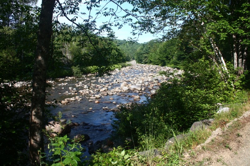
The Narrow Gauge Pathway is a rail trail which hugs the east bank of the scenic Carrabassett River. Visitors may access the trail at three different trailheads and enjoy this non-motorized trail in all seasons. The trail has a gentle grade that increases upstream from the Carrabassett Valley Town Office. In the winter the trails are groomed for both classic and skate style cross-country skiing.
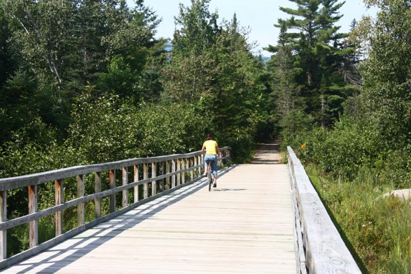
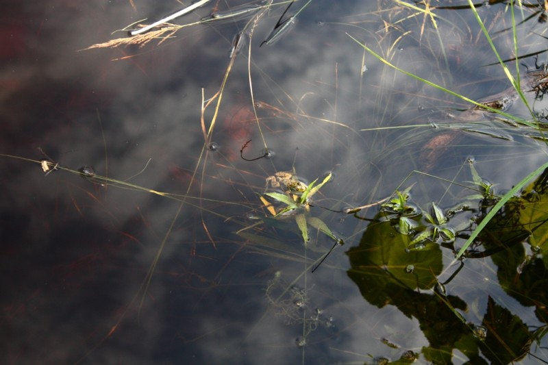
The Narrow Gauge Pathway offers plenty of places to stop and enjoy the scenery or have a picnic. One notable location is the long bridge that passes over wetlands and a small pond. Picnic tables along the way provide excellent spots in the shade to cool off, to grab a meal, or to enjoy the quiet of the Maine woods and the pristine waters of the Carrabassett River.
The Narrow Gauge Pathway was established in an effort to create a non-motorized multi-use trail utilizing a historic railroad bed. The original railroad tracks were laid in 1894 to transport timber, passengers and freight. In 1900, the railroad was extended to Bigelow Station where the Russell Remick Birch Mill and the Prouty & Miller Steam Sawmill were located. But by 1927, the railroad had outlived its usefulness and was abandoned from Bigelow Station south to Huston Brook, just north of the current Town Office. In 2001, with help from the State of Maine, the Town of Carrabassett Valley built the trail as it now exists.
The Narrow Gauge Pathway also serves as an extension of the Maine Huts and Trails system which connects the trails at Sugarloaf Outdoor Center with the Maine Hut Trail from Narrow Gauge to Poplar Stream.

This trail passes through a property that was acquired in part with funds from the Land for Maine’s Future program. For more information about the LMF program and the places it has helped to protect, please visit the LMF webpage.
Visit the Town of Carrabassett online for more information or contact:
Town of Carrabassett ValleyRecognize Working Forests and Waters: Maine’s landscapes are not just for recreation—they’re also active, productive environments that support local livelihoods and communities. Forests may be actively logged; waterways are used for lobstering, clamming, aquaculture, and transport. For everyone’s safety, maintain a safe distance from active logging operations, and do not disturb working docks, fishing equipment, traps or buoys.
NOTE: The Narrow Gauge Pathway sustained substantial damage when Tropical Storm Irene hit in late August 2011. Please check out the Town of Carrabasset's website for the most up-to-date trail conditions. Be safe and stay informed!
Carrabassett Town Office
From North: From the intersection of ME Routes 16 and 27 in Stratton Village (in Eustis), follow ME Routes 16/27 south for about 14 miles (about 6 miles beyond the Sugarloaf Access Road) and turn left onto Carriage Road, which is immediately before Tufulio’s Restaurant. Cross the bridge over the Carrabassett River and then turn left into the Carrabassett Valley Town Office for parking.
From South: From the intersection of ME Routes 27 and 16 in Kingfield, drive north on ME Routes 16/27 approximately 9 miles and turn right onto Carriage Road immediately after Tufulios Restaurant. Cross the bridge over the Carrabassett River and then turn left into the Carrabassett Valley Town Office for parking.
Campbell Field
From North: From the intersection of ME Routes 16 and 27 in Stratton Village (in Eustis), follow ME Routes 16/27 south about 8.5 miles and turn left onto Campbells Field Road. The trailhead and parking are about 0.3 miles on the left. Note that Campbells Field Road forms a loop.
From South: From the intersection of ME Routes 27 and 16 in Kingfield, drive north on ME Routes 16/27 approximately 14.25 miles and turn right onto Campbells Field Road. The trailhead and parking are just over a hundred yards beyond this intersection on the right.
Route 27/Stratton Brook Trailhead
From the intersection of ME-27 and ME-16 in Kingfield, drive north on ME-16/ME-27 approximately 15 miles. The Sugarloaf Access Road will be on the left, a few feet past this will be the right-hand turn into the Stratton Brook parking lot. Signs reading Maine Huts & Trails Stratton Brook Trailhead lead to this parking area.
Success! A new password has been emailed to you.